Josesphine Fire Road

Strawberry Peak

New cairn marking the ridge use trail
We continued down Colby Canyon Trail for about half a mile until a GPS check showed we had missed the use trail. We considered heading back to look for it, but since we missed it the first time, decided to scale the ridge next to us and intersect the use trail. After topping the first ridge, we followed a dry creek to the top of the next ridge. Noel was about 20' behind me as we crested it when I heard him drop an F-bomb. A snake had struck at him and missed. I came back and saw a juvenile rattlesnake, maybe 3' long, moving under a bush. I had walked over the exact same spot where Noel encountered the snake, but never saw it. It never rattled to warn Noel. Soon we were back on the use trail, but since 5 years had passed since the area was officially open, large swaths of trail had gone feral. Dead and living poodle dog bush and buckthorn lined the trail and while the trail was never completely choked, there were sections where contact with one or both were unavoidable. The next challenge was a roughly 100' section of class 2 boulder scrambling I called Strawberry Notch. After the notch, we took a short break before tackling the vertical class 3 section of the west ridge. Climbing a short distance up the west ridge, Noel spotted the first painted arrow, showing the best route. The arrows were green, purple, and white, and were very helpful. Some were placed to aid people downclimbing and we made good use of the arrows both ways.

Feral trail

Noel working down Strawberry Notch

Painted arrow

One of the class 3 sections

Nearing the top

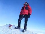
Noel and the Germans on the summit

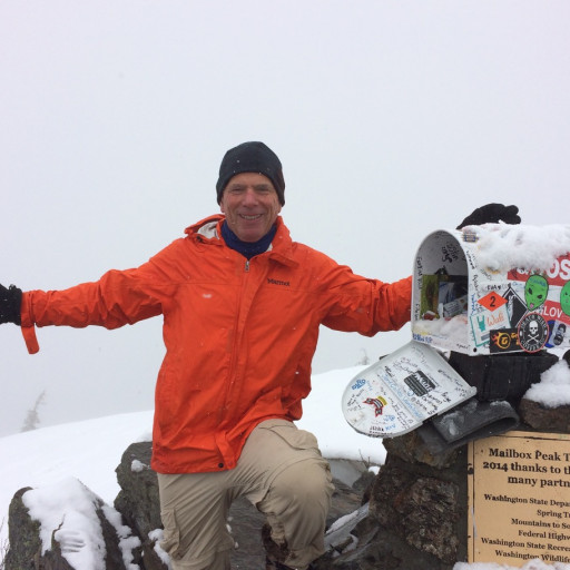
Battered metal box with a fresh register inside tupperware

Baldy a long way off

Wilson cluster from above and behind

Josephine Peak, Hoyt and Lukens in the background (I think)
The down climb on the ridge was fun, and again the arrows were helpful. The few times we strayed from the main route, it was obvious because we hit class 4+ or a cliff. We successfully followed the use trail all the way back to the Colby Canyon Trail, but it led over a bump with an unexpected 50-75' class 3 down climb. The cross country route we came up completely bypassed this section and I think it was easier than following the use trail. With that bit of extra adventure behind us, we cruised down Josephine Fire Road back to the car. It was a great day in the mountains with high adventure and big fun.

Starting the down climb

The bump with the other short class 3 section

Fresh cairn where the use trail leaves Colby Canyon Trail. The approach from Josephine Road is from the other side.