Strawberry and Lawlor Still "Closed To Public Use"

TRs for the San Gabriel Mountains.
Post Reply
User avatar
Sean
Posts: 3725
Joined: Wed Jul 27, 2011 12:32 pm

Post by Sean »

I drove up to Red Box yesterday and took a look at the trailhead for Mt. Lawlor and Strawberry Peak. There was a sign posted: "Closed To Public Use." So I temporarily used it for private use while the government continued its shutdown games.

Image

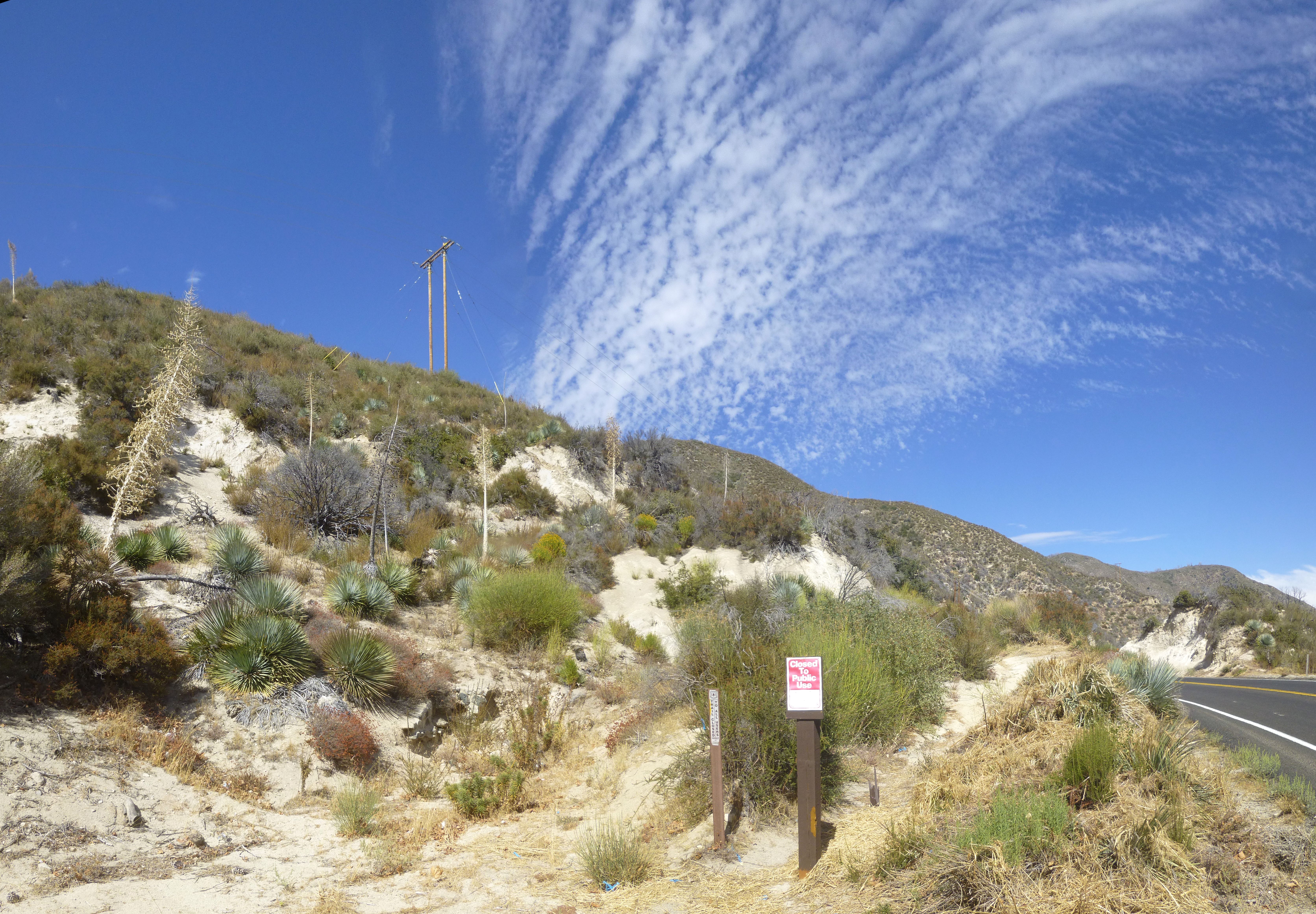
The trail is in fine shape, clearly being worked and utilized, and in better condition than many neglected trails that remain open. There are a few minor landslides and washouts that narrow the track down to a couple feet wide in spots with potentially dangerous falls if you unceremoniously stumble at the worst possible time.

Image

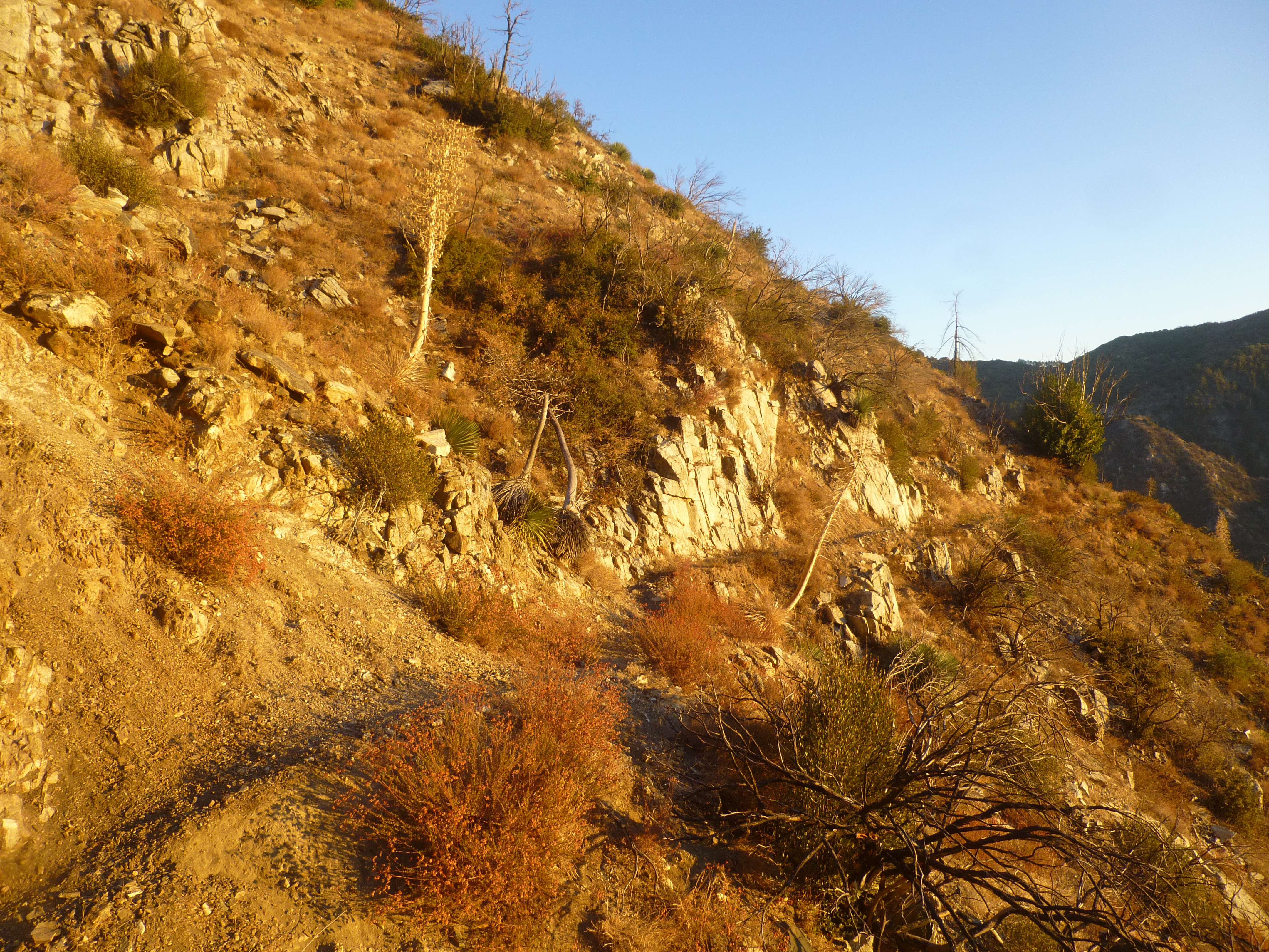
To the Lawlor/Strawberry Saddle it's all Class 1 with a bit of poodle dog next to the trail. If you're not observant, you might lightly brush it in a couple spots, particularly during the contour around Lawlor's west flank, as Strawberry comes into view.

Image

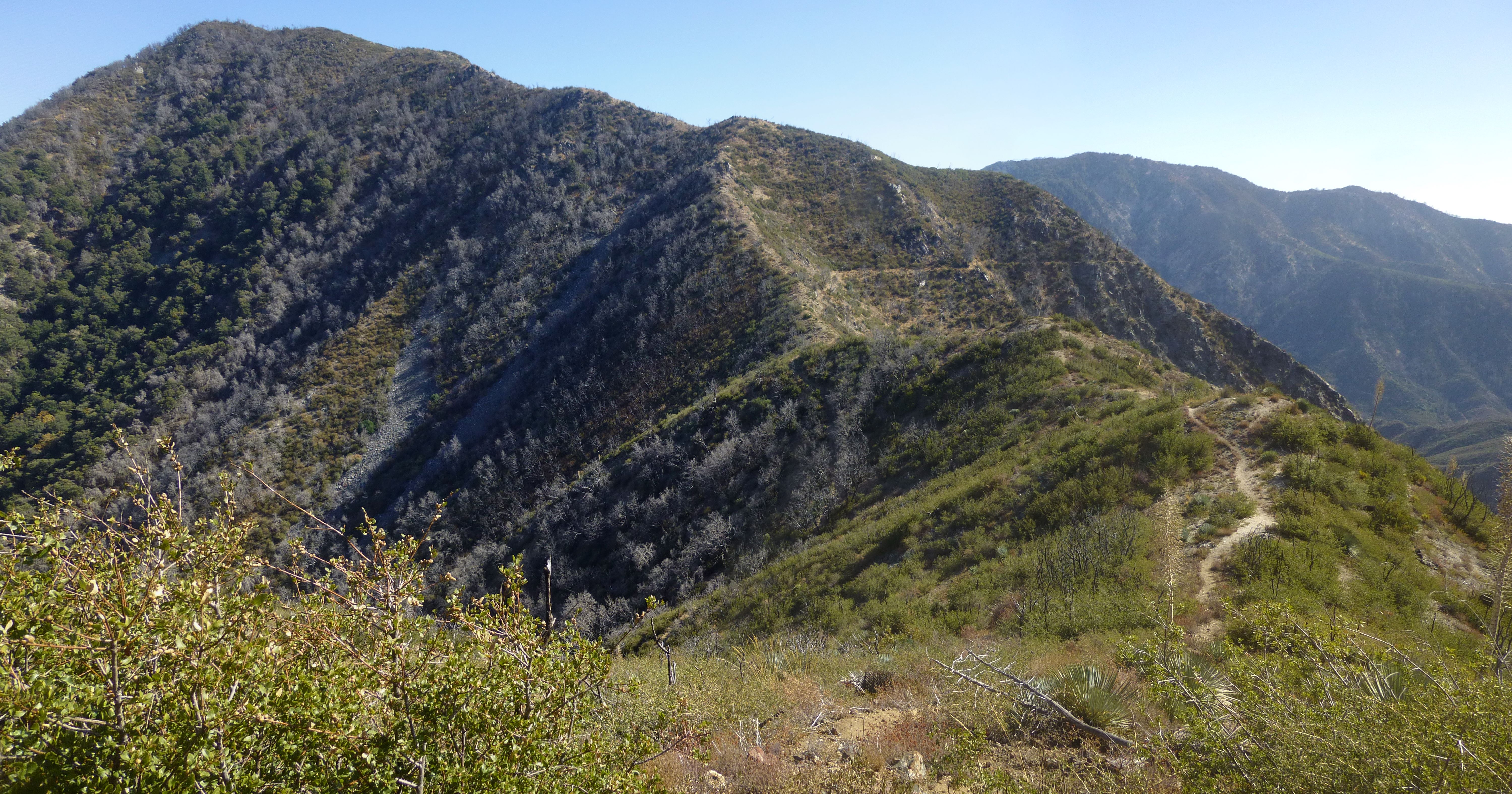
At the saddle the main trail continues downhill, this time contouring around Strawberry. Instead I hopped on the less manicured ridge route up to the peak, which started immediately to the left of the main path.

Image

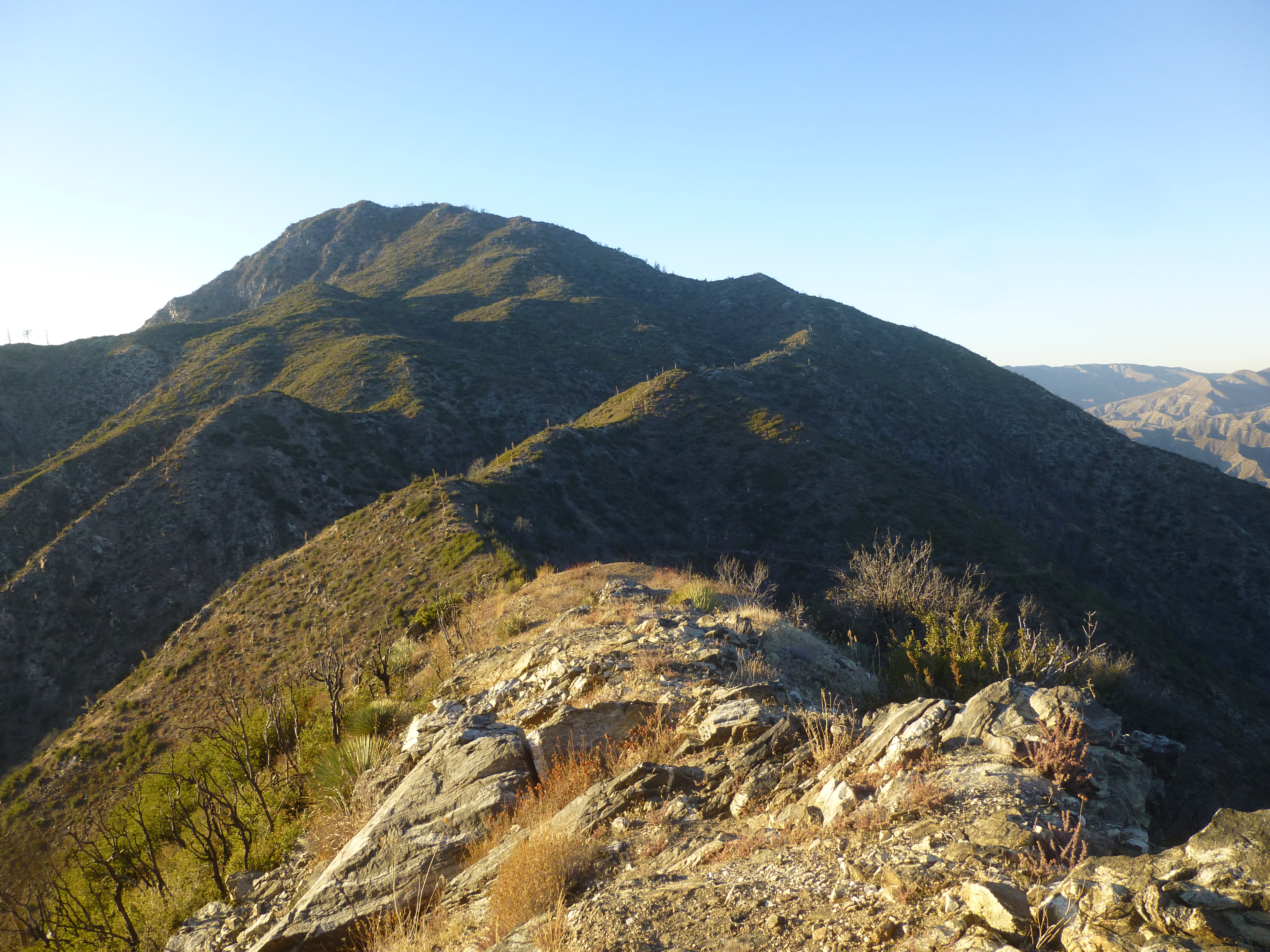
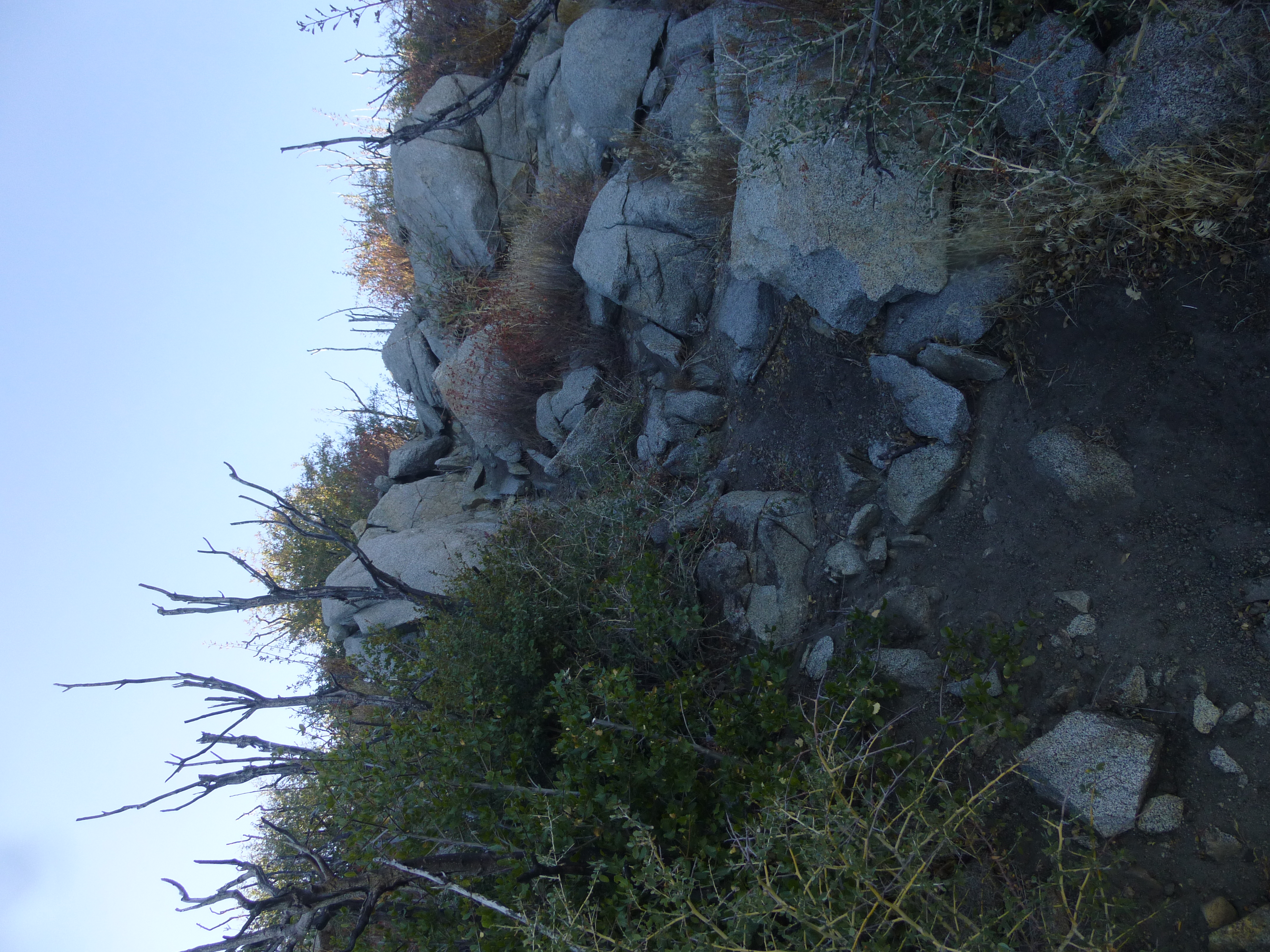
The ridge rollercoasters once or twice before granting some easy Class 2 climbing over a few boulders.

Image

It was steep and sandy at times. Rocky and overgrown at others. But the trail was nearly always obvious. One spot had some poodle dog that required a tiny detour to avoid. After a couple false summits I was standing on Strawberry Peak for the first time.

Image

To the west was Josephine Peak and Colby Canyon.

Image

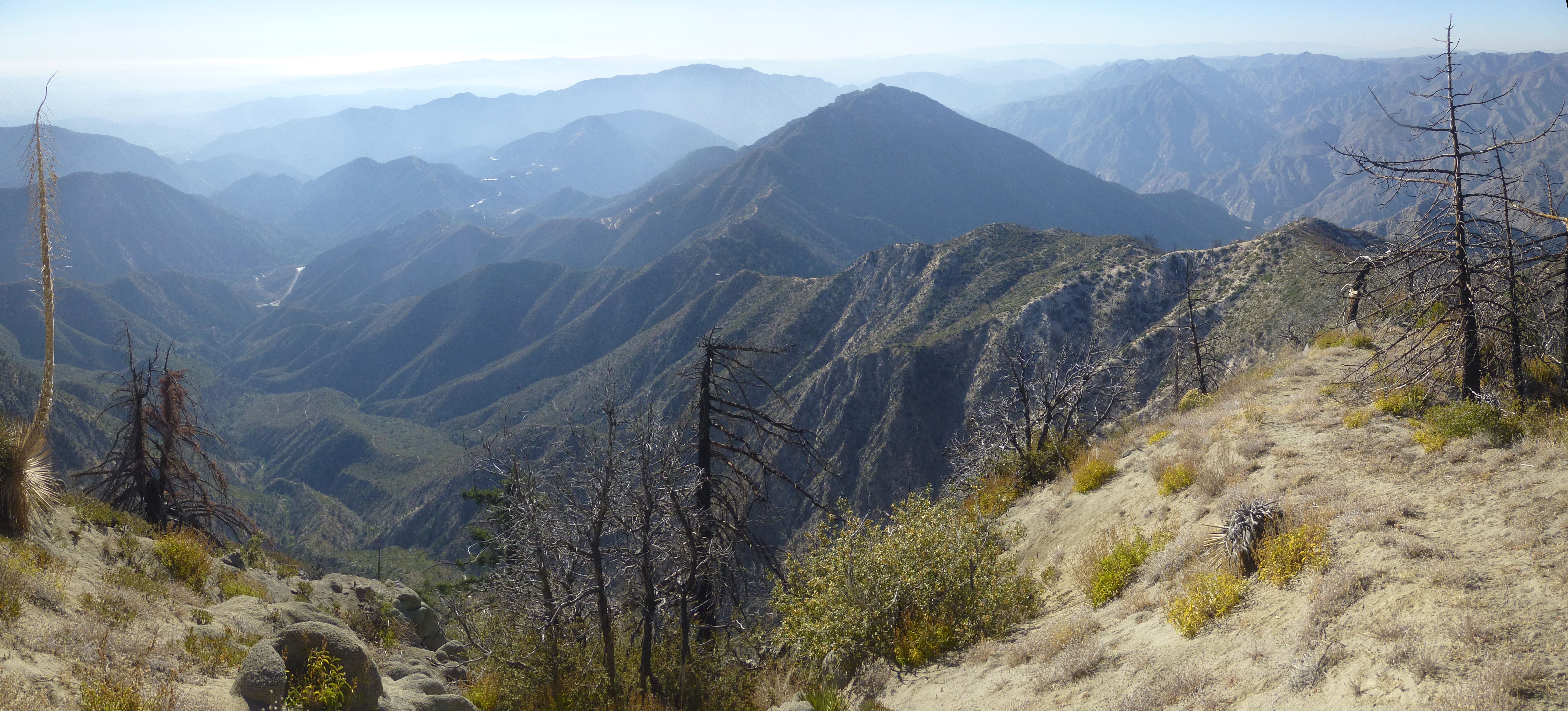
To the south was Wilson and company.

Image

The other directions looked pretty cool too.

Image

Back at the saddle I headed up the other side of the ridge to tag Lawlor.

Image

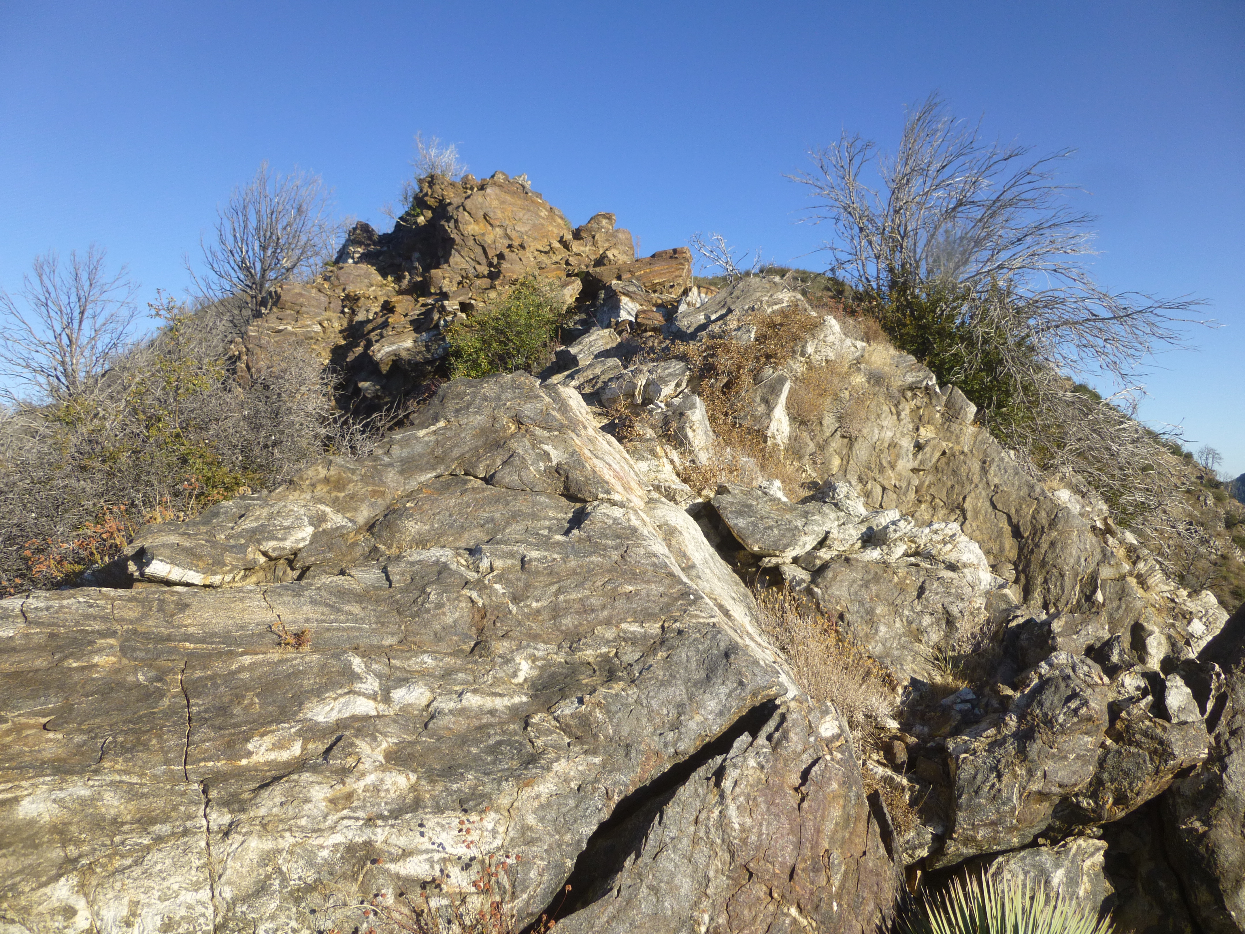
This route is less defined than Strawberry, but still decent for experienced hikers. The Class 2 bits are slightly more challenging. I had to use my hands a couple times.

Image

And a few sections of poodle dog require some rerouting and flexibility to avoid completely.

Image

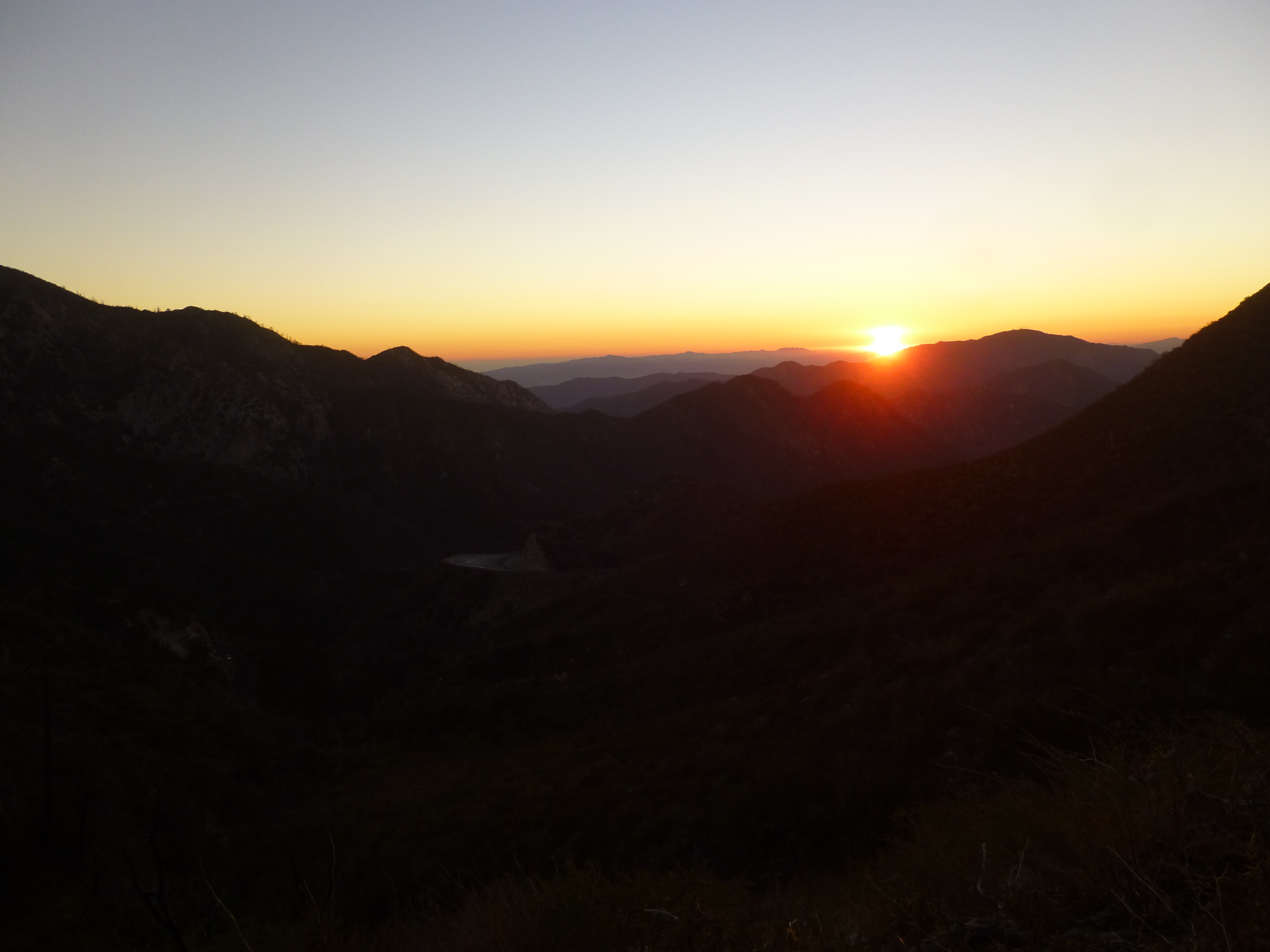
By the time I reached the summit of Lawlor, it was an hour before sunset, and I had no flashlight.

Image

So I promptly turned around and started the descent.

Image
User avatar
ur2slo
Posts: 95
Joined: Sat Jun 29, 2013 12:34 am

Post by ur2slo »

For the people by the people! :D

Great pics!
User avatar
ur2slo
Posts: 95
Joined: Sat Jun 29, 2013 12:34 am

Post by ur2slo »

For the people by the people! :D

Great pics!
User avatar
HikeUp
Posts: 3831
Joined: Thu Sep 27, 2007 9:21 pm

Post by HikeUp »

Gasp!
User avatar
Uncle Rico
Posts: 1386
Joined: Thu Mar 20, 2008 7:48 pm

Post by Uncle Rico »

There was a sign posted: "Closed To Public Use." So I temporarily used it for private use
Ha! Well played Sean.
User avatar
tekewin
Posts: 1189
Joined: Thu Apr 11, 2013 5:07 pm

Post by tekewin »

Great shots and beta. Thanks!

Strawberry has been on list forever, but has been closed forever. I wish I could hit it while the cats away, but I'll probably miss the window.
User avatar
HikeUp
Posts: 3831
Joined: Thu Sep 27, 2007 9:21 pm

Post by HikeUp »

Was the cutlery still there?
Image
Interesting to compare these pics to some from 2 years ago.
User avatar
Sean
Posts: 3725
Joined: Wed Jul 27, 2011 12:32 pm

Post by Sean »

No cutlery. But I found a damaged ammo box and chain on Strawberry. No register.

Image
User avatar
cab
Posts: 23
Joined: Thu Nov 11, 2010 7:45 am

Post by cab »

Good on you for getting out there. The amount of time that area has been closed is ridiculous.
User avatar
Ze Hiker
Posts: 1430
Joined: Mon Jul 28, 2008 7:14 pm

Post by Ze Hiker »

Nice.

Yeah that area has been closed over 4 years now. Hasn't it "recovered" sufficiently??
User avatar
hvydrt
Posts: 494
Joined: Thu Sep 27, 2007 8:18 pm

Post by hvydrt »

Good job! I think this guy is the head of the Angeles National Forest: http://www.youtube.com/watch?v=P8tfuBIutLI
User avatar
LetsGlissadeLhotze
Posts: 20
Joined: Tue Jan 11, 2011 9:50 pm

Post by LetsGlissadeLhotze »

The San Gabriels have naturally/seasonally burned for well over 10,000 years but in the last 30 years I guess there is a special new government aided process
User avatar
Augie
Posts: 345
Joined: Fri Sep 28, 2007 2:17 pm

Post by Augie »

Nice pics about your private use hike-lol. Gotta say, back in the day, that 3d class route on the west ridge was a great route.
User avatar
Trailblazr80
Posts: 10
Joined: Sat Jan 11, 2014 7:23 pm

Post by Trailblazr80 »

Just hiked this today. Saw 3 other hikers. The trail is in pretty good shape, I didn't notice too much overgrowth or washed out areas. The tin box is still there, and no sign of a register.
Post Reply