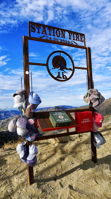
We met at the turn out by mile marker 4.5 on Big Tujunga Rd at 5:30AM. We decided to take my car to Mill Creek summit since the AC is out, we figured we would want some cold air once back at the car at the end of the day at Big Tujunga. We started off on the PCT with very pleasant temps and even a light breeze. We abandoned the PCT and took the paved road at their first junction. The road was not as scenic but much easier walking than the PCT. We came across the memorial to the 2 firefighters that died in the Station Fire. It was really well done and it just happened that the 4 year anniversary was 2 days before we were there.
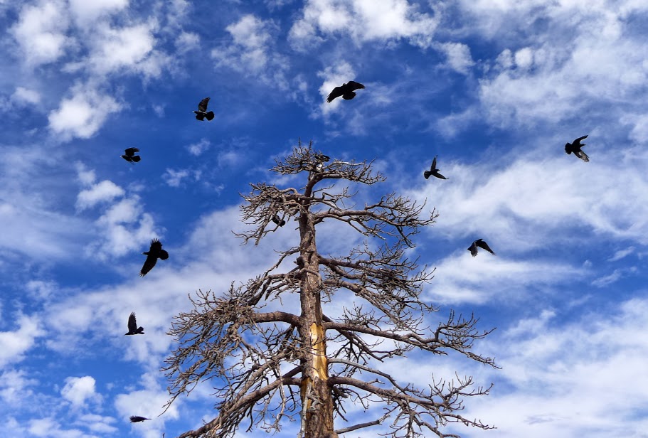
The walk to Mt. Gleason was very leisurely. It was just about 10 miles to the summit from Mill Creek. We signed the register then headed for Iron Mountain. This part was still not bad, it was warming up, but not too hot. Iron Mountain was soon reached after an encounter with a bunch of ravens in a tree.
I decided Iron Mountain #2 was the finest Iron mountain of the 4 I have hiked to so far. We left Iron and headed for Condor. It was getting warm by this point. Probably only in the high 80's, but there was absolutely no shade anywhere. I really started burning through my water at this point. I started the day with 5.5 liters but was down to 1.5 or so. About the only thing that I could manage to eat was jolly ranchers, it was just to hot to eat anything else, and everything else took a lot of water to get down. After a quick break on Condor, we slogged over to Fox Mountain. It was tough getting up the last bit of steep use trail to the top of that one (for me), but we made it.
I originally figured the hike would be about 24 miles, but when we got to Fox, I knew I was off a little. We were at 20 miles on the summit of Fox, so I knew we had 6 miles and 3000' of descent back to the car. This didn't seem bad until we started down the Fox Mountain trail. The trail sucks. It takes the longest most tedious route I have ever seen!!!! Aside from that ,its not in that great of shape so its not the easiest walking. I ran out of water at mile 22. I wasn't really worried about it, I didn't feel thirsty, I was fairly well hydrated from already having drank 7 liters of fluid that day (.5 donated by cab on Condor and 1 at the trail head before we started.) At about mile 23 we came across a very small trickle of water in a canyon. I moved the plants out of the way and we took a break and filled up water bottles and drank water. It was cold and refreshing. After that it was an easy walk out to the highway, which teased us as being so close for the last 3 miles. We got in cab's ice cold AC and headed back to Mill Creek to retrieve my car while sipping on semi warm gatoraid.
My gps died after Fox, but I think it was about 26 miles and approx 4000' of uphill with 6000' of down hill. It took us 11:45 for the hike and probably add an hour for setting up the shuttle. Overall its not a bad way to get all these peaks since the road to Mt. Gleason is still closed. Just Gleason would be 20 miles round trip. More pics.