Triumph In Manker Canyon

TRs for the San Gabriel Mountains.
Post Reply
User avatar
Sean
Cucamonga
Posts: 3902
Joined: Wed Jul 27, 2011 12:32 pm

Post by Sean »

On Sunday Willie and I started up Manker Canyon at 6:36 AM. A few other cars had beaten us to the Baldy Lift parking lot. A layer of high clouds would keep the heat away and periodically tease us with drizzles all morning. It would also allow long-range views up and down the canyon.

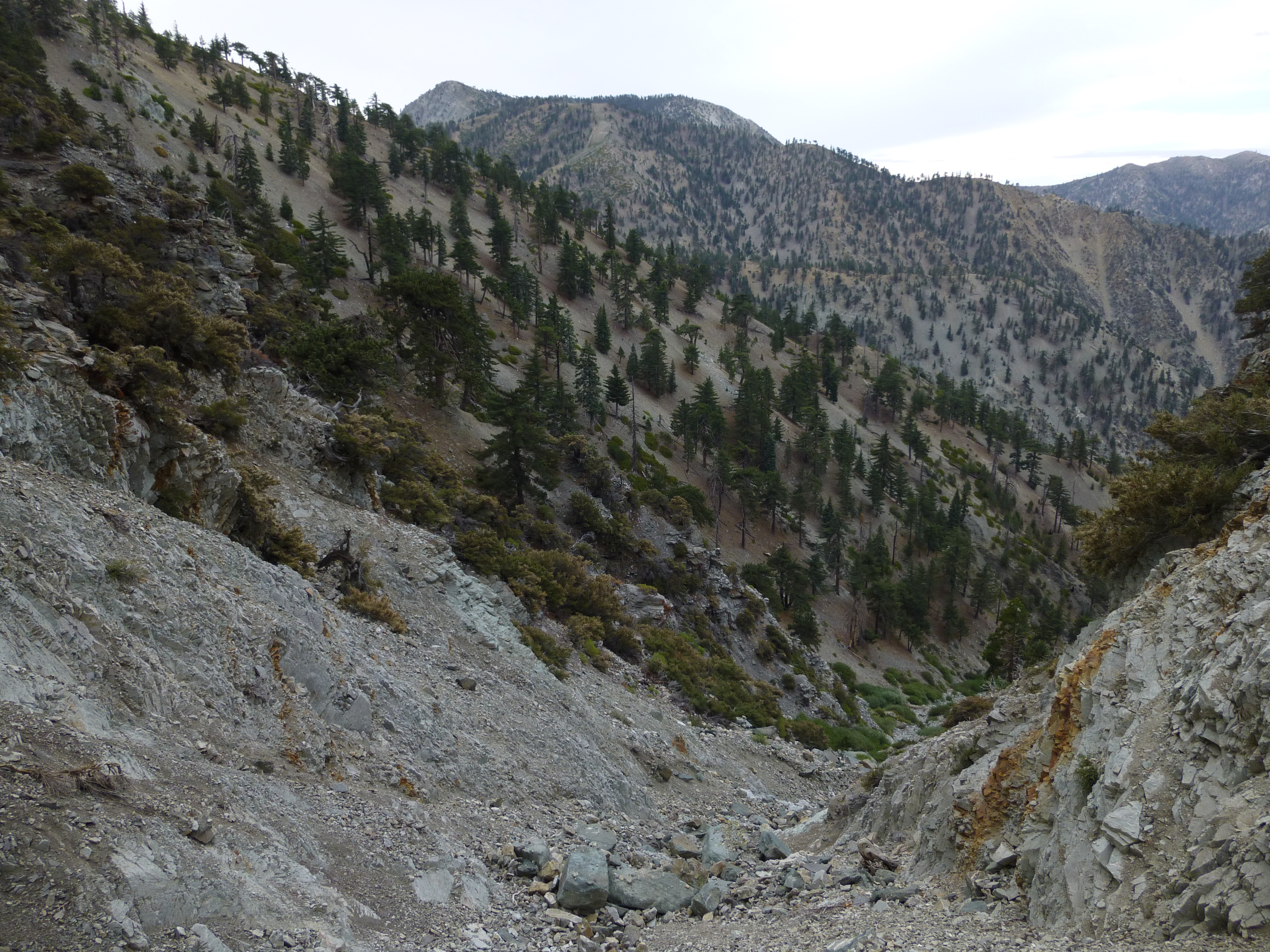
By 6:49 we finished with the Manker fire road and continued cross-country up the canyon. Large boulders filled the creekbed, but we negotiated them with ease. Eventually the rocks lessened in size and number. Some pieces of old pipes and railings and stuff popped up here and there.

Around the 7600' mark a spring still trickled in the main canyon. Also, a 15' waterfall on the right, at the end of a narrow tributary, offered a weak flow.

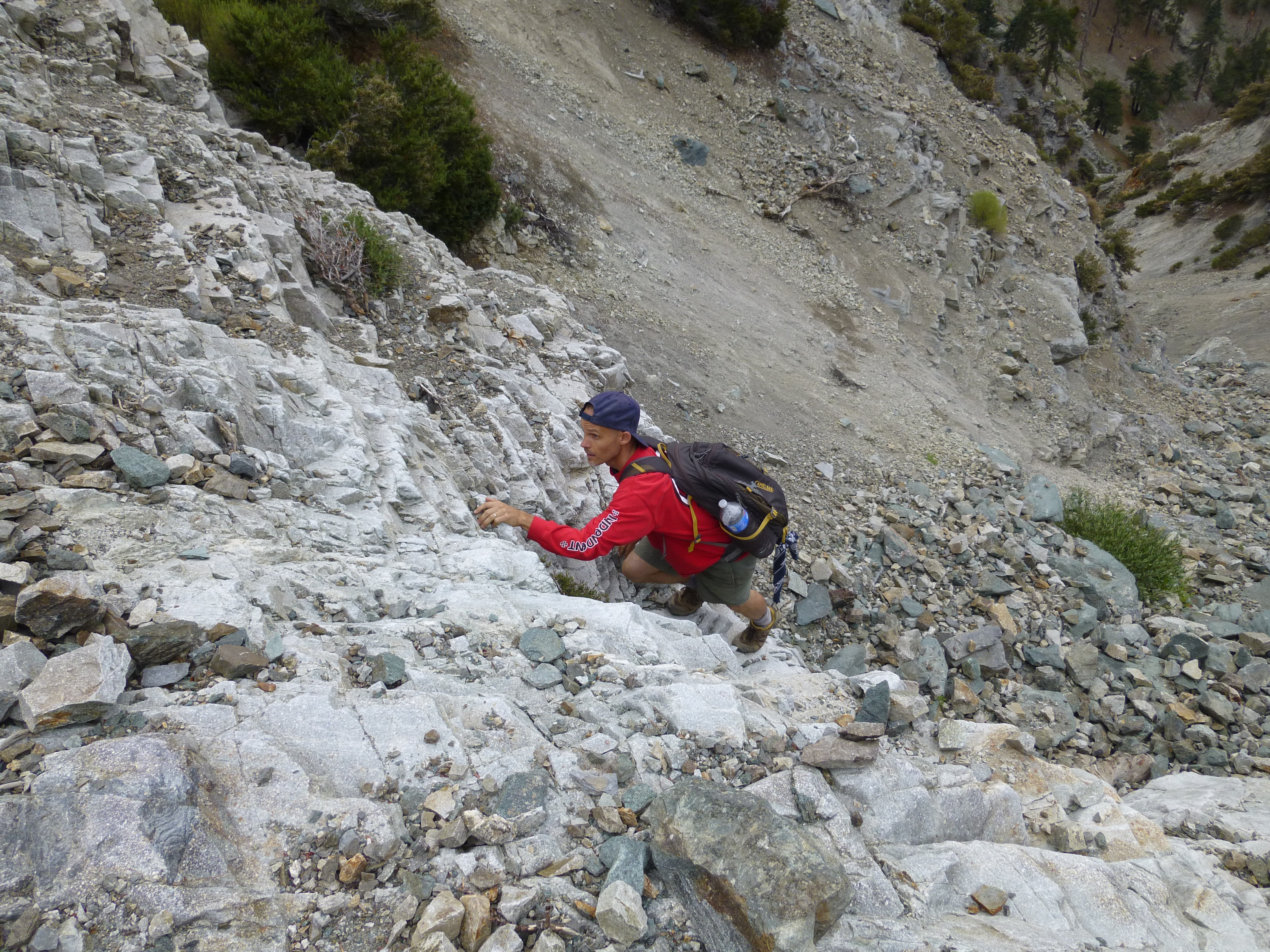
The climbing was generally class 2. However, we encountered a couple solid class 3 scenarios with minimal exposure, one on a near vertical wall of white rock about 15' high with good holds.

Exiting the gulch took some scrambling. The super steep headwall was very loose. Around 8550' we turned right and using tree branches pulled ourselves up the easiest-looking slope. I dislodged a big boulder which passed within a foot of Willie, who was following behind me.

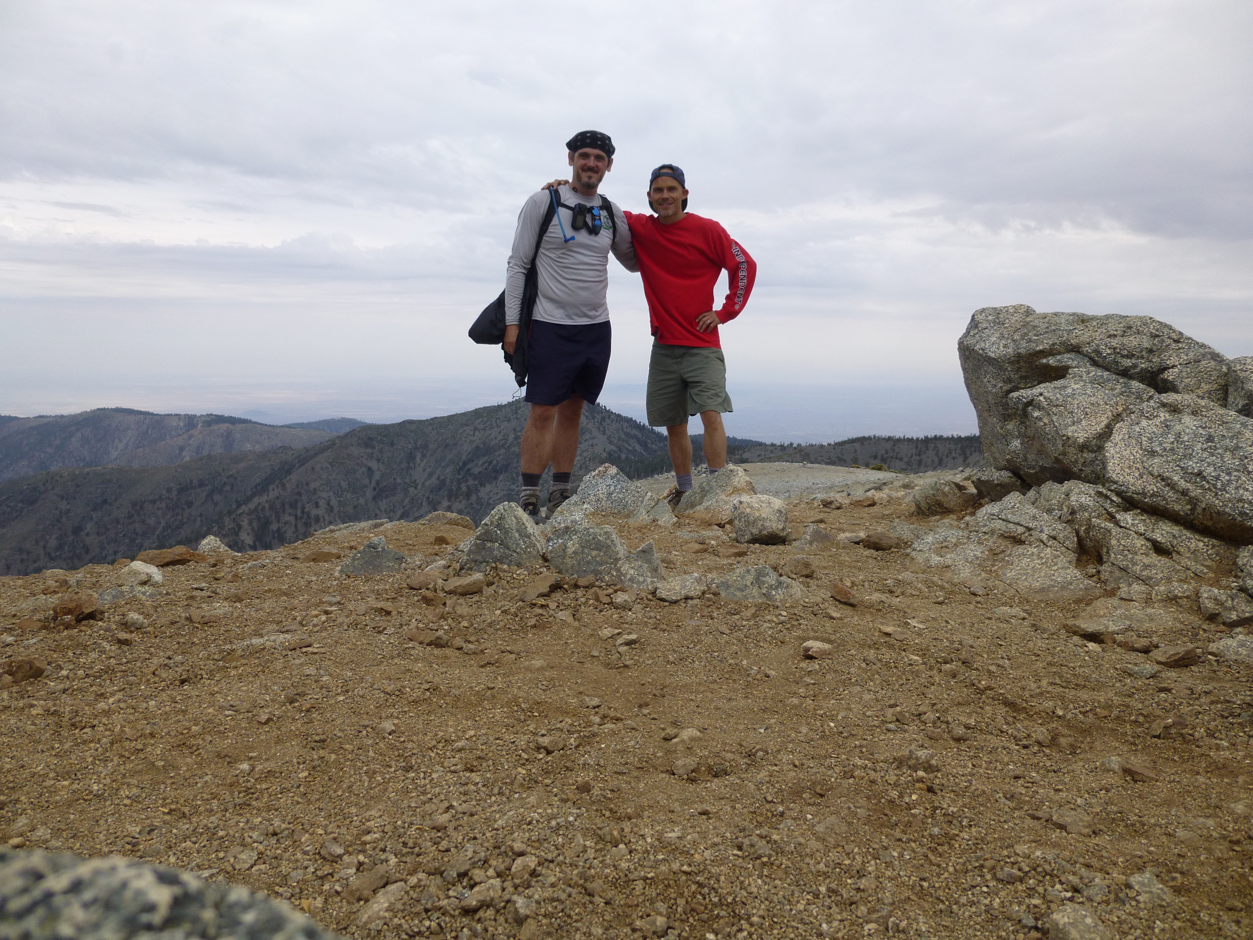
By 8:02 we had completed Manker Canyon and triumphantly stood upon the Devil's Backbone Trail, which we then used to bag Harwood and Baldy.

Willie climbing a rock obstacle in Manker Canyon
Image

Image

Image

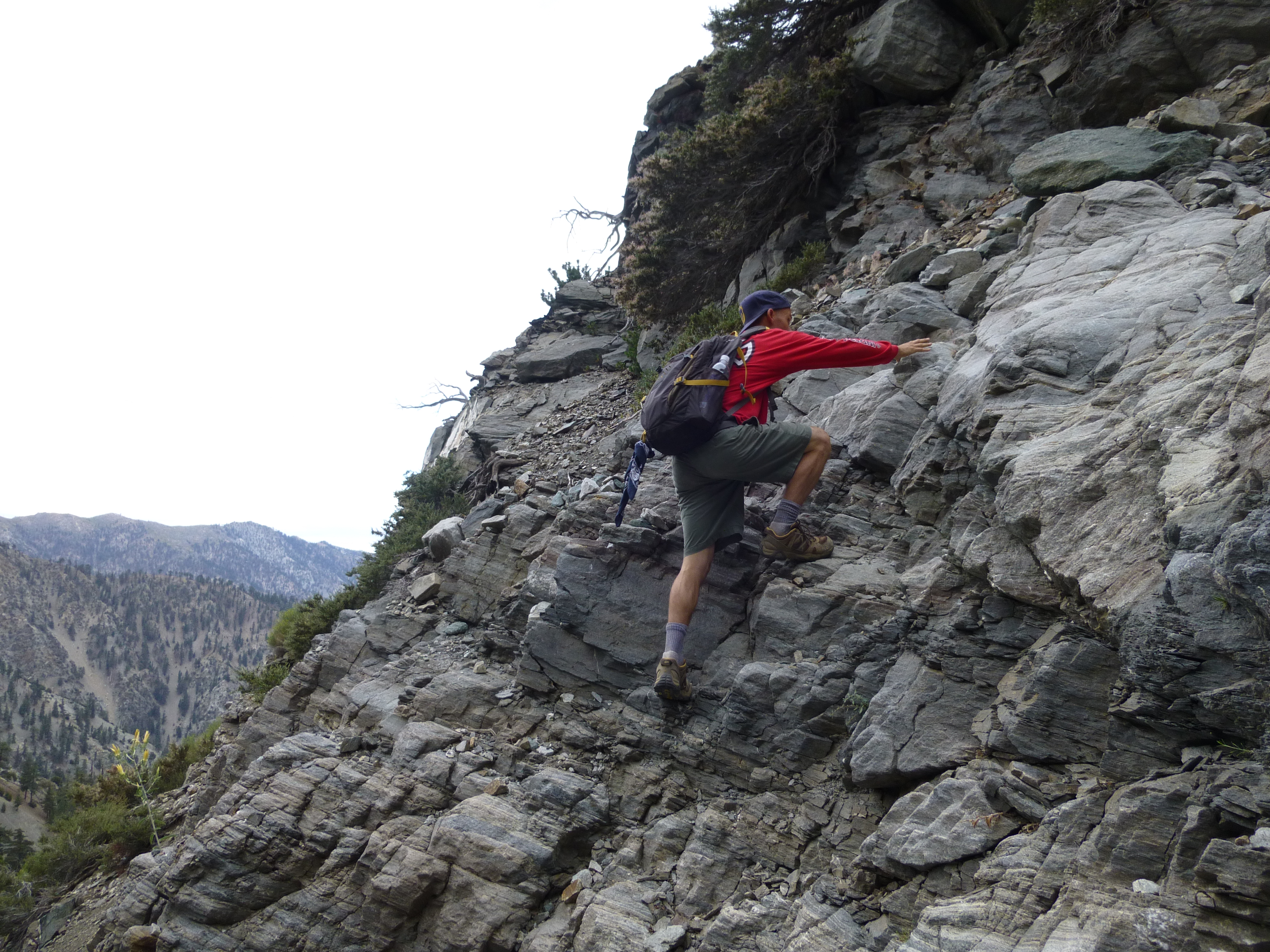
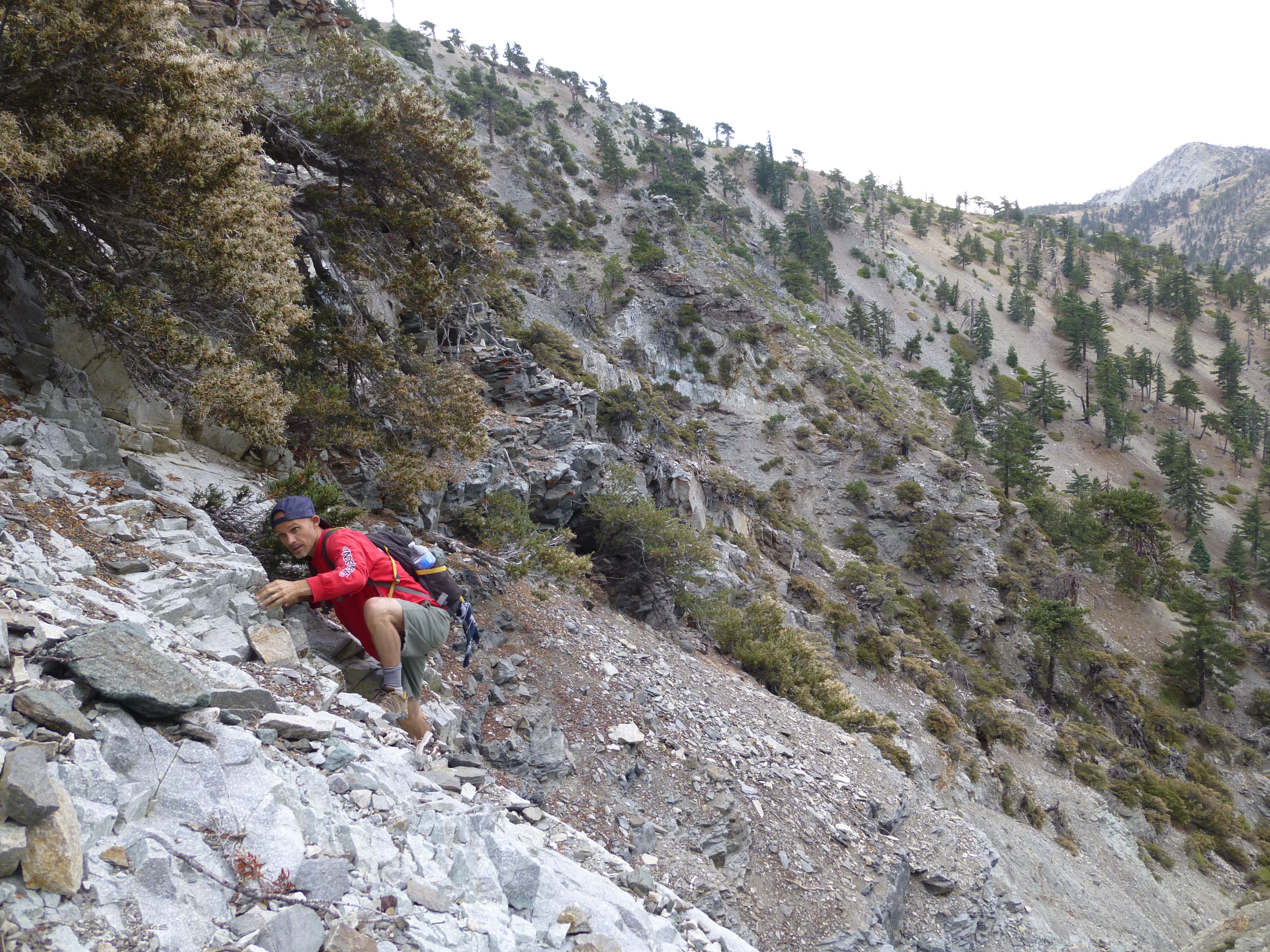
Class 3 wall of white rock, bypass on left (not shown)
Image

Image

Manker Canyon's headwall, exiting up the right side
Image

Willie on the Devil's Backbone Trail
Image

On the Baldy summit
Image
User avatar
mangus7175
Posts: 148
Joined: Wed Oct 12, 2011 3:03 pm

Post by mangus7175 »

BEAST!! :twisted:

Wish I had the guts to do that LOL
User avatar
tekewin
Posts: 1233
Joined: Thu Apr 11, 2013 5:07 pm

Post by tekewin »

Nice trip and photos. Loco!

I am trying to figure out exactly where you came up from satellite, but it looks like there were a couple of choices, all steep. I am guessing north of the last lift. Pretty cool.
User avatar
Sean
Cucamonga
Posts: 3902
Joined: Wed Jul 27, 2011 12:32 pm

Post by Sean »

tekewin wrote: I am trying to figure out exactly where you came up from satellite...
I put my GPS track here.

Image

Image
User avatar
tekewin
Posts: 1233
Joined: Thu Apr 11, 2013 5:07 pm

Post by tekewin »

Thanks, Sean. That helps. That last section looks challenging.
User avatar
RichardK
Posts: 727
Joined: Sun Sep 30, 2007 12:33 pm

Post by RichardK »

mangus7175 wrote: BEAST!! :twisted:

Wish I had the guts to do that LOL
I wish I were physically capable to do that.

Congratulations!
Post Reply