A leisurely picture-taking pace put me on Rattlesnake after three hours. By 9:17 AM the ridge was already disturbingly hot. I had consumed only one liter of electrolyte water, and there were nearly three remaining. That should be enough for the climb to South Hawkins, I thought. Also my pack contained an orange and five energy bars. Plenty of food.
The main objective was to scout the route between Rattlesnake and South Hawkins for a possible attempt at the San Gabriel Death March next year. With a folding saw I also hoped to clean up any remaining brush obstacles en route. The saw came in handy only a few times, during the initial descent from Rattlesnake.
It's an 800-foot drop down to a saddle at the head of Graveyard Canyon. I started approximately 150 feet before the Rattlesnake summit and basically executed a controlled slide down the slope, trying to stay upright until it was possible to contour over to the ridge, where a group of pine trees offered some shade. Below this point were rocks and blackened branches. The remaining decline was a bit slow but generally straightforward, sticking close to the ridge spine.
From Graveyard Saddle (5000+) I climbed up to Summit 5346, where the ridge turned right and immediately dropped down to another saddle (4960+), thereby robbing me of the elevation just gained. This happened again as I rollercoastered up and down to the next saddle (4880+), while crossing the head of Bichota Canyon.
Losing elevation gain can be mentally taxing, especially while simultaneously baking in the sun's burning rays. But I was enjoying the new experience and the fantastic views of Iron Mountain next door. Still, there were another three miles and 3000 feet that needed to be gained somehow.
Occasionally a breeze cooled me off slightly. But it wasn't long before the shirt had to come off. I had forgotten sunscreen and hoped the sun would go easy on my flesh.
At 11:30 AM I was hunting for any shade available. I found some under a large blooming yucca and took a break. The ridge was alternating between steep rocky terrain and steep non-rocky terrain, sometimes involving stepping through brush with thorns that attempted to penetrate my skin.
I was getting low on water and started rationing. Some trees around 6400' provided welcoming shade for a ten-minute rest.
It was a slow climb the rest of the way. Dehydration worked on me. The sun refused to go away. By the time I reached the firebreak at 7000' and turned left toward South Hawkins, I had long abandoned any hope of returning to the car the way I had come. I considered dropping down Pigeon Ridge but instead decided to continue to South Hawkins where I could nap in the shade. Secretly I hoped to find someone on Hawkins and maybe bum some water. My fingers were losing mobility, and it took a long while to chew and swallow an energy bar because of dry mouth.
On Hawkins I drank the last of the water and rested for fifteen minutes. I napped again in some shade in the middle of the S. Hawkins fire road, after deciding to go to Crystal Lake for water. Some ways down the road, however, I noticed a use/animal trail dropping into the head of Soldier Creek, which, to my relief, still had a small flow of water trickling across the rocks.
After getting my fill, I felt brand new and climbed out of Soldier. I descended cross-country to the Crystal Lake campground, picking up an old path here and there, including something called the Tototngna Nature Trail.
The cafe was still open, but I had no money. I was down to one energy bar. Some PCT thru hikers were waiting for a ride down to the city. They had been on the trail for two months already and were going to bypass the closure.
Two Asian dudes gave me a ride down to the East Fork Road, which I then walked all the way back to my car over five miles away. To avoid thinking about the pain in my blistered feet, I counted the last 1,343 steps as the final bits of sunlight faded in the west.
Starting up Shoemaker Road

Shoemaker Canyon watershed with Rattlesnake Peak route

Flowers and scorched yucca

Rattlesnake Peak register

Rattlesnake summit

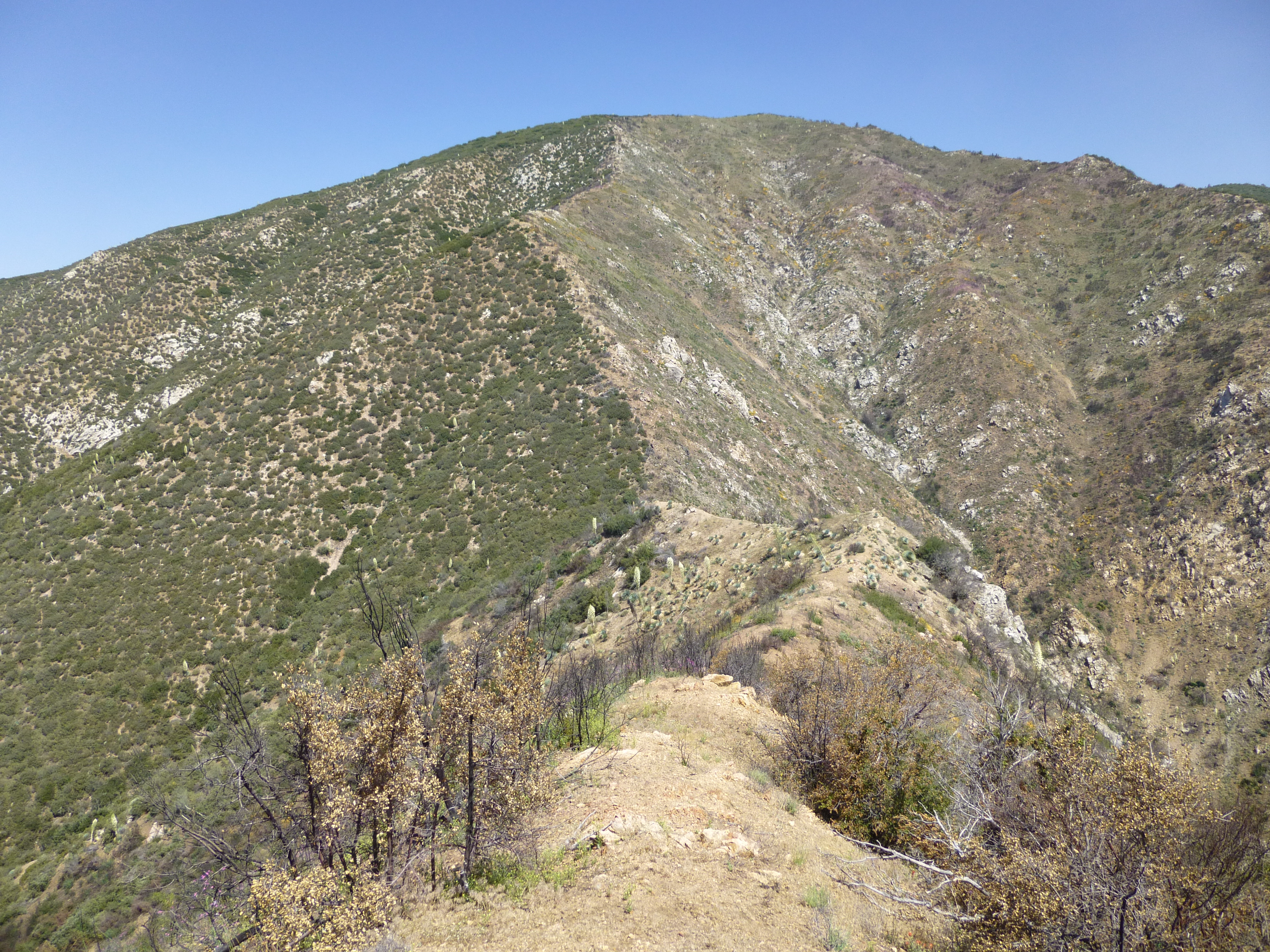
Dropping down to Graveyard Saddle


Approaching Graveyard Saddle with Summit 5346 above it

Viewing Rattlesnake from Summit 5346

Looking back at Rattlesnake

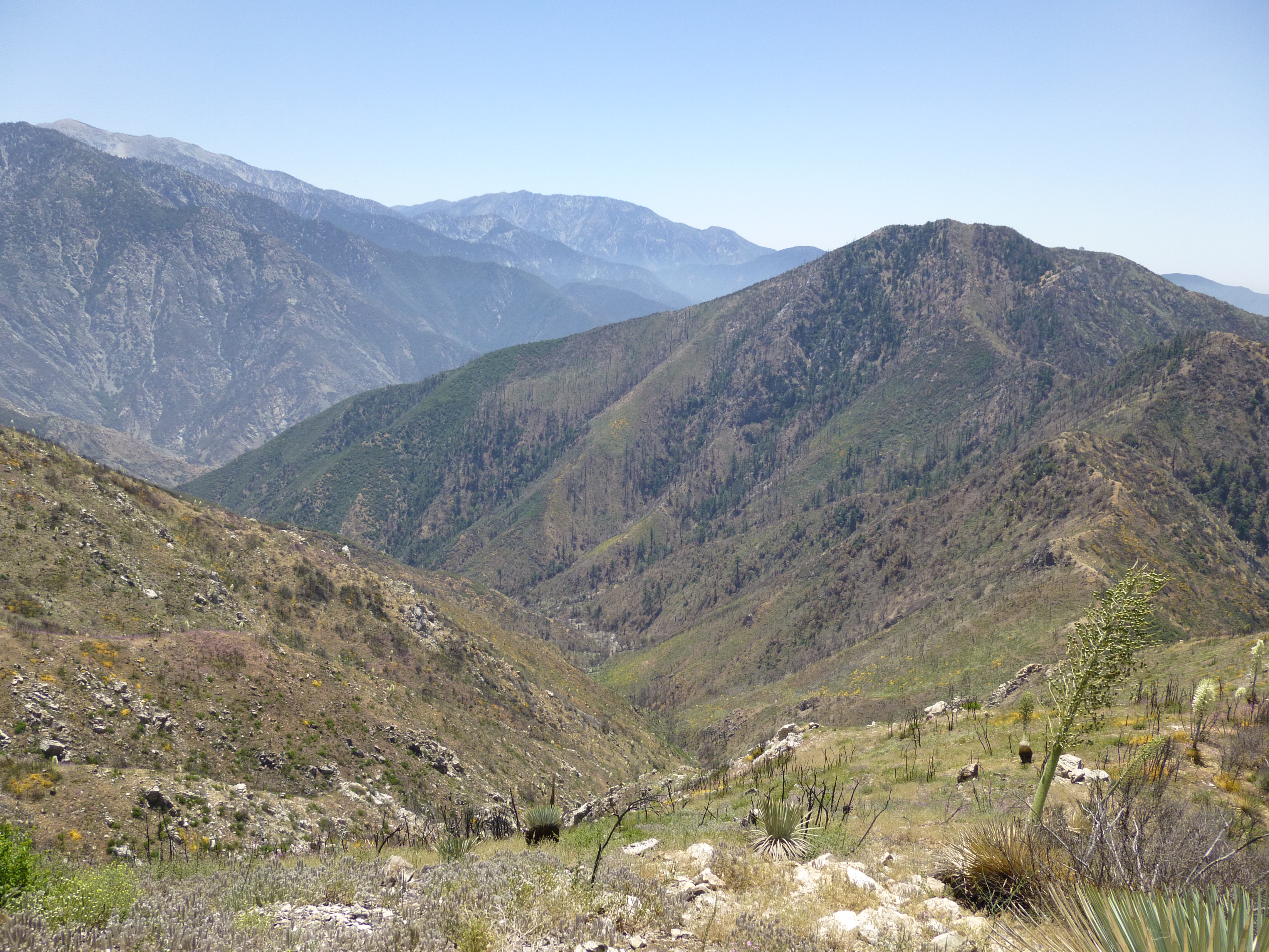
Devil Gulch west fork and Iron Mountain in upper left


Dodder


Trees in sight

Baden-Powell and Ross

Above Devil Gulch north fork

Pigeon Ridge

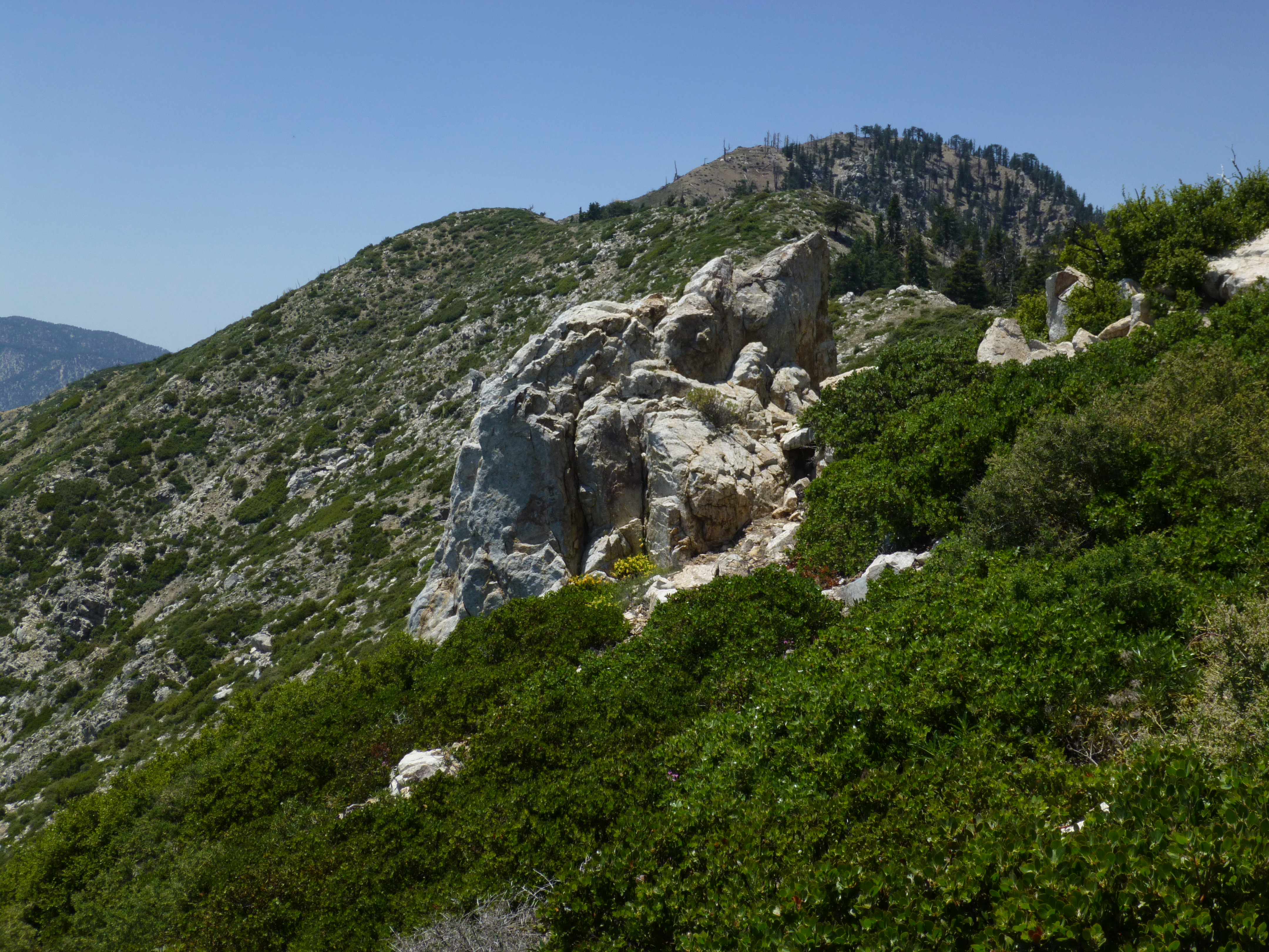
Nearly at South Mt. Hawkins

View from upper Soldier Creek

Descending to Crystal Lake campground

Tototngna Nature Trail

Camp Williams from Shoemaker Road