The Cucamonga Fifty

TRs for the San Gabriel Mountains.
User avatar
Sean
Cucamonga
Posts: 3782
Joined: Wed Jul 27, 2011 12:32 pm

Post by Sean »

Yesterday I completed the toughest hike of my life. I call it the Cucamonga Fifty. Basically it's every trail in the Cucamonga Wilderness out and back, including the seven peaks accessed from those trails.

After starting up Icehouse Canyon at midnight, I bagged Ontario and Big Horn peaks rather quickly in the light of the waxing gibbous moon. My only issue was refilling water at Kelly Camp, which took 15 minutes due to a barely trickling spring.

Next was the long slog to Joe Elliott campground and back, while bagging Cucamonga and Etiwanda peaks, along the Cucamonga Peak Trail. Below Etiwanda the abandoned track is a pretty rough adventure through fire-damaged areas. I reopened a wound in my hand negotiating deadfall and also tore up the bottom of my pants a bit going through thorny bushes. This bit was a tad frustrating, especially on the return climb, but deep down it's the sort of wild hiking I enjoy the most.

Back at Icehouse Saddle I changed shoes because the first pair caused some blisters. I was otherwise feeling pretty good after 26 miles and proceeded down Middle Fork toward Lytle Creek. Descending this section wasn't a problem, but coming back up nearly wasted me. Stupidly I had reduced food consumption and stopped taking electrolyte supplements. I suppose I did this because at this point I was very dehydrated and not thinking clearly. Perhaps I was simply tired of eating and drinking for 12 hours straight.

After falling a half hour behind schedule, I found myself back at Icehouse Saddle and considered quitting. I felt exhausted and still had the daunting task of the Three Tee's trail ahead of me. Moreover, my feet were heavily blistered by now. But in a moment of clarity I concocted a plan. I would take an extended break and shove as much food in my mouth as possible while drinking electrolyte water. I would also duct tape my blisters and change socks.

After twenty minutes I started feeling more myself, and the idea of taking on the Three Tee's became a real possibility in my mind. Once on the trail, I felt even better and actually jogged some of the downhills to make up time lost. Also, while summiting the three peaks (Timber, Telegraph, and Thunder) I left my pack at the main trail to save energy, which had become my primary concern.

On the return to Icehouse Saddle from Thunder Mountain, the full moon appeared in the eastern sky and wished me good tidings. It occurred to me that during this one hike I had witnessed two different phases of the moon, and that simple thought kept me strangely entertained for about two miles.

After finishing the Three Tee's, I was only 12 minutes behind schedule, but my blistered feet were really killing me. And my right knee wasn't doing too well either. Still I pushed hard on the final descent through Cedar Glen camp. The last two miles were brutal and I felt like a zombie stumbling through the forest in the moonlight. My right shoulder hurt from carrying two packs since the saddle. I had kept a stashed backpack at Icehouse Saddle with supplies, and was now lugging it back to the car.

Getting through the boulder-strewn, final mile in Icehouse Canyon seemed like a hazy dream. I thought I saw a bunch of shadowy people and animals standing around in the creekbed, but thankfully I wasn't too far gone that I actually believed what I imagined. The shoulder pain was getting to me, and then I realized I could slip off the one strap and shift all the weight to my left shoulder. Duh!

At 11:47 PM I hobbled into the Icehouse Canyon parking lot, having been on the trail for 23 hours and 47 minutes. My Garmin claimed the trip was a total of 51.3 miles, but it has been known to lie to me before. Total elevation gain was somewhere near 16,500 feet.

My post-hike reward feeding consisted of Jack in the Box's Bacon Ultimate Cheeseburger combo with large curly fries and a Sprite. I passed out for eight hours, woke up around noon today, and managed to walk to the computer--like a crippled old man whose legs barely function.

Starting at midnight with wilderness permit in hand
Image

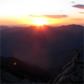
An early morning view from Cucamonga Peak Trail
Image

Sunrise from Cucamonga Peak
Image

In the fog at Joe Elliott campground
Image

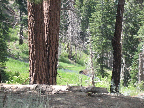
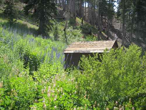
Flowers along the Middle Fork Trail
Image

A hungry deer on Timber Mountain
Image

Finished! back at Icehouse Canyon parking lot
Image

GPS track
Image
User avatar
longcut
Posts: 190
Joined: Wed Feb 02, 2011 1:40 pm

Post by longcut »

congrats! solo hiked it too, good stuff! get some sleep!
User avatar
mangus7175
Posts: 148
Joined: Wed Oct 12, 2011 3:03 pm

Post by mangus7175 »

Congratulations on your accomplishment! What an achievement...I don't think I could ever do something like is in 24 hours :oops:
User avatar
yobtaf
Posts: 297
Joined: Fri Jun 12, 2009 8:52 am

Post by yobtaf »

DAMN! :shock: Congrats! 8)
User avatar
IcyBacon
Posts: 22
Joined: Tue Dec 28, 2010 10:27 am

Post by IcyBacon »

:shock:

That is damn inspiring and incredible. Cool idea with the central resupply stash and great pictures looking down on the clouds.
User avatar
tekewin
Posts: 1195
Joined: Thu Apr 11, 2013 5:07 pm

Post by tekewin »

Epic doesn't even come close to your accomplishment. Triple Epic?

Awesome report. That is the kind of crazy hike I like, just scaled way down for mortals. Great report!

You earned that ultimate cheeseburger and some rest.
User avatar
Uncle Rico
Posts: 1402
Joined: Thu Mar 20, 2008 7:48 pm

Post by Uncle Rico »

You're a frickin' beast dude. Well done.
User avatar
HikeUp
Posts: 3855
Joined: Thu Sep 27, 2007 9:21 pm

Post by HikeUp »

My feet hurt after reading that.
User avatar
Mgreenmk
Posts: 1
Joined: Sat Apr 27, 2013 10:10 am

Post by Mgreenmk »

Absolutely incredible accomplishment! :shock: Shock and awe!
User avatar
lilbitmo
Posts: 1092
Joined: Tue Mar 04, 2008 9:44 pm

Post by lilbitmo »

That's a hell-of-a-24 hours Sean, nice work.

I see the Three Saints in your future - San Antonio, San Jacinto, San Bernardino.

What was the inspiration for just the "out and back" version versus doing the peak bagging version such as Sugarloaf, Ontario, Bighorn, Cuca, Etiwanda, Timber, Telegraph, Thunder and over into the Harwood, Baldy, West Baldy like others have done?

Just curious?

Amazing amount of hiking in that time frame, as others have said I'm tired just thinking about it and I like big hikes but that's bigger than I would consider doing :shock:

Very impressive :D
User avatar
Sean
Cucamonga
Posts: 3782
Joined: Wed Jul 27, 2011 12:32 pm

Post by Sean »

lilbitmo wrote: What was the inspiration for just the "out and back" version versus doing the peak bagging version such as Sugarloaf, Ontario, Bighorn, Cuca, Etiwanda, Timber, Telegraph, Thunder and over into the Harwood, Baldy, West Baldy like others have done?
First, thanks everyone for the nice comments.

My inspiration was complex and gradual. After doing the Mountaineer's Route on Whitney last October, I was contemplating what my next real challenge would be, when I happened upon Brett Maune's 2009 TR for the JMT speed record. I found it absolutely fascinating and immediately wanted to try my hand at fastpacking. I decided that 50 miles would be my initial single-day goal. (The most I had done was 27.)

I then started looking at maps for an interesting course, and I realized that Cucamonga Wilderness had an extensive and unique trail network with a central hub at Icehouse Saddle, which provided a convenient bail out point if things went badly after any one segment. And upon closer inspection, I noticed that the total out-and-back mileage of all the trails added up to about 51, if you include the peaks. I couldn't wish for a more perfect course!

I also like peakbagging challenges and did San Gorgonio 9 Peaks last year. I might one day attempt some crazy Rick Kent-style adventure. Or maybe Fight On's dream of the Baldy/Iron/BP hat trick. But right now I'm obsessed with concocting Wilderness-level fastpacking challenges of my own.
User avatar
HikeUp
Posts: 3855
Joined: Thu Sep 27, 2007 9:21 pm

Post by HikeUp »

Try this loop (I don't even have a guess at how long it would take)...

Heaton Flat
Rattlesnake
South Hawkins
Hawkins
Throop
Baden Powell
Pine
Dawson
Baldy
Iron
Heaton Flat

Throw in all the other minor peaks if you want! Connecting BP to Pine via Pine's western ridge or Blue Ridge/North Backbone.

Almost entirely within the Sheep Mountain Wilderness.

No car shuttle required, although leaving a car at Heaton is dicey at best.
User avatar
hvydrt
Posts: 494
Joined: Thu Sep 27, 2007 8:18 pm

Post by hvydrt »

Good job and great trip report! Thanks for sharing.
User avatar
cougarmagic
Posts: 1409
Joined: Wed May 07, 2008 5:21 pm

Post by cougarmagic »

I just want to say 'way to go!' and congrats. It is a select few who can do these things. I love reading about them.
User avatar
Sean
Cucamonga
Posts: 3782
Joined: Wed Jul 27, 2011 12:32 pm

Post by Sean »

HikeUp wrote: Try this loop...
Unless I overlooked something, that loop runs about 45 miles with 15-16k gain. That's taking the PCT from BP to North Backbone--not Pine Mtn Ridge. Sounds doable, doesn't it? Is there actually a spring at Guffy Camp?
User avatar
HikeUp
Posts: 3855
Joined: Thu Sep 27, 2007 9:21 pm

Post by HikeUp »

Sean wrote: Sounds doable, doesn't it?
Well, I know I couldn't, but I keep tossing it out there hoping Rick Kent, Ze', you, or whoever will do it and let me know :D . Now that the fire has cleared that ridge between Rattlesnake and S. Hawkins, it should be easier :wink: .
Sean wrote: Is there actually a spring at Guffy Camp?
I think there is a spring just north of Guffy down the hill a short ways. I was at Guffy last year with Hikin' Jim and others and I think Jim located it - maybe he or others can provide more useful info.

Edit:from http://www.4jeffrey.net/pct/a.htm
~275 yards N DOWN STEEP slope to old red pump house in Flume Cyn. Take wide use trail at rock cairn on the right (N) below guard rail just before PCT enters the campgrd ~50 yds E of the water tank. Spring UTM 0439545, 3800530 elev. 7724.
User avatar
Slowest_Hiker
Posts: 252
Joined: Sun Jul 31, 2011 12:31 pm

Post by Slowest_Hiker »

Sean wrote: Is there actually a spring at Guffy Camp?
I think there is a spring just north of Guffy down the hill a short ways. I was at Guffy last year with Hikin' Jim and others and I think Jim located it - maybe he or others can provide more useful info.

Edit:from http://www.4jeffrey.net/pct/a.htm
~275 yards N DOWN STEEP slope to old red pump house in Flume Cyn. Take wide use trail at rock cairn on the right (N) below guard rail just before PCT enters the campgrd ~50 yds E of the water tank. Spring UTM 0439545, 3800530 elev. 7724.
[/quote]

It's all true. Go north from the north side of the CG and find a little trail, then once you sight the pump house you'll know where you're going. Rather picturesque when there are a lot of flowers around the pump house too.

Image
IMG_0830 by moore91024, on Flickr

Image
IMG_0828 by moore91024, on Flickr

However, it is not guaranteed year-round in dry years and according to the Big Pines Ranger Station, it is not expected to last this year.
User avatar
tekewin
Posts: 1195
Joined: Thu Apr 11, 2013 5:07 pm

Post by tekewin »

Heaton Flat
Rattlesnake
South Hawkins
Hawkins
Throop
Baden Powell
Pine
Dawson
Baldy
Iron
Heaton Flat
My first impression is that the beginning of that hike may be the toughest. I have not read a successful trip report from Rattlesnake -> South Hawkins but someone may have done it. The loop is mostly cross country on ridge lines. A wild ride for sure, but I would love to see the pictures.
User avatar
Phil B
Posts: 101
Joined: Wed Oct 03, 2007 12:47 pm

Post by Phil B »

Epic hike and great report Sean, Any excuse for the Ultimate cheeseburger and large curly fries - no need to feel guilty about that.
User avatar
Sean
Cucamonga
Posts: 3782
Joined: Wed Jul 27, 2011 12:32 pm

Post by Sean »

tekewin wrote: My first impression is that the beginning of that hike may be the toughest.
Rough estimate of Shoemaker to South Hawkins is 7-8 miles with 7000' total gain. Rich O recently got to Rattlesnake in 2.5 hours. That's about 1.7 mph. Then Rattlesnake to S. Hawkins is another 3.7 miles or so with 3300' to gain. Let's say it's 1mph on that bit. That gives you 6.2 hours to S. Hawkins.

Total remaining stats for the loop are 37-38 miles with 9000 gain. All of that is on a good trail except for parts of Iron. Assuming 2mph this can be done in 19 hours, for a total of 25.2. So somewhere 1.2 hours needs to be shaved in order to do it in a day. I think it would be very easy to maintain at least 2.5 mph on the PCT, making this loop very possible, assuming plentiful water can be had on the PCT.

I would start 6 hours before sunset, so that I'm not doing Rattlesnake and S. Hawkins in the dark. Then I huff it along the trails all night long to Baldy (26-27 miles, 10.5-13.5 hours). The sun should be coming up by then, and I can tackle Iron in the refreshing morning sunshine.

Unfortunately, I have other big plans for this summer. But I'd thoroughly enjoy reading about someone else doing it.
User avatar
HikeUp
Posts: 3855
Joined: Thu Sep 27, 2007 9:21 pm

Post by HikeUp »

Phil B of this board made the trek from Shoemaker to S. Hawkins quite a few years ago... his pictures.

Yeah, the toughest part will be getting from the parking lot at Heaton across the river to Shoemaker Road :lol: . Probably take an hour!
User avatar
tekewin
Posts: 1195
Joined: Thu Apr 11, 2013 5:07 pm

Post by tekewin »

HikeUp, thanks for the link. Awesome! I'll stop polluting this thread. I don't want to diminish the C50.
User avatar
lilbitmo
Posts: 1092
Joined: Tue Mar 04, 2008 9:44 pm

Post by lilbitmo »

The original objective (still not accomplished) was to do Wright Mountain, Pine, Dawson, Baldy, West Baldy, Iron, drop to Heaton Flats cross the river and ascend Rattlesnake, S. Hawkins, (Saddie/Middle) Hawkins, N. Hawkins, Throop Peak, Burnham and Baden Powell - this trek was fondly nicknamed (by David Bosman/Enfuego and myself) the San Gabriel Death March - even some folks in the SAR community that had been watching this board thought anyone willing to attempt this was quite frankly - insane :shock:

Obviously as noted the section from Rattlesnake to S. Hawkins, to name a just one obstacle was going to be the most difficult to overcome as it was a thick as can be and might still be as I've not read any reports of anyone getting through there since the fire. Rick Kent did try this section three years ago and posted a report, he left Heaton Flats super early in the morning and spent a significant amount of time working through the brush on the ridge between Rattlesnake and S. Hawkins, then made it to Baden Powell if I remember correctly mid-afternoon, realized he wasn't going to be able to make the second half, dropping down into Prairie Fork following the East Fork of San Gabriel River back to Heaton. It's not that easy to do and he was forced into an overnight bivy halfway back to Heaton.

After that Zach Cyrus (Sweetstacks/Pancakes) attempted to go from Vincent Gap/Baden Powell, Burnham, Throop, all the Hawkins Peaks, then to Rattlesnake going in that direction on a December day. Well as luck would have it the overcast clouds hanging at 10,000 feet dropped late in the day to 2,000 feet thus socking in the ridge lines making visibility about 30 feet at the time when he was between S. Hawkins and Rattlesnake, forcing him to decide which ridge was the correct one by dead reckoning and forcing another unplanned bivy.

Needles to say, no one that I know of has made even one half of this adventure without some problems of some sort. FO claim of having done Baldy Village/Bear Canyon, to West Baldy, Baldy, Pine, Dawson, Wright Mountain, drop into Wrightwood had lunch and made it back just after dark retracing those peaks, while amazing is still under question as to the distance, time, elevation gain and descent at this time cannot be verified (good for him if he did, just having hard time believing he did it, IMHO).

The challenge is to get a start from either end and make it past both Rattlesnake/S. Hawkins and West Baldy to Iron to Heaton in either direction, the picking off of the peaks will be the easy part once those monster things have been done, but if someone has BETA on the Ridge between S. Hawkins(post fire) and Rattlesnake, then I'm in for a major attempt at this feat.

My suggestion would be a night time start on Wright Mountain with almost full moon, go over Pine, Dawson, Baldy, W. Baldy, drop to Iron, drop to Heaton - get some needed fuel and water from a friend and continue up Rattlesnake and do the rest (if that ridge is partially clear from the fire). The challenge is more to do with terrain than distance as Gunsight Notch is not easy, I've done the Manker to Baldy, to W. Baldy to Iron and back and that alone was a full day.

If anyone does it please let me know, this adventure has been one on my list since the day I presented it to Enfuego and Zach some four years ago, it's up there with the toughest ones I can think of.

Once again Sean great TR and accomplishment on the 51 miler, that's always a big outing no matter where it's done :D
User avatar
Sean
Cucamonga
Posts: 3782
Joined: Wed Jul 27, 2011 12:32 pm

Post by Sean »

lilbitmo wrote: Obviously as noted the section from Rattlesnake to S. Hawkins, to name a just one obstacle was going to be the most difficult to overcome as it was a thick as can be and might still be as I've not read any reports of anyone getting through there since the fire ... but if someone has BETA on the Ridge between S. Hawkins(post fire) and Rattlesnake, then I'm in for a major attempt at this feat.
I probably won't attempt it this year. But if you want I'll scout Shoemaker to S. Hawkins with you. We can take some loppers and try to improve the route.
User avatar
Ze Hiker
Posts: 1430
Joined: Mon Jul 28, 2008 7:14 pm

Post by Ze Hiker »

dude, nice job!
User avatar
JeffH
Posts: 1169
Joined: Sun Nov 28, 2010 7:09 am

Post by JeffH »

Not enough superlatives for this journey.... But it's Freakin' Awesome.
"Argue for your limitations and sure enough they're yours".
Donald Shimoda
User avatar
Uncle Rico
Posts: 1402
Joined: Thu Mar 20, 2008 7:48 pm

Post by Uncle Rico »

Damn! You guys are so far out of my league it's embarrassing. :oops:
User avatar
lilbitmo
Posts: 1092
Joined: Tue Mar 04, 2008 9:44 pm

Post by lilbitmo »

Sean wrote:
lilbitmo wrote: Obviously as noted the section from Rattlesnake to S. Hawkins, to name a just one obstacle was going to be the most difficult to overcome as it was a thick as can be and might still be as I've not read any reports of anyone getting through there since the fire ... but if someone has BETA on the Ridge between S. Hawkins(post fire) and Rattlesnake, then I'm in for a major attempt at this feat.
I probably won't attempt it this year. But if you want I'll scout Shoemaker to S. Hawkins with you. We can take some loppers and try to improve the route.
You gotta love a wife that buyers her husband a "Machete" for Christmas, I'll bring that, it works just like loppers if there's anything in the way we can make a path for now :shock: :D
User avatar
AW~
Posts: 2040
Joined: Mon Oct 01, 2007 12:00 pm

Post by AW~ »

lilbitmo wrote:
Sean wrote:
lilbitmo wrote: Obviously as noted the section from Rattlesnake to S. Hawkins, to name a just one obstacle was going to be the most difficult to overcome as it was a thick as can be and might still be as I've not read any reports of anyone getting through there since the fire ... but if someone has BETA on the Ridge between S. Hawkins(post fire) and Rattlesnake, then I'm in for a major attempt at this feat.
I probably won't attempt it this year. But if you want I'll scout Shoemaker to S. Hawkins with you. We can take some loppers and try to improve the route.
You gotta love a wife that buyers her husband a "Machete" for Christmas, I'll bring that, it works just like loppers if there's anything in the way we can make a path for now :shock: :D
Why do you think there is anything remotely needing a lopper or machete on that ridgeline?...it was incinerated. The beta is shorts and a tshirt....maybe an oxygen mask from kicking up dust and chemicals in a burn area....oh and a hiking stick. The soil is very loose.
Image
User avatar
lilbitmo
Posts: 1092
Joined: Tue Mar 04, 2008 9:44 pm

Post by lilbitmo »

AW I had a feeling you might know, you've done some fun drop-ins in that area - good to know that it will not require loppers or the machete :D
Post Reply