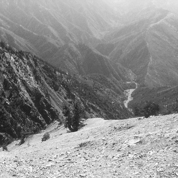
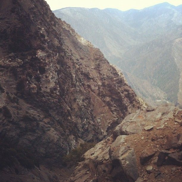
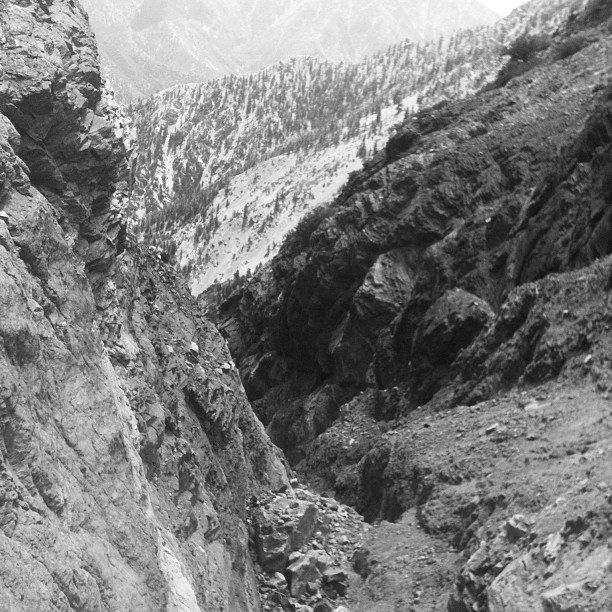
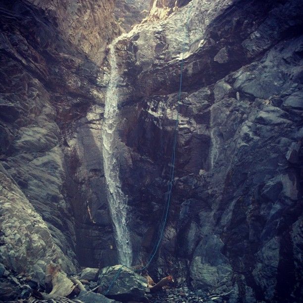
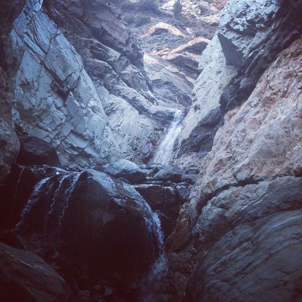
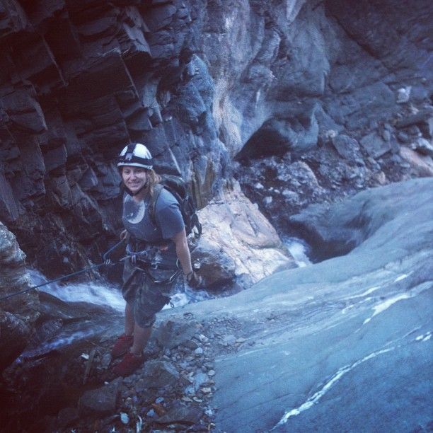
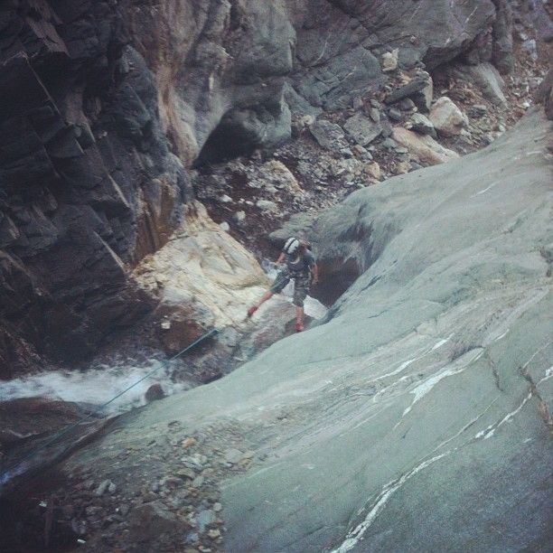
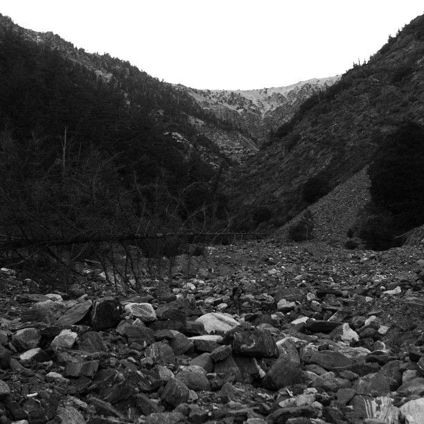
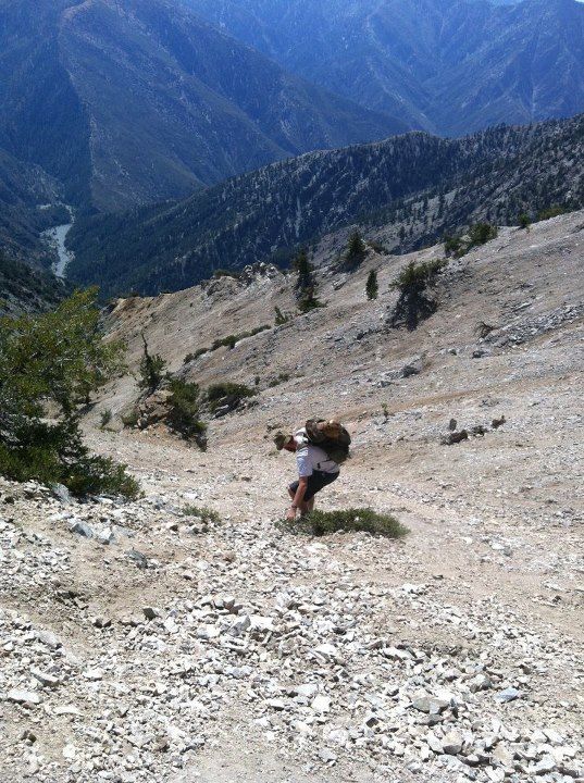
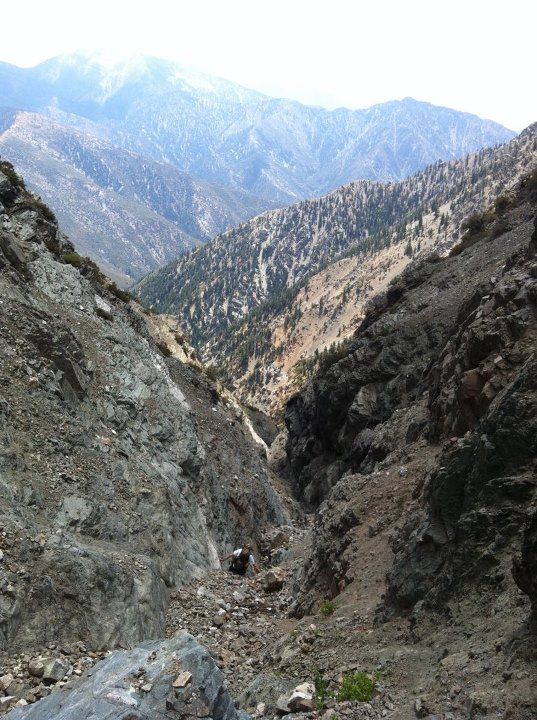
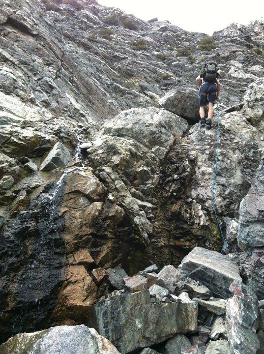
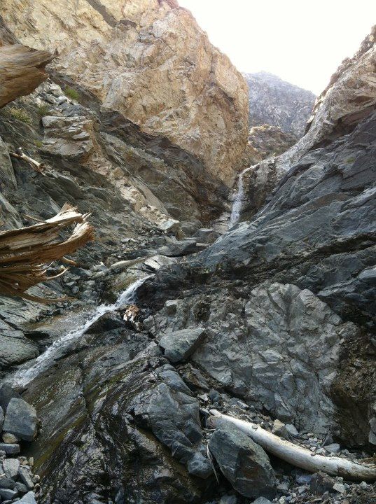
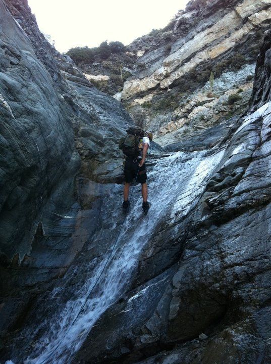
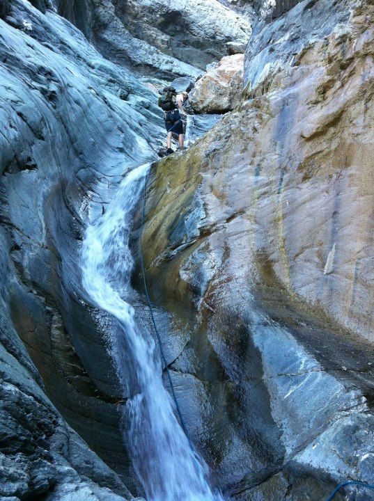
Amanda and I hiked up to the summit of BP, then dropped into Mine Gulch next to the Wally Walmart tree. Took that down Mine Gulch for a long time. Had about 10 rapps, longest was about 80ft. The lower part of the canyon is very pretty and relatively safe. The upper part is very dangerous and extremely loose. Lots of rockfall.
Started the hike at 0730 and got back to the cars at 2310.
My weekend route is puny and insignificant compared to Taco's rather well endowed route. Perhaps that's why the ladies like to go into the mountains with Taco man and not me.
And incredibly daring trip I think. Just going down the ridge from the Wally Waldron tree is a pretty gutsy move. You do not want to make a misstep there. Congratulations on making it go.
Interesting that you chose to not use the trail on the last part of your exit. Deliberate choice or just didn't catch the trail or ? From where the trail crosses Vincent Gulch, it took me, my wife, and my daughter 1:20 to get back to Vincent Gap yesterday (and we're slooow). Is going right up the drainage faster?
Was there water in the side stream by point "K" on your map? That's where I've seen good flow in years past.
Jim, we took the same old trail up but it took longer, probably because we were beat, it was dark, and there was some routefinding. You take the same pretty-easy-to-follow trail up to the cars from there, yeah?
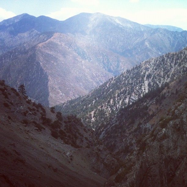
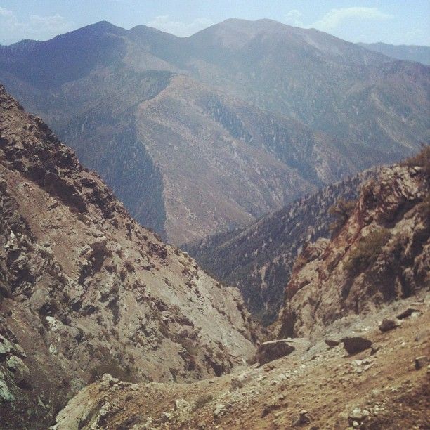
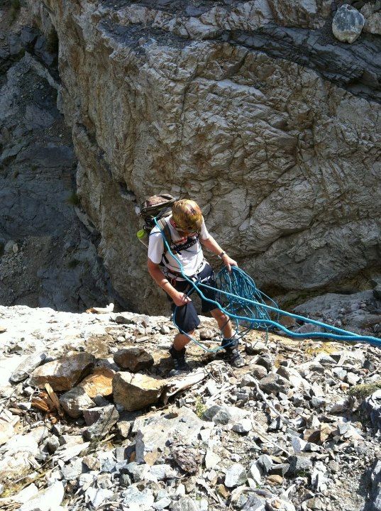
AW, yeah it was like DV except for the occasional water. The nice part of the canyon starts about the same elevation as Bighorn Mine, so I think future parties would do VERY WELL to hike to the mine (easiest thing in the world), then continue along the mtn to drop in somewhere around the same contour line in Mine Gulch. Everything above that is scree, with a couple rapps but they're bad and loose anyway. I got beaned in the helmet by a softball size rock while on rapp, so we really cleaned the rapps on the rest of the rapps so no more rocks would be moved by the rope. Also almost got hit when some rocks fell from way up high and hit near me. Woulda been very very bad to be hit there.
After that, Amanda got AMS and was in a bad way for a bit. She stuck it out and we moved down and down to get her better, and she felt MUCH better after a while. AMS sucks. Had it bad once on Langely once we hit 13,500, and that was 1430 or so. Didn't feel better til we got back to Lone Pine around 2200.
Anywho, the temps were arright. We got off the summit early to avoid thunderstorms, which built overhead quickly, as expected. They provided us with shade and music, though the thunder was not that loud. No precip. Light to moderate gusts upcanyon. Temps were in the 60-70's, but the sun felt hot at times. Was probably 60 in the lower part since it was wet, then it warmed up in the part of Mine Gulch everyone has been in, as that's wide and white and whatnot.
1. Mostly deadman anchors, rockpinches, and a couple tied off bushes. Used every last piece of webbing. Considering the rockfall, the anchors will probably be buried and gone by late next spring.
2. I was too tired last night to say much, so now I'm puking out the info.
3. Got another big canyon on my mind. Might nab it prior to moving to the halls of granite.
Taco wrote: I can't mark the trail on ACME because it would take forever.
Taco wrote: How long is it from the confluence of Mine Gulch and the trail to the parking lot? Sign says 4.5mi but I doubt it.
My estimate is about 3.5mi although it can certainly feel like 4.5 mi after a long day. I'm basing my estimate in part on how long it has taken me to do it in the past and in part on the Tom Harrison map which only lists a single figure for the mileage all the way from Vincent Gap to Lupine Campground.
Wow... to Lupine? Going up Prairie Fork is stupid. Terrible. Then again we did it at night, after Fish Fork in a day. Still terrible during the day, I'd imagine.
Taco wrote: Wow... to Lupine? Going up Prairie Fork is stupid. Terrible. Then again we did it at night, after Fish Fork in a day. Still terrible during the day, I'd imagine.
Yeah, Harrison's maps are a mixed bag. They're more up-to-date than the USGS maps, but they're still pretty out of date.
The reality is that there is no trail up Prairie Fork any more even if there are some old trail signs. The lower part of Vincent Gulch is a trail in name only; one just follows the drainage. The trail that once was there is largely gone, washed out by repeated storms.
The trail to Upper Fish Fork and the Dawson Peak trail are still listed on Harrison's maps, but they in reality no longer exist.
To Harrison's credit, he has removed the trail that once went down the East Fork from Vincent Gulch to (approximately) the Bridge to Nowhere.