Page 1 of 1
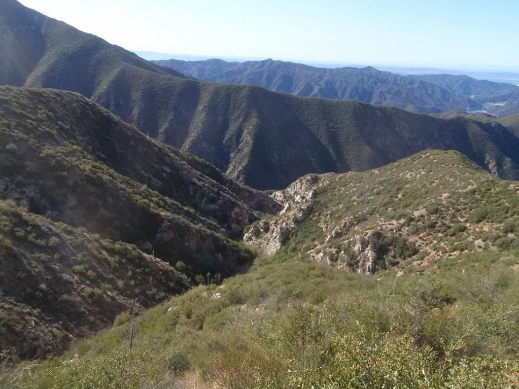
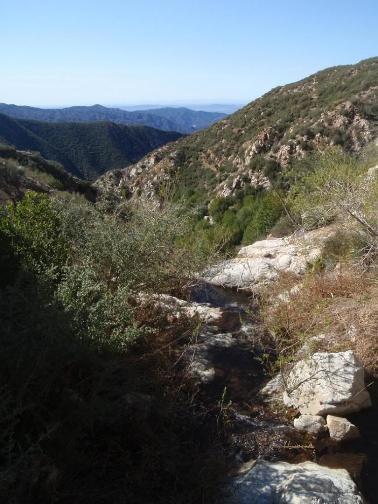
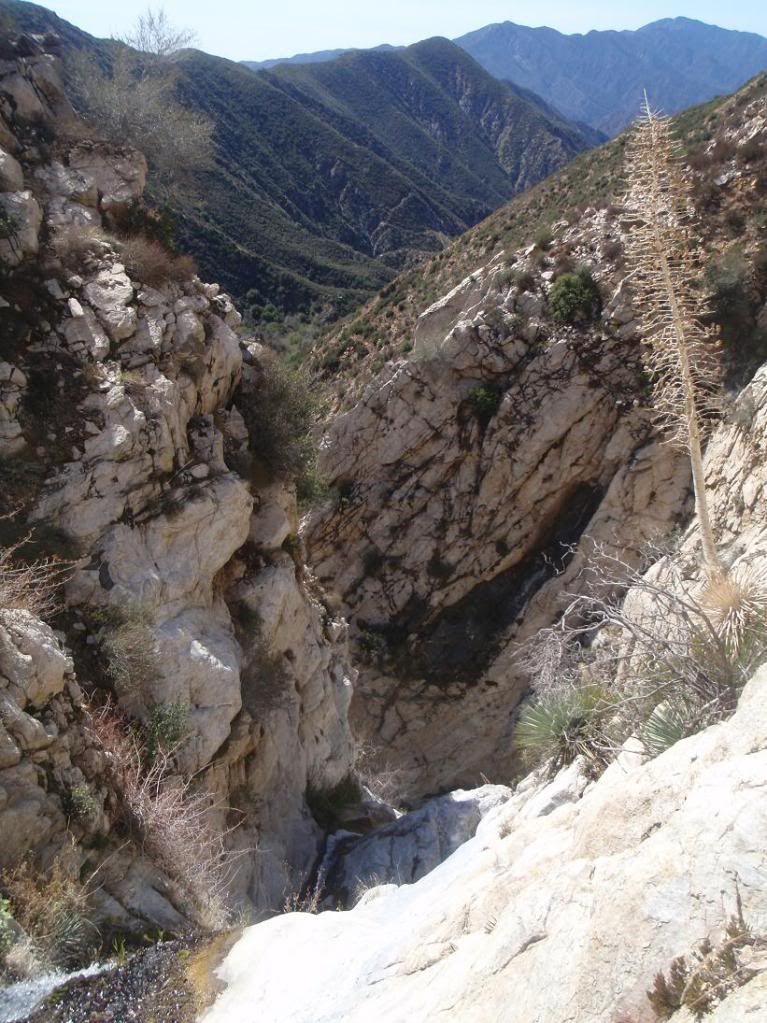
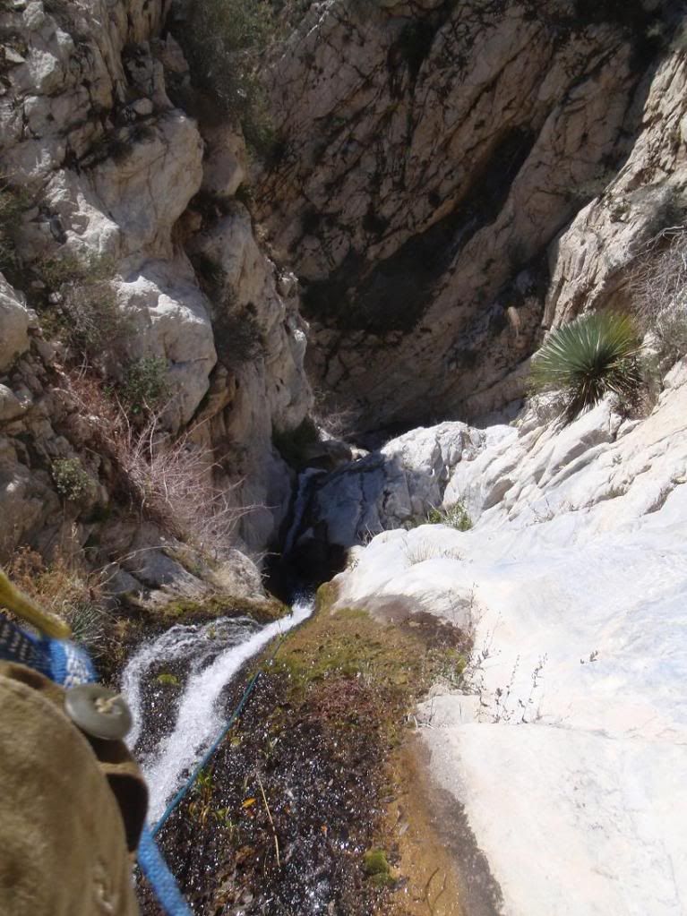
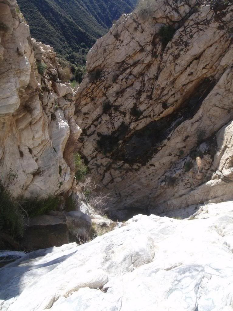
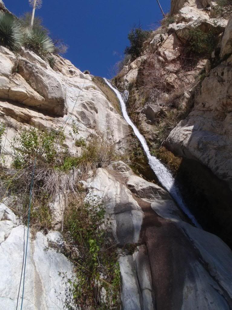
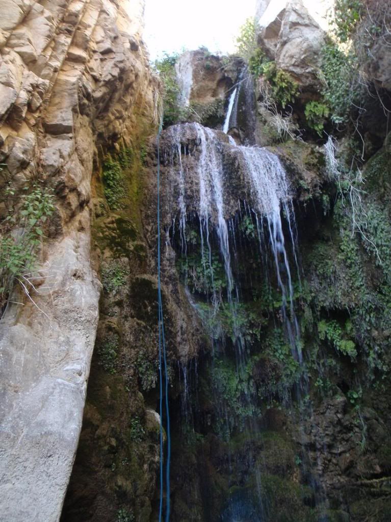
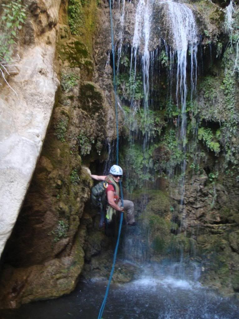
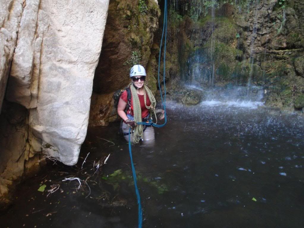
20120304 Schvaterfall Cyn First Descent - 300ft'er!!!!
Posted: Sun Mar 04, 2012 10:26 pm
by Taco
Re: 20120304 Schvaterfall Cyn First Descent - 300ft'er!!!!
Posted: Sun Mar 04, 2012 11:29 pm
by lilbitmo
Nice work Amanda and Taco - looks like another fun outing, had I not been extremely tired from the previous three days I would have found a way to make it work but I needed a down day.
MPO may become a new lexicon for me - Massive Poison Oak, I need that like a sharp stick in the eye - the second one sounds less painful for me


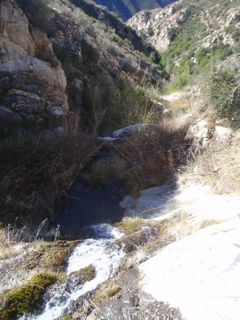
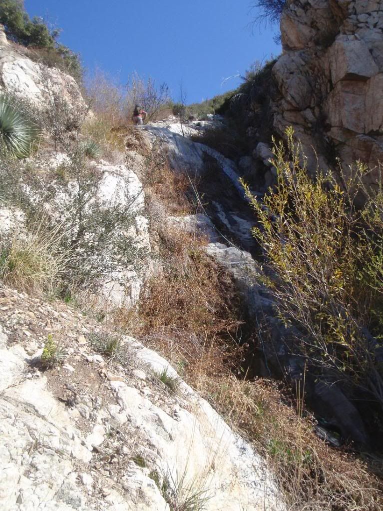
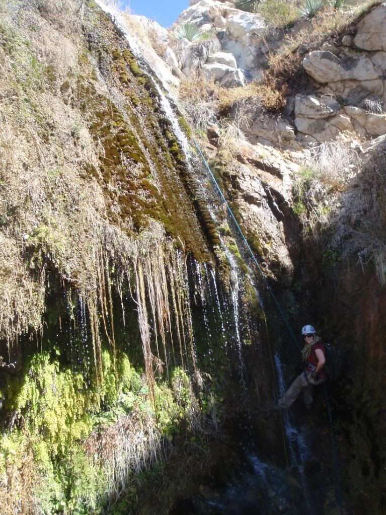
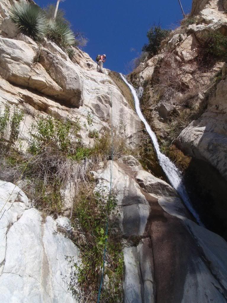
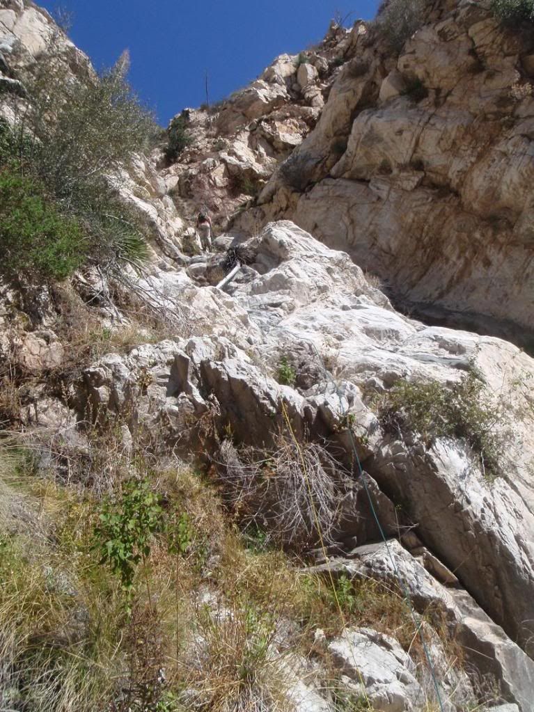
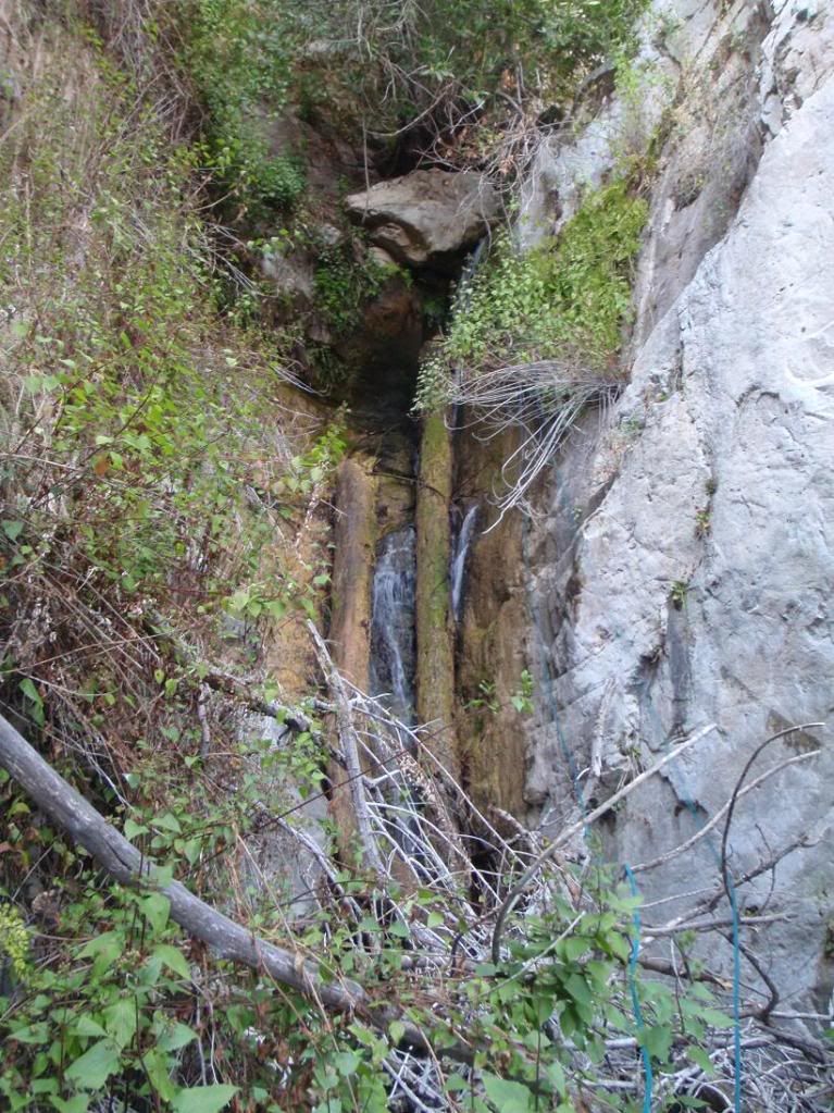
Nice waterfalls - great pictures
Re: 20120304 Schvaterfall Cyn First Descent - 300ft'er!!!!
Posted: Mon Mar 05, 2012 9:05 am
by Max Falcon
Haha, it was a loooong day for sure. We missed our machete bro! No signs of PO yet, keeping fingers crossed. :/
Re: 20120304 Schvaterfall Cyn First Descent - 300ft'er!!!!
Posted: Mon Mar 05, 2012 11:39 am
by AW~
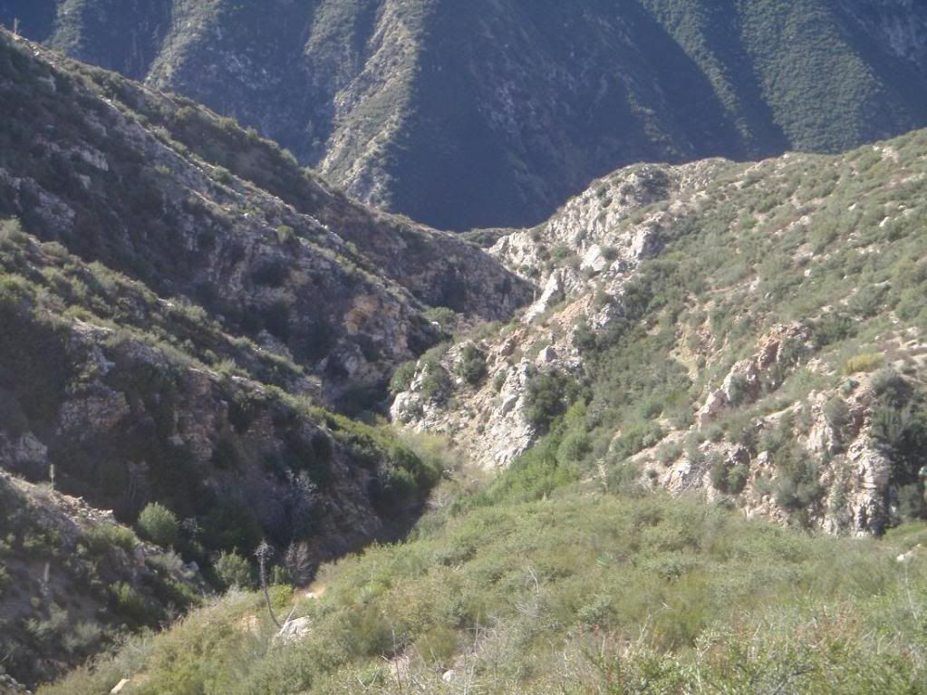
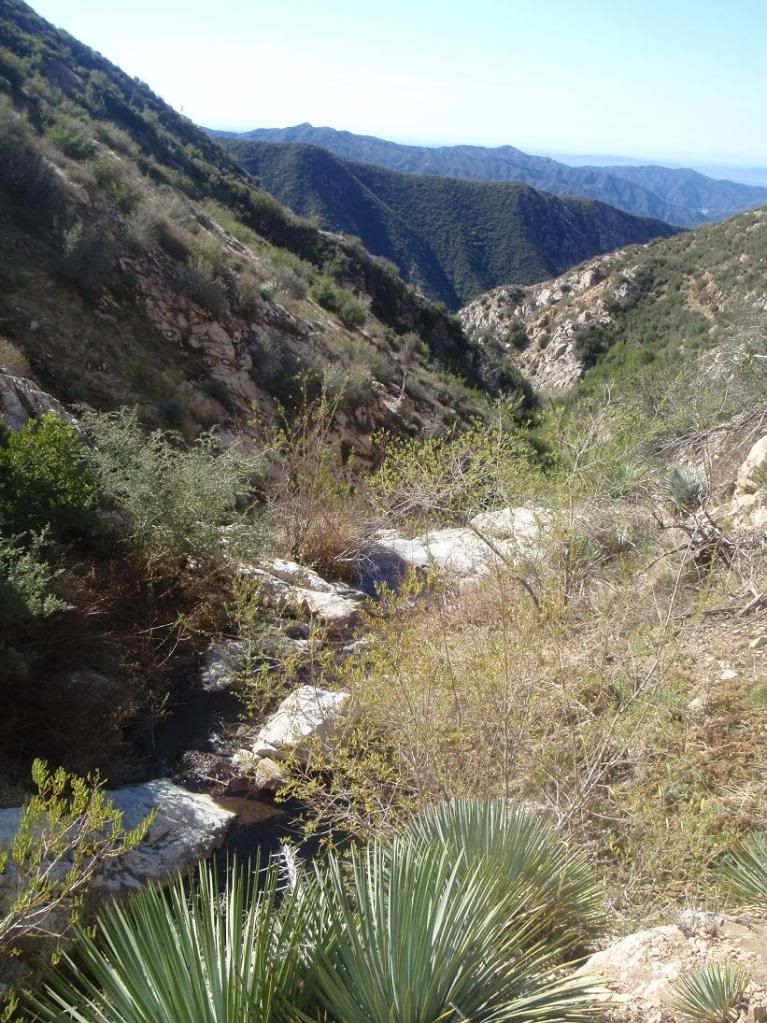
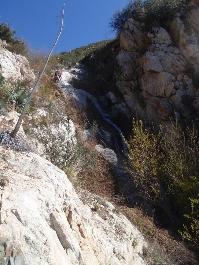
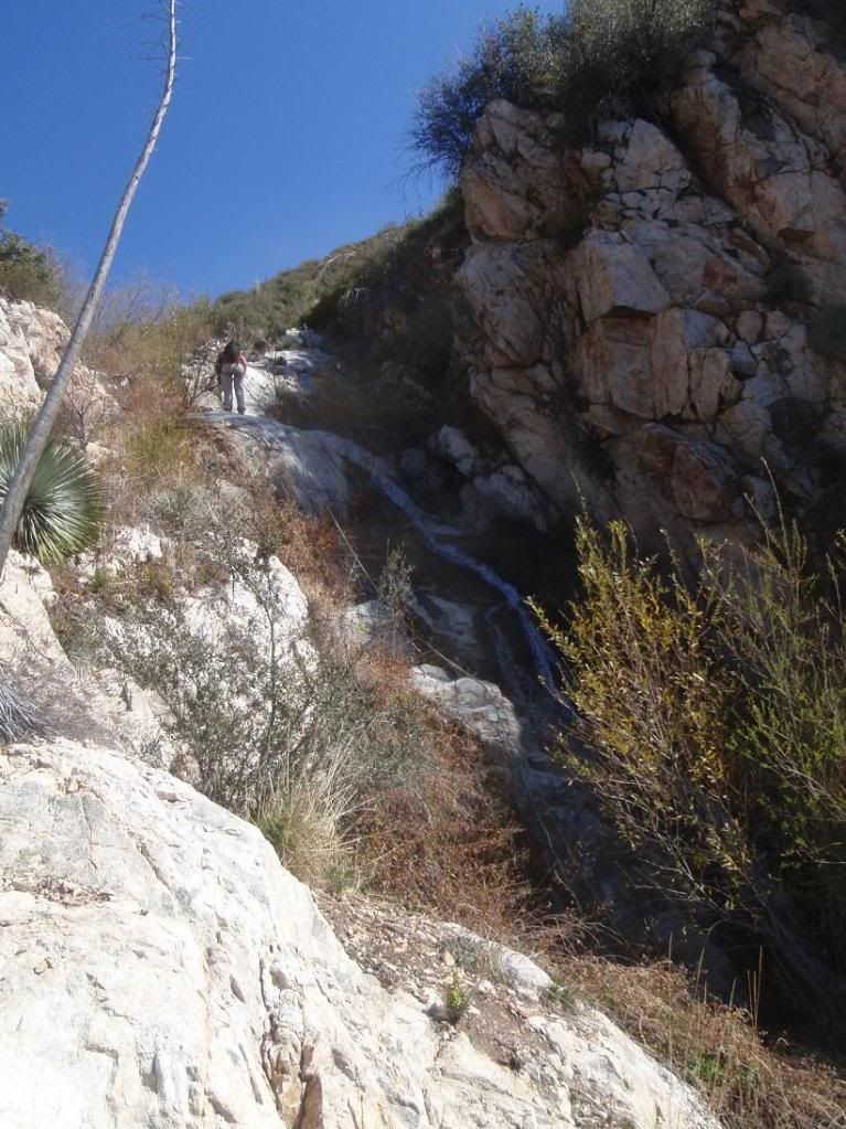
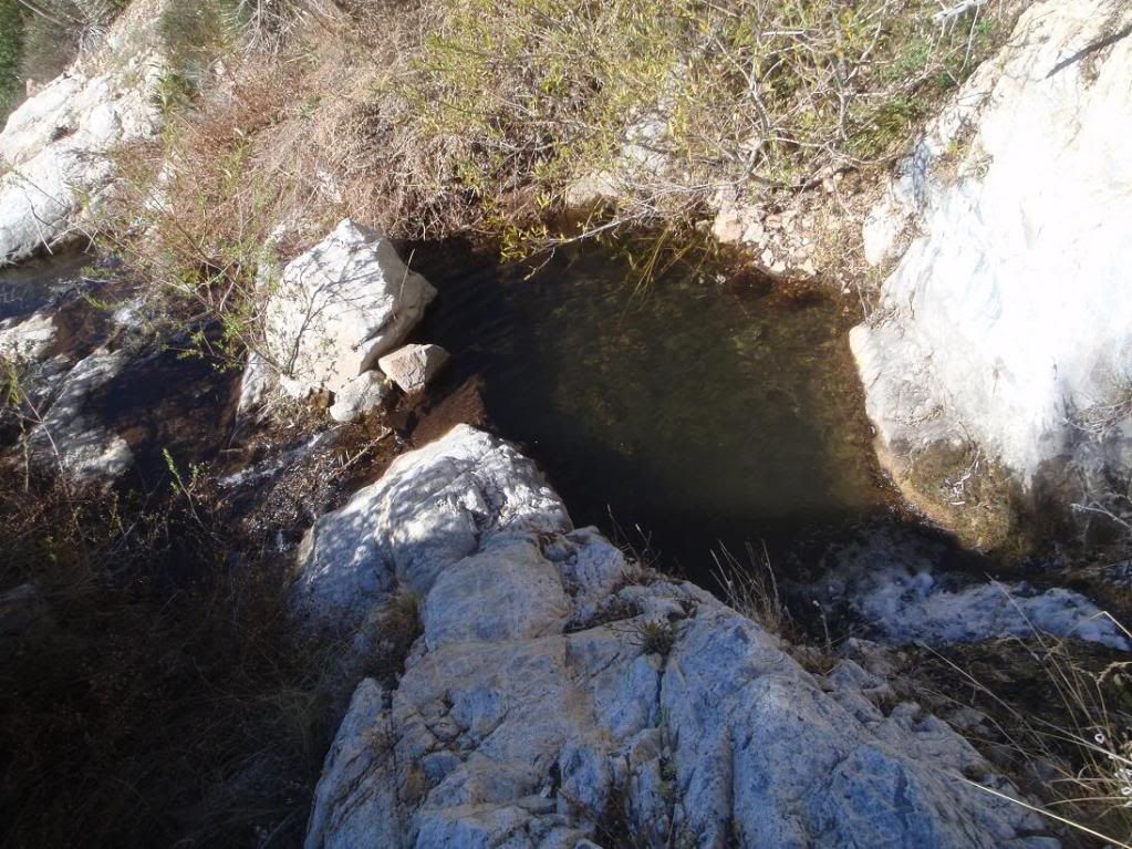
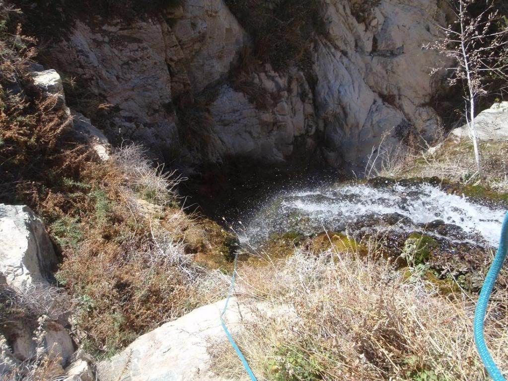
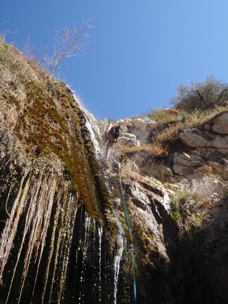
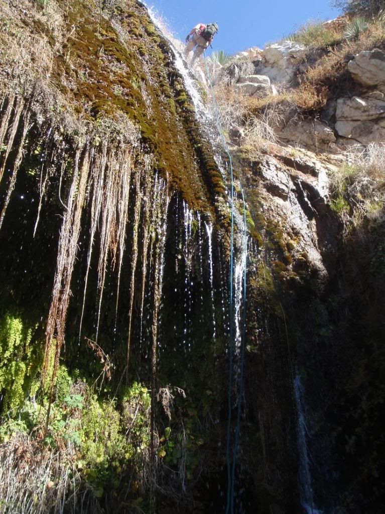
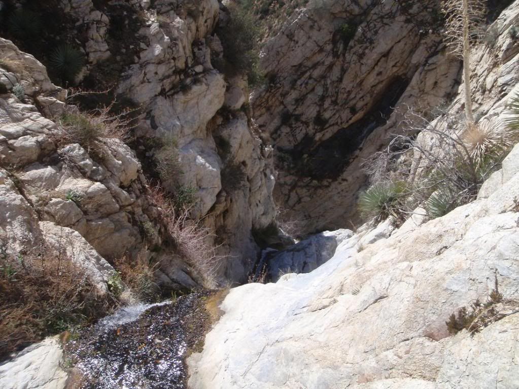
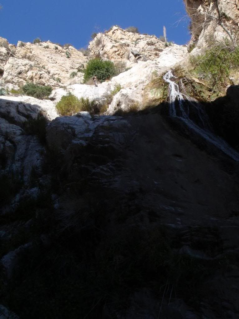
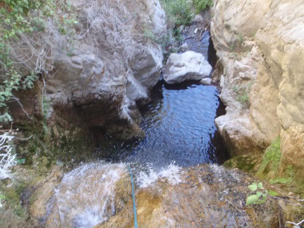
Excellent waterfall....nice flow for this drought season too. me thinks you hit the jackpot in terms of finding a nice SG waterfall amidst jungle bushwhacking.
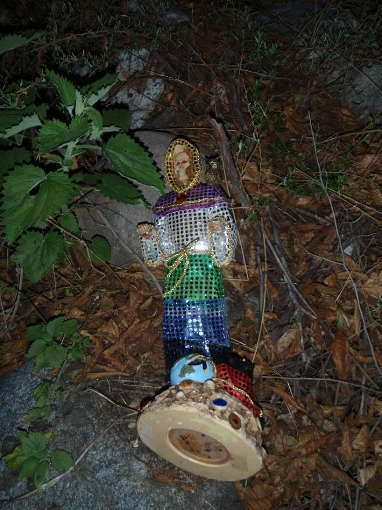
So strange you found that doll. Wasn't Bichota the start of the curve fire and 'they' said it was set by some devil cult? There be the smoking gun?
Re: 20120304 Schvaterfall Cyn First Descent - 300ft'er!!!!
Posted: Mon Mar 05, 2012 11:53 am
by cougarmagic
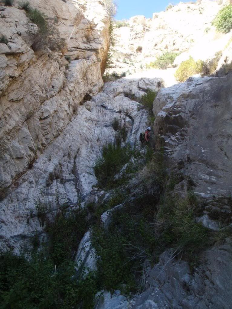
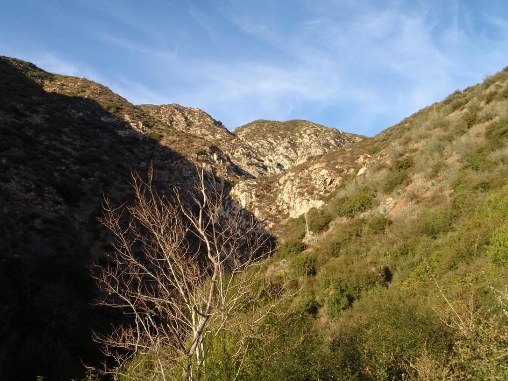
Cool canyon! The name cracks me up.
Does anyone know what the calcified fern formations are called? If it were limestone, it would be called travertine. (Limestone - don't take it for granite.

)
But really - is there a specific term for this? It doesn't occur very much in the SGs.
Re: 20120304 Schvaterfall Cyn First Descent - 300ft'er!!!!
Posted: Mon Mar 05, 2012 4:06 pm
by longcut
really, really cool.
Re: 20120304 Schvaterfall Cyn First Descent - 300ft'er!!!!
Posted: Mon Mar 05, 2012 4:31 pm
by rios
The statue you guys found is "Santa Muerte"
Re: 20120304 Schvaterfall Cyn First Descent - 300ft'er!!!!
Posted: Wed Mar 07, 2012 2:20 pm
by PackerGreg
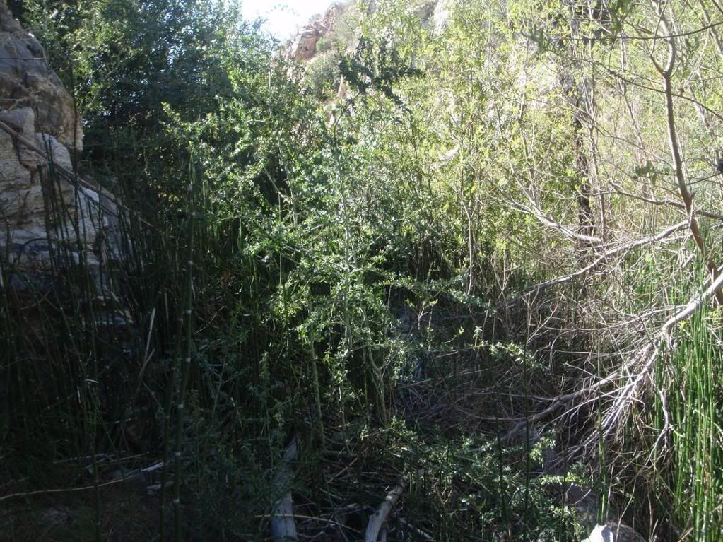
There must have been some sort of civilization near the head of that canyon because of all the Eupatoria. Cool to see that Horsetail Rush in there!
Re: 20120304 Schvaterfall Cyn First Descent - 300ft'er!!!!
Posted: Wed Mar 07, 2012 10:54 pm
by Taco
PackerGreg wrote: There must have been some sort of civilization near the head of that canyon because of all the Eupatoria. Cool to see that Horsetail Rush in there!
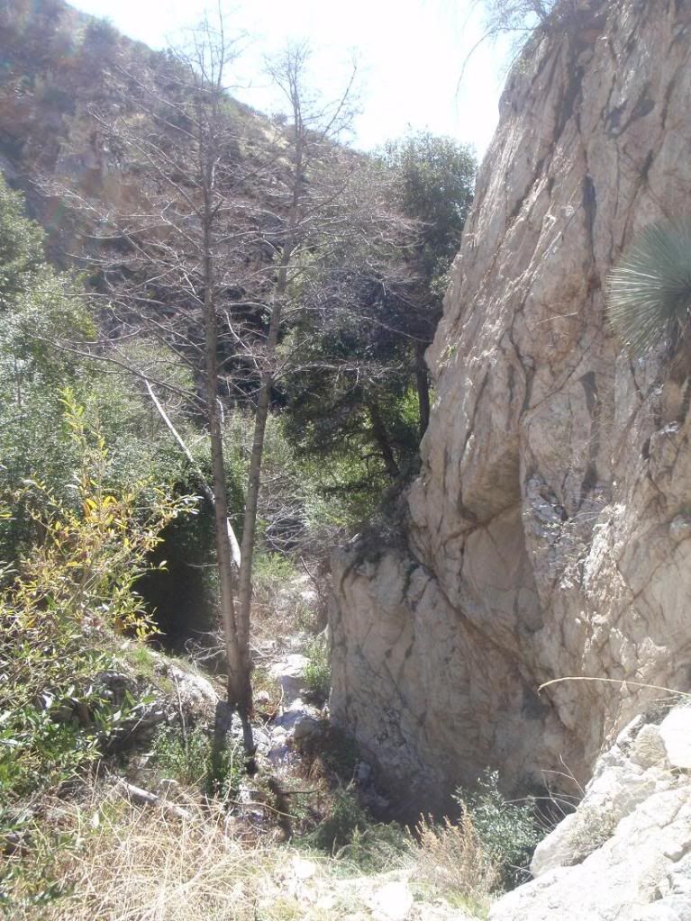
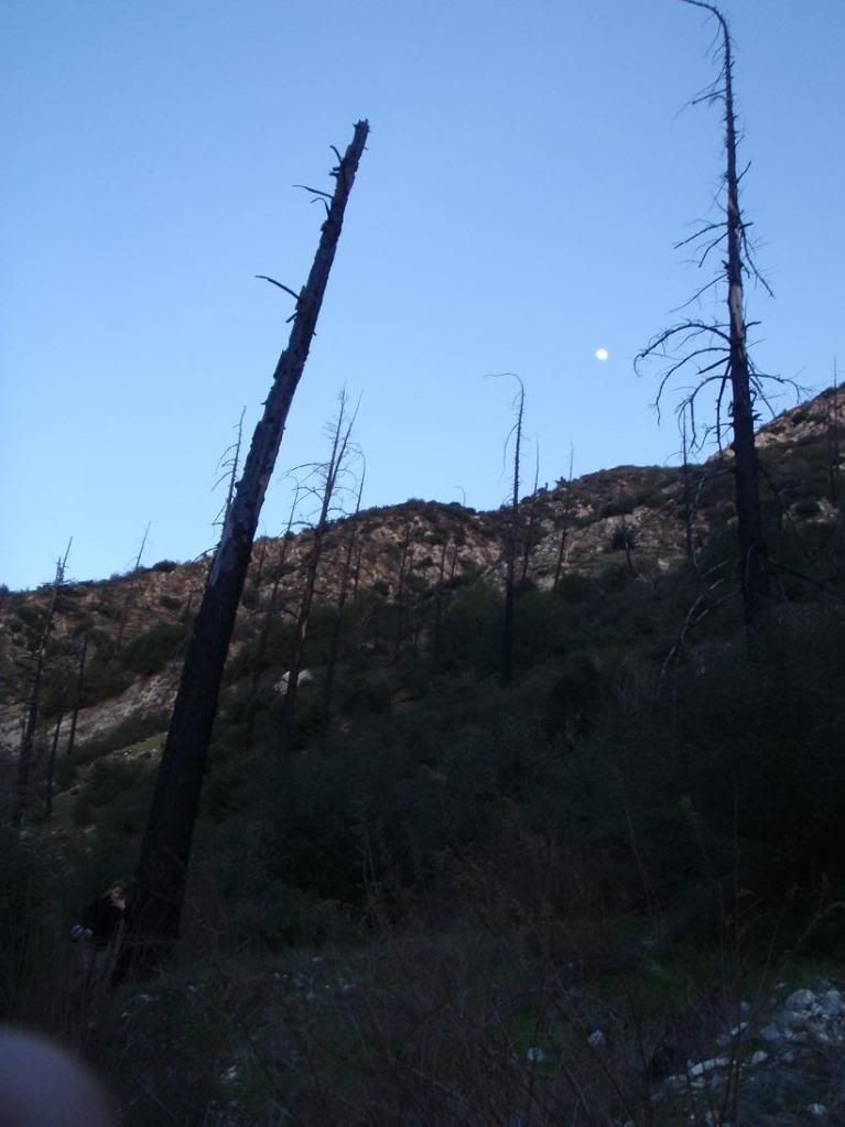
There are a bunch of foundations and chimneys there - remnants of a buncha houses burned in the 2002 Curve Fire.

Re: 20120304 Schvaterfall Cyn First Descent - 300ft'er!!!!
Posted: Thu Mar 08, 2012 7:54 am
by Burchey
Nice work MANG
Re: 20120304 Schvaterfall Cyn First Descent - 300ft'er!!!!
Posted: Thu Mar 08, 2012 11:55 am
by Taco
Re: 20120304 Schvaterfall Cyn First Descent - 300ft'er!!!!
Posted: Tue Jun 11, 2024 7:50 pm
by carl swindle
How was the final descent into the canyon? Do you think it's worth bushwhacking up to from below? I made it ~2.5 miles up Bichota Canyon "trail" last summer if you can even call it that, and It took a lot longer than I thought it would. Are any of the waterfalls back there worth exploring? I may try again, but set aside more time. I think there was a freak rainstorm when I did it too, which made it arguably worse.
Re: 20120304 Schvaterfall Cyn First Descent - 300ft'er!!!!
Posted: Wed Jun 12, 2024 8:45 pm
by Taco
Maybe. I think the bushwhacking at the bottom of the canyon was really bad. I don't think it would be worth it at all.
Re: 20120304 Schvaterfall Cyn First Descent - 300ft'er!!!!
Posted: Wed Jun 12, 2024 11:46 pm
by carl swindle
Thanks, maybe I'll save if for a day I really feel like suffering or something. This looked promising on google maps (
34.27474894994771,-117.80825810460604) and this (
34.274390605735995,-117.81425576156533), which is where I think you went down. I remember seeing a bunch of water flowing on the pigeon ridge fire road ~5 miles out over the summer in the middle of a drought year a couple of years ago, so I expect that there will be a lot of water now.
Re: 20120304 Schvaterfall Cyn First Descent - 300ft'er!!!!
Posted: Thu Jun 13, 2024 9:56 pm
by Taco
carl swindle wrote: Wed Jun 12, 2024 11:46 pm
Thanks, maybe I'll save if for a day I really feel like suffering or something. This looked promising on google maps (
34.27474894994771,-117.80825810460604) and this (
34.274390605735995,-117.81425576156533), which is where I think you went down. I remember seeing a bunch of water flowing on the pigeon ridge fire road ~5 miles out over the summer in the middle of a drought year a couple of years ago, so I expect that there will be a lot of water now.
The first set of coords looks cool on GE but in person isn't as impressive. I checked it out from above when Dima, Danny, and I hiked up through the area.
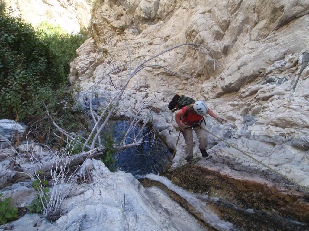
The second set of coords is the bottom of the big waterfall. I don't recall if we dropped in near where the road crosses the canyon or not. Usually we try to drop in as high as possible unless it's clear that there are no technical challenges there.
Re: 20120304 Schvaterfall Cyn First Descent - 300ft'er!!!!
Posted: Fri Jun 14, 2024 5:18 pm
by carl swindle
Thanks, whenever I do this, I'll aim for at least the spot with the big waterfall, and maybe the second depending on how overgrown it is.
Re: 20120304 Schvaterfall Cyn First Descent - 300ft'er!!!!
Posted: Fri Jun 14, 2024 5:37 pm
by dima
A public-service announcement! I just added a custom bbcode to make latlon pairs into clickable links that route to caltopo. So if instead of typing
you can type
And you get this:
34.123,-118.456. Clicking shows the link in caltopo, with some hard-coded zoom level and layer selection. The point in question is at the center of the map, without any marker, unfortunately. But it's better than nothing!
Carl: I updated your post above to use this.
Re: 20120304 Schvaterfall Cyn First Descent - 300ft'er!!!!
Posted: Sat Jun 15, 2024 3:53 pm
by Sean
dima wrote: Fri Jun 14, 2024 5:37 pm
A public-service announcement! I just added a custom bbcode to make latlon pairs into clickable links that route to caltopo.
Could you repeat this info to the Admin & Tech Support forum? Pretty neat. Thanks.