Jones Peak via Bastard Ridge

TRs for the San Gabriel Mountains.
Post Reply
User avatar
mcphersonm80
Posts: 243
Joined: Mon Aug 23, 2010 11:46 am

Post by mcphersonm80 »

Having recently moved to Sierra Madre, I've been searching for variations up the Old Mt Wilson Trail and Bailey Canyon... I noticed an old, somewhat overgrown firebreak going directly up Jones Peak's southeast ridge and gave it a shot last week.

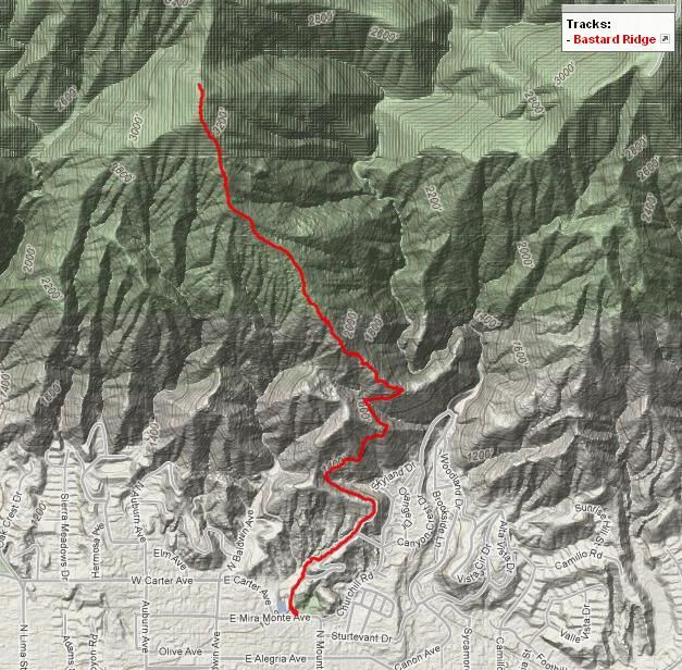
The route starts on the regular Mt Wilson trail, then just under a mile in you notice a fairly obvious (if you're looking for it) use trail heading straight up the ridge. It's the third major ridge you round as you head up, or an easier way is to keep an eye on the Sierra Madre Dam, it's the ridge directly above that.

Image

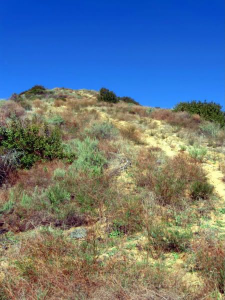
It looks like somebody has been up here fairly recently trying to cut switchbacks up this route, although I'd prefer if they left it as is, since we already have an easier switchbacking route up Jones via Bailey Canyon.

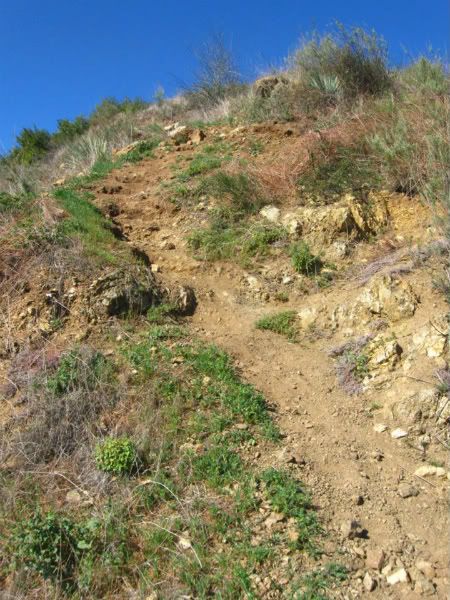
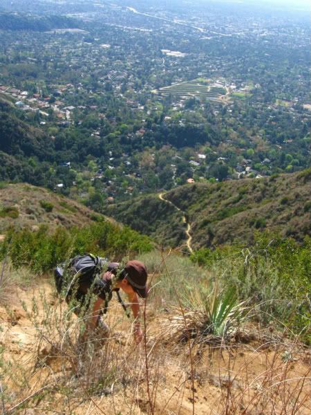
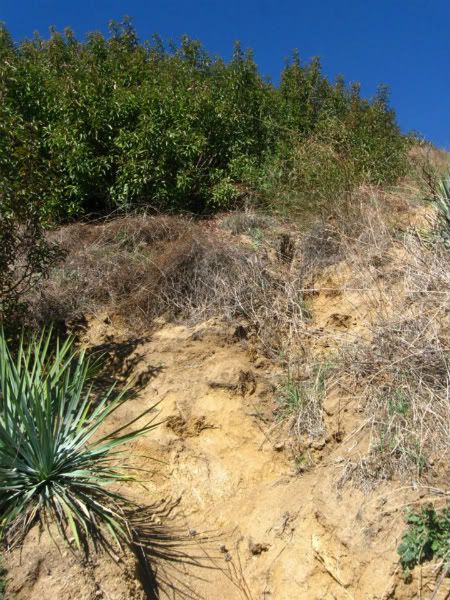
The path starts out extremely steep and doesn't let up much the entire way. Loose, sandy, at times requiring hands and a bit overgrown, it makes for a fun but pretty short conditioning hike. Definitely more exciting than the monotonous Bailey Canyon route up here...

No routefinding is necessary, as it's a ridge (keep going up) and the firebreak, while pretty worn down, is still obvious.

Image

Image

Image

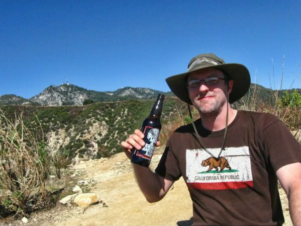
Bring water, don't step on snakes or bear crap, and enjoy a cool one at the top. 8)

Image


From the top, you have several options. You can continue up to Hastings Peak, Mt Yale, and the Mt Wilson Toll Rd; or head north a bit turn down the Hiker Bob connector trail to rejoin the Mt Wilson Trail and loop back to where you started; or you can head down the Bailey Canyon Trail, which would require a short neighborhood walk of about 3/4 of a mile to get back to where you started.

Image

Image

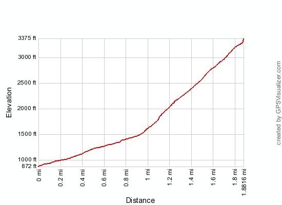
The ridge itself gains 1900+ in just over a mile.... steep enough for you? :shock:
User avatar
Ze Hiker
Posts: 1430
Joined: Mon Jul 28, 2008 7:14 pm

Post by Ze Hiker »

yeah that ridge is steep. I remember hiking it some time after the fire that hit it and had to use my hands in some parts...ended up with black charcoal stains all over my hands, face, and shorts!
User avatar
HikeUp
Posts: 3855
Joined: Thu Sep 27, 2007 9:21 pm

Post by HikeUp »

Best name for that ridge yet! So which way did you return? :D

The fire of April 2008 cleared that ridge nicely - I hear it was a real bushwhack before. Here are some pics of the ridge from November 2008 (I went up Mt. Wilson Trail to the connector trail to Jones Pk then descended Bastard Ridge back to the Mt. Wilson Trail for a nice easy loop.)

Bastard Ridge it is :D :lol:
User avatar
mcphersonm80
Posts: 243
Joined: Mon Aug 23, 2010 11:46 am

Post by mcphersonm80 »

heh Yeah, I searched quite a bit for a name/route description/trip report/anything on this one and found nothing. When I thought of the name Bastard Ridge, it was too appropriate in too many ways not to stick. The day I see that written on a USGS topo map is the day I consider all of my life goals complete. :lol:


And for some reason, I thought the connector trail met up at the saddle just below Jones (as opposed to up the north ridge a bit) so after a couple minutes of searching, we ended up just flying down Bailey Canyon instead.
User avatar
666-The Beast
Posts: 124
Joined: Wed Jun 15, 2011 8:08 pm

Post by 666-The Beast »

Nice reward at the top! I want to see ya do the trek at 10 am in the summer and see if you have any desire to drink any beer!
I plan to do it when it is a nice warm, clear, day and the terrain is green, the field of lupines are in full bloom around Hastings pk and the views of the valley to the ocean are clear. Then march onto the toll rd then to Wilson for a treat at the Cosmic Cafe and of course beer!!!
Hiker Bob with another man build the trail past the cabinet at Bailey Cyn and continuing on to the toll rd; then came the fire, then they destroyed Hiker Bobs super cool trail and put a fire break, thanks a lot FS! They did not have the decency to rebuilt the trail at the start of the toll rd in order to make it easy to go down hill like H.B. had done.
Plenty of rattlers around to keep you alert, lots of deer, also the kitty hangs out there! Enjoy!!! 666
User avatar
goalorientedhiker
Posts: 2
Joined: Fri Mar 11, 2016 10:06 am

Post by goalorientedhiker »

Climbing SE ridge of Jones Pk 2 days ago (3/9/2016). I found this hike to be surprisingly not difficult. It took me 2 hrs (1,600 ft to summit). Bottom of the ridge is steep but no hands required to get up it. I am rather a slow paced hiker for 45 yrs but a determined one. The ridge has about 4 or 5 small high points that obscure the view of the entire ridge and the summit. I found fresh footprints that were no more than 2 days old (rained 2 days ago) which lead me to guess that perhaps a dozen hikers use this ridge every week, ergo this is no longer an obscure trail. The roar and the view of the city far below erased any notion that this was a solitude wilderness type hike. Day was sunny & the temp was in the low to mid 70F with a bit of cool breeze at times. The width of the ridge (~50 - 100 ft) made me feel that I was not on the ridge At least 2 well defined narrow trails existed well past the 24 short switchbacks at the bottom so I kept switching from one to another. The ground was fairly compacted so there was no slipping. My cell phone had no service on the ridge & way beyond the summit. The crux of the ridge (Class 2) was at an elev of 2,100 ft (500 ft above the start) where there is a steep 30 ft section having deep rutted (by rain) dirt that I had to negotiate using the trekking pole & an occasional hand to steady myself ; not a biggy though. My altimeter really helped me gauge where I was with respect to the summit ; the summit itself was not realized until you are about 150 ft from it. Without the 40 photos that I took, (3) of which I used a tripod to get myself in, I could have done the summit in 1 hr 40 min. There is now a new bench at the top made of steel frame and wooden pranks. I drank 1 soda and 2/3 quarts of water to summit. The 0.9 mi route seemed much longer. So to summarize this ridge climb, I found it surprisingly not difficult. Compared to the long & arduous ridge hike of Rattlesnake Pk (3,079 ft gain) which is a rollercoaster terrain with some rock scrambling, this Jones one was short and sweet; just take it nice and slow and even a novice hiker can do it. The hot days of Summer on this ridge would be considerably more taxing however.
User avatar
goalorientedhiker
Posts: 2
Joined: Fri Mar 11, 2016 10:06 am

Post by goalorientedhiker »

Here are some photos taken by me on 3/9/2016 hike up Jones Pk SE ridge.
Image
Click to see full size image

Image
Click to see full size image
User avatar
HikeUp
Posts: 3855
Joined: Thu Sep 27, 2007 9:21 pm

Post by HikeUp »

Bastard Ridge LIVES!!!

Not a very good comparison in my mind to Rattlesnake, but I get your point.
User avatar
Sean
Cucamonga
Posts: 3782
Joined: Wed Jul 27, 2011 12:32 pm

Post by Sean »

goalorientedhiker wrote: So to summarize this ridge climb, I found it surprisingly not difficult.
I think you're ready for Class 3 scrambles.
User avatar
_kick_rocks_
Posts: 49
Joined: Tue Mar 31, 2015 5:53 pm

Post by _kick_rocks_ »

I played around on here during my trail running injury days for physical therapy. The switchback cutting is from the recent explosion of this hidden gem. The local distance running community has taken a liking to its steepness for training. Its literally the only place you can get this kind of gain in such a short amount of A) hiking, and b) driving. Which is why a lot of people also call it "Steep & Cheap". :P
Post Reply