
Silver Moccasin Trail
-
shreddy

- Posts: 241
- Joined: Sun Jan 16, 2011 10:40 pm
Anyone know what condition the Silver Moc trail from Bandido / Newcomb's Ranch area to Westfork is like?
-
caliguy92832
- Posts: 20
- Joined: Sun Jul 25, 2010 2:31 pm
So in the near future (a month or two) I want to try backpacking the Silver Moccasin trail.
Has anyone done it before? Is the whole trail open?
http://en.wikipedia.org/wiki/Silver_Moccasin_Trail
Has anyone done it before? Is the whole trail open?
http://en.wikipedia.org/wiki/Silver_Moccasin_Trail
-
mattmaxon

- Posts: 1137
- Joined: Mon Mar 24, 2008 12:48 pm
As far as I know the whole trail is open. ( technically the segment from Shortcut Saddle to Chilao is within the closure.)
The High Country segments, say cloudburst summit to Vincent Gulch Divide are going to have Ice and Snow this time of year
You're gonna need your Union Suit
If there is significant rain, crossing the West Fork could be a problem.
You'd be wise to consider some crampons & ice Axe for parts of Mt Williamson and Mt Baden-Powell
There have been fatalities in both these areas in the past
-
longcut
- Posts: 190
- Joined: Wed Feb 02, 2011 1:40 pm
Ditto! A couple of us have been talking about doing this trail next week in two long days. Of course, this would be difficult if the trail is fouled up with a lot of fallen trees and alot of ice. Short sections here and there of slow going would be okay though. Has anybody been through here lately? I'd love to hear what conditions were like. Thanks in advance.
-
NOMAN668
- Posts: 16
- Joined: Wed Feb 01, 2012 5:10 pm
Hello all,
First time posting or visiting this site, but I anticipate getting more involved. I'm a resident of Altadena...avid distance trail runner and ultralight backpacker. The San Gabriels are my home playground.
Anyhow, I'm looking for current trail info for the Silver Moccasin. I'd like to do a fast thru-hike/run in the coming weeks, starting up top (getting dropped off) and finishing at Chantry. I'd like to do the trip in 1 night and two days. I don't expect it to be in perfect shape out there, just trying to establish whether or not the trip will degenerate from a hike/run into a trail-less, semi-cross country bushwhack.
Does anyone know how passable the trail is right now? I've been calling all the local ranger districts but nobody knows...
Any info appreciated, even if it's just reports on bits and pieces.
Thanks,
Craig
-
cougarmagic

- Posts: 1414
- Joined: Wed May 07, 2008 5:21 pm
Hi NoMan - I don't have direct info for you, but Gary Valle is a local long distance runner and would probably know. His website is www.photographyontherun.com. I think there is a link to send him a message.
-
AW~

- Posts: 2126
- Joined: Mon Oct 01, 2007 12:00 pm
Yup...Garry Valle
http://www.photographyontherun.com/Afte ... lWork.aspx
Theres also a recent youtube video of the trail. All indications are that it is good to go, but can be a little sneaky/bamboozly if one is moving along too fast.
http://www.photographyontherun.com/Afte ... lWork.aspx
Theres also a recent youtube video of the trail. All indications are that it is good to go, but can be a little sneaky/bamboozly if one is moving along too fast.
-
shreddy
- Posts: 241
- Joined: Sun Jan 16, 2011 10:40 pm
Hey NOMAN668, Please share the info you get. Been looking to hit a lot of this trail too. Let me know if you don't contact Gary and I will.
Thanks for the info y'all
Thanks for the info y'all
-
NOMAN668
- Posts: 16
- Joined: Wed Feb 01, 2012 5:10 pm
Thank you all for the information so far...I'm surprised I haven't gotten involved with this site sooner.
I've been on the phone with both Los Angeles and San Gabriel River ranger districts today, as well as he main headquarters.
Two out of the three people I talked to weren't even sure what or where the Silver Moccasin was. The third at least got out a map to see and referred me to a few more people to call. Suffice to say, I don't think the government knows much about what's going on out there on the trails.
Thanks again. I'll try to contact Gary and let everyone know what I find out. I'll sign up for a maintenance day in return for any info
-
666-The Beast

- Posts: 124
- Joined: Wed Jun 15, 2011 8:08 pm
NM, the whole trail should be fine, with some minor problems?; just go out there and try to do all(insane),half(freak show), or sections (wise) of it and then you can put it all together! You can also contact the AC100 race people for Im sure someone might know. I see them all time out there now training.
The forest people dont know and dont care, cause they have lots of work to do and are short stuffed. Few months ago I did a section from AC to west fork and it was ok for now. Now is the best time to do this, also I would make sure that the half way point is Newks Ranch cause they got food and beer! ..... the walking beast... 666
The forest people dont know and dont care, cause they have lots of work to do and are short stuffed. Few months ago I did a section from AC to west fork and it was ok for now. Now is the best time to do this, also I would make sure that the half way point is Newks Ranch cause they got food and beer! ..... the walking beast... 666
-
mattmaxon
- Posts: 1137
- Joined: Mon Mar 24, 2008 12:48 pm
Welcome aboard!
Again I don't have any direct info.
My guess would be there are some down trees in higher elevations (Chantry Flats) and beyond.
Some Ice on Williamson and approaching Baden Powell
The November wind storm really took down many dead trees in other areas affected by the Station Fire.
Cheers
Again I don't have any direct info.
My guess would be there are some down trees in higher elevations (Chantry Flats) and beyond.
Some Ice on Williamson and approaching Baden Powell
The November wind storm really took down many dead trees in other areas affected by the Station Fire.
Cheers
-
NOMAN668
- Posts: 16
- Joined: Wed Feb 01, 2012 5:10 pm
Gary Valle was kind enough to get back to me with some general info on the area:
"I regularly run the following sections and wouldn’t expect any out of the ordinary issues, except of course possible snow/ice and bad weather:
Three Points to Cloudburst Summit via Pacific Crest Trail
Cloudburst Summit to Islip Saddle via Pacific Crest Trail
Islip Saddle to Mt Baden-Powell via Pacific Crest Trail
Mt Baden-Powell to Vincent Gap via Pacific Crest Trail
Note that there is a segment of the PCT closed between Eagle’s Roost on Hwy 2 and Cooper Canyon. It’s necessary to follow the highway from Eagles Roost to Buckhorn Campground and take the Burkhart Trail down to the PCT.
The segment from Vincent Gap over Baden-Powell to Islip is the highest on the route. In a normal winter snow can be an issue down to about Three Points. Lower sometimes in cold storms. It’s been a relatively mild and dry winter so far, but that could change rapidly. The weather models have been all over the place recently, but seem to be suggesting the possibility of one or more systems over the next 10 days.
Sections of trail in the Station Fire area can have problems with Turricula – a relatively fast growing fire follower that can cause a rash like poison oak.
Last year a lot of trail work was done on the Silver Moccasin segment between WF and Shortcut Saddle. I ran that 2-3 times last year, but I expect it has seen some regrowth since then. Edison Road could also be used to connect to Newcomb Saddle. (Check the AC100 route.)
Last year the section of the Gabrielino Trail between Red Box and Switzers was in terrible condition and really overgrown. Turricula was also a problem. It’s a popular section of trail, and I’ve seen work parties on the trail near Red Box, so it may be better now. I did run the Gabrilino from the WF to Kenyon Devore and from Valley Forge to Red Box road last year and it was OK at that time. However Turricula may have resprouted/regrown on some sections."
Once I get plans finalized and routes set, I'll certainly update everyone on the conditions out there. Thanks again, please let me know if there are any updates on conditions in this area.
Craig
-
longcut
- Posts: 190
- Joined: Wed Feb 02, 2011 1:40 pm
i never know how to spell silver moc(c)as(s)in.
everyday, meet noman. noman, everyday wants to join us in GC. She's a local there and also suffers from our addiction. Apparently she's got it pretty bad, too. April 14 everyday! come on out! We'll be there all day Friday too just lounging around if you'd like to come by and say hi first during daylight hours. Once I find out what campsite we'll be at I'll let you know so you can swing by.
re: silver mocasssin:
Noman, dude, by the way, did you see this: https://eispiraten.com/C ... t4439.html. Nice pics, looks like a fun trail. I still think we can start at Crystal Lake myself but I'm good either way.
-
MtnMan
- Posts: 143
- Joined: Fri May 08, 2009 2:22 am
NOMAN668 wrote: Thank you all for the information so far...I'm surprised I haven't gotten involved with this site sooner.
I've been on the phone with both Los Angeles and San Gabriel River ranger districts today, as well as he main headquarters.
Two out of the three people I talked to weren't even sure what or where the Silver Moccasin was. The third at least got out a map to see and referred me to a few more people to call. Suffice to say, I don't think the government knows much about what's going on out there on the trails.
Thanks again. I'll try to contact Gary and let everyone know what I find out. I'll sign up for a maintenance day in return for any info
Your first problem is calling the San Gabriel Ranger Dist. None of trail even goes into there admin area. There is 1 guy over there (wilderness ranger) that might have some knowledge, but I can't remember his name.
The second problem, unfortunately, in the last 2 months the 2 people that work in that primary area of trails are now gone. G. Reponen (Asst. Recreation officer) recently retired, and A. Fish (trails Coordinator) is on extended leave and I think transferring to another forest. The Rec Officer is new over there, and is still pretty clueless about some of the finer details of everything.
The front desk people at these offices rarely know detailed info about this stuff. However, try David at the LA district office if you haven't already. He usually works the front desk, but not all the time. 818-899-1900- xt-0 If not, he can probably get you in touch with someone that has a little more info. Maybe that's the person you already talked to that gave you some other contacts.
Also, You can also try getting a hold of someone at Chilao Fire Station (Chris?). I don't have the number, but you can ask the front desk person at the number above to give it to you. Those guys are sometimes out on the trails in that area and might have some info. Also, a guy named Kevin will be able to give you some info from at least Chantry up to Newcomb Pass, and maybe beyond. Again, ask for contact info.
To my knowledge, most of the trail from 3 points south/west is clear of snow right now. However, as others have stated, you're running through a big section of the Station Fire burn. It's going to have overgrown spots, downed trees, some trail degradation and Bigfoot to worry about from time to time.
To say the forest/govt' doesn't know is almost fair. To say they don't care is lame. They have 160,000 acres of fire damaged trails to rehab. This trail has has several volunteer groups and employee trail workers on it since the fire busting their asses so you can run/hike it.
-
Hikin_Jim

- Posts: 4688
- Joined: Thu Sep 27, 2007 9:04 pm
Saturday, I did a 10+ mile loop down the Kenyon Devore Trail through West Fork and Devore Trail Camps, up to Newcomb Pass and then back up to Mt. Wilson via the Rim Trail.
The sections of the Silver Moc trail that I did were all basically fine. There's some blow down and such, but nothing unnavigable.
I talked to a guy that came down from Short Cut, and he reported no problems.
HJ
The sections of the Silver Moc trail that I did were all basically fine. There's some blow down and such, but nothing unnavigable.
I talked to a guy that came down from Short Cut, and he reported no problems.
HJ
-
Hayduke
- Posts: 36
- Joined: Sun Sep 06, 2009 2:18 pm
If you ever call the FS about trail conditions, make sure to ask to talk to the someone in the rec program. Usually the folks answering the phones don't know anything other than how to transfer you to someone else in the office.
-
jj442434
- Posts: 2
- Joined: Mon Mar 03, 2014 11:17 am
Hi, first time posting here.
I'm a moderately experienced backpacker, having gone many times in the San Gabriels, and one thru hike of the JMT. But these have mostly been in the Summer/Late Spring/Early fall, so I don't have much experience with snow.
I'm on spring break next week, and I want to take a three day trip. I was thinking of starting at Three Points, heading down Shortcut Canyon, and then making my way down to Altadena eventually.
Does anyone have an idea of what kind of conditions I will encounter?
-
Teejate
- Posts: 107
- Joined: Wed Oct 12, 2011 6:46 pm
Unfortunately, I wasn't able to get up last weekend. First time in a while. Others can probably speak to the snow level but with Three Points at about 5,900 feet, and with the weather heating up this week, you shouldn't have any problems. I might toss the spikes in just to be safe or call the forest service to see if they can clue you in.jj442434 wrote: Hi, first time posting here.
I'm a moderately experienced backpacker, having gone many times in the San Gabriels, and one thru hike of the JMT. But these have mostly been in the Summer/Late Spring/Early fall, so I don't have much experience with snow.
I'm on spring break next week, and I want to take a three day trip. I was thinking of starting at Three Points, heading down Shortcut Canyon, and then making my way down to Altadena eventually.
Does anyone have an idea of what kind of conditions I will encounter?
-
walker

- Posts: 248
- Joined: Mon Apr 08, 2013 11:14 pm
About 9 months ago, there was abundant, eight-foot-tall Poodle Dog Bush completely engulfing the area around Charlton Flats/Vetter Mt. along the Silver Moccasin. Probably not as bad now, but be prepared.
-
Teejate
- Posts: 107
- Joined: Wed Oct 12, 2011 6:46 pm
It will be there for a while. At least another few years. They did cut it back on the PCT heading down toward Sulfur Springs though. Anything off trail in a burn area wouldn't be wise.walker wrote: About 9 months ago, there was abundant, eight-foot-tall Poodle Dog Bush completely engulfing the area around Charlton Flats/Vetter Mt. along the Silver Moccasin. Probably not as bad now, but be prepared.
I got it once. First and last time. It's nasty.
-
jj442434
- Posts: 2
- Joined: Mon Mar 03, 2014 11:17 am
Since I had a bit of a bad experience with a poorly maintained trail in Bear Canyon last year, and I'm not exactly looking to repeat that, I'm thinking maybe this trip isn't the best idea.
Any suggestions? I want to start Monday morning, hopefully walk back to civilization and a bus by some point Wednesday. The more solitude the better, but I'm willing to sacrifice some to have a maintained trail
Any suggestions? I want to start Monday morning, hopefully walk back to civilization and a bus by some point Wednesday. The more solitude the better, but I'm willing to sacrifice some to have a maintained trail
-
babayetu
- Posts: 1
- Joined: Thu Oct 15, 2015 7:02 pm
How achievable is this? I'll be going solo with mostly ultralight gear, moderately experienced backpacker (bunch of 1, 2 night trips in the San Gab and Sierra). I can climb Baldy from the Village (Bear Canyon) in 3.5 hours. Is 18 mi/day on this trail a grueling marathon pace or something I can do if I'm fairly fit & efficient?
-
longcut
- Posts: 190
- Joined: Wed Feb 02, 2011 1:40 pm
totally doable. the stretch over baden powell will be toughest, so I would start there and end at Chantry. Configure your gear/meals so that you can walk 4 miles before breakfast and 4 miles after dinner. Have fun!
-
Sewellymon
- Posts: 113
- Joined: Tue Feb 12, 2008 8:55 pm
where are the logical 2 places to camp? Buckhorn and Chilao...?
-
longcut
- Posts: 190
- Joined: Wed Feb 02, 2011 1:40 pm
Needing to sleep in actual campgrounds would break up your rhythm and make this harder, in my opinion. Chilao is a good last camp and I have done that hike all the way out in a day with a full (UL) pack. But the first day I would have a warm dinner in Little Jimmy and then continue on and bivy somewhere between there and cooper canyon. We slept on what appeared like an old road bed right where the trail comes down close to Little Rock Creek.
Fitness-wise, I think more important than how fast you can do Baldy is how do your legs feel after you do Baldy? Do you feel like you can get up early the next morning and hike Ontario Peak and then repeat another peak the third day? Some folks can move fast but are totally wiped out, and you want the exact opposite. Slow pace and fast full recovery, especially connective tissues in lower legs.
For efficiency, you want a slow pace, moving from dawn until dusk (10hrs x 2mph), eating and drinking almost continuously with only short 30-45 minute breaks. You can vary from this schedule a bit, but just realize you will have to make up for it with longer miles somewhere. Anyway, that's the theory. I have done it, but now Ive moved on to other type2 funs.
-
Sean

- Cucamonga
- Posts: 4450
- Joined: Wed Jul 27, 2011 12:32 pm
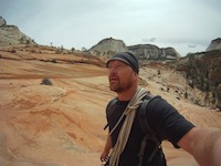
The segment between Chilao and Horse Flats is in good shape. The creek was dry. But the scenery was still beautiful.
You do not have the required permissions to view the files attached to this post.