20110717 Seven Sunday Summits Plus One for More Fun

TRs for the San Gabriel Mountains.
Post Reply
User avatar
lilbitmo
Posts: 1092
Joined: Tue Mar 04, 2008 9:44 pm

Post by lilbitmo »

Zach and I decided that we wanted to hit some summits in the Crystal Lake area after plans to go to the Sierra’s fell through. For me it was time to get back to some unfinished business. In the winter of 2006 I attempted the hike from Islip Saddle to Vincent Gap only to fall short by half a mile of the summit of Baden Powell. The snow was 10 inches deep, soft and I had absolutely no winter skills back then, I was knocking out 15 to 20 miles sections of the PCT and had made it all the way from the Mexican Border and I quit when I got to Mill Creek Summit area and had always wanted to go back to get that last half mile between the Barnham/Baden Powell Saddle. Add to that the fact that 8 weeks ago three of us were going to do the Islip ridge trail to summit hike to reintroduce a friend Gary back into hiking only to get hit be 30 MPH winds, sleet, snow, rain and just plain nasty weather we turned back from that hike as well somewhere around the 4.1 miles in.

From the parking lot Zach and I headed straight up 1,200 feet to the north east picking up a small gorge (which I beleive is Snowslide Canyon?) that leads up to the fire road, instead of taking the main trail at the north end of the camp grounds. Once on the fire road at 6,880 feet we turned south east and continued to the summit of S. Hawkins, the views along that road and at the summit were really nice.

From S. Hawkins we followed the ridge and ridge trail over to Saddie Hawkins, then Middle Hawkins, and then we picked up the PCT heading east to N. Hawkins, then Throop Peak, Barnham Peak, and then Mount Baden-Powell. After a short break, some conversations with other hikers, pictures of the summit obelisk, adding one more “ice pirate sticker” to the one’s already there and the obligatory sign in we headed back down the PCT to our final summit Mount Islip. We covered the 6.6 miles to Islip in less than 2 hours we were starting to feel the heat and the trail miles, once on top though we were rewarded with some nice views of the desert, and the whole Crystal Lake basin. From there we made it back to the car in 55 minutes just glad to be done.

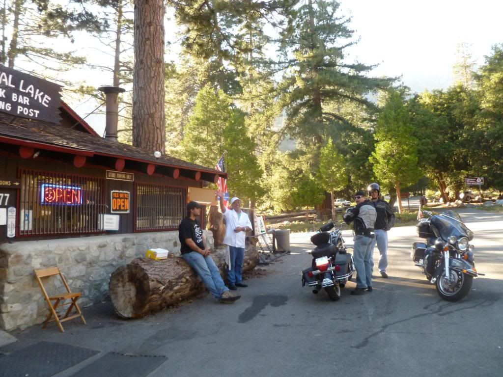
The Crystal Lake store was still open so we stopped in and introduced ourselves to Adam the nice man that runs the store. We slammed down a soda each, talked about our fearless leader TACO and headed down canyon to Azusa to grab my car and get some good grub at Zach’s favorite “Thai restaurant”. On the way down the canyon we found some really slow drivers that did not seem to want to pull over or let us pass so we did the next best thing, we went around a them (and by no means what-so-ever am I admitting that we did anything wrong in posting this, so if big brother is reading this I’m pleading innocent and none of the words used here are to be rebrocast in any form without the express written consent of my mother, my brother and my three dogs ;)), in doing so we got the attention of not one “law enforcement agency, not two, that’s right we got the attention of three different agencies. They were so enamored by our ability to hike 22 miles and peak bag 8 summits that they decided to stop us and get at least one of our autographs. Mind you I have a very let’s say “checkered past”, I’ve been pulled over more times than I care to admit, been in cars raided while sitting in parks partying it up, but this was a whole new experience for me. They were coming out of the woodwork, two more came and went while they had us on the side of the road – now if only they could stop those thieves from breaking into cars, what say you? 40 minutes later we were on our way again, they needed that much time to decide if the “autograph” was the one they really wanted. The Thai food was outstanding and we were on our separate ways.

Mileage’s to the best of my ability without GPS.
Car to South Hawkins 3.2 miles, 2,203 feet ascended.
S. Hawkins to PCT with side trips to Saddie and Middle Hawkins 3.1 miles, 722 feet ascend, 438 feet of descend.
PCT junction to Baden-Powell with side trips to N. Hawkins, Throop Peak, then up and over Mount Barnham 5.6 miles, 1,024 feet of gain, 525 feet of descend.
From Summit of Baden-Powell to Islip Summit 6.6 miles, 1,811 feet of descend (plus a little more for the up and downs here and there and 962 of gain.
From the summit of Mount Islip to Car by Crystal Lake Store 3.5 miles, 2,670 descend
Total mileage was 22 (to the best of my ability to figure) 5,444 gain and loss
Elevations, S. Hawkins 7,783 Ft, Saddie Hawkins 8,047 ft, Middle Hawkins 8,505 ft, N. Hawkins 8,850 ft, Throop Peak 9,138 ft, Mt Barnham 8,997 ft, Mt. Baden-Powell 9,399 ft and Mt Islip 8,250.

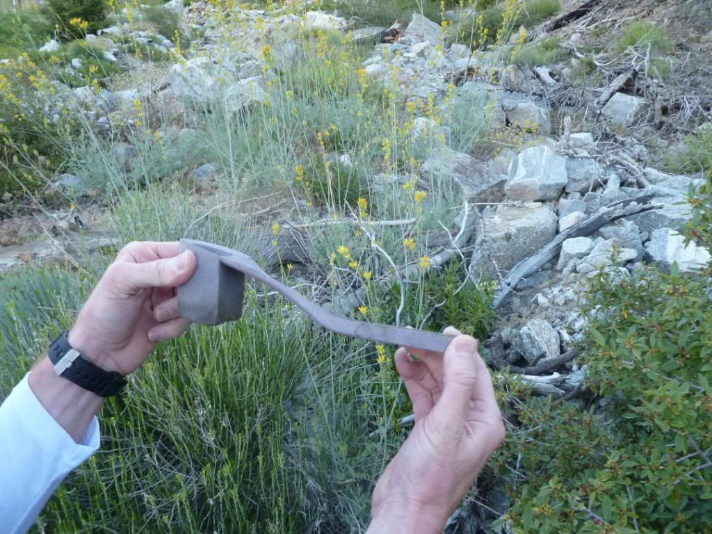
Proof that one of the ladies beat us to this area, Tina is this yours?
Image

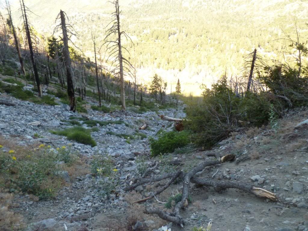
Looking back down canyon after reaching the fire road (Snowslide Canyon?)
Image

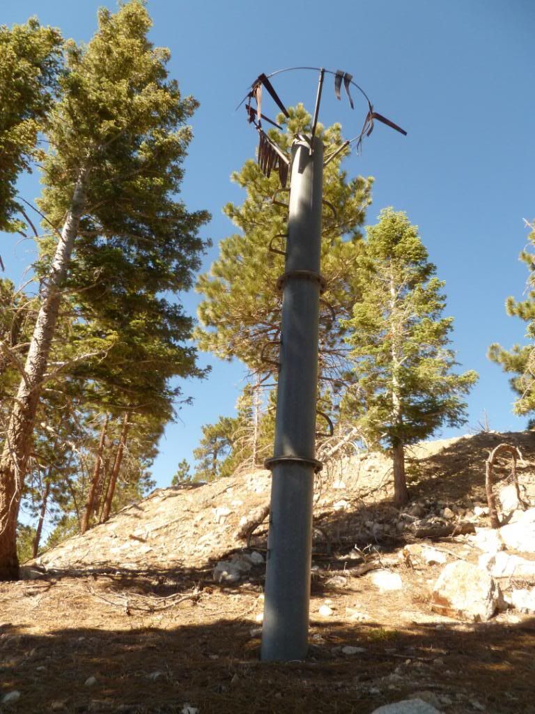
Can anyone tell me what this device is?
Image

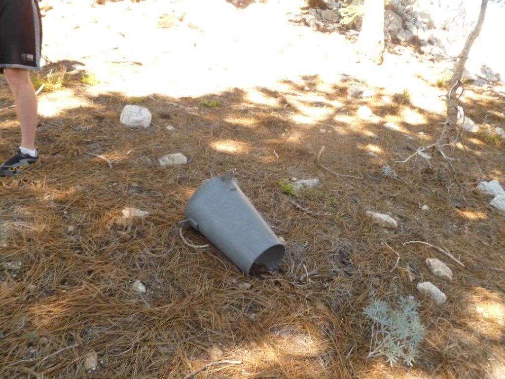
This was laying on the ground next to it
Image

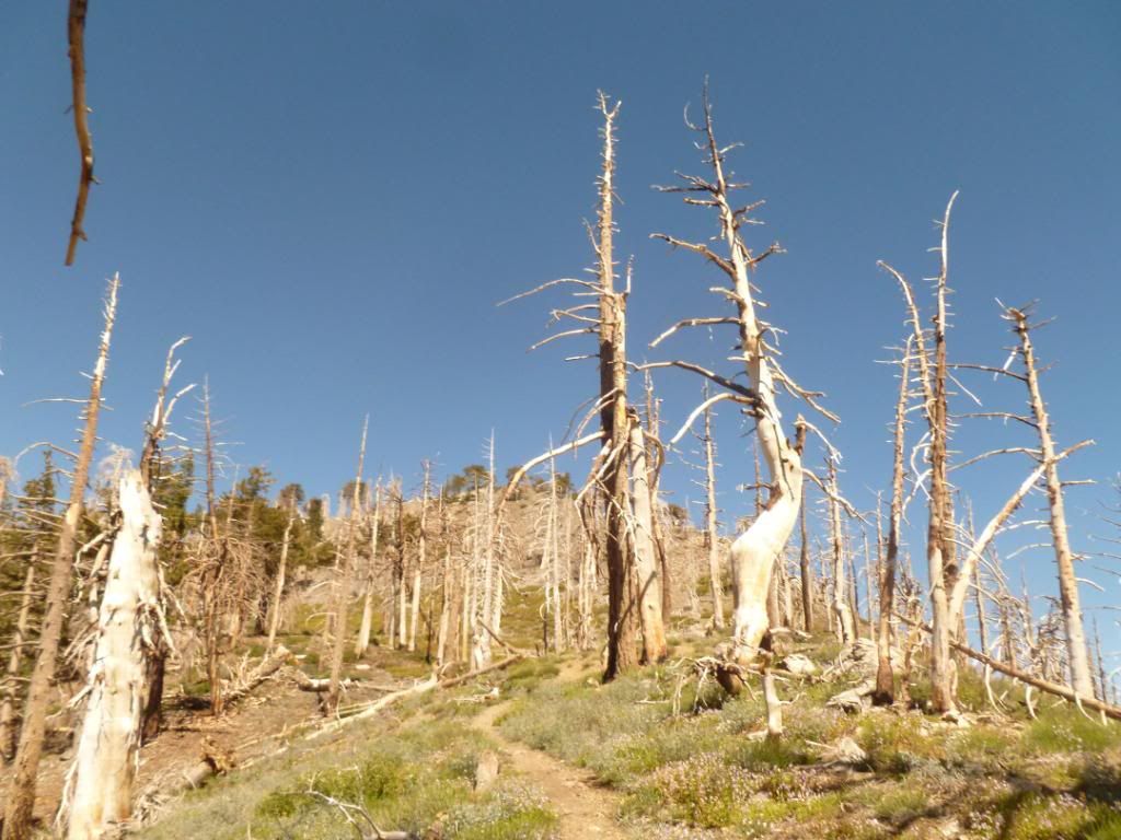
Forestarmageddon - (bark beetle and curve fire damage)
Image

Crystal Lake Store owner and cook waving goodbye (Adam) super nice guy
Image

Rest of Pictures here
User avatar
Elwood
Posts: 612
Joined: Fri Aug 15, 2008 5:23 pm

Post by Elwood »

Beautiful report and pix, Lilbitmo and Zach. Sucks about the run-in with our fine law-enforcement folks. I believe that the device is a rain gauge of sorts. This is merely deduction, not informed.
User avatar
hvydrt
Posts: 494
Joined: Thu Sep 27, 2007 8:18 pm

Post by hvydrt »

Not sure what that device is but I saw one behind the maintenance shed at Dawson Saddle and another near Wright Mountain. Both appeared to be unmaintained. Rain/snow gauge seems like a good guess.
User avatar
HikeUp
Posts: 3861
Joined: Thu Sep 27, 2007 9:21 pm

Post by HikeUp »

I agree...probably a rain/snow gauge. I think that cone should be on top and the Alter shield around the cone (those things hanging off the ring at the top which seem to be heavily damaged) prevent the winds from messing with the accuracy of the gauge. Or it's a metal pipe in the ground. I've seen many of them in the San Gabriels.
User avatar
HikeUp
Posts: 3861
Joined: Thu Sep 27, 2007 9:21 pm

Post by HikeUp »

Perhaps it's one of the NRCS SNOTEL thingies...

http://www.wcc.nrcs.usda.gov/snow/
User avatar
davantalus
Posts: 203
Joined: Mon Jun 08, 2009 9:09 am

Post by davantalus »

Yep! I found one of those old rain gauges up in Panamint City.
http://panamintvalley.com/forum/viewtop ... 408#p72408
User avatar
AW~
Posts: 2043
Joined: Mon Oct 01, 2007 12:00 pm

Post by AW~ »

Nice report.....here is canyon part of Snowslide cyn(below its rappel)..it had a decent amount of water running in it....and cuts through the fireroad.
Image
Post Reply