Trip planning, history, announcements, books, movies, opinions, etc.
25 posts
• Page 1 of 1
Hikin_Jim
Posts: 4688
Joined: Thu Sep 27, 2007 9:04 pm
Postby Hikin_Jim »
Headed up to the Lake Isabella area with the fam. this weekend. Looking forward to a little get away despite all the mishaps of late.
Any decent hiking in and around there? Probably pretty hot there this weekend, so either higher and shadier or near water that I can cool off in would be good.
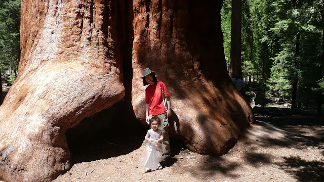
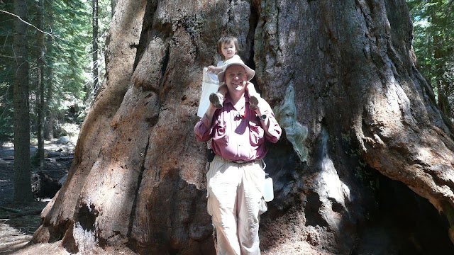
Yessiree, Jim! I couldn't remember the name of the grove above Johnsondale. It is the Long Meadow Grove with the half-mile jaunt, Trail of 100 Giants. Beautiful area and family-friendly.
Lynx: Trail of 100 Giants
Mike P wrote: Yessiree, Jim! I couldn't remember the name of the grove above Johnsondale. It is the Long Meadow Grove with the half-mile jaunt, Trail of 100 Giants. Beautiful area and family-friendly.
Lynx: Trail of 100 Giants
Perfect! Just what I was looking for for my daughter and my wife. Thanks, Mike!
Sunday Peak is a nice little hike. TH to peak is about 1.5 miles with an elevation gain of 800' or so. Nice trail with easy routefinding. The entire hike is in the trees, therefore relatively cool, but there'll be flies. The view from the top is magnificient. Bohna Peak is another good option. Not as good a trail and a bit steeper and longer.
You can find directions on the Sierra Club HPS website or Summitpost.org.T
Both hikes will take 2-3 hours and are easy enough to take the kids along.
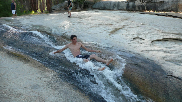
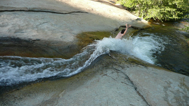
Check out Salmon creek Falls or Peppermint Creek falls. North of lake Isabella on Mountain99 road . Remington Hot Springs is nice too but the crowds may not be family friendly
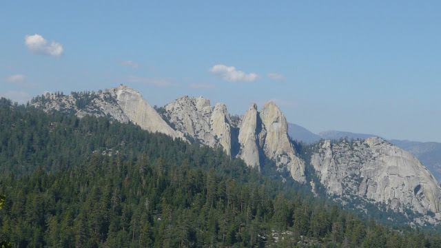
I'm sure your gone already, but the water slide is across from and slightly past lower peppermint creek campground I believe. There's also some nice trails a little further down that road that go thru some Giant Sequoia's, (George Bush Tree, etc) but trail of 100 Giants is more well known. Nobe Young Falls is awesome, but requires a semi-steep .75 scramble. It's a a bit north of Trail of 100 Giants. There's also Dome rock and the Needles Fire Lookout, which are both cool.
All of this is not really that close to Lake Isabella, probably 60-90 minutes north. But if you made it up there, hope you had a taco and a beer at Ponderosa Lodge.
Ponderosa Lodge is very cool! I have camped at upper peppermint many times and we would go to the lodge for a couple beers. Dome rock is very cool too. But like he said, you are probably gone already.
Headed up to Lake Isabella again on Friday morning. Will probably visit the water slide again, but I think I'm going to try to drive to Lloyd Meadows and hike to Jerkey Meadows, Jug Spring, and the Little Kern River. I'll be with my wife and little daughter (see photos earlier in this thread), so I don't want anything too difficult. Anyone been down this route before?
Hikin_Jim wrote: Headed up to Lake Isabella again on Friday morning. Will probably ...hike to Jerkey Meadows, Jug Spring, and the Little Kern River[/b]
HJ
There was recently a fire there. Started in Freeman Creek grove, and burned away from it. The grove is supposed to be OK, but east of it, most of Jerkey Meadow and down to the river will probably be charred a bit. The road is open though. Fires up there are not like the ones we have - tends to burn the understory, leaving green pine treetops.
It's probably OK, but if I were you I'd have a Plan B in mind. There are a couple of relatively easy, scenic walks down to the start of the Seven Teacups canyoneering route nearby. Email me if you want GPS for that.
Editing my previous post. Here is a map of the George Fire. Your trail looks untouched. I remember the first bit from Jerkey TH to be somewhat steep and hot, being a horse trail, but once you get up there it's beau-tee-full.
I'm too late, but for others...that route to the Little Kern is a bit tough-5 miles from the trailhead, 1000' climb to Jerkey, then 1000' drop to the Little Kern. It's beautiful-but not an easy trip, especially for a young child.
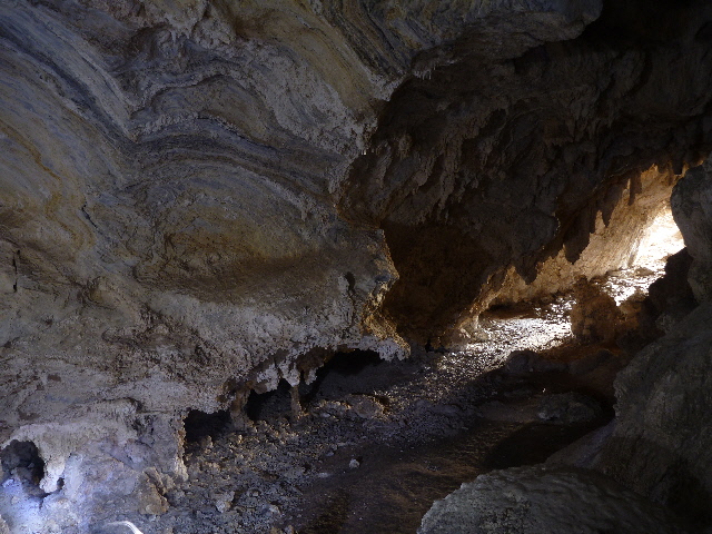
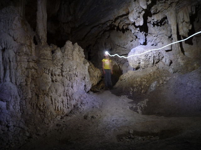
Lots of other great things to do- 7 Teacups, Packsaddle Cave, the Needles, the River trail...
McFlyfi wrote: That route... is a bit tough... 1000' climb to Jerkey... not an easy trip, especially for a young child.
Yeah, it pretty much sucked. It was hot, steep, and there were a lot of bugs. My wife *really* didn't like it (she's not a hiker), and even I who love hiking didn't enjoy it. Schleping my 30lbs daughter up that trail wasn't any fun. We went up the older, more direct trail which may not have been the best idea. The meadow itself was nice.
We went on the Needles Trail on Friday, and it was a lot of fun. Darned shame that the lookout burned down.
We went to Remington Hot Springs yesterday, and that was nice. Eclectic crowd I must say.
McFlyfi wrote: 7 Teacups, Packsaddle Cave, the Needles, the River trail...
This is an annual trip for us, so we're all ears concerning destinations in and around the Kern River. Got any directions to the Seven Teacups, Packsaddle, and The River Trail?
McFlyfi wrote: The River Trail parallels the Kern for 3.5 miles upstream of the Johnsondale Bridge-easy, nice views for the family.
Cool. I see it on the topo map. Looks nice and flat -- just the way my wife likes it. (well, truth be told, so do I when I'm carrying my daughter) Looks like a good family hike. Much appreciated!
McFlyfi wrote: The Packsaddle Cave trailhead is right by McNally's steakhouse on the river. 2.5 miles each way, about 1000' up.
I see the trail and the cave on the topo map. Nice. I'll have to check it out some time.
McFlyfi wrote: The Seven Teacups is very near the waterslide you visited.
I can see what appears to be a route for getting into the vicinity. QUESTION: How hard is it to walk in? How close to the tea cups can I get if I'm carrying my two year old daughter?
Hikin_Jim wrote: QUESTION: How hard is it to walk in? How close to the tea cups can I get if I'm carrying my two year old daughter?
I've never followed the alleged "4wd" road, even though I've been there in a capable truck and on my dual sport bike. It's just easier to walk.
The McNally fire burned through there 9 years ago, after that, we would just cross-country it to the gap. That is getting harder to do now, especially with kids in tow.
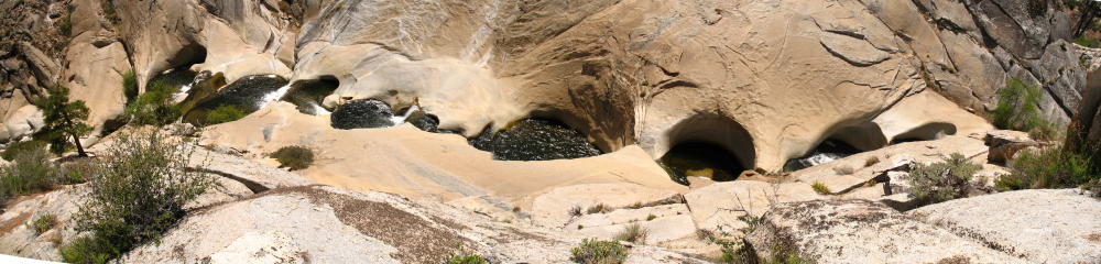
There's actually a trail of sorts that follows the creek. Cross the creek in the campground to the south/west side, follow the trail. When you get to the place where the creek turns to the north/east (where it says "Creek" on your map) cross the creek again. The trail picks up on that side, you can take it to the spot I took the pic. From there, easy scrambling down to selected teacups. It's about a 1.25-1.5 hours on the trail. No significant up-and-down, but the canyon does get narrower towards the end.


