Switzer to Bear Canyon June 6 2011

TRs for the San Gabriel Mountains.
Post Reply
User avatar
cougarmagic
Posts: 1409
Joined: Wed May 07, 2008 5:21 pm

Post by cougarmagic »

Today I hiked one of my absolute favorite places. The trail from Switzer picnic area (and the entire Arroyo Seco) has beautiful pools, shade, solitude, and interesting history. It was great to get back there.

The day started with a drive up the newly opened ACH from La Canada. As others have mentioned, there has been a tremendous amount of work done on the road. It's easy to wonder why the work took so long, until you see the huge new canyons created by rockslides, all the new signage, and appreciate the smooth, fast drive up to Clear Creek.

Of note - as I drove up, it was RAINING. In JUNE.

The Switzer trail is open, but the picnic area is still being worked on, so the gate is closed at the "top" (at ACH). This means a ten minute walk down a paved road, to get to the start of the trail. Not bad. I saw this sign on the way, which seemed to say something about "This may someday be a recreation area, but the amount of brush...".

Image

The canyon bottom looked lush:

Image

There are only scattered remains of fire damage here.

Image

A nice snack!

Image

I've loved this view for the past ten years. What a nice place.

Image

I wanted to check out the view from the Chapel ruins. Because of the regrowth of brush, the use trail is very hard to find. Even knowing where I was going, I ended up about 20' too low, and cliffed out. A little backtracking brought me to the old stone arches.

Image

Looking down canyon from the Chapel:

Image

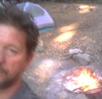
Back at Switzer Camp, life is good:

Image

The trail has obviously been worked on, and was in excellent shape. I think it was nicer than it was before the fire, actually. Big thanks to the volunteer trail crews!!!

These rappels have been on my list for quite some time:

Image

Tiny baby Taricha Torosa, just starting to work on his neurotoxin production:

Image

The pools are doing alright. Not what they were, but getting there. I'll be real happy when I see fish in here again!

Image

At the Bear Canyon junction, foxtails abound, but the trail is otherwise fine.

Image

The Humboldt Lilies are blooming now!

Image

And, hiking solo, this still warm pile (and the nearby bedding area) became my signal to turn around. Don't want to bother Mr. Yogi.

Image

This is a mountain lion track, also nearby. (distorted by the rain)

Image

The Dudleya is also happy

Image

Ahhhhhh - it doesn't get much nicer:

Image
User avatar
Elwood
Posts: 612
Joined: Fri Aug 15, 2008 5:23 pm

Post by Elwood »

Beautiful pictures of a beautiful area of the range. I can't wait to get back down there. Last time down Bear Canyon a tick managed to get up the sleeve fast enough that it wasn't until my swollen arm alerted me to its snacking. Thanks for the report and pictures.
User avatar
robnokshus
Posts: 130
Joined: Fri Apr 04, 2008 7:25 am

Post by robnokshus »

Driving back down from Red Box on Sunday I noticed a bunch of cars parked on ACH by the gate. Had to check the map again when I got home to realize that this area is now open!

Thank you for the awesome pics. Really did my heart well.
User avatar
lik2hik
Posts: 82
Joined: Sun Sep 30, 2007 8:46 am

Post by lik2hik »

Thanks for the T/R. Bear Canyon is one of my favorite areas. I wonder what kind of shape the trail camp is in?
How far did you get up Bear Canyon before you came upon Yogi's camp?
User avatar
MattCav
Posts: 356
Joined: Thu Sep 23, 2010 4:13 am

Post by MattCav »

CM! I was there tonight too. Musta missed you, started out from the lot about 5pmish or so. When were you there?

Also thought of you on the drive back to La Canada... a big bobcat ran across ACH, then took a seat and stared down my car. What beautiful animals!
User avatar
cougarmagic
Posts: 1409
Joined: Wed May 07, 2008 5:21 pm

Post by cougarmagic »

lik2hik wrote: Thanks for the T/R. Bear Canyon is one of my favorite areas. I wonder what kind of shape the trail camp is in?
How far did you get up Bear Canyon before you came upon Yogi's camp?
I've heard Bear Canyon camp is in good shape. I would expect a lot of leaves and acorns, maybe some mud on the picnic tables, but it didn't burn right down in the canyon bottom there. I went only a short way up the trail - maybe 10 minutes - when I saw the pile.

Matt - was there from about 8am till 1pm. I only saw 3 other people the whole day (actually, that's a lot considering it was a weekday)
User avatar
TracieB
Posts: 216
Joined: Mon Feb 22, 2010 8:57 am

Post by TracieB »

Beautiful...never been there but your photos sure make me want to go! Thanks for sharing!
User avatar
AW~
Posts: 2040
Joined: Mon Oct 01, 2007 12:00 pm

Post by AW~ »

that sure is a nice looking canyon to drainage to explore, how tall is that last drop?
User avatar
cougarmagic
Posts: 1409
Joined: Wed May 07, 2008 5:21 pm

Post by cougarmagic »

AW wrote: that sure is a nice looking canyon to drainage to explore, how tall is that last drop?
I think it's a good 200'. Best access is from the south. There is a gully that looked relatively easy to climb at "A". Falls are at "B"

http://mapper.acme.com/?ll=34.25750,-11 ... orest%20CA

I should mention - didn't look like there would be good anchor materials anymore.....
User avatar
PackerGreg
Posts: 623
Joined: Sat Sep 12, 2009 9:31 pm

Post by PackerGreg »

This from Richard Nyerges a few days ago:

Hi Everyone,

The weather was once again almost perfect for doing what we do best, trail maintenance.

We had 23 very energetic folks this past Saturday join in on getting a section of the Bear Canyon & Gabrielino trails back in order. There were 3 trees that had to be removed, lots of weeds to clear and a few rock slides to help down the mountain. Aside from that and not much of a trail to walk on, everyone pulled together and by the time we were finished, there was a trail for forest visitors to hike on, much better than before the Station Fire.

With the number of volunteers working together, we managed to finish up the 3/4 mile section of trail in a little over 3 hours. The work everyone did would make any trail boss proud. I sure know I was extremely proud of the work everyone did. My hats off to each and every one of you.

Afterwards we all went back up top Switzers picnic area and relaxed, socialized and enjoyed a great lunch. While were were enjoying our time there, members of the U.S. Forest Service stopped by. Andrew & Blake. We were also visited by a couple of members of Montrose Search & Rescue and FS Fire also drove in. By 4:50pm, the last of us were gone and heading home, satisfied with a job well done.

Oh yes, the Switzers parking lot was still closed, but the upper lot on the highway was packed with cars of hikers.

I want to thank each and everyone of you who joined in this past Saturday. Your work does not go un-noticed. And as you know already, it won't.

One last note...
July 16th we will be going into the West Fork area once again to finish up a short 1/2 mile section of the Gabrilino Trail near Valley Forge. If you can join us, please let me know.

Other than that, our next time into Bear Canyon will be in the fall when once again work on our beloved canyon trail.

Thanks again for all you devotion & hard work.
Richard"


For those of you looking to volunteer with Bear Canyon Trail Crew, contact Richard at nyerges@sbcglobal.net


Image

Image

Image

Image
User avatar
MattCav
Posts: 356
Joined: Thu Sep 23, 2010 4:13 am

Post by MattCav »

amazing pics. i'm really grateful for the work those groups are doing. thanks for posting that greg.
Post Reply