The route begins at only 5,950' and starts to gain elevation right away. Following the great info provided by Andy's trip report, we made our way up the ridge on the north side of the creek to about 7,200'. The terrain is rough in this area and there are only occasional sections of a faint use trail to follow. It was starting to warm up as we began the traverse across a fairly steep and loose slope to the "7,200' notch". This is a tricky section because there are notches everywhere you look! Once we reached the notch, we got a great overview of the area and our route up to the Bairs Creek Cirque.

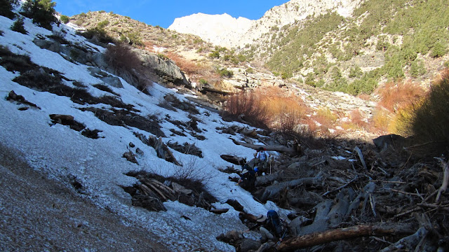
We descended from the notch then traversed across the northerly slope until we reach the creek at about 7000'. We crossed the creek just below a waterfall then climbed up the southerly slope through semi-brushey terrain. We hiked up canyon, staying a few hundred feet above the willow filled creek. After a short distance we dropped into the drainage just before the fork at 7200'. We took the left fork and decided to take the ridge on the west side of the creek to avoid the soft snow and willows. At about 7,800', we left the ridge and began following the drainage up to the cirque. The snow was firm and made for much more enjoyable travel than the loose and rocky ridge. Since the snow was firm we decided to leave our snowshoes on a large rock at about 8,500'.
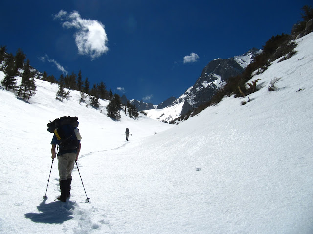
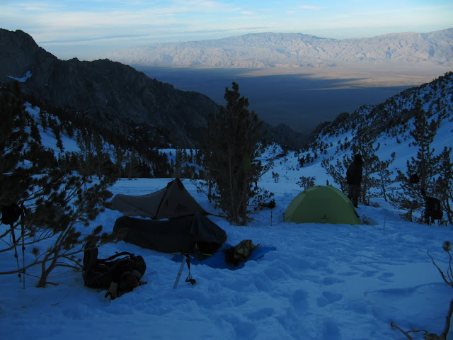
It was either 62 or 72 degrees, depending on if you trust the $3 REI key chain or the $3 Sport Chalet key chain thermometer. Either way, it was getting very hot as we continued up the drainage and I was glad to be wearing shorts and a t-shirt. We wanted to camp on top of the moraine at 11,000' but with the warm temps and fatigue from carrying a heavy load, we settled for a small hill at 10,300'. The views of the Owens valley from our camp were great! It took us 8 hours to reach camp site and we were all glad to be done for the day.
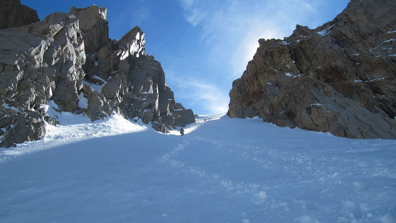
Saturday morning we got up around 5 and left for the peak a little after 6. The upper end of the canyon is amazing!
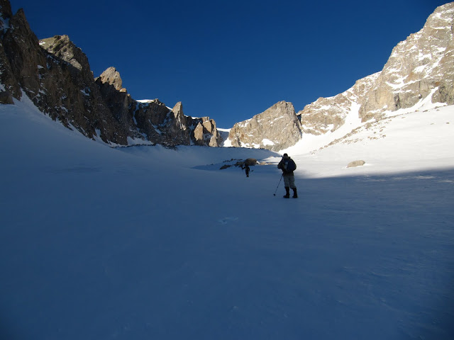
The snow was mostly firm, but we hit several areas that were soft and took a lot more energy to walk through. Snowshoes would have been nice, but thanks to Dagmar and Ron breaking trail, the rest of us got through without much struggle.
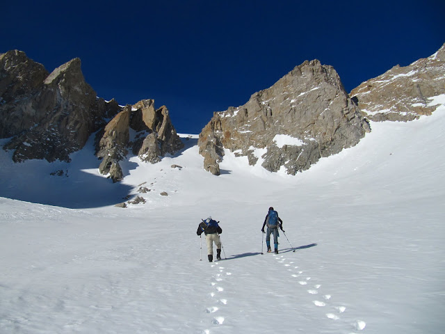
We took a break on a large rock at about 12,000' near the base of the headwall. John decided to continue on as we ate some snacks and rested. We could see that Johns progress was slowed by deeper snow about halfway up the slope. By the time we could catch him, he had already kicked steps to nearly 13,000'.
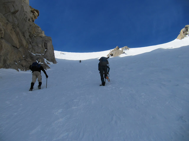
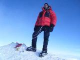
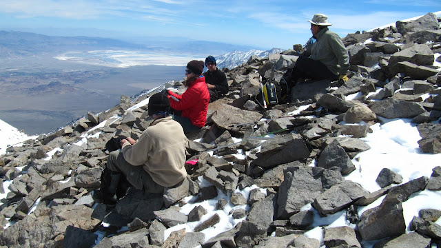
Once we reached the top of the slope, the upper bowl and the 14,000' twin horns came into view. The bowl had a fresh avalanche in the middle of the slope so we decided to ascend the rocky northerly edge. The views of the Owens Valley and the Mt. Whitney area are great from here. Soon we reached the top of the slope and finished off the easy walk across the summit plateau and up to the peak. On top we met two guys who came up from George Creek. They said the bushwhacking in the drainage wasn't bad because a recent avalanche had wiped out some of the vegetation. The weather was very mild on top with almost no wind, clear skies and pleasant temps. It was the perfect day to relax and take in the view on the summit. After signing the register we snacked on some chocolate Cory brought for everyone. This was Cory's first 14eer!
The descent was fairly uneventful, other than John re-climbing half of the upper cirque to retrieve a trekking pole he left behind. Once down the headwall, we stayed high on the moraine, rather than follow the drainage so we could glissade a few sections rather than walk.

When we got back to camp, Ron discovered a raven had gotten into his food and stole his Mountain House lasagna, so I split my chicken and rice with him. We were all in bed early, exhausted from two long days of up hill.
Sunday morning we woke up early, packed up and began the descent. We wanted to take advantage of the hard snow in the early AM. The angle of the slopes in the drainage and the hard snow made for excellent glissading. On the first glissade, we slid past several pieces of Rons stolen lasagna! We were able to glissade a large portion of the 2000' descent back to where we left our snowshoes. Once we regrouped at the snowshoes, we compared the holes in our pants from glissading. Everyone but John had destroyed their pants, but it sure was fun. We were glad to have the snowshoes for the last 1000' of descent to snowline. The area had become rather soft and the snowshoes saved us some misery. Once back in the drainage, we fought our way through a maze of avalanche debris, then bushwhacked back to the creek crossing. Once back on the north side of the drainage, the walk back to the notch and out to Foothill Road was easy. We were back at the cars by 10:45AM.
Round trip was about 14 miles and 8,800' of vertical gain. I am glad we took 3 days to do the hike rather than 2. It allowed us to go slow and take lots of breaks to enjoy the area. Thanks again to Andy @ sierradescents.com for the information, it really helped us find way. The rest of my pictures are here