1-15-11 Trip Report: Idlehour

TRs for the San Gabriel Mountains.
Post Reply
User avatar
rokclimbr
Posts: 124
Joined: Mon Jan 03, 2011 5:32 pm

Post by rokclimbr »

AW's comments on my last trip report, kept me up at nights my imagination running wild with visions of bomber untouched rock faces stretching into the sky. So the first chance I got I set off to recon the lower reaches of the "Mt Wilson bowl" via Idlehour and upper Eaton Canyon.
I got a late start on Saturday, my buddy Henry and I did not get on the trail till 1:30pm. The hike up Mt Wilson Toll Road was very warm but it did not keep the crowds away, all the way to Henninger Flats there were swarms of hikers, couples, dog walkers and even some shady looking characters that were probably out spray painting rocks.

By the time we reached Henninger Flats I had finished off a 70oz Platypus and was making steady progress on my Nalgene, it was warm!
I had never been to Henninger Flats before and was quite surprised to see so many pine trees, buildings, and campgrounds. It smelled wonderful and to boot there was an amazing breeze coming down off Mt Wilson that dramatically decreased the temperature.

Once past Henninger Flats the crowds dissipated considerably and besides one Boy Scout Troop we did not see anyone else the rest of the day. Just under two hours after leaving our car (at the Pinecrest trailhead - mistake) we made it to the Idlehour trail. The push up to the saddle was amazing, the views to the ocean were spectacular the Pacific looked like shimmering gold!

The 1.59 mile descent (for anyone out there with an iPhone check out Motion X a $2.99 GPS app in the AppStore ((or free if you have jailbroken the device)), I used it on this trip and was very impressed... still trying to figure out how to upload my waypoints and tracks from the trip. When I figure it out I'll post to this thread) was cool and the views of Mt Wilson and Eaton Canyon were amazing. As soon as we dropped over the other side of the saddle we could hear the river raging in the canyon below. We stopped a few times on the way down to take pictures and just soak in the views and by 4:30pm we were at the bottom.

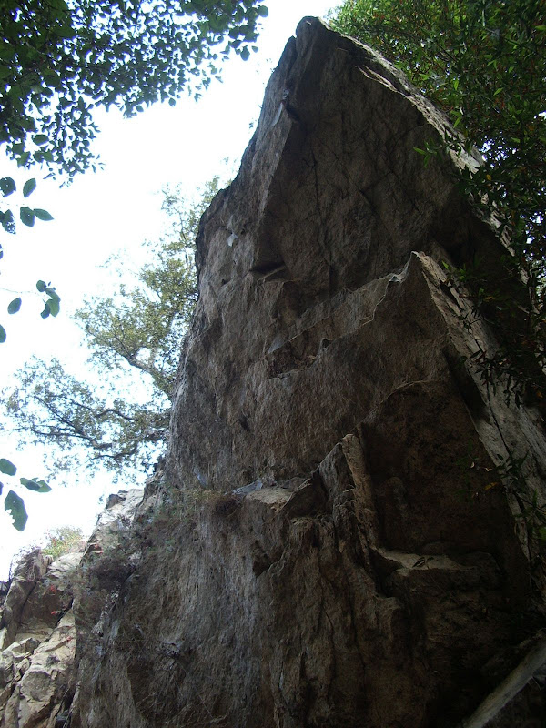
view of Middle Muir & Upper Eaton

There was a Boy Scout Troop camping at Idlehour Campground, not a bad place to camp. The river looked inviting so we found a nice pool and went for a swim. It was pretty dang cold but after the exposed slog up Mt Wilson Toll Road it was a welcome refreshment. Much thanks must go to MattCav for his recent trip report, I took his advice and brought my water filter and we refilled our empty water supply with ice cold water!
We had not brought much in the way of food so we snacked on a few crackers and dropped down Eaton Canyon but only a few hundred meters to the first side canyon which we followed back up to Idlehour Trail. The short route down Eaton Canyon was beautiful, boulder hoping down the creek bed with moss and fern covered cliffs on either side and water polished VW Bus sized boulders.

At the first switch back, on the way up Idlehour Trail, we stopped to peel off some warming layers and I got one bar of service so I shot off a text to my wife to let her know I was still alive and that she did not need to call for a rescue. A little further up we ran out of natural light and had to take out our headlamps. After we crested the saddle we were greeted with an amazing sunset and the view of the city lights stretching to the ocean!

The moonlight was bright enough that we could hike down Mt Wilson Toll Rd without headlamps. Near the bottom we almost stepped on a frog who was hoping along the road and we spooked a night owl that was roosting in a pine next to the road. It was a peaceful hike down.
We could almost taste the Tonny's Mexican food when we arrived at the gate, we were famished! Imagine our horror when we discovered that the gate was locked!!! This meant that we would have to hike down to the trailhead at the intersection of Midwick, Roosevelt & Altadena Dr adding another 2 miles to our hike! So dejectedly we headed back down the road to the bridge and followed the trail down the valley. After one more creek crossing and some bush-wacking we found the trail on the other side of the river and made our way back to the car.

Total trip stats: 12 miles in 6 hours (1:30pm - 7:30pm)

Side-note: The rock climbing potential does look promising, thank you AW, I will surely be coming back for a longer trip possibly multiday to explore. Even from Idlehour Campground there are some huge boulders on the western slopes!

And boy did those fish tacos and flautas taste amazing!!!

I cleaned both plates, not a grain of rice left :)
User avatar
MattCav
Posts: 356
Joined: Thu Sep 23, 2010 4:13 am

Post by MattCav »

rokclimbr
epic hike! great pics and details! i've never made it to idlehour campground but feel inspired to do so from your post. how far below the campground was the river?
i'm glad the hike went well and the water filter idea paid off :-) keep posting t.r.'s - you're good at em!
User avatar
AlanK
Posts: 1069
Joined: Thu Sep 27, 2007 9:28 pm

Post by AlanK »

I like the innovation of including pictures of the post-hike meal. That may provide as much inspiration as pictures of the hike itself. 8)
User avatar
Terry Morse
Posts: 126
Joined: Mon Mar 03, 2008 8:55 pm

Post by Terry Morse »

I was also at Idlehour yesterday with a few friends, but we were there at 10:30 AM. There wasn't anybody else at the campsite, but we did run into a bunch of boyscouts on the way back up. That area down there is just beautiful this time of year. Eaton Canyon Falls is booming right now too.
User avatar
rokclimbr
Posts: 124
Joined: Mon Jan 03, 2011 5:32 pm

Post by rokclimbr »

Tonny's Mexican Restaurant is great, I go to that place all the time (it helps that it's less than a block from my pad too).

The campground is right on the river, it is kind of a small campground maybe 3 sites and no fires I'd be psyched to head back up there again. Hit me up if you plan on going...

I bet doing a decent of the canyon right now would be next to impossible with all that water, you'd definitely need a wet (I'd prefer a dry) suit though the water is COLD!

And just for kicks, a short kind of random video...
http://www.youtube.com/watch?v=HaJlF20QI2s
User avatar
Taco
Snownado survivor
Posts: 6010
Joined: Thu Sep 27, 2007 4:35 pm

Post by Taco »

It would be neat to see what kinda rock you've found up there. 8)
User avatar
Hikin_Jim
Posts: 4686
Joined: Thu Sep 27, 2007 9:04 pm

Post by Hikin_Jim »

Taco wrote: It would be neat to see what kinda rock you've found up there. 8)
I give you, Taco Rock-o:
Image

HJ
User avatar
AW~
Posts: 2043
Joined: Mon Oct 01, 2007 12:00 pm

Post by AW~ »

The extreme stuff is East Muir....jeez, only more extreme than that is the south face of Twin Peaks. The photo titled "Middle Muir..." is actually Caltech canyon(left) and upper Eaton canyon(right). The ridge in the middle is where we went...and we had to manuveur to avoid climbing where we could.
User avatar
Hikin_Jim
Posts: 4686
Joined: Thu Sep 27, 2007 9:04 pm

Post by Hikin_Jim »

AW wrote: The extreme stuff is East Muir....jeez, only more extreme than that is the south face of Twin Peaks. The photo titled "Middle Muir..." is actually Caltech canyon(left) and upper Eaton canyon(right). The ridge in the middle is where we went...and we had to manuveur to avoid climbing where we could.
Photo? Did I miss something?

By the way, that photo of Taco Rock-o really is near Idlehour.

HJ
User avatar
Taco
Snownado survivor
Posts: 6010
Joined: Thu Sep 27, 2007 4:35 pm

Post by Taco »

Any loooooong lines?
User avatar
AW~
Posts: 2043
Joined: Mon Oct 01, 2007 12:00 pm

Post by AW~ »

Hikin_Jim wrote:
AW wrote: The extreme stuff is East Muir....jeez, only more extreme than that is the south face of Twin Peaks. The photo titled "Middle Muir..." is actually Caltech canyon(left) and upper Eaton canyon(right). The ridge in the middle is where we went...and we had to manuveur to avoid climbing where we could.
Photo? Did I miss something?

By the way, that photo of Taco Rock-o really is near Idlehour.

HJ
Sorry Hiking_Jim, I was referring to the orginial post...3rd photo.
User avatar
AW~
Posts: 2043
Joined: Mon Oct 01, 2007 12:00 pm

Post by AW~ »

Taco wrote: Any loooooong lines?
The longest line is a tributary vein to East Muir's last rappel...size is huge..LOL. I dont have a good picture of it...basically we are talking helicopter territory...I think its about 600-800ft high...not all 90 degrees though.

Its the cut on the left...its easy to see on the Telephone trail as there is a side path to an overlook of East Muir.
Image
User avatar
Taco
Snownado survivor
Posts: 6010
Joined: Thu Sep 27, 2007 4:35 pm

Post by Taco »

Now I have to do it. 8)
User avatar
rokclimbr
Posts: 124
Joined: Mon Jan 03, 2011 5:32 pm

Post by rokclimbr »

Alright figured out how to transfer waypoints and tracks from my motion X GPS app on my iPhone. Here is a waypoint from my Monday climbing trip in Joshua Tree
Click Here

In regards to AW's comment i was looking at this map and got a bit confused. So Middle Muir is south of Caltech Canyon then... ?

As for rock, as you drop down Idlehour Trail you get many clear views of this...

Looks to be about 50 feet tall at the most... and upon closer inspection the rock is very high quality. I do not think it would be very granular...
User avatar
Taco
Snownado survivor
Posts: 6010
Joined: Thu Sep 27, 2007 4:35 pm

Post by Taco »

Access looks 'entertaining'. :lol:
User avatar
HikeUp
Posts: 3861
Joined: Thu Sep 27, 2007 9:21 pm

Post by HikeUp »

rokclimbr wrote: In regards to AW's comment i was looking at this map and got a bit confused. So Middle Muir is south of Caltech Canyon then... ?
Yes.
rokclimbr wrote: As for rock, as you drop down Idlehour Trail you get many clear views of this...

Looks to be about 50 feet tall at the most... and upon closer inspection the rock is very high quality. I do not think it would be very granular...
That is the pile of rocks AW and I climbed (me part of the way up, AW all of the way up). Link to TR. I thought the rock was loose (hence I stopped part way up) but I'm not a rock climber. AW was like a mountain goat getting up that slope!
User avatar
HikeUp
Posts: 3861
Joined: Thu Sep 27, 2007 9:21 pm

Post by HikeUp »

Your picture with pretty colored lines on it...
Image
Red (on the left) = Caltech Cyn.
Light blue (on the right) = Upper Eaton Cyn.
Purple (in the middle) = pile of rocks mentioned in post above that AW climbed.

My pic of the pile of rocks...
Image
Red = route
Blue = where I chickened out
Green = AW's high point (or somewhere near there)
User avatar
HikeUp
Posts: 3861
Joined: Thu Sep 27, 2007 9:21 pm

Post by HikeUp »

Some pics of rocks on that pile...
Image
Image
Image

AW...
Image
User avatar
Taco
Snownado survivor
Posts: 6010
Joined: Thu Sep 27, 2007 4:35 pm

Post by Taco »

Thanks for posting the pics, HikeUp.
Post Reply