Forgotten Byways of the SGW
Posted: Fri Sep 24, 2010 3:04 pm
I don't get out like I used to what with being married and having a child and all. Not that I'm complaining mind you. Just saying.
But last Friday I got one of those now rare opportunities in my life: an entire day free to do nothing but go hiking in the San Gorgonio Wilderness. Whoopie!
I haven't been on the old Lodgepole Trail for years and years, so I thought I'd give it a shot. What's that? You haven't heard of the old Lodgepole Trail? Well, you're not alone. It's one of the forgotten byways of the SGW.
Where is it? First clue: Look at John Robinson's Trails of the San Bernardinos. Look at his directions for Mine Shaft Flats and Big Tree. The book says to go to Mine Shaft Saddle and to go straight from the saddle. What? Straight? Going straight takes you over the edge right into the brush. Could John "the man" Robinson be wrong? Hardly. It's just that in the revisions of the book, something fell through the cracks. Robinson's directions are correct; they're just for a different time, a time when the main route went not through Trail Flats but Lodgepole Spring and Lodgepole Sadddle. Lodgepole Saddle is the saddle immediately NE from Mine Shaft Saddle. Regrettably, the old Lodgepole Trail has long been unmaintained and is really now more of memory than a trail.
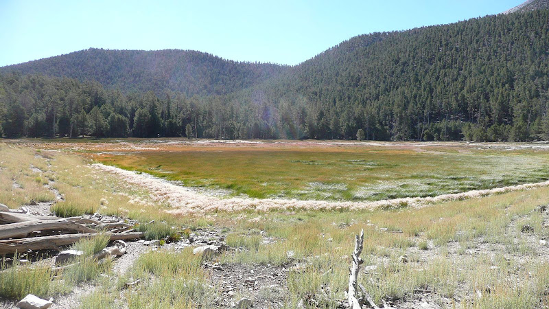
Well, let's get started on our expedition to find the trail, shall we? First, let's get to our jumping off point, Dry Lake, or, more accurately for 9/17/2010, Dry Lake Marsh.
Now, when sniffing out old trails, it's almost always easier to do so in the down hill direction, so let's head up via the modern day route to Trail Flats first.

From there, let's head up to Mine Shaft Saddle, and heck, while we're in the neighborhood, let's bag Zahniser Peak (10,056'), one of seventeen peaks over 10,000' in the SGW.
The summit of Zahniser Peak (10,056'). This old gnarled snag graces the summit.
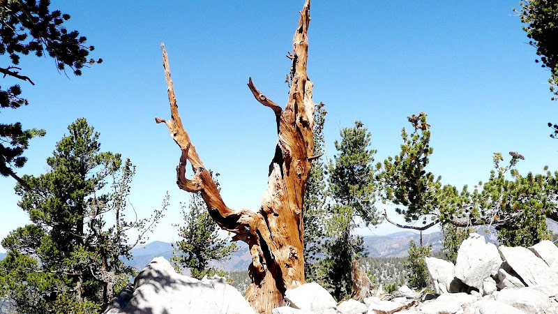
Dry Lake from the summit of Zahniser Peak. You can definitely see a few spots of open water.

Lest you think that I haven't climbed much from the lake to the summit, here's a photo without the zoom.

Another look at the beautiful old tree on the summit of Zahniser.

From Zahniser, let's drop down to the start of our forgotten byway, Lodgepole Saddle, which is sometimes also called Zahniser-Lake Saddle.

Now, let's find the start the trail. There it is. Not too tough.

The trail is pretty easy to spot in many places even though it hasn't been maintained in years.
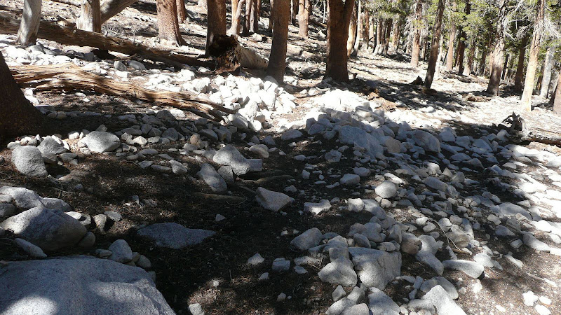
Of course as in most old trails, it's not always so easy to spot the route. The thing to remember is that the old Lodgepole trail *always* stays above (west) of the drainage.
Sometimes you can find little clues, like the line of rocks here marking the downhill side of the trail.

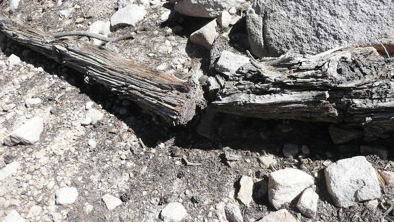
Or this old sawn log.
Eventually though, you're going to get down into Lodgepole Flats. I've never been able to follow the trail through the flats. I basically follow the drainage at this point.

All you need to do when going downhill is to follow the drainage until it meets the main drainage coming down from Fish Creek Saddle. When you meet the main drainage, proceed as though as though the drainage from Lodgepole Saddle continued, and you'll hit the Fish Creek Saddle Trail in maybe 50 yards. If you're going uphill, it's much trickier. You basically need to go up the drainage at about 170 degrees true.
In the photo below, I'm following the route (it's really not a trail at this point) through Lodgepole Flats.

Here's a critical juncture. This is the confluence of the main drainage going up to Fish Creek Saddle and the somewhat lesser drainage going up to Lodgepole Saddle. One needs to follow the right hand drainage.

Again, coming down is no problem. However, if coming up the trail to Fish Creek Saddle from Lodgepole Spring, keeping looking to the right. A hundred or so yards past the upper edge of greenery surrounding the spring you should see an opening through the trees where a gap can be seen as shown in the photo. The gap is of course Lodgepole Saddle. Proceed here at approximately 175 true to the confluence shown in the previous photo. The confluence is perhaps 75 yards away from the trail. From the confluence head up the right hand drainage at about 170 true.
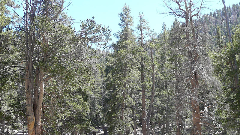
Looking down trail from the point where the trail from Lodgepole Saddle hits the trail to Fish Creek Saddle, one can see the upper edge of the greenery surrounding Lodgepole Spring.

This shark like rock marks the point at which you must leave the Fish Creek Saddle trail in order to get on the route/trail to Lodgepole Saddle.

The route/trail from Lodgepole Saddle hits the Fish Creek Saddle trail just above Lodgepole Spring. Speaking of the spring, there were dozens and dozens of these little frogs around Lodgepole Spring.


Lodgepole Spring was flowing well.

Below Lodgepole Springs, of course I once again reach the shores of Dry Lake.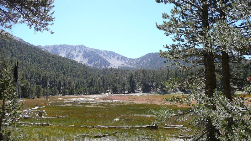
Well, I hope you've enjoyed one of my little excursions down one of the many forgotten byways of the San Gorgonio Wilderness. Map of route.
For more photos, and for directions for finding the old Dry Lake Trail (yet another forgotten byway of the SGW), see my photos of the Old Lodgepole Trail and Old Dry Lake Trail.
Thanks for joining me on my journey through one of the best places in Southern California, the San Gorgonio Wilderness,
HJ
But last Friday I got one of those now rare opportunities in my life: an entire day free to do nothing but go hiking in the San Gorgonio Wilderness. Whoopie!
I haven't been on the old Lodgepole Trail for years and years, so I thought I'd give it a shot. What's that? You haven't heard of the old Lodgepole Trail? Well, you're not alone. It's one of the forgotten byways of the SGW.
Where is it? First clue: Look at John Robinson's Trails of the San Bernardinos. Look at his directions for Mine Shaft Flats and Big Tree. The book says to go to Mine Shaft Saddle and to go straight from the saddle. What? Straight? Going straight takes you over the edge right into the brush. Could John "the man" Robinson be wrong? Hardly. It's just that in the revisions of the book, something fell through the cracks. Robinson's directions are correct; they're just for a different time, a time when the main route went not through Trail Flats but Lodgepole Spring and Lodgepole Sadddle. Lodgepole Saddle is the saddle immediately NE from Mine Shaft Saddle. Regrettably, the old Lodgepole Trail has long been unmaintained and is really now more of memory than a trail.
Well, let's get started on our expedition to find the trail, shall we? First, let's get to our jumping off point, Dry Lake, or, more accurately for 9/17/2010, Dry Lake Marsh.
Now, when sniffing out old trails, it's almost always easier to do so in the down hill direction, so let's head up via the modern day route to Trail Flats first.
From there, let's head up to Mine Shaft Saddle, and heck, while we're in the neighborhood, let's bag Zahniser Peak (10,056'), one of seventeen peaks over 10,000' in the SGW.
The summit of Zahniser Peak (10,056'). This old gnarled snag graces the summit.
Dry Lake from the summit of Zahniser Peak. You can definitely see a few spots of open water.
Lest you think that I haven't climbed much from the lake to the summit, here's a photo without the zoom.
Another look at the beautiful old tree on the summit of Zahniser.
From Zahniser, let's drop down to the start of our forgotten byway, Lodgepole Saddle, which is sometimes also called Zahniser-Lake Saddle.
Now, let's find the start the trail. There it is. Not too tough.
The trail is pretty easy to spot in many places even though it hasn't been maintained in years.
Of course as in most old trails, it's not always so easy to spot the route. The thing to remember is that the old Lodgepole trail *always* stays above (west) of the drainage.
Sometimes you can find little clues, like the line of rocks here marking the downhill side of the trail.
Or this old sawn log.
Eventually though, you're going to get down into Lodgepole Flats. I've never been able to follow the trail through the flats. I basically follow the drainage at this point.
All you need to do when going downhill is to follow the drainage until it meets the main drainage coming down from Fish Creek Saddle. When you meet the main drainage, proceed as though as though the drainage from Lodgepole Saddle continued, and you'll hit the Fish Creek Saddle Trail in maybe 50 yards. If you're going uphill, it's much trickier. You basically need to go up the drainage at about 170 degrees true.
In the photo below, I'm following the route (it's really not a trail at this point) through Lodgepole Flats.
Here's a critical juncture. This is the confluence of the main drainage going up to Fish Creek Saddle and the somewhat lesser drainage going up to Lodgepole Saddle. One needs to follow the right hand drainage.
Again, coming down is no problem. However, if coming up the trail to Fish Creek Saddle from Lodgepole Spring, keeping looking to the right. A hundred or so yards past the upper edge of greenery surrounding the spring you should see an opening through the trees where a gap can be seen as shown in the photo. The gap is of course Lodgepole Saddle. Proceed here at approximately 175 true to the confluence shown in the previous photo. The confluence is perhaps 75 yards away from the trail. From the confluence head up the right hand drainage at about 170 true.
Looking down trail from the point where the trail from Lodgepole Saddle hits the trail to Fish Creek Saddle, one can see the upper edge of the greenery surrounding Lodgepole Spring.
This shark like rock marks the point at which you must leave the Fish Creek Saddle trail in order to get on the route/trail to Lodgepole Saddle.
The route/trail from Lodgepole Saddle hits the Fish Creek Saddle trail just above Lodgepole Spring. Speaking of the spring, there were dozens and dozens of these little frogs around Lodgepole Spring.
Lodgepole Spring was flowing well.
Below Lodgepole Springs, of course I once again reach the shores of Dry Lake.
Well, I hope you've enjoyed one of my little excursions down one of the many forgotten byways of the San Gorgonio Wilderness. Map of route.
For more photos, and for directions for finding the old Dry Lake Trail (yet another forgotten byway of the SGW), see my photos of the Old Lodgepole Trail and Old Dry Lake Trail.
Thanks for joining me on my journey through one of the best places in Southern California, the San Gorgonio Wilderness,
HJ