Forgotten Byways of the SGW

Archived TRs for ranges in California.
Post Reply
User avatar
Hikin_Jim
Posts: 4686
Joined: Thu Sep 27, 2007 9:04 pm

Post by Hikin_Jim »

I don't get out like I used to what with being married and having a child and all. Not that I'm complaining mind you. Just saying.

But last Friday I got one of those now rare opportunities in my life: an entire day free to do nothing but go hiking in the San Gorgonio Wilderness. Whoopie! :)

I haven't been on the old Lodgepole Trail for years and years, so I thought I'd give it a shot. What's that? You haven't heard of the old Lodgepole Trail? Well, you're not alone. It's one of the forgotten byways of the SGW.

Where is it? First clue: Look at John Robinson's Trails of the San Bernardinos. Look at his directions for Mine Shaft Flats and Big Tree. The book says to go to Mine Shaft Saddle and to go straight from the saddle. What? Straight? Going straight takes you over the edge right into the brush. Could John "the man" Robinson be wrong? Hardly. It's just that in the revisions of the book, something fell through the cracks. Robinson's directions are correct; they're just for a different time, a time when the main route went not through Trail Flats but Lodgepole Spring and Lodgepole Sadddle. Lodgepole Saddle is the saddle immediately NE from Mine Shaft Saddle. Regrettably, the old Lodgepole Trail has long been unmaintained and is really now more of memory than a trail.

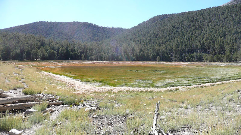
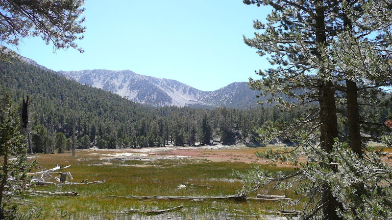
Well, let's get started on our expedition to find the trail, shall we? First, let's get to our jumping off point, Dry Lake, or, more accurately for 9/17/2010, Dry Lake Marsh.
Image

Now, when sniffing out old trails, it's almost always easier to do so in the down hill direction, so let's head up via the modern day route to Trail Flats first.
Image

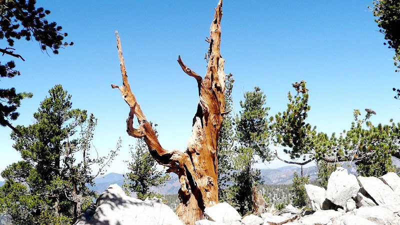
From there, let's head up to Mine Shaft Saddle, and heck, while we're in the neighborhood, let's bag Zahniser Peak (10,056'), one of seventeen peaks over 10,000' in the SGW.

The summit of Zahniser Peak (10,056'). This old gnarled snag graces the summit.
Image

Dry Lake from the summit of Zahniser Peak. You can definitely see a few spots of open water.
Image

Lest you think that I haven't climbed much from the lake to the summit, here's a photo without the zoom. :)
Image

Another look at the beautiful old tree on the summit of Zahniser.
Image

From Zahniser, let's drop down to the start of our forgotten byway, Lodgepole Saddle, which is sometimes also called Zahniser-Lake Saddle.
Image

Now, let's find the start the trail. There it is. Not too tough.
Image

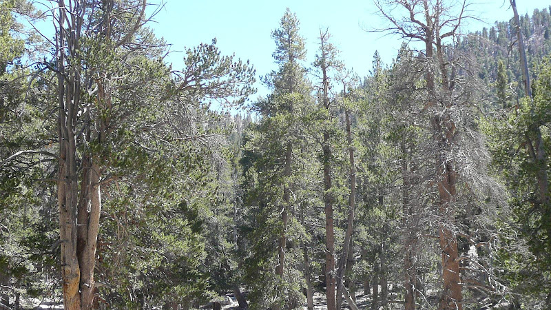
The trail is pretty easy to spot in many places even though it hasn't been maintained in years.
Image

Of course as in most old trails, it's not always so easy to spot the route. The thing to remember is that the old Lodgepole trail *always* stays above (west) of the drainage.

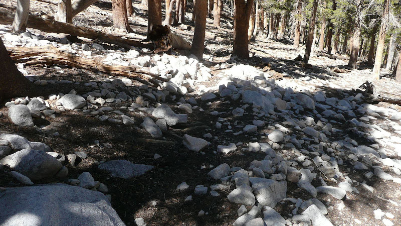
Sometimes you can find little clues, like the line of rocks here marking the downhill side of the trail.
Image

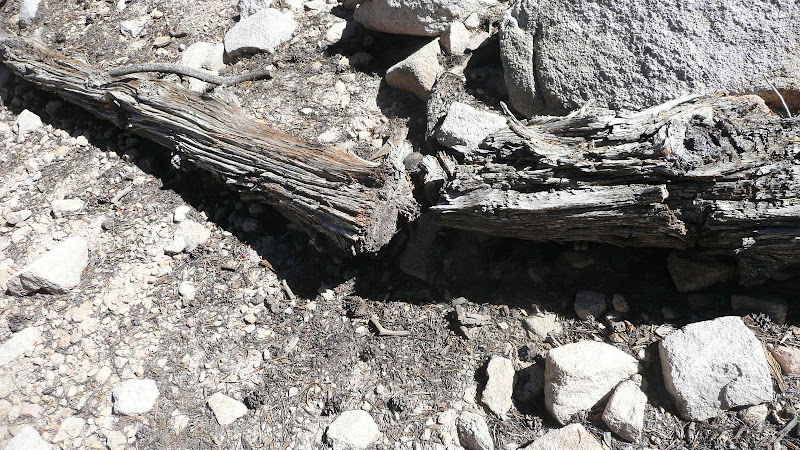
Or this old sawn log.
Image

Eventually though, you're going to get down into Lodgepole Flats. I've never been able to follow the trail through the flats. I basically follow the drainage at this point.
Image

All you need to do when going downhill is to follow the drainage until it meets the main drainage coming down from Fish Creek Saddle. When you meet the main drainage, proceed as though as though the drainage from Lodgepole Saddle continued, and you'll hit the Fish Creek Saddle Trail in maybe 50 yards. If you're going uphill, it's much trickier. You basically need to go up the drainage at about 170 degrees true.

In the photo below, I'm following the route (it's really not a trail at this point) through Lodgepole Flats.
Image

Here's a critical juncture. This is the confluence of the main drainage going up to Fish Creek Saddle and the somewhat lesser drainage going up to Lodgepole Saddle. One needs to follow the right hand drainage.
Image

Again, coming down is no problem. However, if coming up the trail to Fish Creek Saddle from Lodgepole Spring, keeping looking to the right. A hundred or so yards past the upper edge of greenery surrounding the spring you should see an opening through the trees where a gap can be seen as shown in the photo. The gap is of course Lodgepole Saddle. Proceed here at approximately 175 true to the confluence shown in the previous photo. The confluence is perhaps 75 yards away from the trail. From the confluence head up the right hand drainage at about 170 true.
Image

Looking down trail from the point where the trail from Lodgepole Saddle hits the trail to Fish Creek Saddle, one can see the upper edge of the greenery surrounding Lodgepole Spring.
Image

This shark like rock marks the point at which you must leave the Fish Creek Saddle trail in order to get on the route/trail to Lodgepole Saddle.
Image

The route/trail from Lodgepole Saddle hits the Fish Creek Saddle trail just above Lodgepole Spring. Speaking of the spring, there were dozens and dozens of these little frogs around Lodgepole Spring.
Image

Image

Lodgepole Spring was flowing well.
Image

Below Lodgepole Springs, of course I once again reach the shores of Dry Lake.Image

Well, I hope you've enjoyed one of my little excursions down one of the many forgotten byways of the San Gorgonio Wilderness. Map of route.

For more photos, and for directions for finding the old Dry Lake Trail (yet another forgotten byway of the SGW), see my photos of the Old Lodgepole Trail and Old Dry Lake Trail.

Thanks for joining me on my journey through one of the best places in Southern California, the San Gorgonio Wilderness,

HJ
User avatar
Elwood
Posts: 612
Joined: Fri Aug 15, 2008 5:23 pm

Post by Elwood »

Beautiful documentation of a "lost" trail. Great pictures to boot. Thanks for sharing this terrific experience. Are those frogs as tasty as the Mountain Yellow-Legged variety?
User avatar
Hikin_Jim
Posts: 4686
Joined: Thu Sep 27, 2007 9:04 pm

Post by Hikin_Jim »

Elwood wrote:Are those frogs as tasty as the Mountain Yellow-Legged variety?
Why, yes they are as a matter of fact, which is fortunate inasmuch as I've eaten so many of the yellow legged variety that they're getting harder to find. Not to worry though, I've asked several large Korean hiking clubs to comb the woods around Williamson Rock for those tasty little suckers. Dinner's just around the corner, my friend. :)

HJ
User avatar
Dave G
Posts: 321
Joined: Sun Jun 22, 2008 9:51 am

Post by Dave G »

Very cool--I love this type of historical stuff! :D
Do you know any of the history of the Lodgepole Trail, e.g. when it was contructed/in regular use and who built it? Was it a CCC project?
User avatar
Hikin_Jim
Posts: 4686
Joined: Thu Sep 27, 2007 9:04 pm

Post by Hikin_Jim »

Dave G wrote:Very cool--I love this type of historical stuff! :D
Do you know any of the history of the Lodgepole Trail, e.g. when it was contructed/in regular use and who built it? Was it a CCC project?
Hi, Dave,

I don't have any specific knowledge about the construction of the old Lodgepole Trail. I can say that someone put a lot of time into it. It's well constructed, well laid out, and was built to last. If I were a betting man, I'd say it's related to the old mine in Mine Shaft Flats. What's the most direct route from Barton Flats (the logical resupply point for the mine) to Mine Shaft Flats? Up and over Lodgepole Saddle. Whenever I see something old and well built in a remote place, I typically think mining. I'm speculating a bit, but I'd say that's probably a pretty safe bet.

HJ
User avatar
Taco
Snownado survivor
Posts: 6010
Joined: Thu Sep 27, 2007 4:35 pm

Post by Taco »

That's a nice, secluded trail. I like how it sees little traffic in comparison to nearby trails. It's my favorite way off the NE face of San G and thereabouts. You can sneak up on the normal Dry Lake camp real quicklike from there without their knowledge of your movement. ;-)
User avatar
Rumpled
Posts: 271
Joined: Mon Feb 25, 2008 10:57 pm

Post by Rumpled »

Where's the ACME map?
Otherwise, very nice report.
User avatar
Hikin_Jim
Posts: 4686
Joined: Thu Sep 27, 2007 9:04 pm

Post by Hikin_Jim »

Rumpled wrote:Where's the ACME map?
Otherwise, very nice report.
Sheesh. What kind of self respecting practitioner of Acme-Fu am I? :lol:

TR Updated.

HJ
User avatar
HikeUp
Posts: 3855
Joined: Thu Sep 27, 2007 9:21 pm

Post by HikeUp »

Nice hike. Way to make the most out of a day in the mountains.

Your TR's are the making of a book!
User avatar
Hikin_Jim
Posts: 4686
Joined: Thu Sep 27, 2007 9:04 pm

Post by Hikin_Jim »

I guess I have been called the "details guy". Hopefully my TR's can get people into some of the interesting places I've gone.

I enjoy hiking were there's some mental element to it. Navigation, route finding, planning, sleuthing out old routes, etc.

Fun stuff!

HJ
User avatar
simonov
Posts: 1087
Joined: Tue Nov 27, 2007 5:44 pm
Location: Reno, NV
Contact:

Post by simonov »

Great report, Jim. I wonder how the Forest Service would feel if certain public-spirited citizens were to start maintaining that trail?

BTW, the white stuff you can see beyond Big Bear is the Omya Lucerne Valley limestone quarry.
Nunc est bibendum
User avatar
Hikin_Jim
Posts: 4686
Joined: Thu Sep 27, 2007 9:04 pm

Post by Hikin_Jim »

Officially, trail maintenance is handled by volunteers coordinated by the SGWA. One is supposed to go through the training and become a member of the SGWA. Officially.

What I've seen in practice is that the volunteers don't seem to object if a person is out there who knows what he's doing. I also notice that while only certain trails are officially maintained, some of the "other" trails are getting at least some maintenance (Lower Falls Creek, Upper Johns Meadow, and Dry Lake to Fish Creek Saddle trails), so I don't think there would be any objection to keeping the old trails alive, particularly if one were discreet. I've seriously considered taking my special forces shovel (think lightweight) and turning a few spades of earth on the old Dollar Lake foot trail because it's all but gone.

HJ
User avatar
TracieB
Posts: 216
Joined: Mon Feb 22, 2010 8:57 am

Post by TracieB »

Very nice! One of these days I have to get over to Fish Creek.

Thank you for posting
User avatar
EManBevHills
Posts: 387
Joined: Fri Sep 28, 2007 12:40 am

Post by EManBevHills »

Nice read, Jim.
User avatar
Hikin_Jim
Posts: 4686
Joined: Thu Sep 27, 2007 9:04 pm

Post by Hikin_Jim »

Thanks, guys.

There's a lot of good stuff over that way.

HJ
User avatar
EManBevHills
Posts: 387
Joined: Fri Sep 28, 2007 12:40 am

Post by EManBevHills »

Fish Creek ought to be more popular than it is.
It's a wonderful route up the hill.
User avatar
Dave G
Posts: 321
Joined: Sun Jun 22, 2008 9:51 am

Post by Dave G »

EManBevHills wrote:Fish Creek ought to be more popular than it is.
It's a wonderful route up the hill.
I heartily agree. As one of our Whitney prep backpacks, I took my scouts up there in July. The only part they (especially the parents) didn't like was the climb back up from Lodgepole Springs to fetch water. If the word ever gets back to them that the "secret" spring near Fish Creek Saddle really was flowing (per a recent post on the SGW board), I'll be in trouble. :oops:
User avatar
Hikin_Jim
Posts: 4686
Joined: Thu Sep 27, 2007 9:04 pm

Post by Hikin_Jim »

Dave G wrote:
EManBevHills wrote:Fish Creek ought to be more popular than it is.
It's a wonderful route up the hill.
I heartily agree. As one of our Whitney prep backpacks, I took my scouts up there in July. The only part they (especially the parents) didn't like was the climb back up from Lodgepole Springs to fetch water. If the word ever gets back to them that the "secret" spring near Fish Creek Saddle really was flowing (per a recent post on the SGW board), I'll be in trouble. :oops:
Your secret's safe with me. I too was pretty surprised when I heard that spring was flowing this late in the year. I think I may have even told you not to bother. Sorry for giving you a bum steer. Really cool that it's flowing but still hard for me to wrap my mind around it.

HJ
User avatar
Dave G
Posts: 321
Joined: Sun Jun 22, 2008 9:51 am

Post by Dave G »

Hikin_Jim wrote:
Dave G wrote:
EManBevHills wrote:Fish Creek ought to be more popular than it is.
It's a wonderful route up the hill.
I heartily agree. As one of our Whitney prep backpacks, I took my scouts up there in July. The only part they (especially the parents) didn't like was the climb back up from Lodgepole Springs to fetch water. If the word ever gets back to them that the "secret" spring near Fish Creek Saddle really was flowing (per a recent post on the SGW board), I'll be in trouble. :oops:
Your secret's safe with me. I too was pretty surprised when I heard that spring was flowing this late in the year. I think I may have even told you not to bother. Sorry for giving you a bum steer. Really cool that it's flowing but still hard for me to wrap my mind around it.

HJ
No problema, HJ. When we did the Whitney hike a couple of weeks later, everyone summited. I attribute our success to the extra training from the Lodgepole water runs :wink:
User avatar
Hikin_Jim
Posts: 4686
Joined: Thu Sep 27, 2007 9:04 pm

Post by Hikin_Jim »

Glad I could, um, help out. :lol:

Seriously though, I am glad all you guys made it up Whitney. That's quite an accomplishment for the boys.

HJ
Post Reply