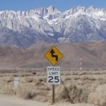
I went out anf finally hiked this 3 peak loop that I have been wanting to for some time on Sunday, Sept. 23rd. The weather was perfect, sunny yet cool with some light clouds. Everything smelled so fresh and the air so clear. I really enjoyed the hike, we started at mile marker 4.5 on Tujunga Canyon Road, hiked to Fox, Condor then Iron and back out via Trail Canyon Trail. Had to walk 2.5 miles along the road back to my car. Over 20 miles and 6000 ft gain. Here are my GPS tracks and Elevation Profile,
http://www.gpsmountaineering.com/fox,condorandironpeak
Travis
Fox Mnt. #2, Condor Peak and Iron Mnt. #2 Loop
-
He219

- Posts: 386
- Joined: Thu Sep 27, 2007 11:18 pm
6K/20 miles, sounds like a good hike!
Heyhey, first post for this n00b

Heyhey, first post for this n00b
-
Rob

- Posts: 158
- Joined: Thu Sep 27, 2007 9:26 pm
Travis, I like the way you added photos to your Google Earth KMZ file. 
