SG Wilderness(Twin Peaks) from WF SG river 2/18/08

TRs for the San Gabriel Mountains.
Post Reply
User avatar
AW~
Posts: 2043
Joined: Mon Oct 01, 2007 12:00 pm

Post by AW~ »

Nice pink/purple glow sunrise over Baldy and managed to grab last convenient parking space for the West Fork at 6:50am. 1 mile later turned upstream along Bear Creek, then 30 crossings later, to the west Fork. Nice river, was certainly running along, but none of the crossings like the East Fork during storm. My nickname for the west fork is Grim creek, but winter had shedded all the trees and it was a delightful canyon. It did seem like forever to get to its tributary coming from Triplet, something like 15 crossings. This tributary(shall we call it Triplet creek for lack of a name) was actually(likely) a class 3 canyoneering canyon and kept on throwing obstacles at me. I was finally foiled at a swimmer(swim through a pool and climb up a small waterfall), which it was like, if its starting to get technical now and Im in the easy part, whats the point of continuing?. As it happened, the one way up to get some views was at this spot.

Followed an animal trail up finally to a small summit. Took a look around some nice views and thought about getting to a nearby peak(3200). However, an infusion of paranoia about this remote place was amplified by the trails made by whatever roams this area...I was thinking mountain lion but could be bears. Started back and returned to the confluence of the 2 bear creeks. Forgot to charge my camera battery and it was out at this point in the trip.

Headed upstream to check out any approaches. Progress upstream much harder, little or no trail, heavy water at times, but some cool looking boulders. Got to the first tributary upstream of the 2 creeks, which is one tributary short of a Smith mtn approach to Triplet. Not bad to gain the canyon rim, but the question as I saw from my earlier view was then what? I guess follow the GPS closely, but the bottom line is a Triplet Peaks hike is best served from the top. The east ridge was quite steep and lastly Triplet looked unobtainable right near the end as there was a drop of unknown height. If I had to guess maybe 30 or 40ft minimum.

Thereby I returned the way I came at arrived at 2pm. Drove over to Glendora mtn ridge road but was closed at the Saddle. So headed back on Glendora Mtn road, which had some great views, including Twin Peaks. Hazy that day, but still snow on major mountains except for the imposing Ross.

Pictures: like 8 more also to be added to Flickr later today...
Sunrise over Baldy...
Image
Boulder in Bear Creek(the best rock I saw was one spilt in half, and one side was completely straight up vertical with water flowing over the other side on its side)....
Image
Trail view just after 13th crossing....
Image
Foiled by the swimmer...
Image
View of lower Triplet peak(center) from little hill summit perch(SG canyon ridge left, unnamed ridge right with Twin east ridge of out sight)
Image
West side of Smith Mtn
Image
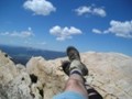
isolation shot Looking back at Bear Creek
Image
Trail at summit....
Image
User avatar
Hikin_Jim
Posts: 4686
Joined: Thu Sep 27, 2007 9:04 pm

Post by Hikin_Jim »

Good info.

How was the poison oak along Bear Creek? I was there maybe 5 years ago and it was bad. I haven't been there since the big rains of 2005 which may have scoured things a bit.
User avatar
AW~
Posts: 2043
Joined: Mon Oct 01, 2007 12:00 pm

Post by AW~ »

Poison oak was neglible along the creek....its starting to crank up now though... :roll: Granted, who knows what I traveled on in the hillsides.

Got bit on the back of the neck by an ant though....still emits pain a day later :cry:
User avatar
AW~
Posts: 2043
Joined: Mon Oct 01, 2007 12:00 pm

Post by AW~ »

Also, added the pictures in case anyone is interested...

http://www.flickr.com/photos/13833920@N03/

Flickr has stopped me at 200 photos, I guess they dont like anyone leeching off the system or something.
User avatar
Taco
Snownado survivor
Posts: 6011
Joined: Thu Sep 27, 2007 4:35 pm

Post by Taco »

Awesome pics, as always.

Almost ready to try Triplet from the bottom! Been around where the East Ridge hits the creek between PK 5495 and Smith Mtn?
User avatar
AW~
Posts: 2043
Joined: Mon Oct 01, 2007 12:00 pm

Post by AW~ »

>Been around where the East Ridge hits the creek between PK 5495 and Smith Mtn?

Nope.....

Just for the sake of posting, heres another picture towards Triplet Rocks...its almost like all those boulders are Triplet Rocks, but Triplet is above them(picture is of a false summit). Try Glendora mtn road lookout for seeing what you are looking for.

Image
User avatar
Taco
Snownado survivor
Posts: 6011
Joined: Thu Sep 27, 2007 4:35 pm

Post by Taco »

Looks like it'll end up being interesting...
User avatar
Chicken Legs
Posts: 33
Joined: Fri Oct 19, 2007 12:04 am

Post by Chicken Legs »

Is this the same trail that0 goes up Bear Creek and ends up at HWY 39 up near ColdBrook?

If so has anyone been all the way thru? And what were the conditions like?
User avatar
Taco
Snownado survivor
Posts: 6011
Joined: Thu Sep 27, 2007 4:35 pm

Post by Taco »

Bear Creek Trail from R39 to the creek in the north is washed-out in one section. I don't believe they've repaired that. Should not be an issue.

There was a lot of water and quite a few crossings in Lower Bear Creek, last time I went through.
Post Reply