
Falling Rock Canyon (Sugarloaf Peak)
-
Sam Page

- Posts: 267
- Joined: Fri Sep 04, 2009 10:59 am
How would descending the entirety of Falling Rock Canyon from Ontario Peak be right now? Anything above class 3? Any steep ice?

-
Tim

- Posts: 560
- Joined: Tue Apr 08, 2008 8:55 pm
Can't comment on snow conditions, but I have gone down FRC from OP during the summer. No Class 3 in the upper and middle part of the canyon. There are two waterfalls just like Brennen describes, but they were easily bypassed by going to the side. With snow, it might not even be an issue since it could be mainly filled in. Then again it might also be hard to spot the dropoff--dunno. Anyhow, good luck and be safe! FRC had a fatality 2 years ago almost to the day.
-
Tim
- Posts: 560
- Joined: Tue Apr 08, 2008 8:55 pm
-
Sam Page
- Posts: 267
- Joined: Fri Sep 04, 2009 10:59 am
Where exactly in Falling Rock Canyon was that unfortunate guy climbing?
-
Tim
- Posts: 560
- Joined: Tue Apr 08, 2008 8:55 pm
Not sure exactly, but I spoke to a SAR person who was on the body recovery team and she said it wasn't that far up the canyon.
-
LD
- Posts: 93
- Joined: Sat Jan 31, 2009 10:03 pm
Sam,
Did the FRC to Sugarloaf, Ontario, Bighorn loop this morning. Can’t tell you about conditions in FRC past the saddle though. Once you get past the first waterfall there’s a snow tongue all the way up to the Sugarloaf saddle and beyond. Class 2 at most. Didn’t need crampons after the first hour. Snow was perfect for edging. A cruise compared to when there’s no snow.As the day went on snow soften up quite a bit. I imagine tomorrow it will be even softer as it’s supposed to get hotter. Pretty windy today which was nice as it kept temps down.
Lyn
-
Sam Page
- Posts: 267
- Joined: Fri Sep 04, 2009 10:59 am
Thanks for your response, Lyn. You must have followed our tracks from Friday all the way up to the summit of Ontario Peak. Did you see our tracks heading down the west ridge of Ontario Peak?
-
LD
- Posts: 93
- Joined: Sat Jan 31, 2009 10:03 pm
Yeah, I saw that. I've been eying that SW ridge. Thinking of starting from stoddard flats though and coming down FRC. I thought someone beat me to it. How far did you go? I looked with my binos and it didn't look like the tracks continued on too far down the ridgeline.Sam Page wrote:Thanks for your response, Lyn. You must have followed our tracks from Friday all the way up to the summit of Ontario Peak. Did you see our tracks heading down the west ridge of Ontario Peak?
Hey Tim, if I knew that was you I would have stayed longer and conversed
-
Tim
- Posts: 560
- Joined: Tue Apr 08, 2008 8:55 pm
Yeah, it would have been cool to hear about your extreme hikesLD wrote:Hey Tim, if I knew that was you I would have stayed longer and conversedHow'd the snow pit turn out?
It wasn't much of a real pit. I didn't have the proper tools to do any tests and I was just keeping busy until my friends returned. I dug the pit to just look at the layers. Everything seemed pretty well bonded but I'm new at this so don't take my word for it!
-
Sam Page
- Posts: 267
- Joined: Fri Sep 04, 2009 10:59 am
We climbed the drainage in between Cherry Canyon and Kerkhoff Canyon. Here is my trip report.LD wrote:I've been eying that SW ridge. Thinking of starting from stoddard flats though and coming down FRC. I thought someone beat me to it. How far did you go? I looked with my binos and it didn't look like the tracks continued on too far down the ridgeline.
-
vbmatloff
- Posts: 19
- Joined: Wed Jun 30, 2010 6:49 pm
I'm planning on hiking down Falling Rock Canyon tomorrow from the Ontario Peak Trail. Does anyone have anything specific that I should be aware of, or watch out for? Maybe like stay to the south over a certain portion, or whatever? 
Thanks for any advice.
Thanks for any advice.
-
Dave G

- Posts: 321
- Joined: Sun Jun 22, 2008 9:51 am
I was out that way last weekend, but followed the ridge down to the Ontario-Sugarloaf saddle and took the fun scree run down to FRC. The waterfall above that point is flowing, but everything below is dry.
The only things to watch out for are the Stinging Nettles and, of course, falling rocks
  . FRC is always a fun route--all year 'round!
The only things to watch out for are the Stinging Nettles
-
vbmatloff
- Posts: 19
- Joined: Wed Jun 30, 2010 6:49 pm
Thanks Dave, that is the route we decided on, too - the HPS way. Should be pretty hot tomorrow  , so some water would have been ok
I appreciate the tips, I'll watch out for the Nettles and of course the rock - hopefully I can run faster tan the rock can fall
I appreciate the tips, I'll watch out for the Nettles and of course the rock - hopefully I can run faster tan the rock can fall
-
Funyan005
- Posts: 203
- Joined: Tue Apr 01, 2008 11:17 pm
Was thinking of going up to sugarloaf then taking the ridge to Ontario. Anyone know conditions of it?
-
Sam Page
- Posts: 267
- Joined: Fri Sep 04, 2009 10:59 am
I just descended Falling Rock Canyon in its entirety today. Very roughly -- the bottom half is dry and the top half is covered in consolidated snow. I only saw the top of Sugarloaf Ridge, and it was covered.
The route to the top of Sugarloaf via FRC looked completely dry.
The route to the top of Sugarloaf via FRC looked completely dry.
-
LD
- Posts: 93
- Joined: Sat Jan 31, 2009 10:03 pm
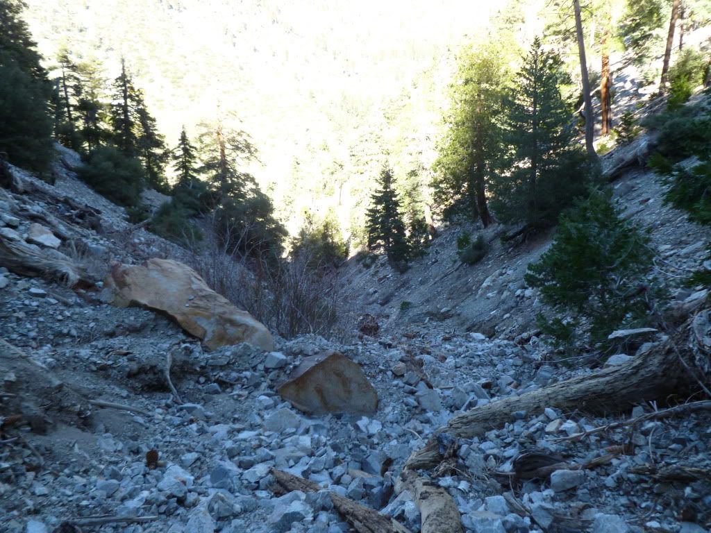
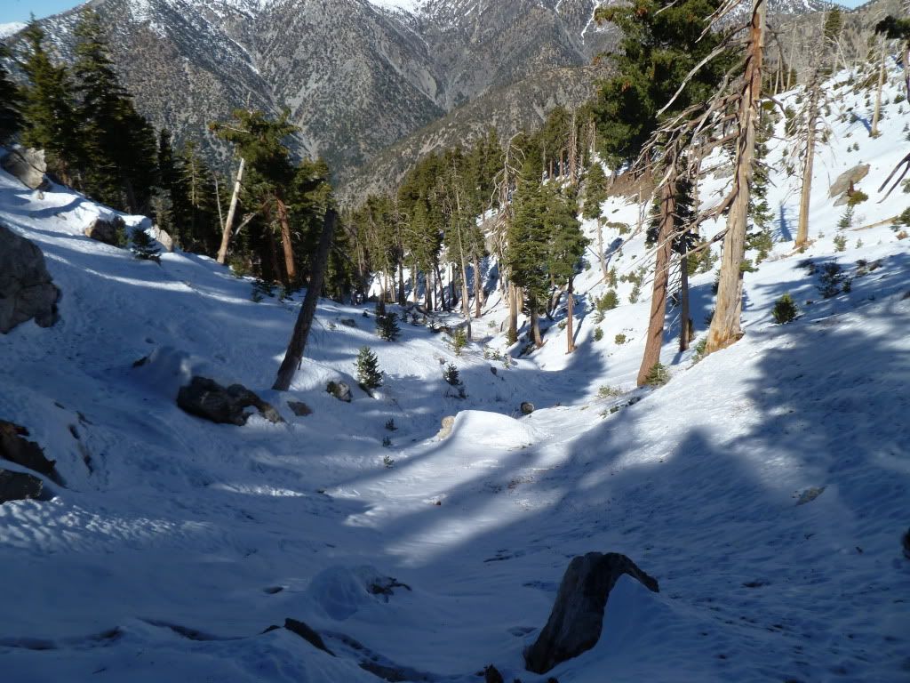
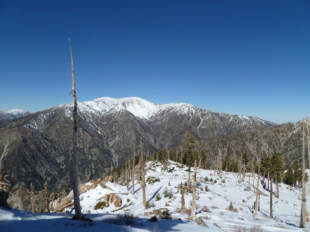
What Sam said. Here are some shots from yesterday
Sugarloaf
.JPG)
Ontario Ridgeline
.JPG)
LD
Sugarloaf

Ontario Ridgeline

LD
-
lilbitmo

- Posts: 1092
- Joined: Tue Mar 04, 2008 9:44 pm
Funyan005 - snow was consolidated in upper canyon all the way to summit as Sam indicated, lower canyon was snow free, see pictures with area indicators below
Lower part of FRC approx 5,500 feet lookinig down canyon
Yesterday around 12 noon looking from the east due west at the summit of Sugarloaf
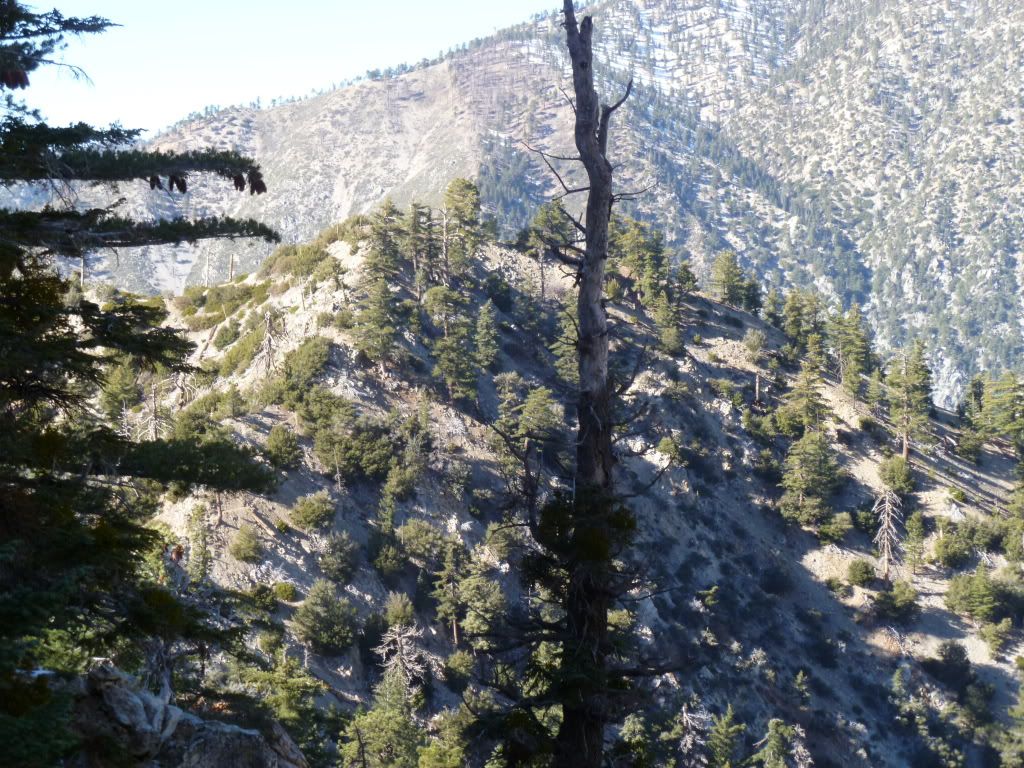
Halfway down canyon approx 6,200 feet where snow ends and dirt/rock begin
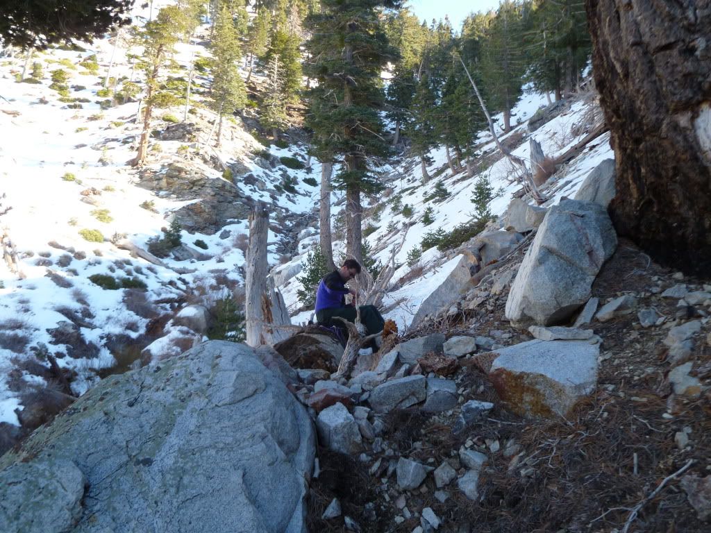
Upper part of FRC where it comes out into the dead/burnt forrest section
Nob that sits west of entrance to FRC - FRC is in the bottom right of picture
Lower part of FRC approx 5,500 feet lookinig down canyon
Yesterday around 12 noon looking from the east due west at the summit of Sugarloaf
Halfway down canyon approx 6,200 feet where snow ends and dirt/rock begin
Upper part of FRC where it comes out into the dead/burnt forrest section
Nob that sits west of entrance to FRC - FRC is in the bottom right of picture