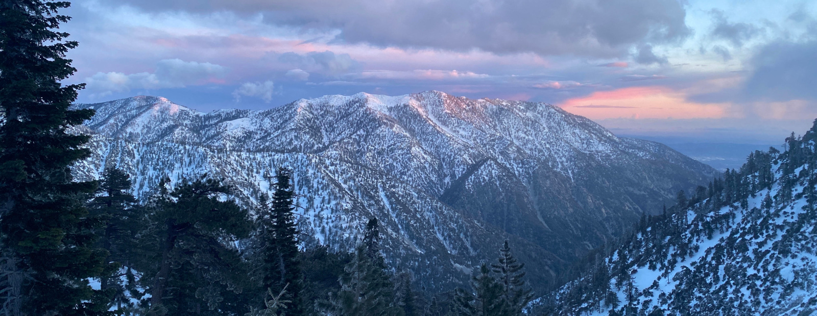
Hey, you! Wanna go?
-
Taco
- Snownado survivor
- Posts: 6193
- Joined: Thu Sep 27, 2007 4:35 pm
This was a poll. These haven't been imported. Sorry.
-
bluerail

- Posts: 60
- Joined: Mon May 25, 2009 4:16 am
i went with the group of lemmings on the kweschuns...
you REALLY going up Baldy ?
you REALLY going up Baldy ?
-
Taco

- Snownado survivor
- Posts: 6193
- Joined: Thu Sep 27, 2007 4:35 pm
Yeah, one of the Mikes and I. Interested in the extreme and unending excitement that is Baldy Bowl?
-
bluerail

- Posts: 60
- Joined: Mon May 25, 2009 4:16 am
whats going to make the decision, is knowing which Mike it is 
-
bluerail

- Posts: 60
- Joined: Mon May 25, 2009 4:16 am
I imagine i'll be there, unless something comes up. i'll get in touch with you tomorrow
-
GigaMike
- Posts: 164
- Joined: Sun Feb 24, 2008 4:37 pm
I'm down.
Yo Taco, you need a ride up to Wanker?
Yo Taco, you need a ride up to Wanker?
-
bluerail

- Posts: 60
- Joined: Mon May 25, 2009 4:16 am
so what are the two of you gonna do when you go wanker ?
-
Taco

- Snownado survivor
- Posts: 6193
- Joined: Thu Sep 27, 2007 4:35 pm
THERE WE GO!
Still don't know what that means.
Still don't know what that means.
-
simonov

- Posts: 1108
- Joined: Tue Nov 27, 2007 5:44 pm
- Location: Reno, NV
Ingrid and I will probably meet you at Wanker, but I don't think we'll go above the ski hut.
Nunc est bibendum
-
EManBevHills
- Posts: 387
- Joined: Fri Sep 28, 2007 12:40 am
Looks like tomorrow will be the better travel and play day especially with an alpine start:
...WINTER STORM TO AFFECT THE AREA LATE TONIGHT THROUGH SATURDAY
NIGHT...
A STORM SYSTEM CURRENTLY DEVELOPING OFF THE NORTHERN CALIFORNIA
COAST TODAY IS EXPECTED TO BRING ANOTHER ROUND OF PRECIPITATION
TO THE AREA BEGINNING LATE TONIGHT AND CONTINUING THROUGH SATURDAY
NIGHT AS IT DROPS SOUTHWARD. AT THIS TIME...THE COMPUTER MODELS ARE
KEEPING THE TRACK OF THIS STORM ABOUT 400 MILES WEST OF THE COAST.
IF THE STORM REMAINS THIS FAR OFFSHORE...THE AMOUNT OF PRECIPITATION
EXPECTED ACROSS THE AREA WILL BE LIMITED.
AT THIS TIME...RAIN IS EXPECTED TO BECOME LIKELY OVER SAN LUIS
OBISPO AND SANTA BARBARA COUNTIES SATURDAY MORNING...WITH THE RAIN
AFFECTING VENTURA AND LOS ANGELES COUNTIES SATURDAY AFTERNOON AND
NIGHT. THE RAIN WILL TURN TO SHOWERS SUNDAY MORNING WITH THE
SHOWER ACTIVITY DECREASING THROUGH SUNDAY AFTERNOON. RAINFALL
TOTALS WITH THIS STORM ARE EXPECTED TO RANGE BETWEEN ONE QUARTER
AND THREE QUARTERS OF AN INCH. LOCAL AMOUNTS TO AROUND ONE INCH
WILL BE POSSIBLE OVER THE FOOTHILLS AND MOUNTAINS...ESPECIALLY
ACROSS THE SAN GABRIEL MOUNTAINS. RAINFALL RATES WITH THIS STORM
ARE EXPECTED TO REMAIN BELOW ESTABLISHED USGS THRESHOLDS. SO...NO
SIGNIFICANT PROBLEMS ARE ANTICIPATED FOR THE RECENT BURN AREAS.
SNOW LEVELS WITH THIS SYSTEM ARE EXPECTED TO DROP TO AROUND 4000
TO 4500 FEET BY SATURDAY AFTERNOON AND NIGHT...AND EVEN LOCALLY
DOWN TO 3500 FEET. SNOWFALL ACCUMULATIONS THROUGH SATURDAY NIGHT
ARE EXPECTED TO RANGE BETWEEN 2 AND 6 INCHES. WITH SUCH LOW SNOW
LEVELS...TRAVEL THROUGH THE MOUNTAIN PASSES...SUCH AS THE
INTERSTATE 5 CORRIDOR...COULD BE ADVERSELY AFFECTED BY SNOW AND
ICE.
THE EXACT TRACK OF THIS STORM WILL DETERMINE THE OVERALL IMPACT
UPON THE AREA. IF THE STORM MOVES CLOSER TO LAND...MORE SIGNIFICANT
PRECIPITATION MAY DEVELOP. HOWEVER IF THE STORM TRACKS FURTHER
WEST THAN THE CURRENT FORECAST...PRECIPITATION AMOUNTS WILL BE
LESS. PLEASE STAY TUNED TO THE LATEST FORECASTS FROM THE NATIONAL
WEATHER SERVICE FOR THE MOST CURRENT INFORMATION ABOUT THIS
UPCOMING STORM.
-
simonov

- Posts: 1108
- Joined: Tue Nov 27, 2007 5:44 pm
- Location: Reno, NV
Here's the plan. I'm staying the night at the Buckhorn, and Ingrid's supposed to come up and meet me by about 5:15-5:30 or so. But we have no idea whether she will make it because she doesn't have chains.
I have chains (cables, actually), but I don't want to drive up to Manker. So if anyone wants to stop at the Buckhorn (the motel side) around 5:30 to get us (including my dog), feel free. If Ingrid isn't there by then, head up without me.
I have chains (cables, actually), but I don't want to drive up to Manker. So if anyone wants to stop at the Buckhorn (the motel side) around 5:30 to get us (including my dog), feel free. If Ingrid isn't there by then, head up without me.
Nunc est bibendum
-
mve
- Posts: 414
- Joined: Fri Dec 11, 2009 12:53 pm
Tempting ... but gotta give my knee a longer break ...
-
Taco

- Snownado survivor
- Posts: 6193
- Joined: Thu Sep 27, 2007 4:35 pm
THERE WILL BE NO QUITTER'S TALK IN THIS HERE THREAD!!!!!!!simonov wrote:Ingrid and I will probably meet you at Wanker, but I don't think we'll go above the ski hut.
She should be fine. We go up Baldy Rd after minro storms. As long as you're used to driving on a little snow and ice, you'll (she'll) be fine. Also, getting up there before the throngs of snowthieves is KEY.
Oh shit, I need one of those assboards to FLY down the Bowl in.
-
EManBevHills

- Posts: 387
- Joined: Fri Sep 28, 2007 12:40 am
Looks like your visualization of better weather is working, Ryan! 
-
GigaMike

- Posts: 164
- Joined: Sun Feb 24, 2008 4:37 pm
You need one of these...TacoDelRio wrote:Oh shit, I need one of those assboards to FLY down the Bowl in.
http://www.metacafe.com/embed/584621/
-
Taco

- Snownado survivor
- Posts: 6193
- Joined: Thu Sep 27, 2007 4:35 pm
Poor Chevy Chase. That makes him look almost as bad as Rob Schnieder. Just kidding, that would be physically impossible.
-
Taco

- Snownado survivor
- Posts: 6193
- Joined: Thu Sep 27, 2007 4:35 pm
That I do. No idea what the Americanized name is, but it's an Ushanka.
-
simonov

- Posts: 1108
- Joined: Tue Nov 27, 2007 5:44 pm
- Location: Reno, NV
I was standing outside the Buckhorn this morning from 5:00-6:00am.TacoDelRio wrote:THERE WILL BE NO QUITTER'S TALK IN THIS HERE THREAD!!!!!!!simonov wrote:Ingrid and I will probably meet you at Wanker, but I don't think we'll go above the ski hut.
No sign of the Tacowagon.
Quitters indeed.
Nunc est bibendum
-
Taco

- Snownado survivor
- Posts: 6193
- Joined: Thu Sep 27, 2007 4:35 pm
I drove past about six times. You have shitty Accord parked outside with strange fake vents on hood?
Didn't make it past the last switchback before the road turns north to Wanker.
YOU LIKE MOUTHSEX? GET IN SPORTSCAR.
Didn't make it past the last switchback before the road turns north to Wanker.
YOU LIKE MOUTHSEX? GET IN SPORTSCAR.
-
GigaMike

- Posts: 164
- Joined: Sun Feb 24, 2008 4:37 pm
I lost traction on the second to last switchback and had to back down. I was able to get up the second time. Sometimes FWD is cool.
-
Taco

- Snownado survivor
- Posts: 6193
- Joined: Thu Sep 27, 2007 4:35 pm
I was wondering if the ITR would make it.
I spun out on the bridge. The uphill approach to the bridge (just south of Icehouse) is always tricky. Did a few E-brake turns in the IHC parking lot while watching for anyone's car I recognized.
I spun out on the bridge. The uphill approach to the bridge (just south of Icehouse) is always tricky. Did a few E-brake turns in the IHC parking lot while watching for anyone's car I recognized.
-
GigaMike

- Posts: 164
- Joined: Sun Feb 24, 2008 4:37 pm
Yeah, that bridge is always slippery. I drove up a little earlier (got to Manker at 5:40 and only one other car was before me) and there was still fresh gravel on the road. I bet after more cars drove up the gravel disappeared and the road got worse.
