http://www.youtube.com/watch?v=txH38JrrqUo
ACA Rating: 3AR I
Our Hiking Time: 3½ hours
Our Hiking Distance: 1.4 miles
Elevation Gain: 630 feet
Elevation Loss: 630 feet
Our Rope: 1 223ft 8mm, 1 100ft 9mm, 1 160ft 5mm pull cord
Other Gear: 30 ft 1" tubular webbing, 3 quicklinks
Rappels: 3, 180-190 ft largest
Hazards: Very steep loose scree, on approach, auto burglaries, gang activity
Permits: "Adventure Pass" or America the Beautiful Pass
USGS TOPO map(s): Valyermo, CA
General Description:
This short canyon is one of few known to contain falls on the High Desert side of the San Gabriel Mountains. The falls are not shown or named on any map. No known local names either.
My introduction to these falls was the winter of 2004 / 2005 and they along with every other drainage in the San Gabriel Mountains where roaring.
Trailhead:
End of forest road 4N11A at locked gate to South Fork Group Campground (34.39518N, 117.82091W, 4563ft)
The Trip:
Proceed through locked gate, and keep right at the outhouse and join the South Fork Trail. A short way down the trail a use trail going up the creek splits off (left) the South Fork Trail, this is the "Low Road", the "High Road" is South Fork Trail to a use trail down to the creek @ N34.39102°, W117.82206°, 4662 ft. Either route will take you to the same place. We took the "Low Road" to the gully just north of the falls @ 34.3909, 117.82174, 4609ft.
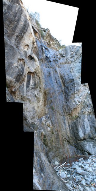
The gully is very steep with varying degrees of scree, I found the water course to be the best because the very loose small stuff wasn't sliding away under foot. OTOH the rocks, big and small are unstable at best, pick your poison, stay out of the fall line, test every step and hand hold!
About 340 vertical feet up bear right at large Oak tree. Here we decided to traverse in a steep manner across the scree up to what appeared to be a good point on the ridge that hid our destination from view.
N34.38965° W117.82039°, 5115ft is the point where we arrived at on the target ridge a frightening 500+ feet above the creek on chossy rock. The top of the falls in sight we made our way down to there, past lots of signs of Bighorn Sheep, Bobcat, and Black Bear.
After peeking over the edge (on safety) it was decided to drop the 30 ft or so (R1) anchored low around a very large deadwood stump, to a wide ledge and set up another anchor.
Surveying the options we anchored low around a stout bush (R2) and tossed half the rope. Two toots of the whistle got Johanna lowered another 70ft until we got another two toots ! WOW 180-190ft! COOL!
The third and final drop is just below here and is about 100ft, we anchored on a Cedar tree a few feet up, there is some fancy foot work on rope required here, but that's the fun part!
The canyon here is a breeze compared to the trip up the scree filled gully and South Fork is in sight...We crossed over the creek and took the use trail up to South Fork Trail back to the locked gate for a short but sweet exploration.
Looking down to SF Big Rock Creek
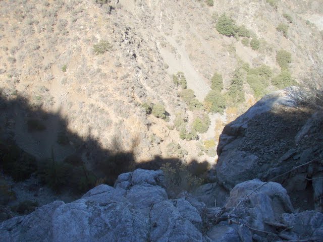
South Fork Big rock Creek
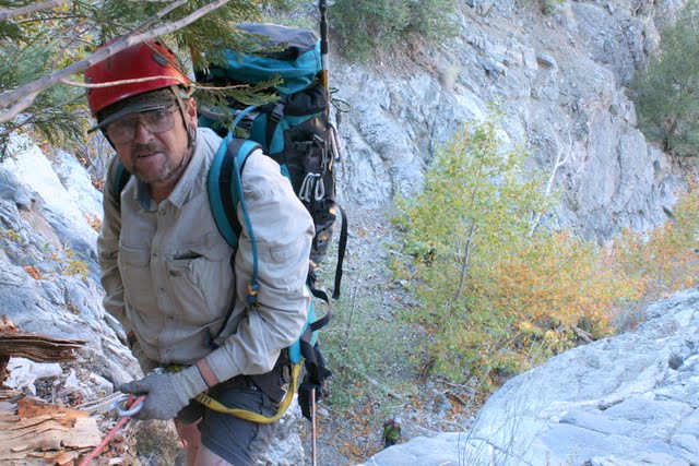
Cougarmagic on rope
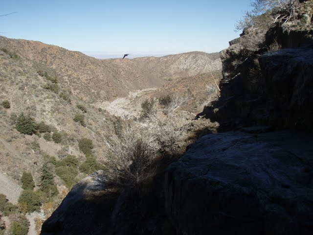
This is the big drop, without any thing in the photo to compare it looks like nothing...
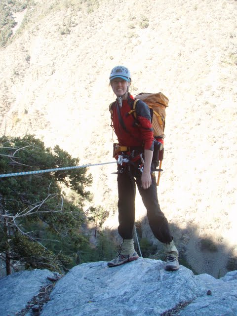
Cougarmagic took this photo of me on rope on the final drop