Dawson Peak Trail from Fish Fork

TRs for the San Gabriel Mountains.
Post Reply
User avatar
jeffd
Posts: 16
Joined: Thu Aug 13, 2009 2:40 pm

Post by jeffd »

On Saturday I found myself climbing out of Manker Flats at 6:10am, not to return again for 14 hours and ~33 miles later. My original plan was to hike to Wrightwood for lunch and back, but I've never been too fond of out-and-back hikes and had another idea after studying Mr. Tom Harrison's map at 4:45am that morning -- the Dawson Peak Trail. I decided to pack enough food and water for a long day, and make a loop consisting of Baldy, Dawson, Pine, Wright, Lupine campground, up the Fish Fork trail to Pine Mountain Ridge, then down to the Dawson Peak Trail and finally up North Backbone back over Baldy.

Everything went mostly as planned. Brought enough food but eventually ran out of water and drank from a few different streams, luckily to no ill effect yet. Was moving pretty quick up until the base of Dawson Peak Trail, but somehow lost the trail completely and bushwhacked through some scrub, seeing lots of bear scat and berries and hoping I wouldn't run into the scat's generator(s). After about an hour and a half of wandering I finally hit the old logging road turned trail, but the 4.5 miles on the map took me over 3 hours and really sapped my energy. Needless to say, the climb back up Baldy on North Backbone was slightly demoralizing, nose to the trail. Topped out on Baldy about 6:30pm and was happy to bomb back down the Bowl Trail to my truck and a cold bottle of chocolate milk (great recovery drink). Called my friends to let them know I was safe and proceeded to sleep like a rock for 9 hours.

Probably around 33 miles with approximately 11,000' elevation looking at a topo. I do know that my knee was sore by the end, and that usually doesn't happen unless I work pretty hard. Mule deer proved to be the only larger wildlife I saw -- was hoping for some bighorn but wasn't graced by their presence this weekend. The stretch from Lupine campground up the Dawson Peak Trail was the real highlight of this trip. Truly a forgotten trail that emanates a lot of history.

Starting off from Manker Flats:

Image

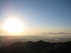
I was told this "smoke soup" was due to the Santa Barbara fires:

Image

Looking east over the high desert:

Image

Descending North Backbone, not thinking of the return climb:

Image

Peaceful trail leading to Pine Mountain:

Image

San Antonio Ridge, Iron Mtn at the western terminus:

Image

Not so peaceful "trail":

Image

Heading down to Lupine campground:

Image

Easy way down? Maybe in my younger days...

Image

Filling up:

Image

Overgrown trail up to the Pine Mountain Ridge:

Image

Atop Pine Mountain Ridge:

Image

Not sure what this once said:

Image

Things started to get interesting here:

Image

Didn't take any pictures along the Dawson Peak Trail as I was preoccupied with navigation, unfortunately.

Back up near Dawson Peak:

Image

Obligatory summit shot:

Image

All in all, a great day in the mountains!
User avatar
lilbitmo
Posts: 1092
Joined: Tue Mar 04, 2008 9:44 pm

Post by lilbitmo »

Nice work Jeff, that's quite a day.

Lucky for you there was some water to be had out there.

Great pictures, glad you had the energy to make it back over Baldy, that's a butt kicker after everything else you did.

:D
User avatar
Tim
Posts: 560
Joined: Tue Apr 08, 2008 8:55 pm

Post by Tim »

Well done Jeff! Nice pictures and welcome to the board!
User avatar
Ze Hiker
Posts: 1430
Joined: Mon Jul 28, 2008 7:14 pm

Post by Ze Hiker »

lotsa gain, great job!

I have yet to go to that area...is it worth dropping down into praire fork & lupine or just head down pine mt ridge into fish fork then up dawson peak trail? I figured the latter would be the nicest part.
User avatar
jeffd
Posts: 16
Joined: Thu Aug 13, 2009 2:40 pm

Post by jeffd »

wrote:...is it worth dropping down into praire fork & lupine or just head down pine mt ridge into fish fork then up dawson peak trail? I figured the latter would be the nicest part.
There wasn't much special about Lupine & Prairie fork except for the evergreen canopy. I'd still like to take Prairie fork up to Vincent Gap, just for the sake of connecting everything. Would also really like to explore the Fish Fork more when I'm not so concerned about daylight. Maybe approach Iron from the NE via Fish Fork?

Lupine is in there somewhere...

Image
User avatar
Taco
Snownado survivor
Posts: 6010
Joined: Thu Sep 27, 2007 4:35 pm

Post by Taco »

Heck of a day!

What's that snow slab looking thing on Pine Mountain's Slide Zone?
User avatar
jeffd
Posts: 16
Joined: Thu Aug 13, 2009 2:40 pm

Post by jeffd »

TacoDelRio wrote:What's that snow slab looking thing on Pine Mountain's Slide Zone?
It's a big ol' rock slab. Seemed to reflect the light pretty well...

Image
User avatar
LD
Posts: 93
Joined: Sat Jan 31, 2009 10:03 pm

Post by LD »

TacoDelRio wrote:Heck of a day!

What's that snow slab looking thing on Pine Mountain's Slide Zone?
Back away from your tools. It's not that time of the year yet :lol:

Nice little epic with not so little miles Jeff :shock:

Having never been down that area how is that Pine Mountain ridgeline?
Is it pretty clean or overgrown looking toward Baden Powell?
User avatar
Taco
Snownado survivor
Posts: 6010
Joined: Thu Sep 27, 2007 4:35 pm

Post by Taco »

:lol:

I guess it's a bigass hunk of shale? Er, Slate... I'm no rockologist.
Post Reply