
Lately my goals seem to be a bit beyond my reach. This past weekend was no exception and things didn't quite work out in my favor.
I started out at 3:15am Sunday morning (6/14/09) from Heaton Flat. My impossible goal was to tag the Big 3 of the San Gabriels (Baden-Powell, Baldy, & Iron) in a single dayhike and without a car shuttle. This was something I had briefly considered a few years ago but dismissed as being unworkable. Recent discussion on this message board however stoked my interest. Various routes were put forward about how one might connect these three. I had my own idea (impossible as it was).
So from Heaton Flat I crossed the river and ascended the brushy slope to the Road to Nowhere (Shoemaker Road). This would have been formidable in the dark but I had already scouted out this option a few months ago. The only problem was that fog and drizzle had left the brush dripping wet and in no time I was starting to get soaked. Shortly up the road I veered off and up the path to Rattlesnake Peak. Here the brush was even more wet and by the time I reached the summit my shoes and socks were close to saturation. Unfortunately worse was yet to come.
From Rattlesnake I descended down the ridge to the NW to connect up with South Hawkins. As expected this was the crux of the day. While most of the route really wasn't too bad there was one spot where the brush and vegetation was formidable and most unpleasant. Going through this I was completely drenched and covered with leaves and dirt. It was so bad I was soon ready to give up. I yelled out to any nearby mountain lions to come get me and put me out of my misery. None took up the offer so I continued on forcing my way over, under, and between branches, logs, and deep vegetation. Fortunately it eventually opened up and the rest of the way up to South Hawkins wasn't bad. It had taken a lot more time and effort than expected though. I reached South Hawkins at 10:35a and took a break to wring out my totally soaked socks.
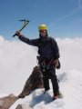
After the break I continued on tagging the summits of Middle Hawkins, Hawkins, Throop, Burnham, and finally Baden-Powell at 2:42p. I was a bit behind schedule and tried to get down to Vincent Gap as quickly as possible. It was 3:45p when I got there. I now had to make a decision. The plan was to continue on hiking down the road and then the PCT on Blue Ridge, tag Wright, Pine, and Dawson, summit Baldy, traverse over to Iron, and descend back to Heaton Flat (um yeah ... what was I thinking). As I added up how much time I thought the rest would take and looked at how much time I had left I knew there was little hope in completing within 24 hours. Certainly I would have to do the entire Iron-Baldy traverse in the dark. Even if I had a little more time what I had done so far was quite a bit more draining than I anticipated. I had already done at least 10,000 feet of gain and more than a few miles.
So now what? Hey ... isn't there a trail from Vincent Gap back to Heaton Flat? Seems I heard of someone going this way (the East Fork) before but I didn't really know anything about it. Hmmm. My crude map I printed out seems to show a dotted line here. Oh and my GPS has a red dotted line too. Sweet! This will take me right back to Heaton Flat! It still looked like quite a few miles but it appeared to be my only option. Perhaps I can even get back before dark (I had 4 1/2 hours of daylight left)!
Anyone who has descended from Vincent Gap to Heaton will at once recognize how colossally bad this decision was. You may also be able to guess how it ended.
Initally the trail down to Mine Gulch was very nice and very pleasant. With such a good trail I was convinced I had made the right decision. Approaching Mine Gulch however the trail eventually disappeared. From then on it was simply hiking in the river bed over endless rocks and logs with frequent river crossings. Each bend brought greater difficulties with increasing vegetation blocking my way. Sometimes the GPS indicated a trail or road was some distance back from the river bed but this couldn't be. There was only rugged terrain and cliffs on both sides.
After several hours I was deep into the East Fork of the San Gabriel. As a canyoneer I admired the qualities of this canyon. This place was wild and untamed. Eventually it was no longer possible to hop across rocks on the river crossings and I had to soak my shoes and socks over and over again.
Despite my best efforts I finally lost my battle with the fading sun. Checking my GPS I could see that I hadn't yet reached the spot labeled "the Narrows" and that there was still a long way to go. My hope was that I could reach the Bridge to Nowhere by dark. I figured if I could do that there should be a reasonably easy to follow route from there down to Heaton Flat. It was getting cold and I wasn't prepared for an overnighter. None-the-less there seemed little option. To continue would require me to tackle the Narrows and who knows what else in the dark. Would I have to swim? In the vicinity of "Iron Camp" I stumbled upon a cache of goodies. Inside a couple of plastic bags there was some camping gear including a tarp and other items. There was no pad or sleeping bag but there was a dry pair of shoes that was just my size. Nice! Time to make camp for the night. Fortunately I had also brought a Bic lighter and was able to make a fire for some warmth. I didn't sleep well and it did get a bit cold but I've certainly had far less pleasant nights.
The next morning I returned all items to the cache and continued my journey down the East Fork. After about 30 minutes I reached the Narrows where the canyon tightens up and the pools become deeper. There's no way not to get your feet wet but I didn't have to wade more than about knee deep or so in the shallow spots. Beyond the narrows I passed a few tents. A couple of these looked like semi-permanent encampments. After a little more than an hour and a half I reached the Bridge to Nowhere. It was now after 8am and I knew that work would probably be wondering where I was. By now I had hiked about 31 miles from when I started and there was another 5 miles to go.
From here on the route was much more obvious and as I expected I probably could have done this part in the dark. There were however a number of river crossings and at one point I was confused where the road/trail is washed out.
Finally at 10:14am (31 hours after I started) I returned to my vehicle at the Heaton Flat parking area. No goals were met (other than staying alive) but it had been quite an adventure. Total distance was about 36 miles with at least 10,000 feet of gain.
Photos are here:
http://www.rickkent.net/ViewerPlus/view ... lderID=818
-Rick
30 miles to Nowhere
-
Taco

- Snownado survivor
- Posts: 6191
- Joined: Thu Sep 27, 2007 4:35 pm
That's a heck of a hike.
That trail down from Vincent Gap is a PITA.
That trail down from Vincent Gap is a PITA.
-
AW~

- Posts: 2109
- Joined: Mon Oct 01, 2007 12:00 pm
And then you had to go to work? Yikes.
Awesome run&photos.....
notes: That south ridge of S.Hawkins be the way. Baden-Powell to Vincent Gap in 1 hour...whew...smoking. Too bad for the view earlier with all that fog/clouds?
East Fork favors the southern side of the canyon. Isnt Iron Fork a nice place to camp? Peaceful. Oh, Iron Camp is a short distance along the Iron Fork
You were eyeing BTN canyon eh? Hard to miss.
Any mosquito/flies buzzing?
canyoneering:Hawkins to Heaton via Iron Fork...5 stars
Hopefully I get to the S.Fork Iron Fork this year.
-
Ze Hiker

- Posts: 1432
- Joined: Mon Jul 28, 2008 7:14 pm
just too entertaining
thanks for doing these hikes and letting us read about the craziness
thanks for doing these hikes and letting us read about the craziness
-
Cy Kaicener
- Posts: 163
- Joined: Fri Sep 28, 2007 5:19 am
Holy Macarel - thats amazing. Thanks for posting  To add to this you did Bailey Peak on Saturday. (on Rick's website) "nowhere" might be a bit modest.
-
hvydrt
- Posts: 494
- Joined: Thu Sep 27, 2007 8:18 pm
Sounds like an episode of Survivor Man. To bad you didn't find a deer carcass or squirrel to eat for dinner.there was no pad or sleeping bag but there was a dry pair of shoes that was just my size. Nice! Time to make camp for the night. Fortunately I had also brought a Bic lighter and was able to make a fire for some warmth.


-
Hikin_Jim

- Posts: 4688
- Joined: Thu Sep 27, 2007 9:04 pm
Good job, Rick. I think getting from Heaton to ACH via Rattlesnake, Hawkins, and B-P (plus all the other intervening peaks) is an accomplishment in and of itself.
 ) is really quite a trick. Ask most any SAR team member and they'll tell you that's when people do stupid things like forging ahead ("if I just get back to the car, I'll be O.K.") in the dark and getting seriously lost, injured, or both. Major kudos for keeping a level head and deciding to stop and spend the night out. I've had some un-planned overnighters (one day hike turned into a three dayer ). They're typically not much fun. Thank God you did yours in June not in December in the rain like someone else (ahem) on this forum did.
Plus, now you've seen the middle section of the East Fork. Not too many people get into the section between Iron Fork and Mine Gulch.
There actually were trails back in there at one time. According to Robinson, the old Pacific Lighting and Power (PL&P) trail went high on the west (I think it was west) side, but it was pretty much untravelable even 40ish years ago when Robinson wrote Trails of the Angeles. Topo maps: once you get a trail on 'em, you cant' get 'em off! Those little dotted lines on one's GPS or map seem to be such a nice option, don't they? Sadly, in the East Fork, it's simply not so.
Oh dear. Yours isn't the first write up of an unplanned overnighter on the East Fork. Christopher Brennan did the same thing, so you're in good company. Sounds like you handled it well. Good thing you found that tarp and were able to start a fire. Handling the psychological shock well ("holy cr@p, I'm going to have to spend the night out here!"Rick Kent wrote:Anyone who has descended from Vincent Gap to Heaton will at once recognize how colossally bad this decision was. You may also be able to guess how it ended.
Plus, now you've seen the middle section of the East Fork. Not too many people get into the section between Iron Fork and Mine Gulch.
There actually were trails back in there at one time. According to Robinson, the old Pacific Lighting and Power (PL&P) trail went high on the west (I think it was west) side, but it was pretty much untravelable even 40ish years ago when Robinson wrote Trails of the Angeles. Topo maps: once you get a trail on 'em, you cant' get 'em off! Those little dotted lines on one's GPS or map seem to be such a nice option, don't they? Sadly, in the East Fork, it's simply not so.
-
Rick Kent
- Posts: 150
- Joined: Tue Oct 02, 2007 11:21 am
This was only the 4th time in my life I had an unplanned bivy and I'm sure there will be many more to come. There was too much of an unknown about what lay ahead in the "Narrows". My fear was that I'd end up wading across chest deep somewhere completely soaking my clothes and then have to bivy in those wet clothes and perhaps not in a place of my choosing. That would have been an easy way to go hpyothermic. Or perhaps there would be some waterfall obstacle I'd have to deal with.
I was at a nice campsite, had access to a cache of items, and there was plenty of wood around. I would do anything to avoid a bivy but given what was available to me it was a pretty easy descision. It certainly didn't bother me and it was a pretty cool place. Unlike past bivies this night went by more quickly.
For your amusement here is my bivy history:
#1 - 08/10/2003 - Above Robinson Lake (below University Peak)
Still a newb. Hadn't yet learned about the 10 essentials. No flashlight or headlamp. Pushed past my turnaround time to summit University Peak. Ran out of daylight. Used camera LCD to find my way through a morraine before finally getting lost in a maze of Manzanita. Slept on a hard rock all night to get away from ants and other critters. No sleep. Had bruises on my hips the next morning.
#2 - 6/4/2007 - Below Lamarck Col
Took a wrong turn coming down from the Col and got lost just as it was getting dark. GPS batteries died just as I was trying to figure out what went wrong. Several hours of searching for the use trail failed. It was very cold and windy. Tended a fire that blew mostly horizontal all night. Stood directly over the fire most of the night to stay warm, constantly falling asleep and waking as I fell into the flames. In the morning I found I had made my fire ring directly on the trail (doh!).
#3 - 10/18/2008 - Hall Canyon with Mike Schasch
Hall Canyon is a technical canyon which lies on Telescope Peak within Death Valley. It is truly one of the all-time wildest (and unpleasant) experiences one can ever go through. Extreme bushwhacking beyond what most can possibly comprehend. Only suitable place we found to bivy had a tarantula den just a couple feet away. Slept on our ropes for padding. At least I had an emergency bivy sack this time. Bivied about 2/3 the way down the canyon with several rappels to go. Progress even in daylight was extraordinarily difficult. In the dark it would have been ludicrous and especially hazardous (a couple times we came up to what we realized was a rappel only after seeing a hole directly through the brush we were standing on and realizing there was 100 feet of air below).
#4 - East Fork San Gabriel River
Quite pleasant in comparison to the first three.
-
Bill

- Posts: 332
- Joined: Thu Jul 24, 2008 6:09 pm
That was a cool adventure! 8) I think what makes it interesting is that these challenges are available to all of us right under our noses, and we can bite off as much or as little as we are able or dare to go.
Very inspiring my friend!
Very inspiring my friend!
-
luciano136
- Posts: 35
- Joined: Mon Oct 01, 2007 11:52 am
Can't believe I just missed you Rick! I was on BP the same time you were. I remember vaguely thinking: this guy looks like he's been going for a while; sort of looks like Rick Kent. Doh, it was you!!
I'm the guy in the middle of this pic with the cap:
http://www.rickkent.net/ViewerPlus/view ... ?ID=114319
Interesting you got lost below Lamarck Col btw. We got lost going up to it this past weekend due to snow and some misleading footprints. By the time we figured out the mistake, there's wasn't enough time left to make it home at a decent hour. I'll be back though...
-
Rick Kent
- Posts: 150
- Joined: Tue Oct 02, 2007 11:21 am
Hey! Too bad you didn't stop me and talk some sense into me! Oh well ... it was pretty cool anyway. I got a real kick out of reading Chris Brennen's report last night. It's truly amazing he got a bike all the way down the East Fork. I wonder if that's when he got interested in canyoneering.
-
luciano136
- Posts: 35
- Joined: Mon Oct 01, 2007 11:52 am
I probably would've just encouraged youRick Kent wrote:Hey! Too bad you didn't stop me and talk some sense into me! Oh well ... it was pretty cool anyway. I got a real kick out of reading Chris Brennen's report last night. It's truly amazing he got a bike all the way down the East Fork. I wonder if that's when he got interested in canyoneering.
-
lilbitmo

- Posts: 1092
- Joined: Tue Mar 04, 2008 9:44 pm
Rick, I'm impressed, just got back from my vacation and had no idea that you were about to tackle the "Death March" but I'm glad you did and now we have some "Beta" for the West end of things. You always inspire me and I'm glad you decided to Hunker down for the night and not risk the river in the dark - good idea.
If the trails were better defined on South Hawkins do you think you could have made it? Without all the dampness of course?
I'm about to post my TR from the White Mountains - I too was unable to pull off the complete 11 summits and I too got soak but mine was from equipment failure.
I think I will try the Wrightwood to Heaton Flat hike and see how I do on that before I try the second leg of that Death March, but I would like to try the second leg in the fall to see if I can catch it on a cool morning with no moisture on the plants - if that's possible.
Once again, nice work. Just doing what you did was "Outstanding"