SGW: Momyer/Alger Creek Loop, 30-May-2009

Archived TRs for ranges in California.
Post Reply
User avatar
Tim
Posts: 560
Joined: Tue Apr 08, 2008 8:55 pm

Post by Tim »

This was one wild hike. Rain, hail, lightning, thunder--I got it all.

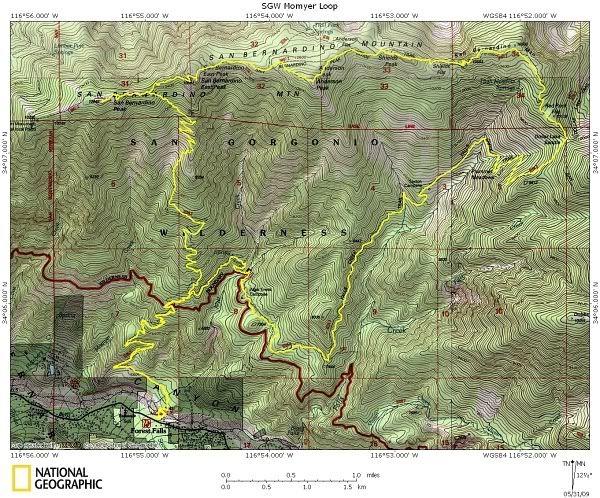
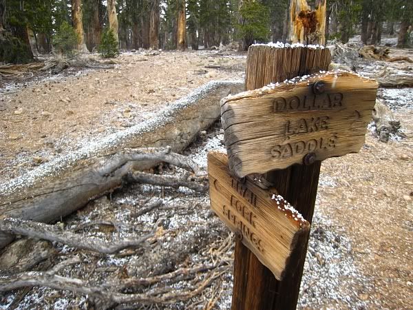
I went up Momyer to San Bernardino Peak via the unmaintained trail then east along the Divide to Dollar Lake Saddle and returned via Falls Creek Trail.

I had some minor ambitions of completing the SGW 9 Peaks so I headed for SB Peak first via a shortcut a few switchbacks below where the trail begins to veer east of E. SB Peak. I went northwest across the manzanita and boulders to hook up with the saddle east of SB Peak.

Weather was nice going up Momyer then by noon it started to hail. It was coming down pretty hard. I didn't mind the hail but when I got to Shields Peak, there was thunder and lightning. I decided to get out of there. I've had a bad experience with lightning before and am terrified of it.

On the way back on Falls Creek Trail, it rained heavily for at least an hour. I was soaking wet. It was a little uncomfortable to be wet, but it wasn't that cold and there was no wind so it was actually very nice to walk through a damp forest in the rain.

The area that Falls Creek Trail goes through was fascinating to me. It's like a lost world back there. 10,000 ft ridges surround the entire canyon so you can't see outside at all. It's very lush with vegetation everywhere. I don't think anyone ever goes back there because it's a long ways from any trail head. I hope it stays that way.

Image

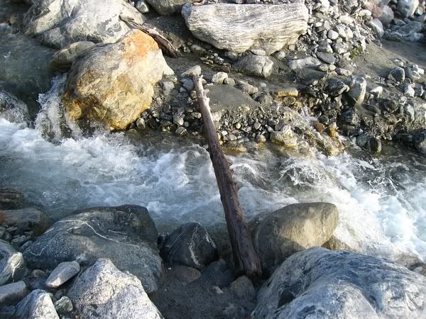
Mill Creek was flowing like crazy and there were very few places to cross it safely without getting wet. I had to go upstream about 50 yards from the Momyer parking lot to find this narrow log to cross the creek.
Image

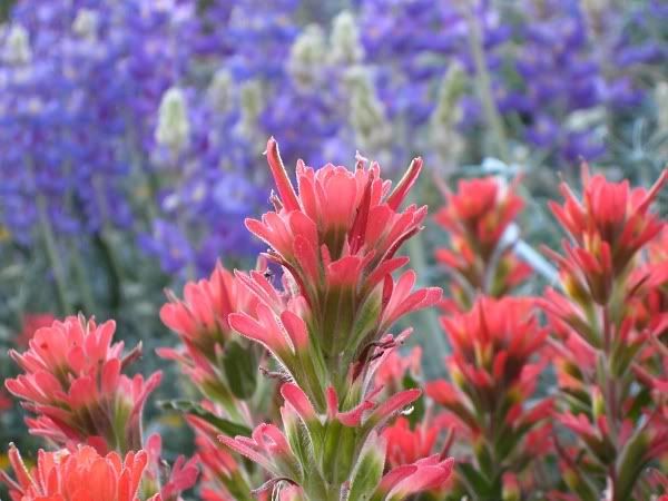
Explosion of wildflowers at around 7,000':
Image

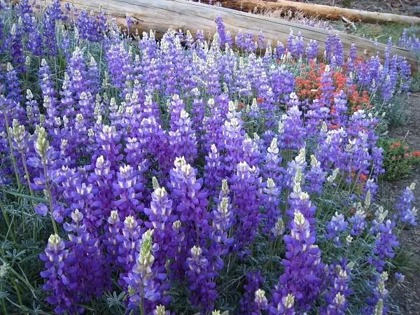
Indian Paintbrush and Lupine: beautiful!
Image

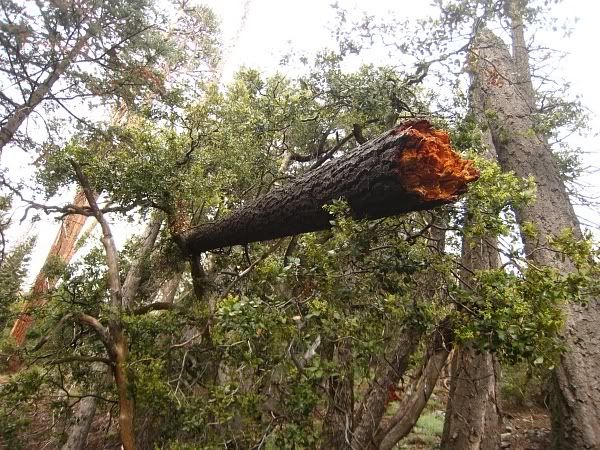
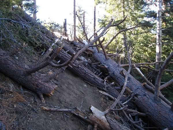
Lots of downed trees and debris along the first section of the trace trail to SB Peak. All are easily climbed or bypassed. Some larger logs had steps chopped into them.
Image

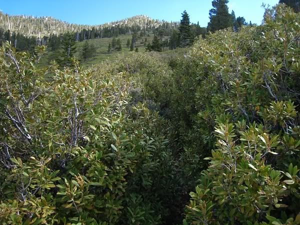
The upper part of the unmaintained trail is through a massive manzanita and brush field. The trail is overgrown in spots, but you can still follow it fairly easily. Pants highly recommended. My legs got chewed up by the buckthorn even though I wore pants.
Image

The hail was interesting. The consistency was more like tiny little snowballs, rather than ice. It was almost like Dippin' Dots. Man, if those really were Dippin' Dots falling out of the sky, I would have been in heaven.
Image

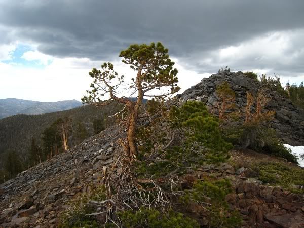
Ominous clouds over Shields Peak.
Image

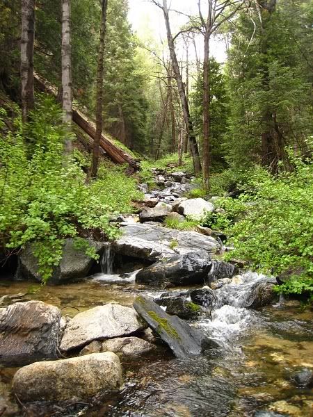
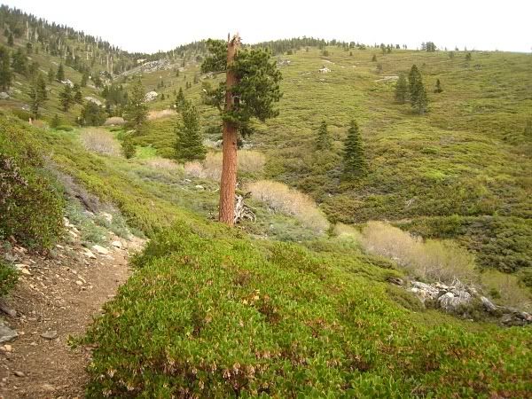
Plummer Meadows. This place is amazing. I have never see the forest so green as it is here.
Image

This doesn't look safe.
Image

Image
User avatar
hvydrt
Posts: 494
Joined: Thu Sep 27, 2007 8:18 pm

Post by hvydrt »

Great pictures Tim. I have done that same loop before. That trail down from dollar saddle is a beautiful area. Getting to San Bernardino Peak from Momyer is a tough hike. I would like to try the 9 peaks loop reversed some day and come down that way.
User avatar
brian90620
Posts: 123
Joined: Sun Jan 27, 2008 8:34 pm

Post by brian90620 »

Nice pictures, the San Gorgonio Wilderness is such a cool place............It must of been fun hiking in the rain and hail !!!!!!!! 8) 8) 8)
User avatar
Taco
Snownado survivor
Posts: 6010
Joined: Thu Sep 27, 2007 4:35 pm

Post by Taco »

Awesome shots fo sho.
User avatar
lilbitmo
Posts: 1092
Joined: Tue Mar 04, 2008 9:44 pm

Post by lilbitmo »

Tim,
Great Report and great pictures.

Sorry the weather made it a bit uncomfortable. I've been on Fish Creek before when lightning hit within 20 feet, scared the hell out of me and my newphew about "Crapped" himself.

Looks like the spring bloom is making all the plants show there bright colors, niceeeeeeeeeeeeeeee.

Glad you got out of there safely.

Nice work. :D
User avatar
EnFuego
Posts: 677
Joined: Mon Dec 15, 2008 11:14 am

Post by EnFuego »

Wow. There are some really nice pictures there. I can only imagine how beautiful it must have been in person.

Nice TR. I can't tell from your topo, but how many peaks did you bag? And what was the total mileadge?
User avatar
Tim
Posts: 560
Joined: Tue Apr 08, 2008 8:55 pm

Post by Tim »

hvydrt - The SB Peak register had a lot of entries of people completing the 9 peaks in reverse. That would be a nice, but long, trip too.

brian90620 - As long as there is no lightning, I'm down with hiking in the rain. The ambiance is definitely something else.

TacoDelRio - Thanks Taco, nature made it easy to take great shots here.

lilbitmo - Wow, glad to hear you guys didn't get hurt. When I was on SB Peak, I met a guy who said he also nearly got struck within a few feet. In my incident the lightning seem to have been just a cloud-to-cloud discharge right above our heads. But the thunder was deafening.

EnFuego - Stats were 21 mi, 6000' gain. I crossed off 5 peaks on the ridge: SB Peak, E. SB Peak, Anderson, Shields and Alta Diablo (sort of a peak).
User avatar
406
Posts: 321
Joined: Thu Jan 17, 2008 10:36 am

Post by 406 »

nice photos
User avatar
Hikin_Jim
Posts: 4686
Joined: Thu Sep 27, 2007 9:04 pm

Post by Hikin_Jim »

Great photos, Tim. Where was that last photo looking up a creek shot from? Alger Creek?

So, this short cut you took to SB peak. I've heard of it but am not familiar with it. It doesn't sound like a use trail. It sounds like an XC route, yes? Any tips on where to turn off the Momyer Cr trail and how to follow the short cut route?

One last Q: how bad was the brush on the short cut route?
User avatar
Tim
Posts: 560
Joined: Tue Apr 08, 2008 8:55 pm

Post by Tim »

Yep, that's Alger Creek. Really nice place.

The shortcut is a cross-country route. I turned off Momyer at about 9900' (this is 4 or 5 switchbacks below where the trail starts to go east) and just went northwest. Below this point the manzanita is too thick and tall. Here there are pockets of rocks/small boulders among low-lying manzanita. If I recall, the manzanita is only 1 or 2 feet high, so you can just step over them when hopping from one rock pocket to the next. Basically, the shortcut is a scramble--no bushwhacking. Hope that helps!
User avatar
mattmaxon
Posts: 1137
Joined: Mon Mar 24, 2008 12:48 pm

Post by mattmaxon »

Tim wrote:This was one wild hike. Rain, hail, lightning, thunder--I got it all.
You forgot flora & Fauna?...

This hike is on my todo list....

You wouldn't happen to have a GPX of your track?

And yes the snag in the tree is dangerous :shock:

With a GPX I can locate the tree... Getting a trail crew out there will be tough but this may inspire them!

Cheers
Matt
User avatar
Ze Hiker
Posts: 1430
Joined: Mon Jul 28, 2008 7:14 pm

Post by Ze Hiker »

yeah Tim, the GPX! I would also like your gpx as I'll probably use the same Momyer shortcut as you did. thanks
User avatar
Hikin_Jim
Posts: 4686
Joined: Thu Sep 27, 2007 9:04 pm

Post by Hikin_Jim »

Tim wrote:Yep, that's Alger Creek. Really nice place.
Absolutely, and reliable water even in the driest years. It's a nice spot to camp if you want to get a jump on a backpack. Drive up after work, hike up to Alger Creek Camp, flop. The next day, you're already part way in -- and you've gotten to spend an extra night in the wilderness. How cool is that?
Tim wrote:The shortcut is a cross-country route. I turned off Momyer at about 9900' (this is 4 or 5 switchbacks below where the trail starts to go east) and just went northwest. Below this point the manzanita is too thick and tall. Here there are pockets of rocks/small boulders among low-lying manzanita. If I recall, the manzanita is only 1 or 2 feet high, so you can just step over them when hopping from one rock pocket to the next. Basically, the shortcut is a scramble--no bushwhacking. Hope that helps!
Very helpful; thanks!
Post Reply