
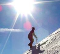
Bear Creek Trail (Smith Mountain)
-
Mike P

- Posts: 1005
- Joined: Tue Oct 02, 2007 10:48 pm
What is the trail status? Has the trail been cleared to the point that a hike can be done starting at Hwy 39 going over Smith Saddle and then down Bear Creek to West Fork Road?
-
mattmaxon

- Posts: 1137
- Joined: Mon Mar 24, 2008 12:48 pm
Yeah what the hell was I thinking! Bear Cyn Tr in late August Oy Vey!
The trail at that time was nice to the canyon floor (Long gone Upper Bear cpgd)
The trail is non-existent past there until you approach Lower Bear camp.
Between the Upper Bear & Lower Bear it is a canyon bottom scramble
Hope this is of some help

The trail at that time was nice to the canyon floor (Long gone Upper Bear cpgd)
The trail is non-existent past there until you approach Lower Bear camp.
Between the Upper Bear & Lower Bear it is a canyon bottom scramble
Hope this is of some help
-
Richard N.
- Posts: 91
- Joined: Tue Feb 12, 2008 9:47 pm
The trail from Highway 39 is still closed. Thats why the gate is locked down near West Fork.
It is scheduled to open in early June if all goes well.
The only way to access Bear Creek like Matt has mentioned. Hike the West Fork to where the creek enters and then follow the canyon north to the camps.
Its a more rugged hike but very do-able.
It is scheduled to open in early June if all goes well.
The only way to access Bear Creek like Matt has mentioned. Hike the West Fork to where the creek enters and then follow the canyon north to the camps.
Its a more rugged hike but very do-able.
-
Mike P
- Posts: 1005
- Joined: Tue Oct 02, 2007 10:48 pm
Thanks, Matt and Richard.
For some reason I thought the gate was already opened. I would like to do the route from north to south and didn't know how far up DamO's people worked on the trail.
For some reason I thought the gate was already opened. I would like to do the route from north to south and didn't know how far up DamO's people worked on the trail.
-
Richard N.
- Posts: 91
- Joined: Tue Feb 12, 2008 9:47 pm
Mike,
The road was opened at one time to the Bear Creek trailhead.
When the big slide occurred about 3/4 in on the trail, because of safety concerns, the Forest Service & Cal-Trans shut the road just north of the West Fork area.
Once the trail is repaired, and thats anyones guess, then the road will be opened once again just to the Bear Creek Trailhead.
The reason for the closure is that blasting is required to clear the slide and repair the trail.
Hopefully in time the road will re-open all the way to Crystal Lake.
Don't hold your breath waiting for the road to open up to Highway 2 any time soon. If your lucky, you might see that open by 2020.
-
Hikin_Jim

- Posts: 4688
- Joined: Thu Sep 27, 2007 9:04 pm
I know they've completed some blasting and restoration on the trail. Not sure how much more they've got to do but I think it's pretty close to being ready to re-open. Where's "DamoTClese" (or however he spells it) when you need him? He would know.Richard N. wrote:Mike,
The road was opened at one time to the Bear Creek trailhead.
When the big slide occurred about 3/4 in on the trail, because of safety concerns, the Forest Service & Cal-Trans shut the road just north of the West Fork area.
Once the trail is repaired, and thats anyones guess, then the road will be opened once again just to the Bear Creek Trailhead.
The reason for the closure is that blasting is required to clear the slide and repair the trail.
Hopefully in time the road will re-open all the way to Crystal Lake.
And promptly close again the following winter under 20 tons of unstoppable rock. Your tax dollars at work.Richard N. wrote:Don't hold your breath waiting for the road to open up to Highway 2 any time soon. If your lucky, you might see that open by 2020.
-
Hikin_Jim
- Posts: 4688
- Joined: Thu Sep 27, 2007 9:04 pm
Mike,Mike P wrote:What is the trail status? Has the trail been cleared to the point that a hike can be done starting at Hwy 39 going over Smith Saddle and then down Bear Creek to West Fork Road?
I asked some questions and basically I've been told that the work on the badly damaged section that ascends from Hwy 39 has been repaired. That section is now about 3' wide and is "horse capable." After one goes over the shoulder of Smith Mountain and starts to descend to Bear Creek, there are a number of downed logs and things but it didn't sound like there were any show stoppers.
From where the trail drops in to Bear Canyon down to the West Fork, there are no major obstacles per se, but it's poison oak city.
Supposedly the "trail closed" signs should be removed shortly if they haven't been already. There's no telling when CalTrans might open the gates to allow access further up the road. There's talk that CalTrans wants to "lift" one of the bridges on 39 above the current closure point and work on the pilings.
There you have it.
HJ
-
EnFuego

- Posts: 677
- Joined: Mon Dec 15, 2008 11:14 am
Mike - another forum member and I did Bear Creek up to Smith Saddle and down to hwy 39 and then back to West Fork trail head. The TR is here with pics:
https://eispiraten.com/a ... highlight=
I know you want to go from Hwy 39, to West Fork SG, but we did it the reverse way.
I think we had to cross the river like 27 times from West Fork SG to the start of the trail up to Smith Saddle. Flows were a lot higher then, than they are now. So I'm sure most crossings are easy jumps across rocks or logs.
The only thing to worry about is poison oak. It's avoidable, you jsut ned to be careful. It will get on your pant legs, just be careful not to touch them with your bare skin.
The trail from Smith Saddle to Hwy 39 is easy and clear of any brush or rock fall. There are no signs posted about the trail being closed from Bear Creak to Hwy 39.
Hope this helps.
-
Mike P
- Posts: 1005
- Joined: Tue Oct 02, 2007 10:48 pm
Thank you for all of the responses. I hope to do the loop sometime this year.
-
Oilslinger
- Posts: 14
- Joined: Tue Jan 26, 2010 9:07 pm
It's been a 5 or 6, maybe more years since I've used that trail, and even then it was washed out in a spot, and badly overgrown most of the way down, but passable. I noticed that it was not included in my new copy of "Trails of the Angeles". Has anyone tried it recently? Is it still passable without any special equipment?
-
Taco

- Snownado survivor
- Posts: 6193
- Joined: Thu Sep 27, 2007 4:35 pm
The trail is easy and clear for the most part. There were a few sections that the SGM Trailbuilders "modified" with explosives to clear debris and make them passable again.
Our resident SGMTB member disappeared last year, not sure why. He recently signed back up, and might be able to help you, if he's reading this.
Our resident SGMTB member disappeared last year, not sure why. He recently signed back up, and might be able to help you, if he's reading this.
-
Oilslinger
- Posts: 14
- Joined: Tue Jan 26, 2010 9:07 pm
Thanks for the info! found a boyscout web page with all the details. Apparently the forest service, or department of forestry ( I can't keep em' straight) blasted the trail back into shape just last month, unfortunately the gate is still closed at west fork. Can't wait till they re-open the road. Hope upper bear is still as deserted as it was last last time I was there... Should be now that it's no longer in Robinsons book
-
Logan
- Posts: 53
- Joined: Wed Apr 13, 2011 12:50 am
I am thinking of hiking up to Smith and then going down the backside to bear creek. That trail has typically been overgrown and difficult to follow in years past. Coming up the first part is really nice and looks maintained. Just wondering if anyone has any information on the way down to bear creek.
Thanks
Logan
Thanks
Logan
-
AW~

- Posts: 2110
- Joined: Mon Oct 01, 2007 12:00 pm
Upper Bear Creek trail...I did see this on the internet from Dec 1st.
http://myown100hikes.blogspot.com/2010/ ... trail.html
http://myown100hikes.blogspot.com/2010/ ... trail.html
-
Hikin_Jim
- Posts: 4688
- Joined: Thu Sep 27, 2007 9:04 pm
Anyone go in via Smith Saddle to Bear Creek lately? What kind of shape is the trail down Bear Creek? Is there even a trail or is it pretty much a bushwhack until you start getting closer to the West Fork?
How's the poison oak? I seem to remember that it was all over the place, really thick.
HJ
How's the poison oak? I seem to remember that it was all over the place, really thick.
HJ
-
Ze Hiker

- Posts: 1432
- Joined: Mon Jul 28, 2008 7:14 pm
are you planning on going into a closed area?!!!!

-
Hikin_Jim
- Posts: 4688
- Joined: Thu Sep 27, 2007 9:04 pm
I'm asking for Jake.
Seriously though, I don't think it's closed. I went up to Smith Saddle a couple of weeks ago, and there were no "closed" signs or anything that might indicate a closure.
HJ
-
Ze Hiker
- Posts: 1432
- Joined: Mon Jul 28, 2008 7:14 pm
i think it might have been, until may 16th. but who cares about a few days?
but actually thinking about it I think bear creek itself was the boundary, so you could hike down to it, just stay a few feet above the creek or you might be struck by lightning
but starting may 16th, but here is the updated closure map OMG it's high resolution!!!! praise the lords!!!
because I'm such a stickler for these things
-
Hikin_Jim
- Posts: 4688
- Joined: Thu Sep 27, 2007 9:04 pm
Yeah, that's a pretty good map, but the download links don't seem to work. 
Oh, wait, try this: http://maps.fs.fed.us/stationfire/Stati ... 600dpi.jpg
HJ
Oh, wait, try this: http://maps.fs.fed.us/stationfire/Stati ... 600dpi.jpg
HJ
-
Illusive

- Posts: 115
- Joined: Fri Jan 28, 2011 2:19 pm
Bear creek trail is open from west fork to smith saddle. The closure area closely follows bear creek. The areas to the west of bear creek and obviously north of the west fork are considered closed.
-
Hikin_Jim
- Posts: 4688
- Joined: Thu Sep 27, 2007 9:04 pm
No beta on the section between W Fork SG River and the trail coming down from Smith Saddle?
HJ
HJ
-
Zach

- Posts: 522
- Joined: Sun Jan 04, 2009 4:25 pm
I did that hike a long while back. Started @ the West Fork though and worked my way up the creek to hwy 39. It was kinda bush-whacky and yes, i ended up with poison oak... 
-
Logan
- Posts: 53
- Joined: Wed Apr 13, 2011 12:50 am
I am going tomorrow to Bear Creek via Smith so I will let you know.
-
Illusive
- Posts: 115
- Joined: Fri Jan 28, 2011 2:19 pm
Well it looks like newcomb saddle will be re-opened from chantry flats.Hikin_Jim wrote: Yeah, that's a pretty good map, but the download links don't seem to work.
Oh, wait, try this: http://maps.fs.fed.us/stationfire/Stati ... 600dpi.jpg
HJ
Back on topic, sorry Jim I dont have any other info from smith down to bear creek. We had planned on going down to bear creek when we summited smith but the flies turned us away.
-
Logan
- Posts: 53
- Joined: Wed Apr 13, 2011 12:50 am
That reminds me. I am going to get a bug net for my head before I go. I would like one that has a bug candle on the top for added security. Do they make a backpacking bug zapper lol.
Logan
Logan
-
MattCav

- Posts: 356
- Joined: Thu Sep 23, 2010 4:13 am
i was up at bear creek yesterday...took west fork up to the wilderness camp site and that was all open and ladden with poison oak. ill put up at tr tomorrow.
-
OutdoorAbstract
- Posts: 32
- Joined: Thu Jan 22, 2009 4:43 am
Anybody have knowledge of the route following the Smith Mountain trail to the Saddle and then down to Bear Creek and out at the West Fork of SG river? Are there any route finding challenges descending from the saddle down to the creek?