Pleasant View Cat Tracks

Poppies & cougars & shrooms, oh my!
Post Reply
User avatar
Elwood
Posts: 612
Joined: Fri Aug 15, 2008 5:23 pm

Post by Elwood »

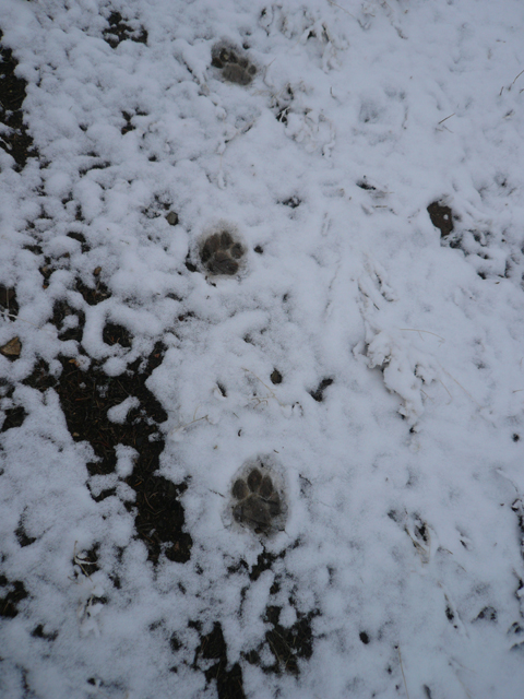
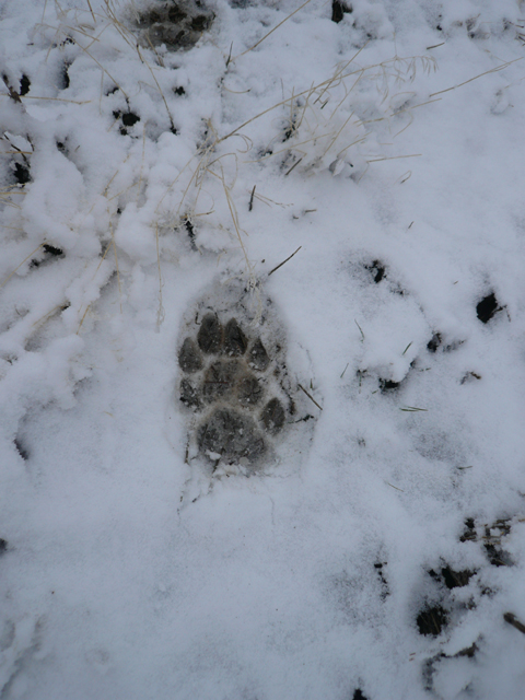
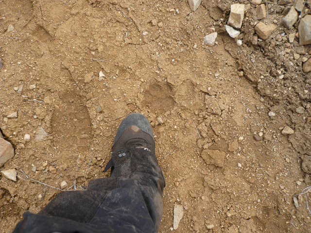
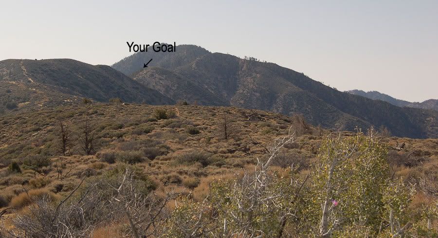
I parked my car at the gate on 4N14 and hiked up Pleasant View Ridge this morning. A little kitty left its pawprints along the ridge for a mile or so, seemingly recently. I Turned around at 7174 feet along the western flanks of Will Thrall, due to mediocre route finding through snow and Buckthorn. I'm not sure where kitty went.

Image
Image
Image
User avatar
cougarmagic
Posts: 1409
Joined: Wed May 07, 2008 5:21 pm

Post by cougarmagic »

Wow!!!

Wow wow wow!

Those are beautiful tracks! Great pics. Where is 4N14? Did you hike from Williamson, or the Punchbowl side? That cat must have been there last night or early this morning.

Burkhart saddle would be a great place for a camera, I think. A natural junction, and funnel for everything passing through there.
User avatar
Elwood
Posts: 612
Joined: Fri Aug 15, 2008 5:23 pm

Post by Elwood »

Forest Service Route 4N14 is also known as Alimony Truck Trail. It begins, unmarked at the intersection of Cima Mesa Road and 96th Street East in the lovely town of Juniper Hills, roughly 4.25 miles SSE of Littlerock. It is a dirt road and sloppy in spots. Distance to the gate is around 1.76 miles. Approaching Pleasant View Ridge from this side entails hiking several steep, though short slopes. I saw a few deer tracks too, though seemingly unrelated to our concolor friend.
User avatar
Kit Fox
Posts: 152
Joined: Tue Dec 25, 2007 11:33 am

Post by Kit Fox »

Elwood wrote:Forest Service Route 4N14 is also known as Alimony Truck Trail. It begins, unmarked at the intersection of Cima Mesa Road and 96th Street East in the lovely town of Juniper Hills, roughly 4.25 miles SSE of Littlerock. It is a dirt road and sloppy in spots. Distance to the gate is around 1.76 miles. Approaching Pleasant View Ridge from this side entails hiking several steep, though short slopes. I saw a few deer tracks too, though seemingly unrelated to our concolor friend.

I park in the little valley before the gate. The first hill is like a wall, but once you overcome it, and reach the plateau, it is a nice hike.


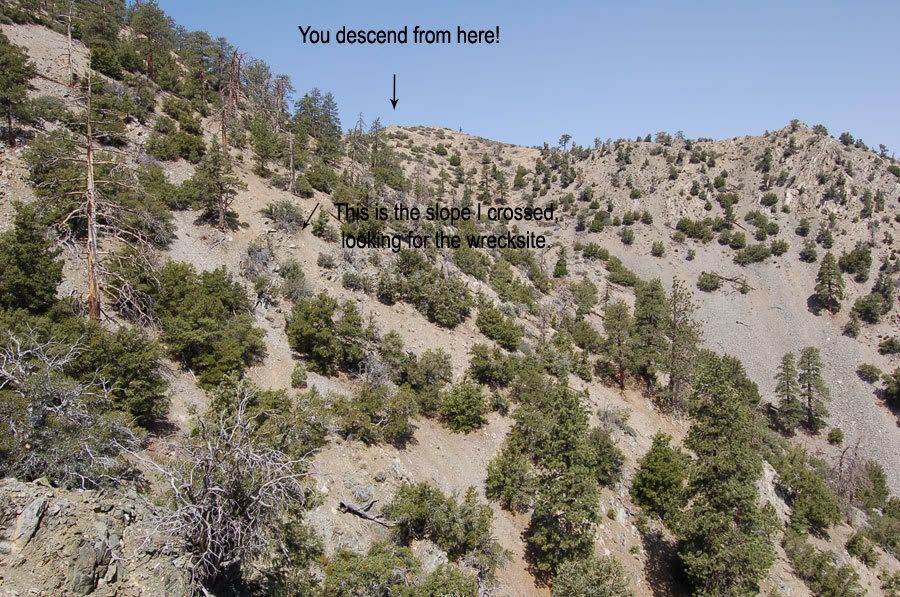
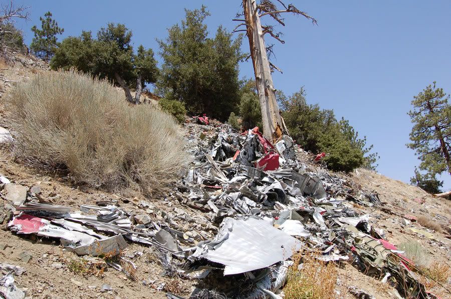
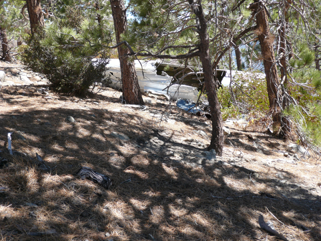
I took that route to find a C-130 crash site. I followed Mtn Lion tracks when I made that hike also.

Image

Image
Image
Image
User avatar
Elwood
Posts: 612
Joined: Fri Aug 15, 2008 5:23 pm

Post by Elwood »

Hey KF,

Have you had the sad pleasure of visiting the 1966 C-119 wreck on the eastern slope of Pallett Mountain (also off of PVR)?

Image
User avatar
EManBevHills
Posts: 387
Joined: Fri Sep 28, 2007 12:40 am

Post by EManBevHills »

Little Kitty?

Watcha think she weighed?
User avatar
Kit Fox
Posts: 152
Joined: Tue Dec 25, 2007 11:33 am

Post by Kit Fox »

Elwood wrote:Hey KF,

Have you had the sad pleasure of visiting the 1966 C-119 wreck on the eastern slope of Pallett Mountain (also off of PVR)?

Image
Yep http://s4.photobucket.com/albums/y144/sgbofav/C-119/

and the C-46 below the C-119.
http://s4.photobucket.com/albums/y144/sgbofav/C-46/
User avatar
Elwood
Posts: 612
Joined: Fri Aug 15, 2008 5:23 pm

Post by Elwood »

Very nice pictures, thank for sharing!
User avatar
cougarmagic
Posts: 1409
Joined: Wed May 07, 2008 5:21 pm

Post by cougarmagic »

I am so there. :D

I've seen the C119. That is spooky. The wreckage is spread out so far. And they were so close to making it over the ridge.

Looks like an average adult-size kitty - somewhere around 100, 120 maybe?
User avatar
Kit Fox
Posts: 152
Joined: Tue Dec 25, 2007 11:33 am

Post by Kit Fox »

Elwood wrote:Very nice pictures, thank for sharing!
You're welcome!

Two F-105s I visited in the Sequoia National Forest (one in the Scodie mtns, and one in the Piute mtns.)

http://s4.photobucket.com/albums/y144/sgbofav/F-105/
http://s4.photobucket.com/albums/y144/s ... e%20F-105/

Another site is the Mill Canyon B-25 South of Acton.

http://s4.photobucket.com/albums/y144/s ... on%20B-25/
Post Reply