
All trip reports heading to Ross first ascend Baden-Powell from the north, then head down to Ross. I am interested in try to ascend Ross from the south. Start at East Fork, hike up to the Narrows, where one (in theory) could pick up the south ridge and ascend up to Ross.
The old topos show some old trails around this area, but none heading up. Anyone ever hear of someone going up this way?
Anyone have any photos from around the Narrows that could help?
Thanks
Ross Mountain from the south

-
Elwood

- Posts: 627
- Joined: Fri Aug 15, 2008 5:23 pm
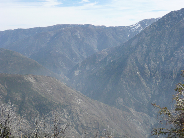
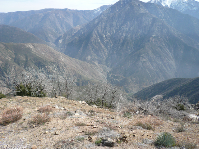
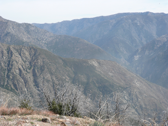
I was up on Rattlesnake last Saturday. These pictures are looking up the Narrows, towards Blue Ridge. I THINK the second ridge on the left is the one up to Ross. The one in the foreground runs up to South Hawkins.
-E
-E
-
AW~

- Posts: 2124
- Joined: Mon Oct 01, 2007 12:00 pm
Havent been to Ross yet...that trail on the topo is brushed over. The start is from a little plateau(trail to this place from east fork) ....from there could sometimes thick but always brush it up 300-500ft + countouring back to the south ridge. I actually tried just going up the south ridge from the very start...not doable as it micro-cliffs out(and thats after the fifth class slab hand jam nonsense)...thats all I know for the public info.
Very doable for your group and the idea is a good route concept. Highly recommend that area. You thinking about going all the way to Vincent Gap or coming back to Heaton? You could put in some elevation gain if you were to take on all of the southern peaks of Baden-Powell from Vincent Gap so in addition to Ross also pk5995,5599,6658, & 7350
Very doable for your group and the idea is a good route concept. Highly recommend that area. You thinking about going all the way to Vincent Gap or coming back to Heaton? You could put in some elevation gain if you were to take on all of the southern peaks of Baden-Powell from Vincent Gap
-
Ze Hiker

- Posts: 1432
- Joined: Mon Jul 28, 2008 7:14 pm
Thanks for the responses.
AW, I would just head back to Heaton. I think that would be sufficient of a hike
Looks like could veer slightly up Iron fork then gain the ridge. Main problem of the whole thing is gonna be brush. Hmm. I might save the brush for the other one.
AW, I would just head back to Heaton. I think that would be sufficient of a hike
Looks like could veer slightly up Iron fork then gain the ridge. Main problem of the whole thing is gonna be brush. Hmm. I might save the brush for the other one.