
HJ
Middle Fork Trail (Lytle Creek)
-
Hikin_Jim

- Posts: 4688
- Joined: Thu Sep 27, 2007 9:04 pm
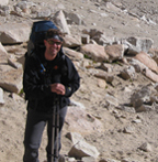
Hey all you SGM Trail Builder types out there (you know who you are)  any chance of getting some maintenance on the trail that goes up the middle fork of Lytle Creek (I think it's the middle fork -- it's the one that goes to Icehouse Saddle from the east)? It's a great trail and generally in good shape, but there are two serious washouts between 3rd Crossing and Comanche. The washouts are on slopes where a slip could mean serious injury or death.
HJ
HJ
-
RyanB
- Posts: 17
- Joined: Sun Feb 22, 2009 10:43 am
Anyone know if water is available at any Middle Fork Trail camps? Also, does anyone know trail and snow conditions from Icehouse Saddle to Ontario and Cucamonga Peaks. Crampons? 
-
Dudley Heinsbergen

- Posts: 109
- Joined: Tue Jan 22, 2008 9:02 pm
the water is most reliable this time of year.
crampons would be usefull at 8,200
crampons would be usefull at 8,200
-
Hikin_Jim
- Posts: 4688
- Joined: Thu Sep 27, 2007 9:04 pm
Water is pretty reliable at all three trail camps year-round. I think Comanche is the nicest in terms of greenery and the farthest away from crowds. There are a couple of washouts that dissuade the scouts and such from going all the way up to Comanche. A good hiker can get around them without inordinate difficulty although they'd be a major bummer if you slipped.
-
Hikin_Jim
- Posts: 4688
- Joined: Thu Sep 27, 2007 9:04 pm
Cool! That's a really worthy area. If my knee ever really heals up, I'd love to get back up there again.
-
Hikin_Jim
- Posts: 4688
- Joined: Thu Sep 27, 2007 9:04 pm
What?! I have swine flu!! 
How on earth did I ever get that??!

How on earth did I ever get that??!
-
tarol
- Posts: 126
- Joined: Tue Nov 06, 2007 12:28 pm
Anybody been up this trail recently? Question about where the snow/ice starts, I assume it's above 3rd Stream but anybody know anything concrete?
Thanks in advance for any info!
Thanks in advance for any info!
-
Hikin_Jim
- Posts: 4688
- Joined: Thu Sep 27, 2007 9:04 pm
Careful on that trail above 3rd stream crossing. There were some really steep slide areas where the trail was 100% washed out that I encountered the last time I was up there, about 2 or 3 years ago. It was OK but not great to scramble around them (unless you're afraid of heights like my buddy, Jared), but I did it in October before any snow had fallen. Unless someone has repaired the trail relatively recently, I would think twice before heading up there when the trail is icy.
HJ
HJ
-
edenooch

- Posts: 504
- Joined: Fri Jul 03, 2009 7:42 pm
FROM ice house sadlle u would need crampoons and ice axe

-
Funyan005
- Posts: 203
- Joined: Tue Apr 01, 2008 11:17 pm
Anyone know the conditions of the trail up towards three stream crossing campground? I know the rain tore some of the lower sections up this past winter and am wondering if anyone has been up there.
-
Madrox

- Posts: 26
- Joined: Sun Oct 10, 2010 2:13 pm
The trail was in good shape about a month ago. There were three small washouts after the Cucamonga Wilderness boundry.
-
HikeCA
- Posts: 2
- Joined: Tue Jul 30, 2013 2:54 pm
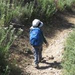
My fiancée and I took a hike up the Middle Fork Trail yesterday, with the intention of reaching Third Stream Crossing before heading back to our vehicle. We're recent transplants to Southern California and it was our first trip to this area so I did some online research and also read the description of the trail in one of our many hiking books before starting out. Based on our experience yesterday, we either got sidetracked and got off the trail or I relied too heavily on my apparently outdated book that instructed us to continue up the trail beyond the campground. I would like to believe the latter.
Everything was going well until we got beyond Stonehouse Campground. The trail followed the south side of the creek but gradually became harder to follow and then ended abruptly at a large pool. I looked around and determined the only conceivable place for the trail to continue was on the opposite (north) side of the stream. The problem with my theory was that the whole area was covered with dense vegetation and apparently impassable, unless one came equipped with a sickle!
After this disappointing finding, we decided to enjoy the beauty and tranquility in the canyon bottom before heading back to our vehicle. When we returned to the junction at the saddle, we considered going up the main trail to our original destination but decided to save it for another day. When we returned to the trailhead, we studied the map on the sign and it showed what appeared to be the very trail that had fizzled out along the stream. Perhaps the sign is outdated, as well? Is anyone familiar with the 'trail' that leads up the canyon from Stonehouse Campground?
-
HikeUp

- Posts: 4070
- Joined: Thu Sep 27, 2007 9:21 pm
When you head west from the parking lot you hit a fork in the trail.
The left fork goes downhill to the Stone House Crossing campground.
The right fork (main trail) stays north of the creek and heads west to Third Stream and beyond.
If you took the left fork you eventually cross to the south side of the creek as you go through the Stone House camp, and as you found out, it peeters out in a jungle of stinging nettle and other stuff - impassable. The maps all show it continuing on to eventually meet up with the main trail but it doesn't do that any more.
If you had taken the right fork (main trail) you stay north of the creek and continue on as far as you want. Just before you would have hit the wilderness boundary you may actually notice a side trail on your left that heads back east/southeast down towards the creek - this is where maps show the trail through Stone House re-connecting with the main trail. In fact you can follow it almost all the way back to a point directly across the stream from where you "deadended" on the south side.
So basically the trail shown going through Stone House is interuppted by an overgrown "swamp" of impassable brush. The trail shown north of the creek is the main trail that should get you to points west.
That took way too many words to describe.
-
Sean

- Cucamonga
- Posts: 4289
- Joined: Wed Jul 27, 2011 12:32 pm
Very thorough reply, Hike Up. It felt like I was actually walking the trail myself.
I think it's worth going to Commanche Camp if you have the time. It's peaceful and lush, very pretty in autumn with the changing leaves. From Third Stream you cross the creek, head up and left on the slightly faint, debris-covered path, then find the trail ascending and switchbacking southward to the upper part of the canyon as it bends toward Cucamonga Peak.
I think it's worth going to Commanche Camp if you have the time. It's peaceful and lush, very pretty in autumn with the changing leaves. From Third Stream you cross the creek, head up and left on the slightly faint, debris-covered path, then find the trail ascending and switchbacking southward to the upper part of the canyon as it bends toward Cucamonga Peak.
-
HikeCA
- Posts: 2
- Joined: Tue Jul 30, 2013 2:54 pm
HikeUp, Your informative response is most appreciated. It completely solved the mystery and put my mind at ease.
Sean, we're going to follow your suggestion and come back in the fall and make Comanche our destination. The combination of cooler temperatures and fall foliage could very well turn a nice hike into a remarkable one.
Sean, we're going to follow your suggestion and come back in the fall and make Comanche our destination. The combination of cooler temperatures and fall foliage could very well turn a nice hike into a remarkable one.
-
JDB22
- Posts: 55
- Joined: Fri Feb 17, 2012 9:44 am
Perfect timing, I have been wondering...
Does anyone know if there is water running at Comanche Camp this time of year? Wanting to do Cucamonga/Etiwanda without going up the Icehouse Canyon 'Highway'. Thinking return trip filtering would alleviate some weight. Never been up the Middle Fork trail though, looking forward to some uphill hiking.
HikeUp & Sean always have such good info, thanks guys.
-
HikeUp
- Posts: 4070
- Joined: Thu Sep 27, 2007 9:21 pm
Sean (or Hikin Jim, or Elwood or whoever else I can't think of right now who has been on this trail before) is gonna have to answer the water question. I've only been in the area in spring (March thru June) so there was always water.
-
AW~

- Posts: 2110
- Joined: Mon Oct 01, 2007 12:00 pm
http://cucamongawilderness.org/camping/
"•Stonehouse Camp: Water flow Very GOOD (Updated: 7/27/2013)
•Third Stream Crossing / Camp: Water flow MODERATE (updated: 7/27/2013)
•Commanche Camp: Water flow Very LOW, bring water, not recommneded for filtering/re-supply (Updated: 7/27/2013)"
"•Stonehouse Camp: Water flow Very GOOD (Updated: 7/27/2013)
•Third Stream Crossing / Camp: Water flow MODERATE (updated: 7/27/2013)
•Commanche Camp: Water flow Very LOW, bring water, not recommneded for filtering/re-supply (Updated: 7/27/2013)"
-
JDB22
- Posts: 55
- Joined: Fri Feb 17, 2012 9:44 am
Thank yous all around folks. Good info to know. Saving that link as well, hadn't come across that page. Planning accordingly.
-
Sean
- Cucamonga
- Posts: 4289
- Joined: Wed Jul 27, 2011 12:32 pm
Probably dry at Commanche. But you could grab water at Third Stream and stash a liter or two right before Icehouse Saddle. Hardly anyone goes down the trail, so it's unlikely people will find/steal it.JDB22 wrote: Thinking return trip filtering would alleviate some weight.
Also, the beginning and ending stretches of Middle Fork are exposed and can get pretty hot this time of year.
-
JDB22
- Posts: 55
- Joined: Fri Feb 17, 2012 9:44 am
Thanks again AW for the link, many of your posts on the forum have been helpful in the past.
Great advice Sean. Probably stash some off trail below the saddle. It has been warming up all week, kind of expecting a hot one. Thanks for the heads up on the exposed sections.
Great advice Sean. Probably stash some off trail below the saddle. It has been warming up all week, kind of expecting a hot one. Thanks for the heads up on the exposed sections.
-
HikeEnthusiast55
- Posts: 30
- Joined: Tue Jan 28, 2014 4:12 pm
So,
Is walking from Icehouse Canyon to Lytle Creek without equipment possible?
Thanks
Is walking from Icehouse Canyon to Lytle Creek without equipment possible?
Thanks
-
HikeUp
- Posts: 4070
- Joined: Thu Sep 27, 2007 9:21 pm
Equipment? You mean like a "snow plow" attachment to clear the pine cones off the trail or flame thrower or clothes and shoes?
-
HikeEnthusiast55
- Posts: 30
- Joined: Tue Jan 28, 2014 4:12 pm
i mean i don't have to take like ropes or... you know....HikeUp wrote: Equipment? You mean like a "snow plow" attachment to clear the pine cones off the trail or flame thrower or clothes and shoes?
is it hikable down easily without dying/getting stuck, etc?
is there snow right now there in the middle of summer
-
Mike P

- Posts: 1005
- Joined: Tue Oct 02, 2007 10:48 pm
Nope, it's a regular trail. But, you should take a pack with ten essentials, etc. no?
-
fortified
- Posts: 105
- Joined: Sat Mar 02, 2013 10:03 pm
I go trail running four days a week, and I don't know what the ...lets say Pack-ten are. Running/hiking after sunset, two light sources ...just in case, and a ski pole pointed back away from your neck for that one in a million chance for a lion..... cell phone to pretend I can get service anywhere, and time myself.