
Well, since I did 18.5 miles with about 5,000 feet of gain on Saturday...and had no sore legs, I'm ready to push myself a bit more. I'm now thinking I may try a counter clockwise loop from Chantry Flat, up the Sturtevant Trail to Newcomb Pass. Then down to Devore, following the Gabrielino Trail to the Kenyon Devore Trail. I suppose I'd then be on the toll road for a bit, then can bag Wilson. I'd then go down via the Upper Winter Creek Trail.
It would be about 20 ish miles, with about 5,300 ish feet of gain. I've done the Sturtevant Trail, but only up Wilson, and the Winter Creek Trail. Does anyone have any experience with or information on the rest of my route? I'm assuming the Gabrielino Trail is in good condition, but I've never heard anyone mention the Kenyon Devore Loop.
I may try this on Saturday, but not sure yet. I may have a hiking buddy join me, and may choose something else for this week. Or I may have social plans this Saturday evening, in which case I'd do a mere 15 mile day.
Kenyon DeVore Trail (Mt. Wilson)
-
Ze Hiker

- Posts: 1432
- Joined: Mon Jul 28, 2008 7:14 pm
you gotta do something real steep to get sore legs! it's the downhill eccentric contractions that get ya.
-
AlanK

- Posts: 1069
- Joined: Thu Sep 27, 2007 9:28 pm
My son and I did the Gabrielino Trail, more or less, last summer. However, we managed to throw in the Kenyon DeVore Trail in the trip. The whole thing was great. I don't see how you can get sore legs on something that nice! 
-
AlanK
- Posts: 1069
- Joined: Thu Sep 27, 2007 9:28 pm
It's a nice trail, on a par with others in the area. I think it's a good way to get to your goal of an extended loop in that area.Liz wrote:How is the Kenyon Devore trail? Scenic??
The Gabrielino is a good trail, but it does have the problem of requiring some sort of shuttle.
-
Liz
- Posts: 218
- Joined: Mon Dec 22, 2008 8:59 am
I will do the whole Gabrielino Trail with some buddies soon. In that case we will do a car shuttle. On my loop however, I'll just cover a portion of the trail Thanks!
-
cougarmagic

- Posts: 1411
- Joined: Wed May 07, 2008 5:21 pm
Hi Liz. I just hiked the Kenyon Devore trail yesterday. I went from Mt Wilson, down to West Fork camp, then up Shortcut Canyon. Kenyon Devore is beautiful. And up, up, up (which is why chose to go down ...) so I think you would enjoy it! Much of it is pine forest, and it follows a nice running stream in a lot of places, with some cascades and pools. There were a couple of downed trees across the trail, but nothing you can't just step over or around. Toward the top are some snowy patches, but again, nothing to worry about. (just small, rather slushy parts).
I didn't take many pictures, and these don't really do it justice. The upper parts of this trail are very Sierra-like. Lots of granite and pines, and some dramatic views across the canyon. Have a great hike - can't wait to hear about it.


I didn't take many pictures, and these don't really do it justice. The upper parts of this trail are very Sierra-like. Lots of granite and pines, and some dramatic views across the canyon. Have a great hike - can't wait to hear about it.
-
Beantown
- Posts: 45
- Joined: Wed Mar 21, 2012 9:06 am
wondering about trail conditions for this hike for this weekend?
http://www.localhikes.com/Hikes/WilsonDevore_4472.asp
ive hike to devore from chantry years ago, and have hiked to mt Wilson from chantry.
just looking to hike this area and get away from the crownds at chantry
thanks
http://www.localhikes.com/Hikes/WilsonDevore_4472.asp
ive hike to devore from chantry years ago, and have hiked to mt Wilson from chantry.
just looking to hike this area and get away from the crownds at chantry
thanks
-
mattmaxon

- Posts: 1137
- Joined: Mon Mar 24, 2008 12:48 pm
I have hiked the Keyon Devore Tr post Station Fire. It was in good shape. This was like 1 year ago or so. The loop I did was to the Valley Forge Tr.
The Gabrilenio Tr between Kenyon Deveore and Valley Forge was bad. Unless you had hiked it before many times it would be difficult if not impossible to follow.
My recommendation is...If the gabrilenio trail hasn't been repaired I'd continue on the Kenyon Devore tr to the road and hike down to the West Fork camp. Then continue on the trail
-
Beantown
- Posts: 45
- Joined: Wed Mar 21, 2012 9:06 am
Thanks for the info. Found this report of lots of poodle dog brush on the trail from iune
http://www.photographyontherun.com/Bigc ... evore.aspx
I've never encountered any, heard its nasty stuff. Think I will do something different
http://www.photographyontherun.com/Bigc ... evore.aspx
I've never encountered any, heard its nasty stuff. Think I will do something different
-
Coolburn
- Posts: 1
- Joined: Mon Jul 22, 2013 5:43 pm
The poodle dog is this area is unavoidable and nasty. It took over a week to develop and lasted 10 days. Is there any way to eradicate this menace?
-
Uncle Rico

- Posts: 1484
- Joined: Thu Mar 20, 2008 7:48 pm
Has anybody been down Kenyon Devore to West Fork or Devore recently? Or out along the Rim Trail between Newcomb Pass and Mt. Wilson? What are current conditions? Are either or both of those trails poodle dog hell?
Thx.
Thx.
-
Hikin_Jim

- Posts: 4688
- Joined: Thu Sep 27, 2007 9:04 pm
I did a loop, I think late last year, down Kenyon Devore and up the Rim Trail.
The top of the Devore trail was partially obscured by piles of brush that had been cut recently. I think that's gone now.
There was a lot of the brutal poodle once you got down to where you meet the Gabrieleno Trail, but I was able to avoid it. There was one spot where the trail was a bit unclear due to lack of maintenance. However, I know that there has been a lot of volunteer maintenance that has occurred since I hiked it (I've run into the volunteers since then out on the trail).
The trails were in relatively good condition the rest of the way to Mt. Wilson's summit until right when you get to the summit. I found the route to be a bit unclear just below the summit, but when the equipment on the summit is in sight, the route doesn't have to be particularly clear.
I did the route just fine with no poodle dog bush problems, and that was a year or so ago. I think you'd be fine now.
HJ
-
HikeUp

- Posts: 4070
- Joined: Thu Sep 27, 2007 9:21 pm
Eastern end of Rim Trail (near Newcomb Pass) is prone to poison oak if I remember correctly.
-
Uncle Rico
- Posts: 1484
- Joined: Thu Mar 20, 2008 7:48 pm
Figured I'd answer my own question so dropped down Kenyon Devore yesterday, followed the Gabrieleno trail to West Fork, ascended to Newcomb Pass, and then tacked back to Wilson via the Rim Trail. Trails are in reasonably good shape. There are several off-camber sections on all three trails where they've slid, you've got to dodge the poodle here and there and step over/around some downed trees, but otherwise I didn't have any trouble following the path.
The bugs were out in force, however. I had planned on spending some time at West Fork but the little black flies were so bad I blew right through. Went up the Rincon-Red Box fire road to get out in the sun and breeze where the bugs weren't as bad.
I found water flowing at 3 locations: at the Kenyon Devore-Gabrieleno junction; at an unnamed drainage along the Gabrieleno trail going toward West Fork; and Rush Creek at West Fork.
I didn't explore the Gabrieleno trail going toward Valley Forge, but it looked considerably more over-grown the trail toward West Fork.
The forest was empty again. Only saw 2 people all day (at Newcomb Pass).
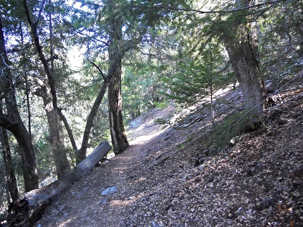
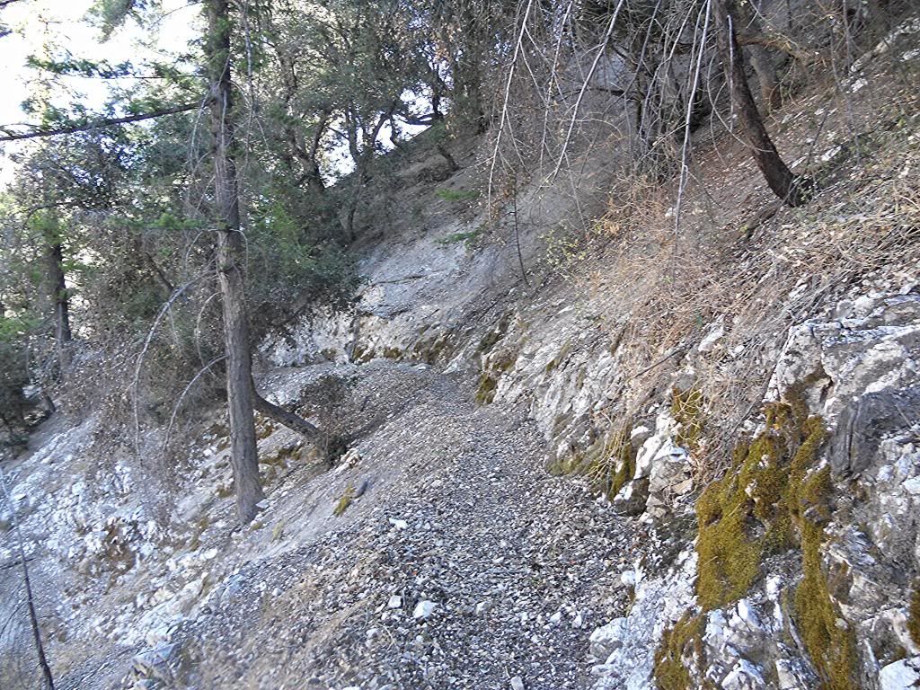
Kenyon Devore Trail
Typical of the trail obstructions you can expect to encounter
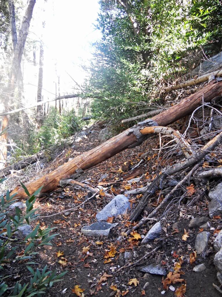
Kenyon Devore-Gabrieleno Junction. There's water just to the right.
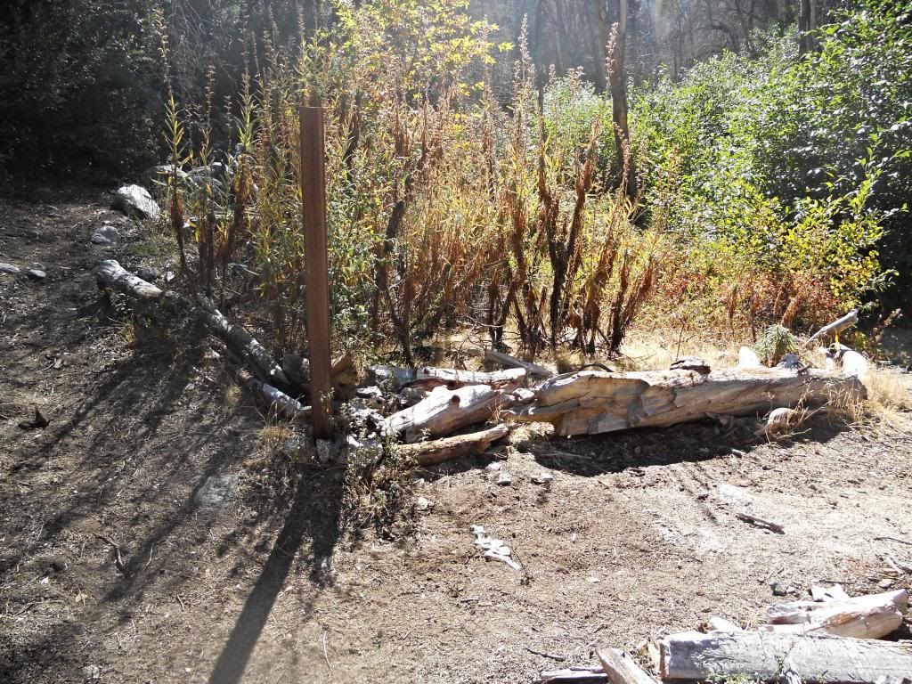
Gabrieleno Trail heading toward West Fork
Typical trail conditions along the Gabrieleno Trail
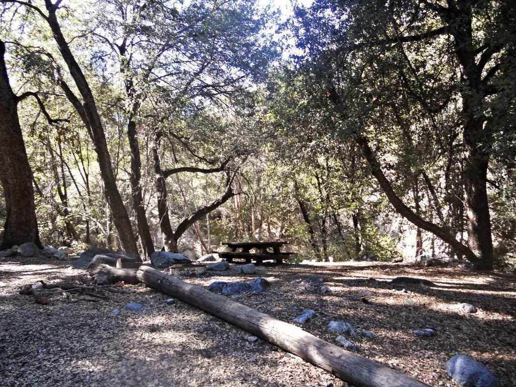
West Fork Trail Camp empty except for the freakin' flies
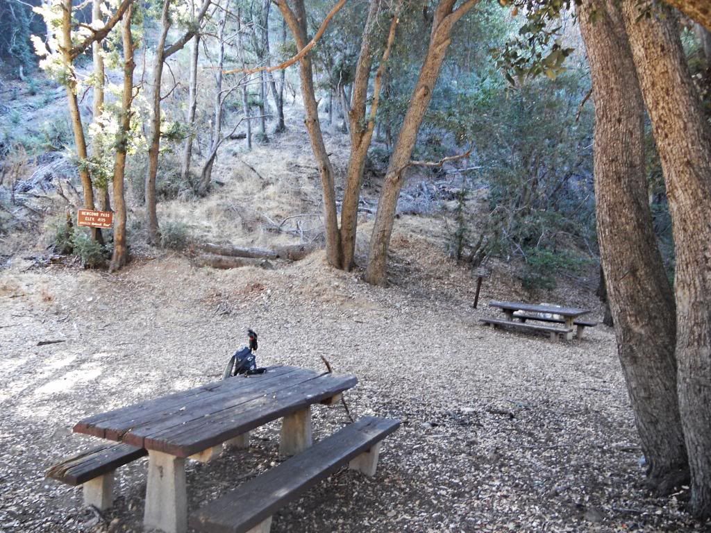
Newcomb Pass
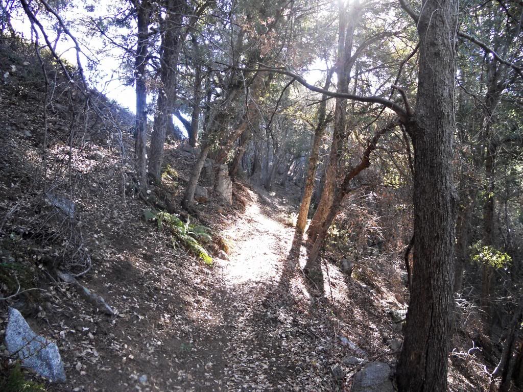
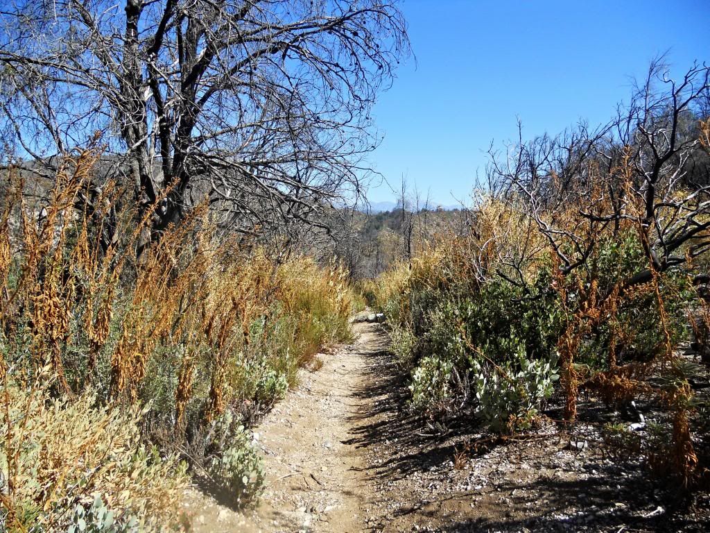
Typical Rim Trail Conditions.
The bugs were out in force, however. I had planned on spending some time at West Fork but the little black flies were so bad I blew right through. Went up the Rincon-Red Box fire road to get out in the sun and breeze where the bugs weren't as bad.
I found water flowing at 3 locations: at the Kenyon Devore-Gabrieleno junction; at an unnamed drainage along the Gabrieleno trail going toward West Fork; and Rush Creek at West Fork.
I didn't explore the Gabrieleno trail going toward Valley Forge, but it looked considerably more over-grown the trail toward West Fork.
The forest was empty again. Only saw 2 people all day (at Newcomb Pass).

Kenyon Devore Trail

Typical of the trail obstructions you can expect to encounter

Kenyon Devore-Gabrieleno Junction. There's water just to the right.

Gabrieleno Trail heading toward West Fork

Typical trail conditions along the Gabrieleno Trail

West Fork Trail Camp empty except for the freakin' flies

Newcomb Pass

Typical Rim Trail Conditions.
-
shreddy

- Posts: 241
- Joined: Sun Jan 16, 2011 10:40 pm
Hi All,
Hoping someone can give me some detail as to current conditions of the following trails? Planning a small group trail run in the area. Thinking about it at least. I haven't been in those trails since the S. Fire.
-Gabrileno from Red Box to Devore Trail
-Rincon Road from RB to Westfork (I imagine it's fine)
-Devore to Wilson (Is that pipe with water still running/)
-Valley Forge Trail
-Trail from Mt Disappointment down to Mt Wilson Rd / Redbox
Appreciate the feedback.
Happy Trails
-
Hikin_Jim
- Posts: 4688
- Joined: Thu Sep 27, 2007 9:04 pm
I was there in March. I need to run now, but I'll type something up tomorrow.
HJ
HJ
-
briangroh
- Posts: 10
- Joined: Fri Nov 22, 2013 9:39 am
I just mountain biked Red Box to West Fork on the Dirt Rincon Road on Sunday the 12th and it was clear with just a slimey trickle of water over the cement slab near valley forge.
There was a small road grader parked off to the side a mile or so in, so there might be some maintenance going on.
I also walked the trail from Red Box to Valley Forge a month ago and it was in good condition. I may have had to climb over one felled tree and at times you're looking for the trail when it gets camouflaged in the dry stream bed.
-
Uncle Rico
- Posts: 1484
- Joined: Thu Mar 20, 2008 7:48 pm
Hey shreddy, I don't know how useful this will be to you, but I was on the trail from Disappointment to Red Box and the Valley Forge Trail in the spring. The trail to Disappointment was in really good shape. The Valley Forge Trail was in pretty good shape--brush encroached onto the trail in few spots up higher, and there were a couple of soft spots, but down low it was in good shape. The trail climbing back up to Red Box was in good shape with no downed trees or brushy areas. TR with some pics here:
https://eispiraten.com/D ... t5742.html
The previous fall (Oct. 2013) I dropped down Kenyon Devore then took the Gabrieleno Trail to West Fork. The Gabrieleno Trail between Kenyon Devore and West Fork was in reasonable shape, but narrowed in a couple areas where PDB encroached. The closer I got to West Fork, the better the trail got. Haven't been down there since, but I have to believe the trail is in better shape now than it was last fall. TR here:
https://eispiraten.com/a ... yon+devore
Haven't been on the stretch of the Gabrieleno between Valley Forge and Kenyon Devore so I can't say what the trail is like along that stretch.
-
shreddy
- Posts: 241
- Joined: Sun Jan 16, 2011 10:40 pm
Thanks guys... this is all the info I need. Appreciate your recon.!
Oh--- Any idea about that water pipe on the Devore trail
Oh--- Any idea about that water pipe on the Devore trail
-
Hikin_Jim
- Posts: 4688
- Joined: Thu Sep 27, 2007 9:04 pm
Here's my GPS track going from Mt Wilson down the Rim Trail to Devore Camp, then to West Fork and Valley Forge, and then up to Eaton Saddle. It could be done in a day, but I did it as a backpack because I was with my daughter.
The trails were generally in decent shape except the lower Devore Trail below the Gabrieleno Trail. It was passable, but had some major downed trees. See waypoint 29.
HJ
-
Hikin_Jim
- Posts: 4688
- Joined: Thu Sep 27, 2007 9:04 pm
You're welcome.
I just talked to one of the guys who does maintenance over there. He says all the downed trees I reported are gone and that several other improvements have been made, so if anything, the trail should be in better shape than my GPS notes would indicate.
HJ
I just talked to one of the guys who does maintenance over there. He says all the downed trees I reported are gone and that several other improvements have been made, so if anything, the trail should be in better shape than my GPS notes would indicate.
HJ
-
Tom Kenney

- Posts: 386
- Joined: Sat Sep 29, 2007 7:51 pm
Any deadfall that was there 2 weeks ago has been cut, but there are a couple new downed trees already from the recent storm. Nothing major, and I cleared what I could by hand yesterday.
-
Gene

- Old Dam Man
- Posts: 212
- Joined: Mon Dec 26, 2011 7:54 pm
I used to work with Kenny, AKA, Kenyon Devore he was a hydrographer for the old LA County Flood Control District. About as nice a person as you'ed ever want to know and when t came to the San Gabriel Mountains he had a wealth of knowledge.
-
Tom Kenney
- Posts: 386
- Joined: Sat Sep 29, 2007 7:51 pm
Saw 2 not-nice things on my ride yesterday:
1) The Kenyon-Devore trail has been damaged by someone who walked nearly the entire length of the trail on the soft outer shoulder, causing the outer edge of the trail to slump. It wasn't natural stride length, either, but seemed a deliberate attempt at damaging the shoulder with short, carefully-placed steps. The perp also attempted to simulate a skidding bike by 'trenching' the middle of the trail at the entrance to some of the corners. I'm wondering if it's the same fellow who keeps placing large rocks on the smooth outside line on Rincon Road.
2) There was a helicopter at Newcomb Pass about 6:30 PM, did some circles and then hovered for 15 minutes. I couldn't see the action from my angle, so don't know what it was. Anybody hear anything about a rescue?
-
Tom Kenney
- Posts: 386
- Joined: Sat Sep 29, 2007 7:51 pm
Survey Tape Jungle
Rode Kenyon-Devore yesterday...survey tape hanging from trees EVERY 50 METERS!!! WTF?!?!?
Rode Kenyon-Devore yesterday...survey tape hanging from trees EVERY 50 METERS!!! WTF?!?!?