
My buddy, George, introduced me to a new part of the San Gabriels today. We began our day at the Eaton Canyon Natural Area in Pasadena. We climbed the old toll road up to Henniger Flats, and a bit beyond, before hooking up with the Idlehour Trail. We then descended into Eaton Canyon, where we came upon Idelhour Camp. It’s quite a lovely spot, alongside a nicely flowing stream. We explored the camp a bit, especially enjoying the alders alongside the stream. Oh, and I’ve yet to mention- the weather was perfect!
We then climbed out of the canyon, hiking another few miles to the fire road. At that point, we walked to Inspiration Point. It was a bit windy there, but it was quiet and peaceful. We took our lunch break there, taking in the view. Next we descended the Castle Canyon Trail, which is a pleasant little trail approaching Echo Mountain. It was my first time on Echo, so we looked around a bit. I even shouted through the “horn” so I could hear my own echo!
After Echo, it was only 2.7 more miles down the Lower Sam Merrill Trail. I enjoyed this trail, winding down, down, down until its terminus at the Cobb Estate. We hopped into my car on Lake Street, and I drove him back to his car. All in all, a fine day. It was one of those hikes that made me feel like I’d been on a mini vacation.
We covered about 13.5 miles, gaining approximately 3,400 feet. Now, my buddy said 13 miles with about 4,100 feet, but I don’t wanna start a fight.
To see pics from our hike, go to www.flickr.com/photos/33777171@N06/sets ... 777262686/
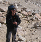
We took lots of pics. Some are silly, but it’s all about having fun on the trail!
Exploring the Front Country 3/3/09
-
EnFuego

- Posts: 677
- Joined: Mon Dec 15, 2008 11:14 am
Yeah, some of those pictures are pretty funny. You must have been having a really fun time out there.
I'm not real familiar with a lot of the hikes in the area you were in, but it all looks beautiful. I'm so unfamiliar with this area, I have no idea where you're talking when you mention "...... Eaton Canyon Natural Area in Pasadena..........old toll road up to Henniger Flats............Idlehour Trail........... Idelhour Camp. .........Inspiration Point. ..........Castle Canyon Trail,............Echo Mountain. .......... Lower Sam Merrill Trail. ...............Cobb Estate" Oh wait, I heard of Sam Merril trail once before. I think you mentioned it. I'm such a noob to this area of the San Gab's. It looks like low country. What was your highest peak? Looks beautiful though. Looks like a nice place to avoid snowy areas. Also looks like a really hot place during the summer.
Hmmmm???? I think I'll have to plan a couple hikes out there. You feel up for guiding a San Gabriel "Front Country" noob?
-
RyanB
- Posts: 17
- Joined: Sun Feb 22, 2009 10:43 am
I've done Echo Mountain and Sam Merrill/Castle Canyon trail to Inspiration Point. This is a unique area with a lot of history (Mt. Lowe Railway). Everyone should do this at least once. Nice pics.
-
Liz
- Posts: 218
- Joined: Mon Dec 22, 2008 8:59 am
Yeah, it was a nice hike! Plus our route took us through that lovely canyon, with Idlehour Camp. Very quiet and peaceful. As for Echo, I can imagine how it can be a zoo on the weekends. So I was happy to check it out midweek.
-
Hikin_Jim

- Posts: 4688
- Joined: Thu Sep 27, 2007 9:04 pm
That's a nice loop, isn't it? The front country of the San Gabriel Valley is really blessed. Because of the "Great Hiking Era" of the 1910's when trail camps and hiking were hugely popular, there's a plethora of really neat trails. Many of the places you can hike to and camp at today are the trail camps of yesteryear, Idlehour being a good example. It used to be that you could find old bed frames and some concrete and rock foundations at the Idlehour site. Did you see anything like that this trip?
Question: How bad was the poison oak down at the camp? Some friends of mine want to do an easy BP, and I was thinking of taking them there, but I'm not sure of the PO levels.
Was the trail out of Idlehour hard to find (going up to Inspiration Pt from Idlehour). The first time I was down there (80's), I didn't see the trail out. The last time I was there, I came from the opposite direction and it wasn't an issue. I'm wondering what your impression of that is.
-
Liz
- Posts: 218
- Joined: Mon Dec 22, 2008 8:59 am
I saw a little poison oak, but was easily able to steer clear. And all trails were easy to find! Cheers!
-
cougarmagic

- Posts: 1411
- Joined: Wed May 07, 2008 5:21 pm
Great TR and pics! That's a nice loop. I've seen most of that route, but never all in one day. I love Castle Canyon - I think it's a really beautiful trail.