

We pulled up to the locked gate that keeps everyone from going up any further towards Crystal Lake only to find a car sitting in the left lane facing downhill from the gate with three guys sitting in it – mind you this was 6:15AM so I approached thinking they were folks waiting for a ranger/sheriff to open the gate. As I got closer to the driver’s window I realized that the two gentlemen in the front seat were (I’m being kind here) pushing a body weight beyond 300+ lbs so I knew right away they were not here to hike. Then I thought I heard the gentleman in the back (which to this point I didn’t realize anyone else was in the car as it was still fairly dark out) saying something like “Do you have a Gun” ? It gave me pause for just a second before I said “What”? He said it again – but this time it was something to the affect – “Do you want to buy or do you have any Bud’s”? And he wasn’t taking about Beer? It was then that I realized that these guys had been sitting there all night and we stoned out of their minds – it was obvious that they’d been doing more than have a little hit off the old “Whacky Tobaccy”. I kindly said thanks but no thanks at which point I climbed back in my truck and said to Zach, “I think we had better find another spot to park as I get the feeling my rim’s and other parts of my truck will not be here when we returned”!
As soon as the sun came up we knew were going to have an outstanding day - So we headed down to where the West/East Fork Split(of the two forks of the river) and headed for Shoemaker Canyon Road and parked at the gate there. Quickly heading up the road we followed that dirt road all the way past the two tunnels until it stop being a road, dipped across a small gulley and followed the shoulder above Allison Gulch and that path soon became a faint but easy to see trail. After 5 minutes of hiking we could see that we needed to go left uphill and gain the ridgeline above, so we did. Up to this point we were completely dry as there was some snow on the ground and some frozen puddles on the road but no real wet spots to worry about. That changes as soon as we started heading uphill, the brush was covered in 3 inches of soft, wet snow which stuck to us quickly, soaking us from the elbow to our feet, there was no avoiding it.
The first ridge line/notch was a steep section then it mellowed out for a bit then got steep again. The trial was not standing out so we had to use a little scouting and make our own switchbacks here and there but it wasn’t that hard to figure out. As we got higher to the next notch following the same ridge line we were finding more and more bush whacking and scrambling that had to be done as the snow was weighing down the branches of most of the foliage putting it in our path. That did not stop us, we had absolutely perfect sunny views of all the peaks north and east of us – Iron looked majestic, Ross was as white covered as I had ever seen it, West Baldy and Badly were as inviting as it gets, the whole ridgeline that is due north showing Hawkins, Burnham and Baden Powell was now clearly visible. We were stoked to be out enjoying this scramble.
After 4 or 5 notches we came to some very exposed spots, little saddles if you will that had steep fall-offs to the north east leading down Rattlesnake Canyon. We took our time here as we did not bring the crampons and the granite underneath the snow here, some 6 to eight inches gave us reason to be extra careful. Soon we were looking up at two medium sized points that were covered in snow separated by 100 yards and we mistakenly assumed that they were the last of the false summits that we’ve read about in previous trip reports – twenty minutes later we crested the first of these to get a fantastic view of all the ridges, peaks and terrain to the west of Rattlesnake and new that we had made it, what a feeling that was. Five minutes later we were sitting on top of the real Peak pulling on the wire that the folks who put the can up there leave attached to the “Register Can” so when you find deep snow you can still find the can to sign in. We dug the wire out, moved a few rocks and found the can, signed in and sat down to enjoy lunch. The snow on the summit was up to our waist and for the last 45 minutes of climbing we could feel the transition layer between the old snow and the fresh powder that had fallen over the last couple of days – the layer underneath was crunchy and slick, when we get the next storm this is going to make things even more unsafe, so if you decide to do this hike after the next storm, be extremely safe we may see some slides.
Having gained the summit and now realizing that the ridge due south of the peak had a trail that was easy to follow, similar to what you find on Devil’s Backbone, we headed south enjoying the views as much as we could as the clouds from the west had finally pushed in from the ocean and were covering all the summits that stood above 7,000 feet blocking our views of those upper reaches. This trial was easy to follow and both of us were surprised to see how well it’s been maintained as everything we read made it sound as if this trail was a total bush whacking adventure.
This trip was somewhat of an expedition to figure out what ridges we might follow on the “Death March” mentioned in another blog. Having followed the ridge that goes North/East, South/West all the way back to the road, it’s my opinion that this is the easy access up to Rattlesnake peak and there’s less bush whacking between Rattlesnake and S. Hawkins if you drop back down to the first saddle south of Rattlesnake before making a direct B-line towards S. Hawkins as the brush near the summit of Rattlesnake is extremely tall and dense.
On a scale of 1-10, 10 being best this hike because of the medium amount of snow, complete solitude, exceptional views and present company was in the 8-10 range for a perfect day hike.
Going up the road towards the first Tunnel - Puddles still frozen.

Close up of Iron as the sun is cresting it's summit
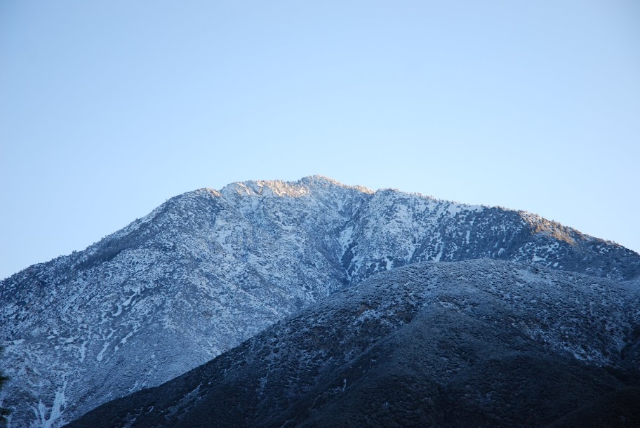
Iron and Baldy as the sun is coming up.

Iron before the sun melted the snow on the lower elevations later that day.

Approaching the first tunnel - a little chilly outside.

Lilbitmo in front of the first tunnel.

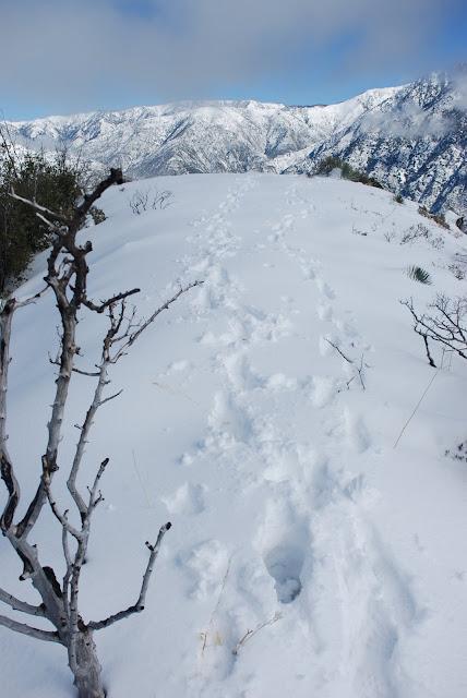
Following the tracks in the snow on the road.

Close up of track for "Cougarmagic" to identify.

Vegitation we waded through on the way up the first ridgeline.

Zach with Iron behind him.

Looking East/Northeast - Iron,Baldy and the ridgeline for Baden Powell - doesn't get much better than this in Southern Cal winters.

Slightly different angle from same spot.

Ridge we took to the summit-going left to right across this picture - see the road ends at the middle of this picture - trail starts just to the left of that.

Virgin snow ahead approaching the last 75 yards of the real summit.

Working our way for the last 30 yards.

Footprints of that wild beast called "Homo Sapiens"
Zach enjoying lunch on the summit - could he look any happier?

The register can after digging it out.

Ridgeline trail that goes South/West, North/East that we followed all the way back to the road - much easier.

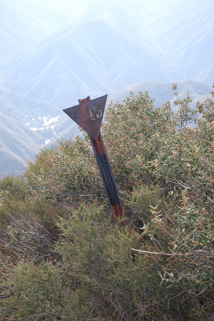
Can anyone please identify these signs we ran across on the ridgeline coming down and what their purpose is?
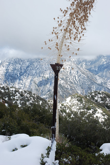
Another one
Nice work Zach
Everyone enjoy.
Lilbitmo


