
From an unusual source, "Westways", an AAA -- not an AARP -- publication:
http://files.me.com/emanla/nf3s85
It may take a minute to load, for some reason. Please excuse the delay.
PHOTOS - Post or link to pictures!
-
Dave G

- Posts: 321
- Joined: Sun Jun 22, 2008 9:51 am
Very cool 8) . Speaking of historical Baldy images, I would love to see what the cable "handrail" along DBB looked like when it was intact.
-
Terry Morse
- Posts: 126
- Joined: Mon Mar 03, 2008 8:55 pm
Dave, I have a picture of the handrail in an old 1972 hiking book called, "100 hikes in California" by Don & Roberta Lowe. Maybe on a hike with you & Norma in the future, I'll bring it along to show you.
-
Dave G
- Posts: 321
- Joined: Sun Jun 22, 2008 9:51 am
Deal!Terry Morse wrote:Dave, I have a picture of the handrail in an old 1972 hiking book called, "100 hikes in California" by Don & Roberta Lowe. Maybe on a hike with you & Norma in the future, I'll bring it along to show you.
-
PackerGreg

- Posts: 623
- Joined: Sat Sep 12, 2009 9:31 pm
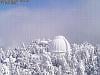
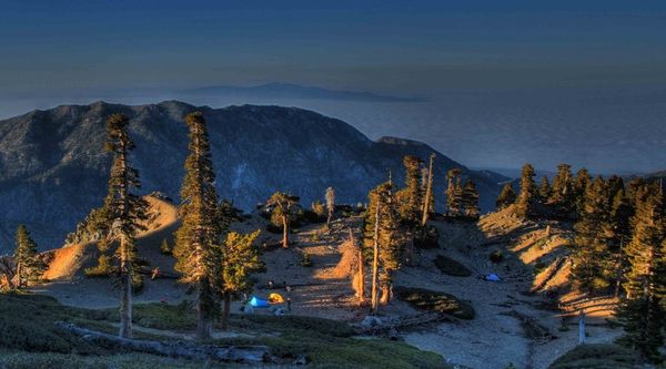
I love when the full moon allows the Mount Wilson webcam to capture more than the security light below the dome...

-
EManBevHills

- Posts: 387
- Joined: Fri Sep 28, 2007 12:40 am
Here's a novel approach to getting the image that you want which might be of interest:
http://www.wired.com/gadgetlab/2010/04/ ... hd-videos/
http://www.wired.com/gadgetlab/2010/04/ ... hd-videos/
-
norma r

- Posts: 707
- Joined: Thu Nov 06, 2008 4:22 pm
cool! did it catch the Atherians on Baldy last night? 
-
PackerGreg
- Posts: 623
- Joined: Sat Sep 12, 2009 9:31 pm
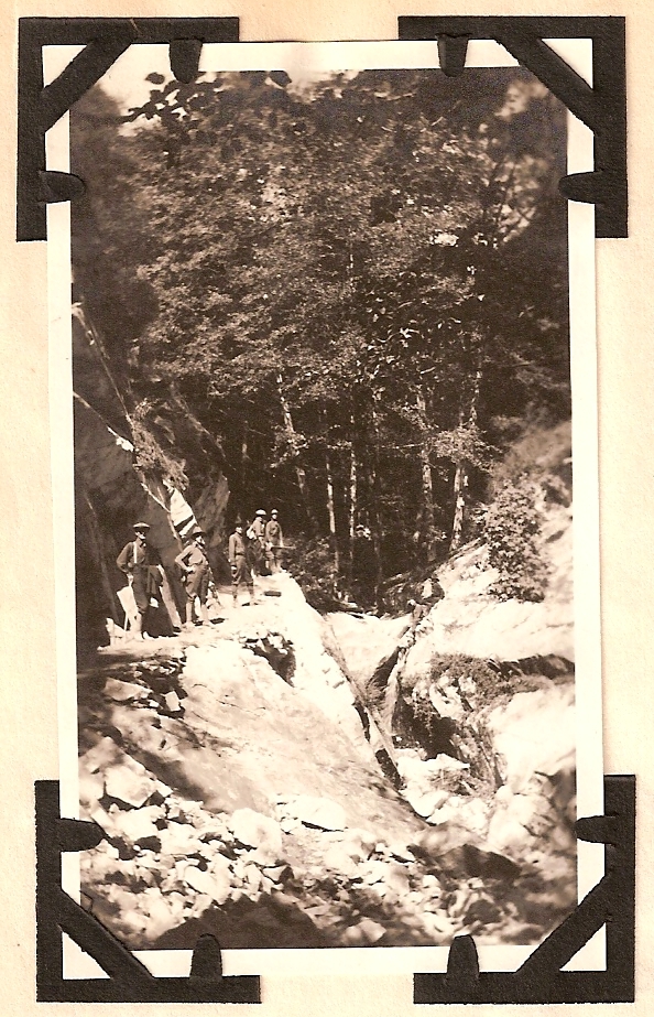
Another scan from the San Antonio Hiking Club's log book. This is the Upper Falls Trail above Sturtevant Falls - October 10th, 1920...
-
PackerGreg
- Posts: 623
- Joined: Sat Sep 12, 2009 9:31 pm
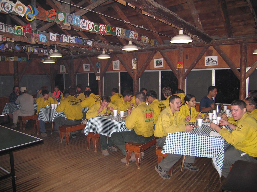
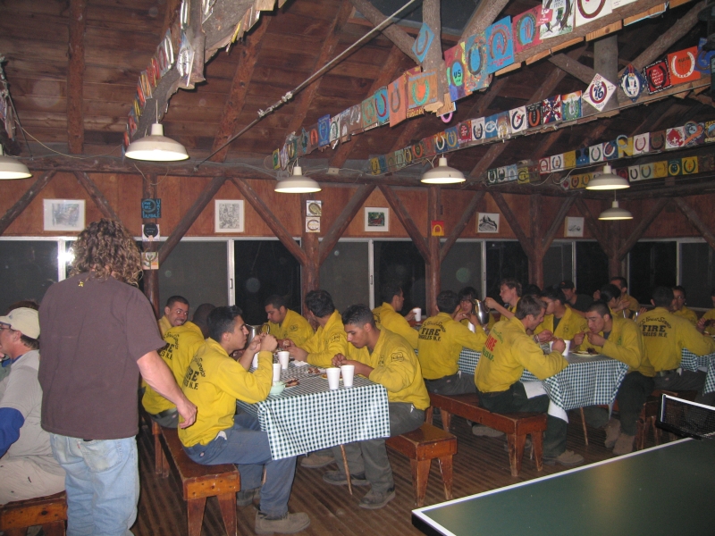
The crew eating BBQ dinner at Sturtevant's Camp after clearing the Mt. Zion Trail in Big Santa Anita Canyon. Chicken, ribs, beans, rice, corn-on-the-cob, salad, and cake. Pancakes and sausage the next morning. All paid for by hiker donations, packed in on donkeys, and cooked by volunteers.
-
PackerGreg
- Posts: 623
- Joined: Sat Sep 12, 2009 9:31 pm
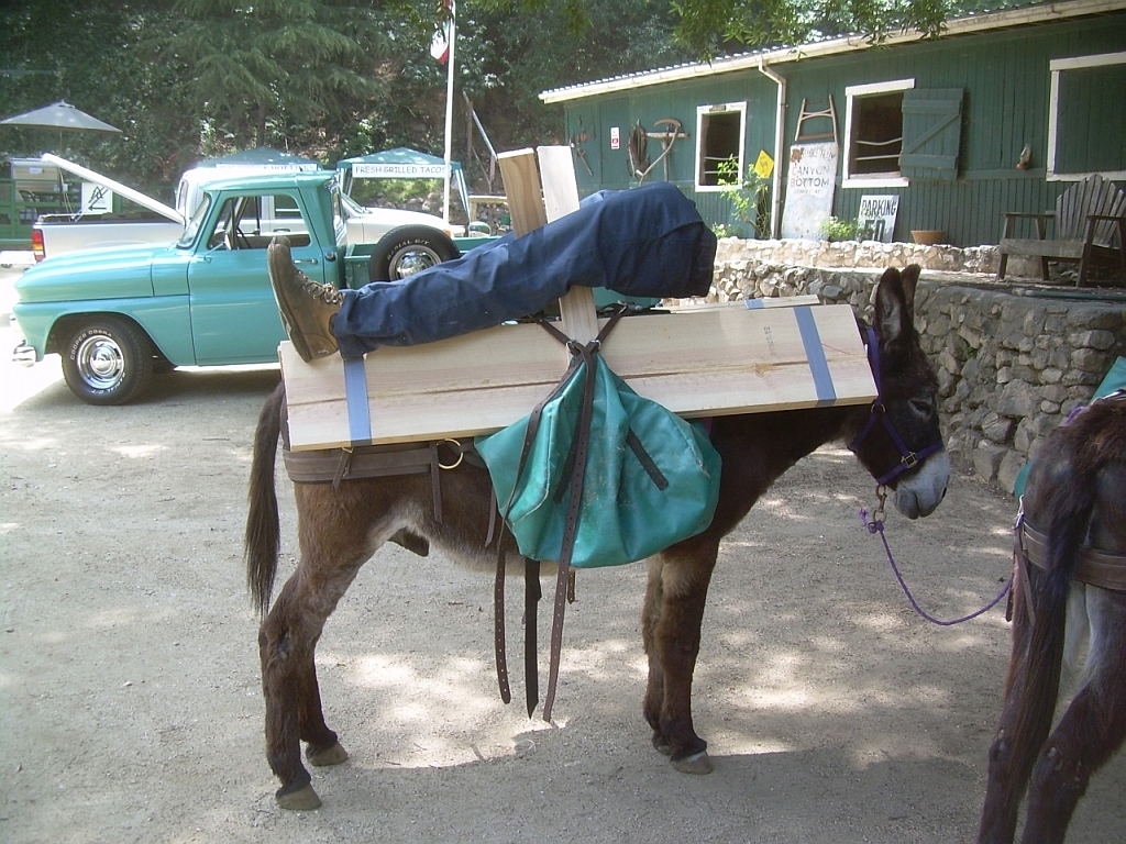
That's the bottom half of a mannequin that I packed into Winter Creek. The mannequin was used by the owner of cabin #130, near Hoegee's Campground, for training new guys at his job. The owner of #127 had planned on cleaning out the crawl space under cabin and #130 wanted to have these legs stuffed under there, apparently to cause an amusing heart attack. The surprise was successful (sans heart attack), and I'm sure #127 has a retaliation planned.
People have asked me about the strangest thing that I have packed. This is the clear winner. He is loaded on donkey Bill, who died last year at about 32 years old. He was the guy on which you could load anything, but even he looks a little spooked (note the upright ears).
People have asked me about the strangest thing that I have packed. This is the clear winner. He is loaded on donkey Bill, who died last year at about 32 years old. He was the guy on which you could load anything, but even he looks a little spooked (note the upright ears).
-
Taco

- Snownado survivor
- Posts: 6218
- Joined: Thu Sep 27, 2007 4:35 pm
Rest in peace, Donkey Bill.
Yeah, that is a bit strange. It would be fun to see people's faces as they watch you take that down the trail on Bill's back.
Yeah, that is a bit strange. It would be fun to see people's faces as they watch you take that down the trail on Bill's back.
-
PackerGreg
- Posts: 623
- Joined: Sat Sep 12, 2009 9:31 pm
I did overhear some comments, but they were all in Korean, so I don't know what they said... I have nicknamed the Winter Creek loop the "Hoegee Min Trail" 
-
Hikin_Jim

- Posts: 4688
- Joined: Thu Sep 27, 2007 9:04 pm
-
PackerGreg
- Posts: 623
- Joined: Sat Sep 12, 2009 9:31 pm
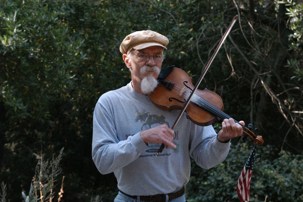
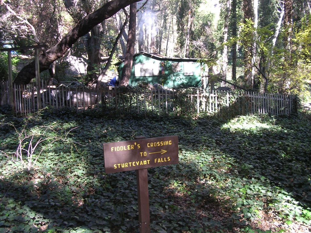
Mike "The Fiddler" Pauro and his cabin/crossing...
-
outwhere

- Posts: 323
- Joined: Sun Jan 25, 2009 5:40 pm
Nice 1 PG - I would love to see more and more pics of the cabins in the Big Santa Anita canyon - particularly the ones along the Lower Winter Creek trail. Must be verrrrrrry interesting living in those cabins.
-
PackerGreg
- Posts: 623
- Joined: Sat Sep 12, 2009 9:31 pm
@ Outwhere: somewhere I have photos inside cabins #130 & #138 (old computer, CD,..?) in Winter Creek. I will try to find them. The old computer also may have photos inside #'s 115, 116 & 117 - also Winter Creek, just above Roberts' Camp.
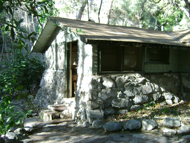
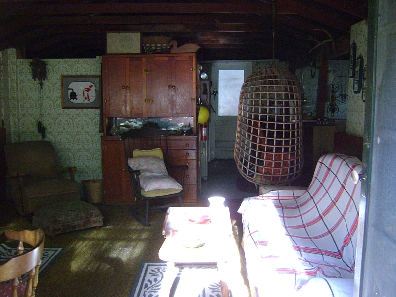
Here are some of cabin #62 across form Fern Lodge, on the way to Sturtevant Falls. This cabin is owned by Glen Owens, president of the Big Santa Anita Historical Society and publisher of most of John Robinson's books. If you put a flashlight up under the kitchen sink cabinet, you can see a board that is inscribed by the lumber mill directing the load to be delivered to Charley Chantry's pack station in Sierra Madre!
Front of the cabin:
Living room looking out:

Living room looking in (I really didn't want to know about the basket chair):
Fireplace:

Chairs & Cuckoo clock:
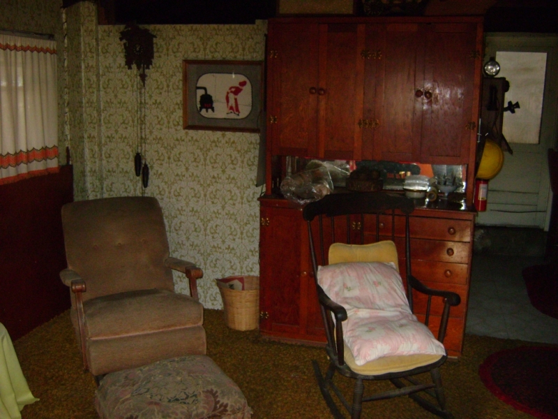
Propane fridge & crank phone (both operational):

Counter & bedroom:

Here are some of cabin #62 across form Fern Lodge, on the way to Sturtevant Falls. This cabin is owned by Glen Owens, president of the Big Santa Anita Historical Society and publisher of most of John Robinson's books. If you put a flashlight up under the kitchen sink cabinet, you can see a board that is inscribed by the lumber mill directing the load to be delivered to Charley Chantry's pack station in Sierra Madre!
Front of the cabin:
Living room looking out:
Living room looking in (I really didn't want to know about the basket chair):
Fireplace:
Chairs & Cuckoo clock:
Propane fridge & crank phone (both operational):
Counter & bedroom:
-
Hikin_Jim
- Posts: 4688
- Joined: Thu Sep 27, 2007 9:04 pm
Cool vintage stuff! Is that refridgerator gas or electric? Does that old phone still work?
Thanks for the pics!!
HJ
Thanks for the pics!!
HJ
-
outwhere
- Posts: 323
- Joined: Sun Jan 25, 2009 5:40 pm
Oh man, I can smell the apple pie on the windowsill as I type, hope the bears dont!
More charming than I ever imagined... lighting that up that fireplace on a rainy winter day, that would be a treat.
Thanks a ton for sharing those pics PackerGreg - I always wondered what the inside of some of those cabins look liked.
Then on top of it, there's a bit of John Robinson/Glen Owens history to it all - fantastic! Glen did a splendid job with that cabin - it's really got a feel to it...
Only problem with the pictures - I want MORE! [greed can be a bitch sometimes]
Tonks again...
-
PackerGreg
- Posts: 623
- Joined: Sat Sep 12, 2009 9:31 pm
Jim,
The fridge is an old Servel (brand) from the 1950's that runs on the propane that the donkeys pack in, and in the old days they used butane. Many of the cabins have these, although some are "newer" like you would find in an RV. The crank phone does work and it is connected to the other cabins, as well as Sturtevant's Camp and Adams' Pack Station. The phone system is thought to be the last of its kind in the US, after a town in Maine got "real" phones around 1985. The phones are a ten-mile party line where anyone can listen in. For that reason I dubbed it CT&T (Canyon Telephone & Tell everyone). The call boxes in BigSAC are also connected. One ring for the pack station (and emergencies), two for Sturtevant's, and three rings means everyone picks up.
The fridge is an old Servel (brand) from the 1950's that runs on the propane that the donkeys pack in, and in the old days they used butane. Many of the cabins have these, although some are "newer" like you would find in an RV. The crank phone does work and it is connected to the other cabins, as well as Sturtevant's Camp and Adams' Pack Station. The phone system is thought to be the last of its kind in the US, after a town in Maine got "real" phones around 1985. The phones are a ten-mile party line where anyone can listen in. For that reason I dubbed it CT&T (Canyon Telephone & Tell everyone). The call boxes in BigSAC are also connected. One ring for the pack station (and emergencies), two for Sturtevant's, and three rings means everyone picks up.
-
mve
- Posts: 414
- Joined: Fri Dec 11, 2009 12:53 pm
-
PackerGreg
- Posts: 623
- Joined: Sat Sep 12, 2009 9:31 pm
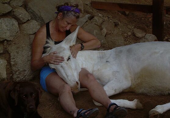
Deb Burgess, owner of Adams' Pack Station, holding her baby, Moonshine.

-
PackerGreg
- Posts: 623
- Joined: Sat Sep 12, 2009 9:31 pm
Somewhere online I found photos of old trail signs from Big Santa Anita Canyon. These were the government issue before Glen Owens and the Big Santa Anita Historical Society replaced them with new etched stone tile signs in the... early 90's?
These would look good on the wall of the pantry inside my garage but, alas, I am not allowed to own such federal property; even if it would have been tossed in the garbage long ago. I wonder what ever happened to those signs?
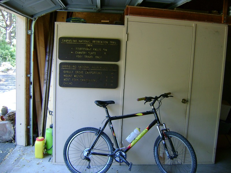
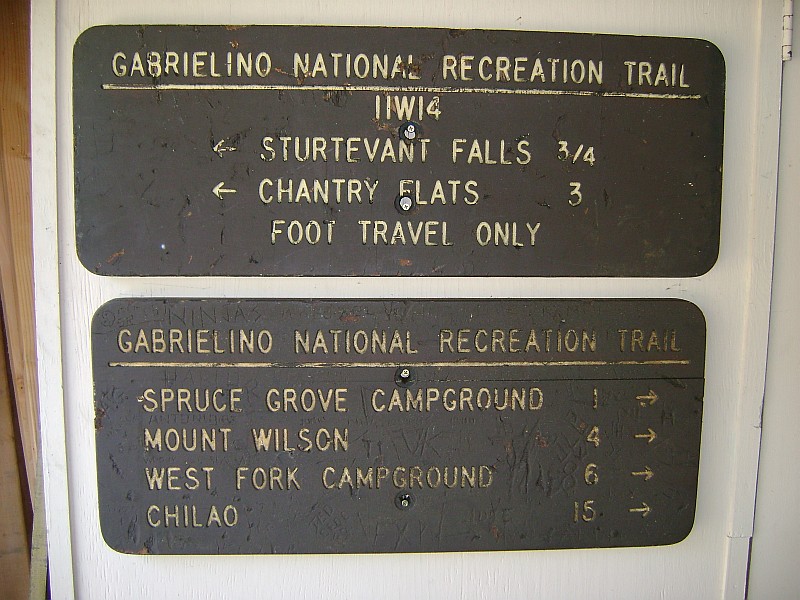
These would look good on the wall of the pantry inside my garage but, alas, I am not allowed to own such federal property; even if it would have been tossed in the garbage long ago. I wonder what ever happened to those signs?
-
Hikin_Jim
- Posts: 4688
- Joined: Thu Sep 27, 2007 9:04 pm
It's a mystery where things like that go, isn't it? Glad you found those pics, um, on the internet.
HJ
HJ
-
caliguy92832
- Posts: 20
- Joined: Sun Jul 25, 2010 2:31 pm
-
PackerGreg
- Posts: 623
- Joined: Sat Sep 12, 2009 9:31 pm
I've seen those - very cool! Also, a backdoor here on satellite images for the transverse ranges (including the San Gabes) @http://130.166.124.2/ca_panorama_atlas/page5/page5.html, as well as the rest of California (left column links).
-
HikeUp

- Posts: 4099
- Joined: Thu Sep 27, 2007 9:21 pm
Wow. It makes the San Gabriels look so small...

