Red Box, Barley Flats truck trail, Lawlor, Cable route

TRs for the San Gabriel Mountains.
User avatar
dima
Posts: 1816
Joined: Wed Feb 12, 2014 1:35 am
Location: Los Angeles

Post by dima »

Anticipating some future trail restoration efforts, I'm thinking of potential loops, and of trails that I wish were usable. One of these is the old powerline road from Red Box to Barley Flats. I've never been on it, but heard that it is quite abandoned. Today I saw it. It's abandoned indeed, but mostly just overgrown, and very clean-up-able.

The start is in the pullout just past Red Box. The beginning chunk overlaps with the boring way to Strawberry that lots of people hike for some reason. There was a cable here:

Image

Much more on that later. Initially, this is a nice, clean old road

Image

Then after a bit you hit a junction: the trail to Strawberry goes left, and the Barley Flats road goes straight. This is blocked off, because abandoned.

Image

It's not bad. This road was used to service the powerlines. At some point newer power towers were built, with a wider spacing and a slightly different routing. Initially and at the end the new towers are in the same locations, and the road is clear. In the middle they diverge, and the road is overgrown. The route has at least a narrow footpath everywhere, and there's sign of old trail maintenance everywhere. I did a lot of cutting, and it is better now. With a dedicated effort this can be restored quickly-ish.

This old power tower was cut down (the clean stump is on the right of the photo):

Image

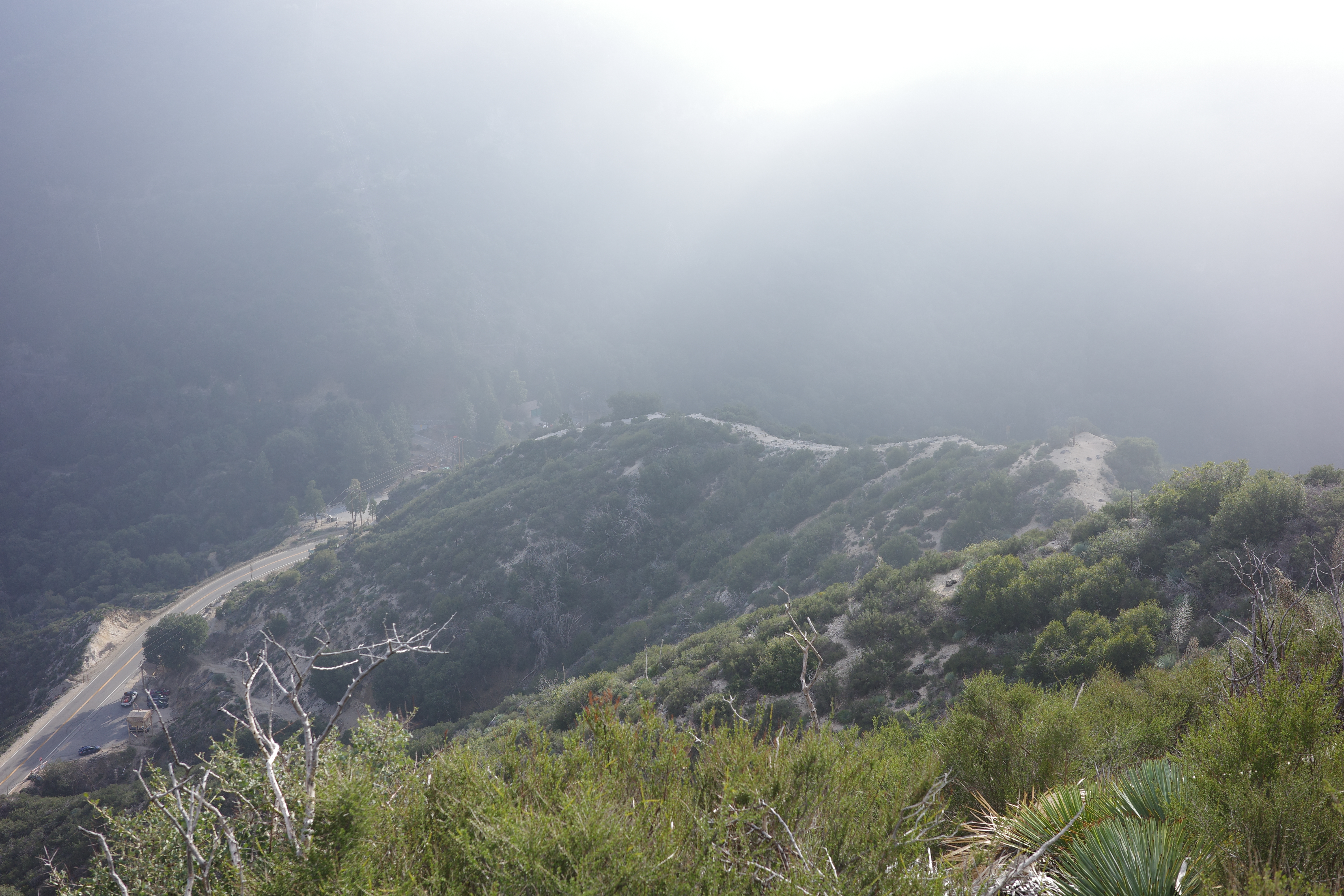
Eventually you emerge to the semi-maintained road:

Image

Image

And you can see Barley Flats

Image

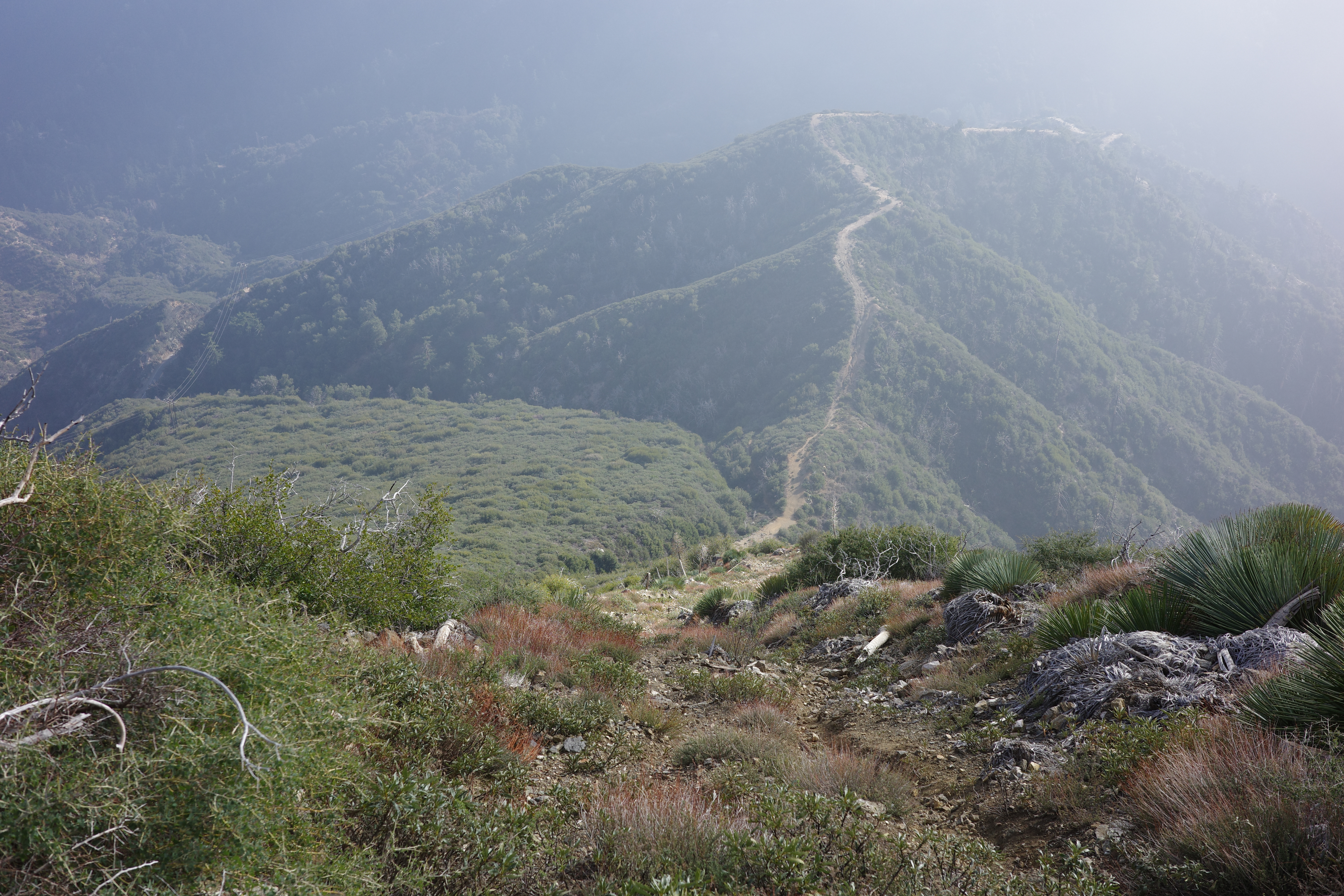
I've been there before, and didn't feel like walking the maintained road all the way there. Instead, I turned left onto the ridge. This has a good currently-overgrowing-but-not-yet-overgrown firebreak:

Image

And you get a good look all the way down the ridge:

Image

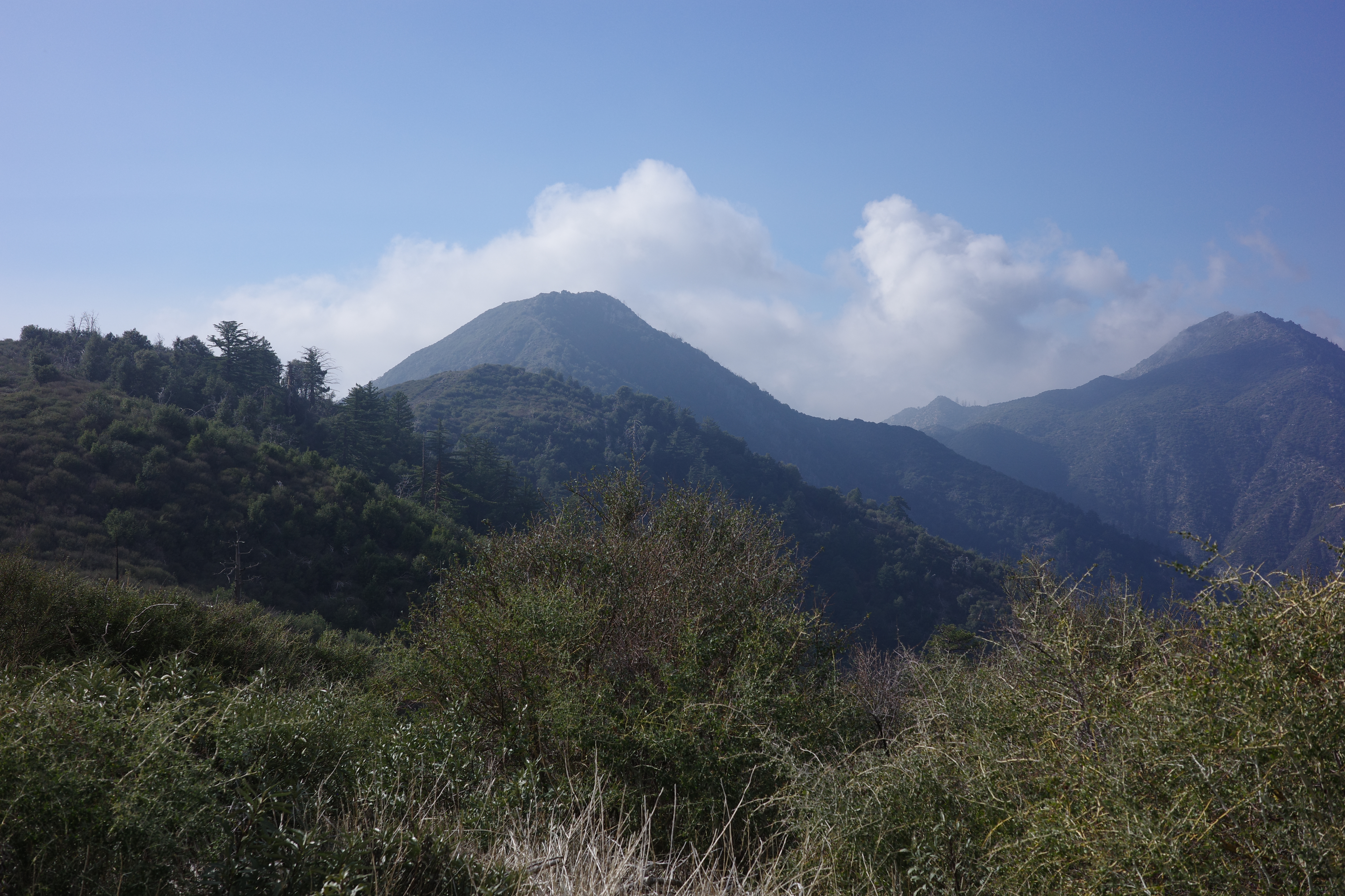
Lawlor on the left, Strawberry on the right, and Josephine peeking above the Lawlor-Strawberry saddle. I'm going up to Lawlor:

Image

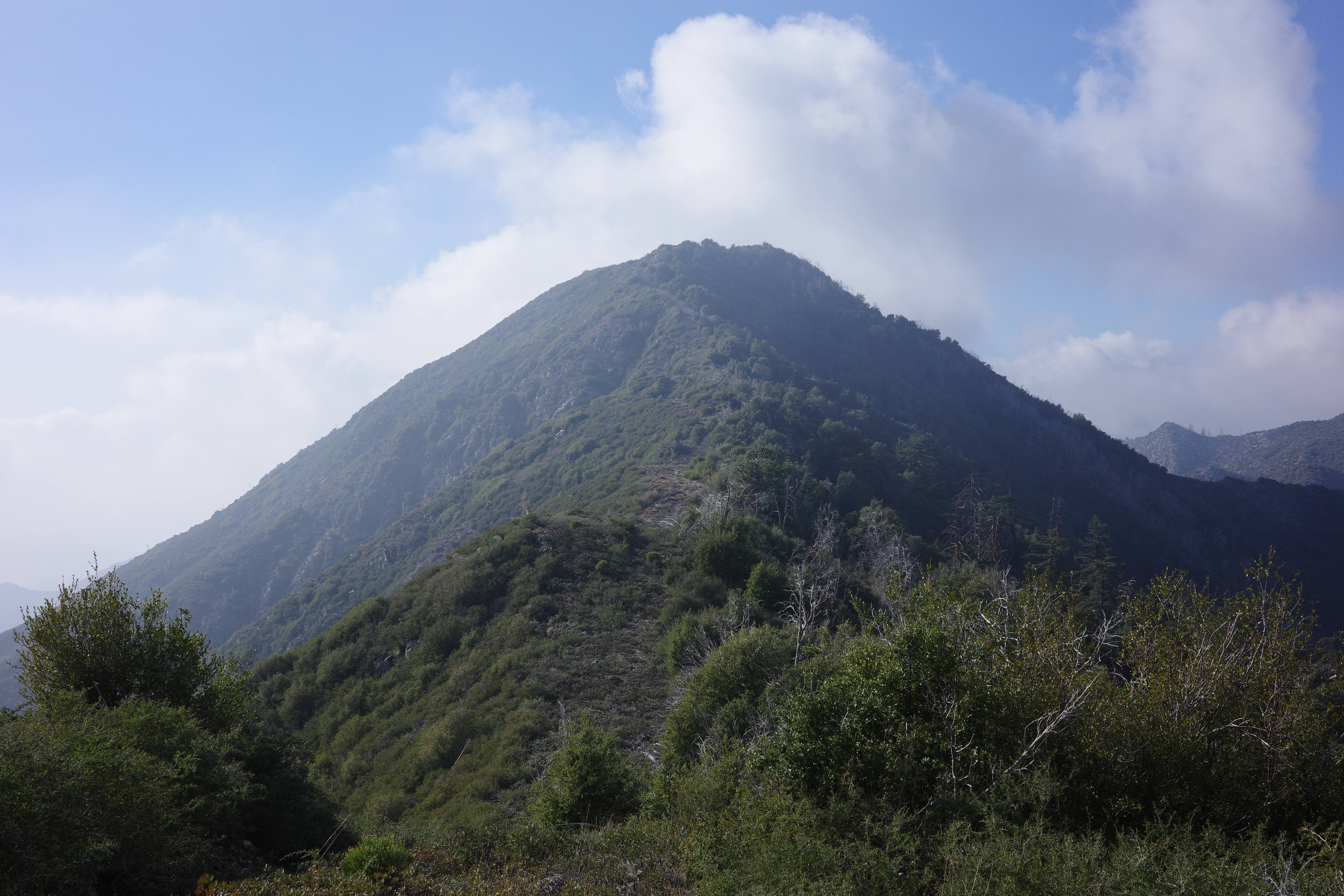
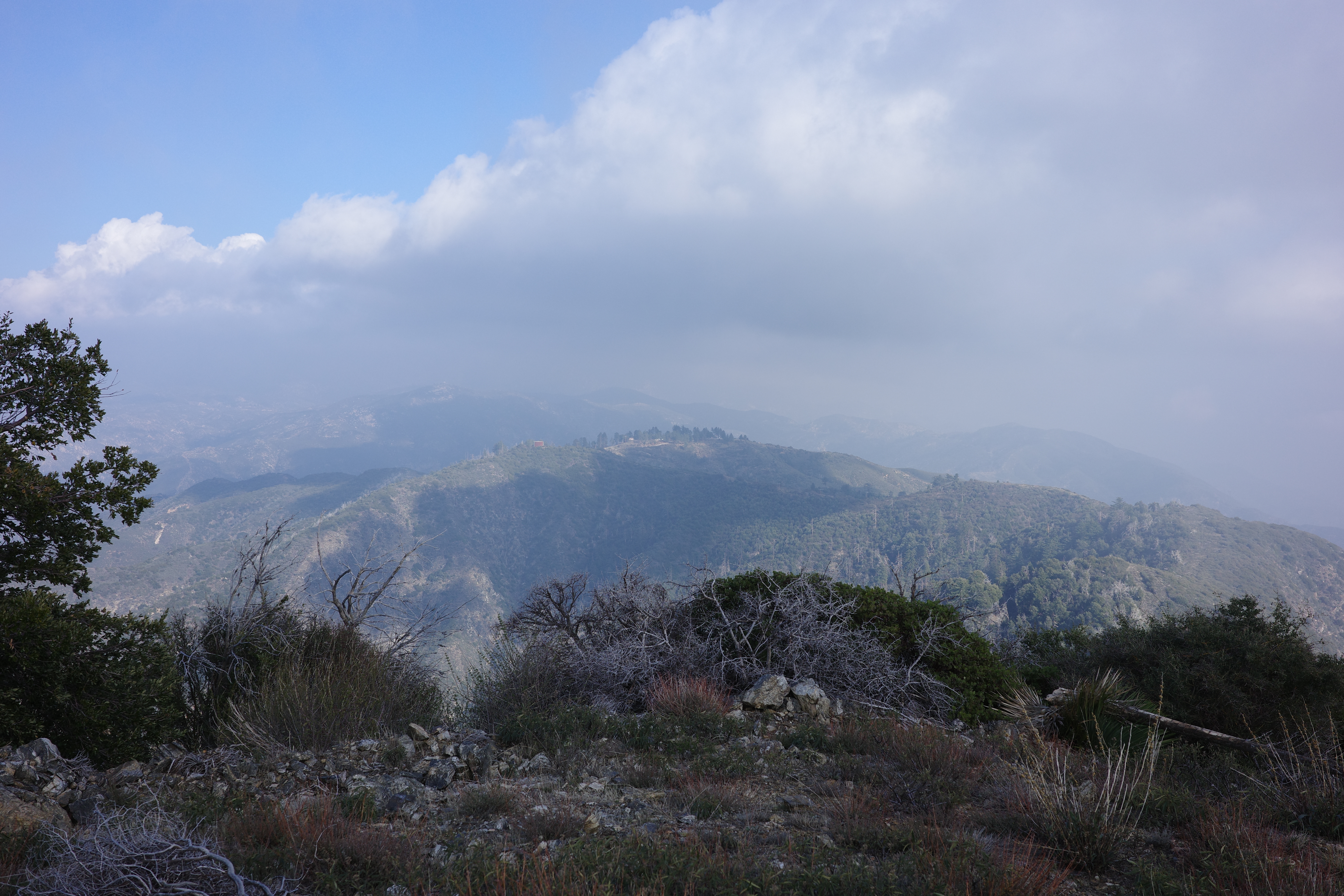
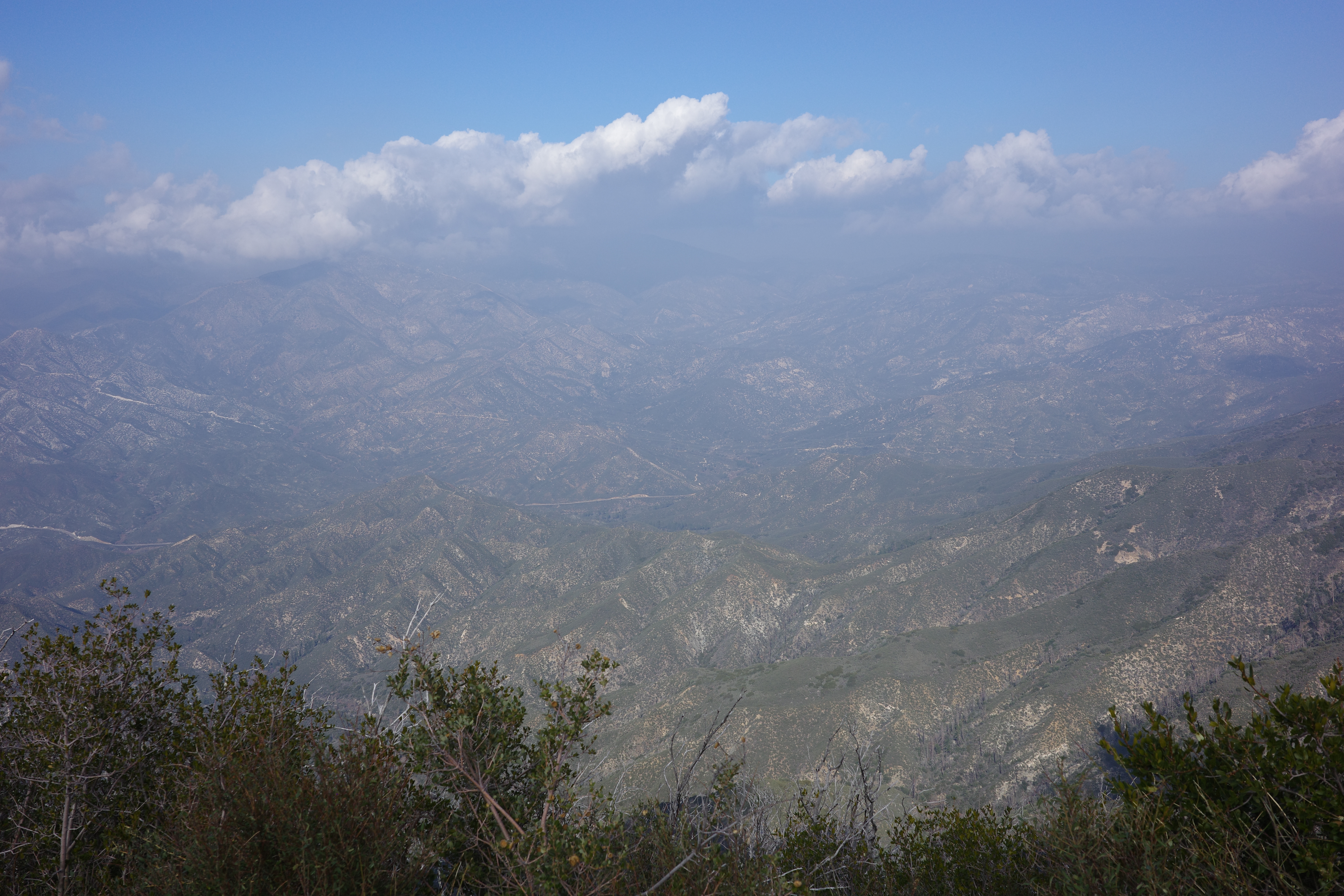
The firebreak runs all the way to the peak. This is straightforward. Views from the top:

Image

Image

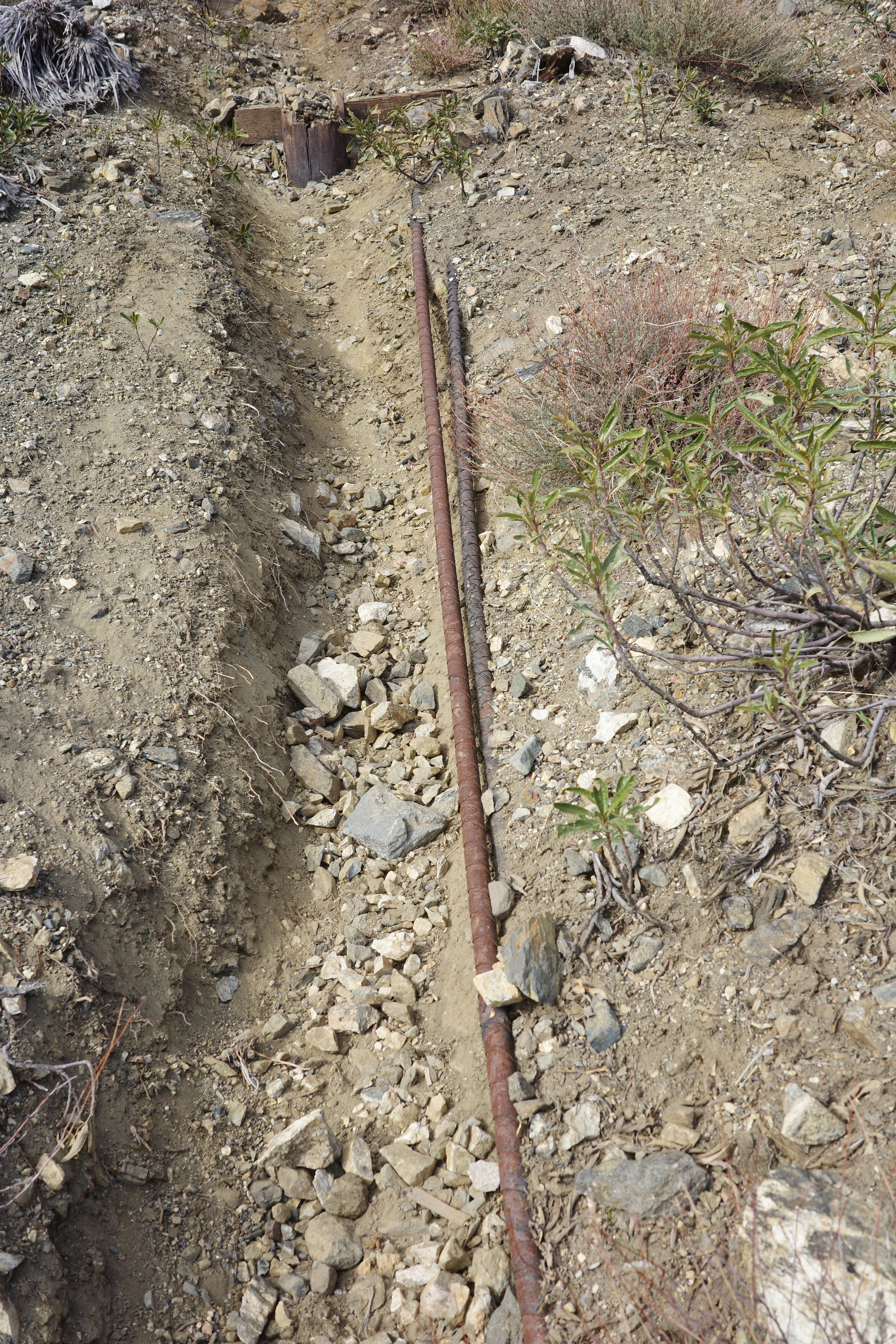
The South ridge of Lawlor runs straight down, directly to Red Box saddle. There's a "cable route" there that is silly steep, and was full of yucca when I was there last. The yucca is gone, but it is still silly steep

Image

Erosion has exposed the cable in spots

Image

Image

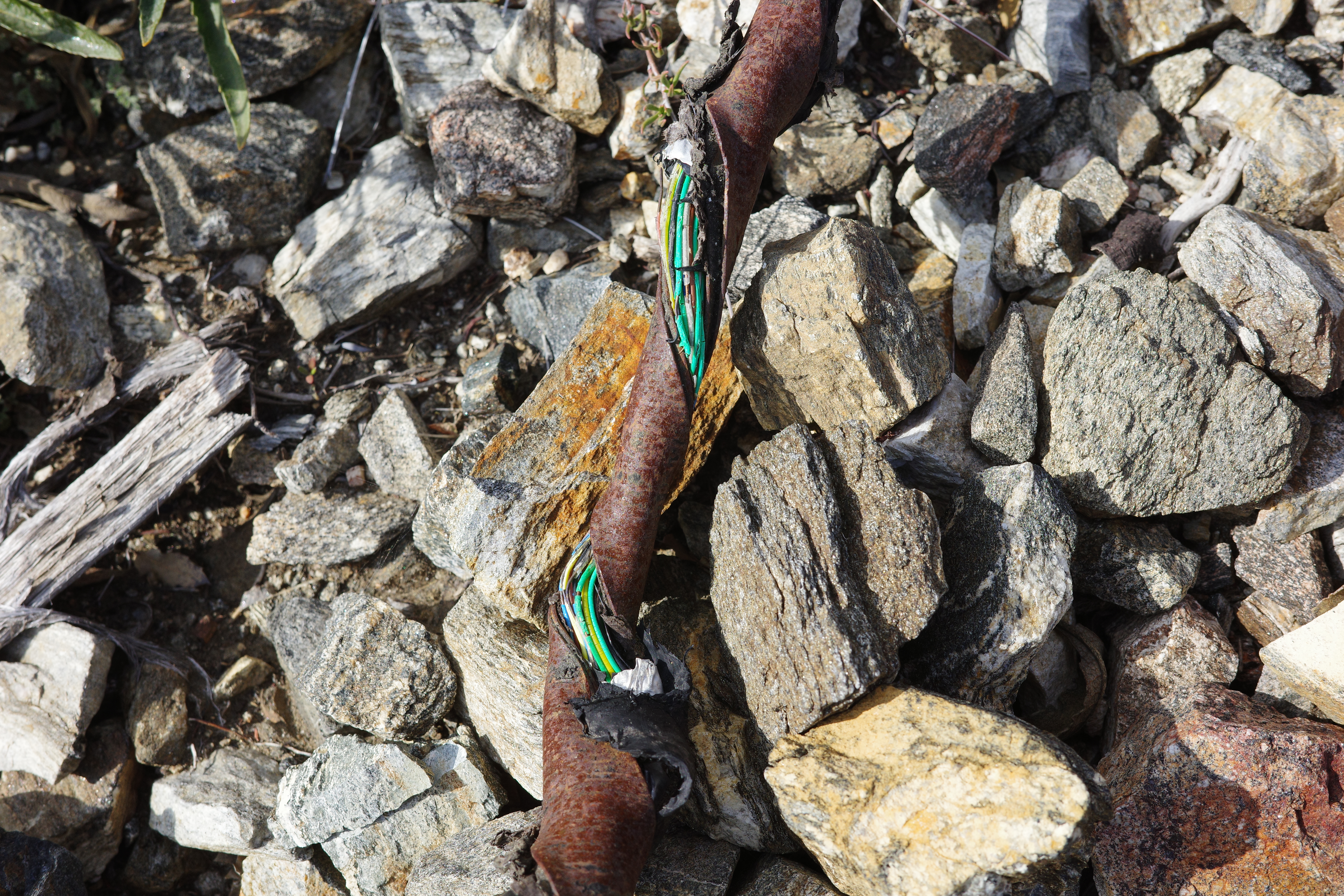
Looking back up at a section. Silly.

Image

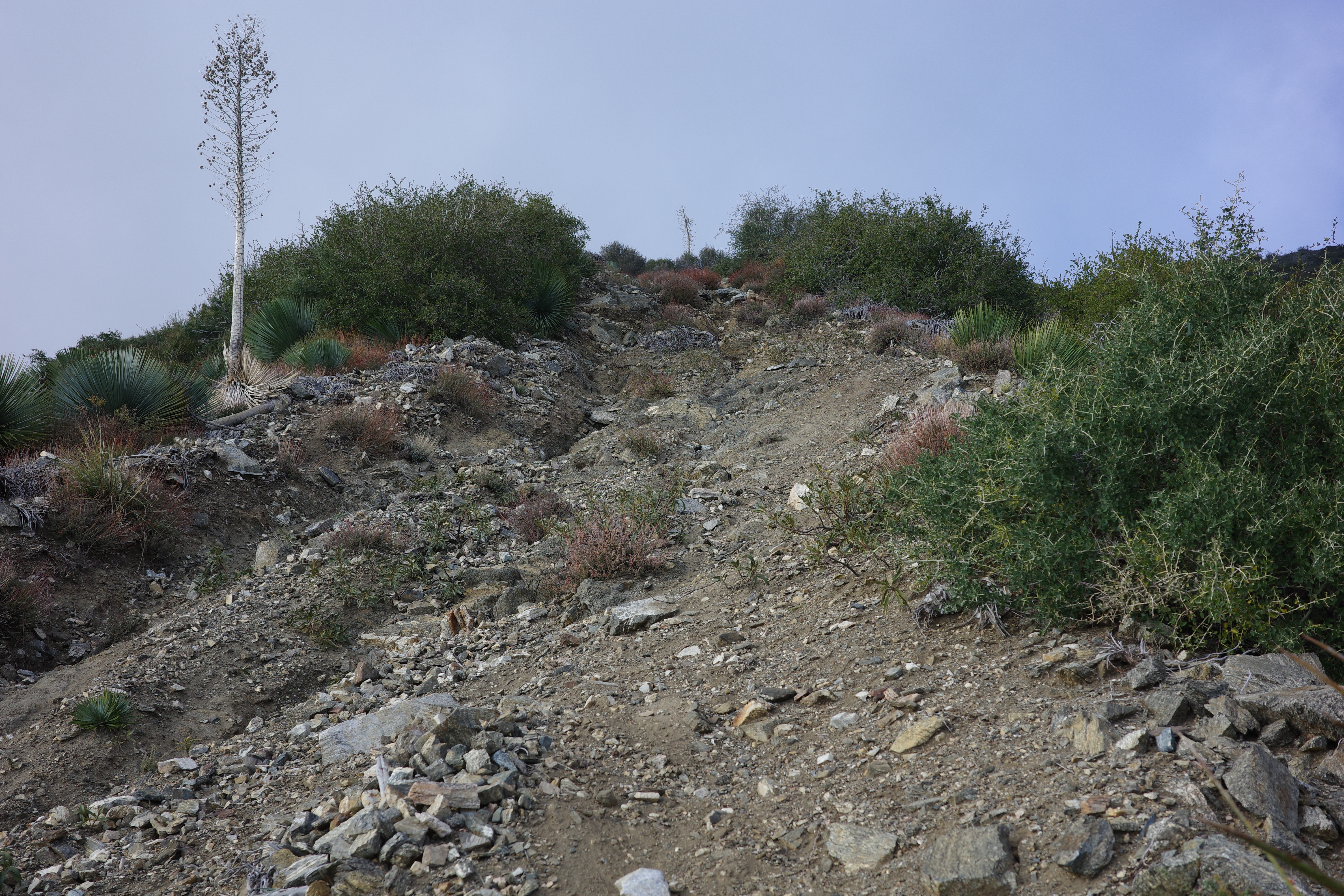
The bottom of the route runs directly to the top of the road cut above the ACH

Image

This was annoying to negotiate before, but the workers doing maintenance of the power tower there recently cleared a trail down to the trailhead, and this is now a breeze. This was a nice, quick outing. Not the greatest area to hike, but if this road and some trails around it were restored, would make for some good biking.
User avatar
mikeywally
Posts: 16
Joined: Wed Nov 03, 2021 7:05 pm

Post by mikeywally »

this MIGHT be from "history of pasadena." i don't know where this is from but i had it copy pasted somewhere so i thought i would share it:

"Years ago, before the Angeles Crest Highway was a
reality, Shortcut Canyon felt the trod of many boots and
hooves. Its busy trail, built in 1893 by Louie Newcomb,
Arthur Carter and John Hartwell, was the major route
into the Charlton Flat-Chilao-Buckhorn backcountry. The
canyon and trail were so named because they greatly cut
the distance into the mountain interior. The old route was
the steep Indian footpath up Valley Forge Canyon and
over Barley Flats, now completely disappeared
. Today,
although the old Shortcut pathway is no longer a major
artery of· travel, it is part of the Boy Scouts' Silver
Moccasin Hike across the range from Red Box to Mt.
Baden-Powell . . ."

I wonder if the valley forge canyon is hikeable or not.

i also wonder how indians got from barley flats to chilao area. im assuming folks walked east to around shortcut saddle.
User avatar
dima
Posts: 1816
Joined: Wed Feb 12, 2014 1:35 am
Location: Los Angeles

Post by dima »

Oh interesting. The modern day Shorcut saddle and pass and road sit E of Barley flat, but maybe that's not the original routing. Thanks for the info
User avatar
HikeUp
Posts: 4061
Joined: Thu Sep 27, 2007 9:21 pm

Post by HikeUp »

FWIW...

There's a trail that heads north out of Barley Flats that "ends" where Alder Creek crosses under Upper Big Tujunga (9-mile) Road. This is where you can continue on the Alder Creek Trail northbound, Chilao, and beyond...

The trail from Barley Flats to Alder Creek is currently being restored. It was clear and passable in 2009 (yeah, very up to date info, right?).
User avatar
dima
Posts: 1816
Joined: Wed Feb 12, 2014 1:35 am
Location: Los Angeles

Post by dima »

Yeah, I know :) That's why I wanted to see the Barley Flats truck trail. Cleaning that up will be the obvious next thing to do, but I bet it will be less work than fixing either of the trails.
User avatar
HikeUp
Posts: 4061
Joined: Thu Sep 27, 2007 9:21 pm

Post by HikeUp »

I don't know a damn thing about the trail from Barley Flats to Alder Creek, but it was a nice walk with great expansive views. How old is it? Is it a part of an historic route from wherever to whatever?
User avatar
dima
Posts: 1816
Joined: Wed Feb 12, 2014 1:35 am
Location: Los Angeles

Post by dima »

I dunno. But this dude has been there, before the new govt road from Mt wilson was completed (Sun, Sep 13, 1908 ·Page 82):
The_Los_Angeles_Times_1908_09_13_82.jpg
Then the new govt road was built, and there was much rejoicing (Thursday, August 23, 1928)
Pasadena_Star_News_1928_08_23_25.jpg
In any case, Upper BIg T road was built in the 1960s-1970s, so the trail probably was built or at least became much more used then (Mon, Feb 22, 1965 ·Page 3)
Pasadena_Independent_1965_02_22_Page_3.jpg
You do not have the required permissions to view the files attached to this post.
User avatar
AW~
Posts: 2106
Joined: Mon Oct 01, 2007 12:00 pm

Post by AW~ »

mikeywally wrote: Fri Jan 23, 2026 10:36 pm i also wonder how indians got from barley flats to chilao area. im assuming folks walked east to around shortcut saddle.
Shortcut Saddle to Chalton Flats to Silver Moccasin trail.
Thats for that, because it leads to someone who has a noteworthy past, which ive joined the fray and looking into.
I think its an imperative to 'walk' this route to interpret her life correctly...which right now is history controlled by armchair idiots.
They would say that a white man interprets 'our' history...nice.
User avatar
mikeywally
Posts: 16
Joined: Wed Nov 03, 2021 7:05 pm

Post by mikeywally »

AW~ wrote: Mon Jan 26, 2026 9:30 am
mikeywally wrote: Fri Jan 23, 2026 10:36 pm i also wonder how indians got from barley flats to chilao area. im assuming folks walked east to around shortcut saddle.
Shortcut Saddle to Chalton Flats to Silver Moccasin trail.
Thats for that, because it leads to someone who has a noteworthy past, which ive joined the fray and looking into.
I think its an imperative to 'walk' this route to interpret her life correctly...which right now is history controlled by armchair idiots.
They would say that a white man interprets 'our' history...nice.
you are being vague. or maybe i'm so ignorant i can't understand you.
who is her? Toypurina?
and what history is controlled by armchair idiots? who are the armchair idiots? is it the archeological academic journals hidden by paywalls?
who is they? Toypruina's descendents? Serrano indians?

i guess my question is more specific. there's probably a couple or a few ways to get from shortcut to charlton. and a couple ways to go from charlton to chilao. it seems like the OG footpaths follow the water and don't tend to go on the ridgelines. i have a caltopo where i am, i dont know what the end goal is, but i have trails with dates and references to some history of when the trails were created. and after that data is collected then maybe realizations or new interesting avenues will reveal themselves. what portions of the 2 were ever footpath (because some writings about this make it seem like the 2 is the OG footpath)?

so the OG footpath went up valley forge canyon (is that passable now?) to barley flats, then took the path of least resistance to shortcut saddle. from there im asking if the OG footpath was the creek or the current trail (silver moc). both will get you to the charlton flat. charlton you can get into the east fork alder creek.

i guess im discovering now that you cant build a road in a creek, or its harder and it will wash out. so that's why the road cant be the footpath.

also as i undertand, mt. mooney was the original way up for a car? and that road went through the current caltrans 7 complex and into chilao?

it would be cool to build a map that you could scrub a timeline through and see how paths and infrustrcuture were added and taken away from the san gabriel area. thanks for being a part of my brainstorming session.

the ways that people used to drive to pacifico and horse flats were crazy back in the day. its hard to imagine. like actually hard to imagine that's why i want this timeline map that doesn't exist.
User avatar
AW~
Posts: 2106
Joined: Mon Oct 01, 2007 12:00 pm

Post by AW~ »

mikeywally wrote: Mon Jan 26, 2026 11:17 am you are being vague. or maybe i'm so ignorant i can't understand you.
who is her? Toypurina?
and what history is controlled by armchair idiots? who are the armchair idiots? is it the archeological academic journals hidden by paywalls?
who is they? Toypruina's descendents? Serrano indians?

...

it would be cool to build a map that you could scrub a timeline through and see how paths and infrustrcuture were added and taken away from the san gabriel area. thanks for being a part of my brainstorming session.

the ways that people used to drive to pacifico and horse flats were crazy back in the day. its hard to imagine. like actually hard to imagine that's why i want this timeline map that doesn't exist.
People who view things through romanticed eyes..yes. I just skip over the death threats that usually accompany them. Basically they all are descendants of toypurina(everyone is), and then if you question them, they are 99.9% not toypurina, but supposedly have that .01%. Our views are so much in opposition...its like there is a guy who is a "they"/adult baby. And he says that he is in solidarity with the tongva/chumash. Hes jewish.
I really want to avoid rustling up that sentiment.

And I just want to go on this segment on the route. We'll see. But in answer to your question, the AI has some leads. It has all the books and stuff.
No, the silver mocassin from Charlton. shortcut saddle to charlton was straight ahead...if you want more specific it might tell you exactly where it deviated fom angeles crest hwy to charlton...but in general say you follow angeles crest highway to charlton.
"To stay level, the Kizh/Tongva would have moved along the High Shoulder of the Big Tujunga drainage.

The Route: Instead of descending the modern switchbacks, you follow the 4,800′ to 5,000′ contour line.

The Benefit: By staying level, you keep your "eyes on the horizon." You maintain a visual lock on Vetter Mountain and the Charlton entry points.

The "Until": You only drop when the terrain forces a crossing. By staying high, you avoid the trap of the creek bed, where visibility is zero and flash floods are a variable.

2. The "Bench" Strategy

Between Shortcut and Charlton, there are several geological "benches"—flat-ish steps in the mountain side.

The Caches: This is where the Springs and Caches would actually be. A "Level" route allows you to check your stores without wasting calories on elevation gain.

The Invisible Path: This isn't a "trail" in the Forest Service sense. It’s a series of connected game trails and granite shelves that keep you just below the ridge (to hide from the wind) but well above the creek (to stay out of the brush).

If you follow the level trace, you’ll likely find that it leads directly to the Upper Feeders of the Big Tujunga, rather than the main creek crossing. You hit the water where it’s still small and easy to cross, maintaining your 5,000-foot "Rank" all the way into the Flats.""

Note: So supposedly there is a water source at the saddle. "1. The Ridge Point (Just East of the Saddle)

As you leave the Shortcut Saddle parking area and head toward Charlton Flats, the trail briefly touches the 4,800-foot contour on the shoulder of the ridge.

Coordinates: 34.2729° N, 118.0321° W

Significance: This is a dry staging area. Historically, this served as a vantage point to scout the path ahead before descending into the canyon.

2. The Mid-Slope "Spring Zone" (Shortcut Canyon)

Continuing toward Charlton, the trail wraps around the north-facing slope of the canyon. About 0.3 miles from the trailhead, you cross a drainage at approximately 4,800 feet.

Coordinates: 34.2741° N, 118.0305° W

Significance: This is where the "Contact Springs" mentioned previously are located. At this specific coordinate, the trail crosses a small gully where moisture is often present even when the surrounding chaparral is dry."