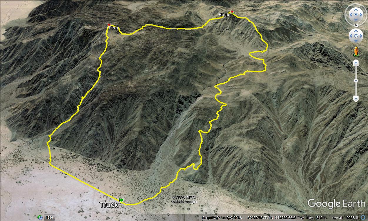
I walked the railroad tracks less than a mile before veering toward the steep ascent gully. I expected a solid 1500' scramble and was not disappointed. The gully was full of large boulders and dry falls. The ascent was a mix of class 2/3, but with careful route finding, most was class 2. From the top of the main gully, it was another 800' to the top of Fish. I found a benchmark, reference mark, and register placed in 1979 by Wes Shelberg. The prior entry in the register was from a year ago and was the only entry in 2020. The register was only half full since 1979.
Start of the gully
Scramble city
Looking over at Eagle from Fish
I dropped back onto the plateau and started down a long class 2 gully with toward Eagle. I was dumped out about 700' below Eagle in a confluence of canyons. I aimed for the slope left of Eagle and slowly picked my way up. At the bottom of the slope, I heard voices and saw a couple of hikers on the ridge on their way to Eagle. After fighting up to the saddle below Eagle, I was startled by an explosion above the summit. Some kind of loud fireworks had gone off and the sound echoed through the canyons. A second explosion quickly followed. In 15 minutes, I was on the summit with a party of six hikers and a dog. They were the vanguard of a larger group and set off the fireworks to let the others know they had reached the summit. I chatted with a guy named Alexis and discovered they were all local. I found no marks on Eagle, but register also went back to 1979. Based on the register, it was much more popular than Fish. I dropped down a steep, loose gully on the north side and regretted leaving the ridge. Even large, stable looking boulders were loose and could not be trusted. I ended up butt scooting down most of it, causing minor rock slides every other step. Once on the lower plateau, I eventually found the remnants of an old miner's trail and was able to follow it on and off for the rest of the descent. I got back about an hour before sunset.
Looking at Fish from Eagle
Crappy descent gully
Looking back at Eagle

