
Bobcat Fire in West Fork
-
dima

- Posts: 1930
- Joined: Wed Feb 12, 2014 1:35 am
- Location: Los Angeles
The incident page, with actual text: https://inciweb.nwcg.gov/incident/7152/
-
Sean

- Cucamonga
- Posts: 4415
- Joined: Wed Jul 27, 2011 12:32 pm
I think you're right, which means it's less than two miles from WilsonHikeUp wrote: I think Mt. Zion is burning.
and Harvard.
The tankers were hitting upper Santa Anita/Manzanita Ridge hard right before sunset.
Lower down the fire in Clamshell Canyon is threatening Arcadia above Elkins and Highland Oaks.
[Edited to add updated images of overnight fire progression.]
You do not have the required permissions to view the files attached to this post.
-
dima
- Posts: 1930
- Joined: Wed Feb 12, 2014 1:35 am
- Location: Los Angeles
So I'm hazy on the intent here. The last few days the fire was slowly creeping down the hillside. I don't know how difficult putting these out really is, but this thing was moving SO slowly. It couldn't be put out before burning Chantry Flat, and now threatening Mt Wilson? Was it the plan to fight it at the bottom?
-
Sean
- Cucamonga
- Posts: 4415
- Joined: Wed Jul 27, 2011 12:32 pm
Well, it's not clear if any structures have burned at the several affected recreational areas. I haven't heard of any property loss. Assuming they saved cabins and buildings, this was their primary intent after evacuating everyone. For days they've been constructing lines of defense around and inside these areas with vulnerable structures. If you watch the raw news footage you can hear chainsaws constantly going in the background at Monrovia Canyon Park. The Pack Station reported that the helicopters were dropping water on cabin sites in Big Santa Anita. Also, limited resources and smoke issues have hindered the aerial assault. Keep in mind too that this fire is immense, covering a large area with some dense canopy and steep terrain.
-
AW~

- Posts: 2124
- Joined: Mon Oct 01, 2007 12:00 pm
Its not considered an error although I think the fire operations 'surprised' them. Like you said, they had it, and then they didnt....badly.dima wrote: So I'm hazy on the intent here. The last few days the fire was slowly creeping down the hillside. I don't know how difficult putting these out really is, but this thing was moving SO slowly. It couldn't be put out before burning Chantry Flat, and now threatening Mt Wilson? Was it the plan to fight it at the bottom?
-
Sean
- Cucamonga
- Posts: 4415
- Joined: Wed Jul 27, 2011 12:32 pm
I don't think they ever had it under control. They only claimed a small percent containment on the east front, and that was due to the previous Ranch Fire burn scar. Also, I could tell that the wind shifted yesterday, because it was less smokey in the cities to the south where I live, and the towercam on Wilson was getting smoked in. So the wind started pushing the fire upcanyon.AW~ wrote: Its not considered an error although I think the fire operations 'surprised' them. Like you said, they had it, and then they didnt....badly.
-
HikeUp

- Posts: 4098
- Joined: Thu Sep 27, 2007 9:21 pm
Is there a "formal" name for the ridge between Big Santa Anita-Winter Creek and Little Santa Anita?
Any way...I hope they can keep it out of Little Santa Anita.
One of those Arcadia webcams shows the fire making a run up the east face of this ridge towards the San Olene Communication Site at the top of 2N41.2
Any way...I hope they can keep it out of Little Santa Anita.
One of those Arcadia webcams shows the fire making a run up the east face of this ridge towards the San Olene Communication Site at the top of 2N41.2
-
davidwiese

- Posts: 92
- Joined: Mon Jul 30, 2018 4:00 pm
Can confirm. Last evening the dark plume started blowing mostly west/southwest. I live in Silver Lake and it was coming right overhead, which it hadn't done before.Sean wrote:I don't think they ever had it under control. They only claimed a small percent containment on the east front, and that was due to the previous Ranch Fire burn scar. Also, I could tell that the wind shifted yesterday, because it was less smokey in the cities to the south where I live, and the towercam on Wilson was getting smoked in. So the wind started pushing the fire upcanyon.AW~ wrote: Its not considered an error although I think the fire operations 'surprised' them. Like you said, they had it, and then they didnt....badly.
-
Sean
- Cucamonga
- Posts: 4415
- Joined: Wed Jul 27, 2011 12:32 pm
The water tank at the top of San Olene road is named Santa Anita Ridge.HikeUp wrote: Is there a "formal" name for the ridge between Big Santa Anita-Winter Creek and Little Santa Anita?
The Friends of BSAC call the portion west of 4101 Manzanita Ridge on their website and map.
You do not have the required permissions to view the files attached to this post.
-
dima
- Posts: 1930
- Joined: Wed Feb 12, 2014 1:35 am
- Location: Los Angeles
Booooo. Adams Pack Station facebook page has an update. The relevant text:
I am just re-posting what I posted on our cabin owners page.. I really am unable to say much else at the moment.
"Good early morning friends. So much happened yesterday and I know emotions have been both hopeful and grim. At the moment, noone knows for curtain what the canyon will look like once the fire subsides. The reports I received from firefighters who braved working in this area, were, that it appeared that much, if not all of the main canyon burned (First Water Trail towards Sturtevant Trail). How far north the fire went is unknown and in which direction the fire ran up is unknown. Until we go in there, we won't know if any cabins made it through the burn. For curtain, the fire was seen going up the San Olin Canyon and rolling up towards upper winter creek. Noone could say exactly where it traveled from there, however I spoke with the superintendent of Mt. Wilson Observatory early yesterday evening and he was able to see the south side of Mt. Zion burning from there at the time. I'm sure with all the online apps and links to maps, you may or have already gotten some answers as to what has been over run by fire. I know there isn't much information here you probably can't already look up. However, it's very difficult for me to say that it appears that as of yesterday evening, the pack station and the forest sevice structures were saved. This was due to efforts made by key individuals who I will forever be indebted to and will always hold firm in my heart for doing what they did. I know they would say it was their job, but I know that they went above and beyond in the face of fire and uncertain safety to do what they did, because they cared about this place, the history and these mountains. I feel a level of gratitude that I have never felt before and yet my heart breaks for every single one of you in the canyon. For the loss and/or for the agonizing unknown. I won't speak of what I don't know, so I continue to pray and hope for the best outcome for everyone. It truly feels unreal that I am posting these very words about our precious canyon. This historic gem of a canyon will live one way or another. I know that as the days pass and the smoke settles, we will come together to figure out how. I send each and every one of you all my love."
-
HikeUp
- Posts: 4098
- Joined: Thu Sep 27, 2007 9:21 pm
You do not have the required permissions to view the files attached to this post.
-
maxmapper
- Posts: 56
- Joined: Fri Jan 17, 2020 5:50 pm
Looks like they also have timelapses: http://myers.seismo.unr.edu/firecams/vi ... /2020/258/HikeUp wrote: latest_full.jpg
-
Sean
- Cucamonga
- Posts: 4415
- Joined: Wed Jul 27, 2011 12:32 pm
The SW front alone is now about 6.4 miles long stretching from the West Fork to Newcomb's Pass to Manzanita Ridge to San Olene road to Arcadia.
I hope Sturtevant and the private cabins survived. Looks like they're all getting overrun.
I hope Sturtevant and the private cabins survived. Looks like they're all getting overrun.
You do not have the required permissions to view the files attached to this post.
-
maxmapper
- Posts: 56
- Joined: Fri Jan 17, 2020 5:50 pm
This is pretty remarkable...
...shows the fire almost reaching 643 Cloverleaf Dr in Monrovia but the firebreak held it, and after reviewing the nights footage from this camera it looks like the firebreak held. You can see the firefighters working along the break
Edit: Thanks for fixing my video link. I also found a link to all the SCE webcams showing where they are on a map http://www.alertwildfire.org/orangecoca ... ?v=81e002f
You do not have the required permissions to view the files attached to this post.
-
HikeUp
- Posts: 4098
- Joined: Thu Sep 27, 2007 9:21 pm
Manzanita Ridge!
You do not have the required permissions to view the files attached to this post.
-
headsizeburrito

- Posts: 279
- Joined: Wed Nov 15, 2017 1:18 pm
Anyone want to get out there and see if my summit register on West Mermaid/4065 is still there? Just look for the orange puddle. ?walker wrote: The next time anybody tries to go to the Mermaids, it should be somewhat less brushy...
But very sad to see this happen, even if I suppose it was inevitable. Wishing the mountains and all of you the best from the other side of the country.
Once the fires are gone it'll be interesting to see what kind of closures happen and for how long.
-
davidwiese
- Posts: 92
- Joined: Mon Jul 30, 2018 4:00 pm
I plan on it once the area opens back up. Can probably do all 3 in one day...headsizeburrito wrote:Anyone want to get out there and see if my summit register on West Mermaid/4065 is still there? Just look for the orange puddle. ?walker wrote: The next time anybody tries to go to the Mermaids, it should be somewhat less brushy...
But very sad to see this happen, even if I suppose it was inevitable. Wishing the mountains and all of you the best from the other side of the country.
Once the fires are gone it'll be interesting to see what kind of closures happen and for how long.
-
HikeUp
- Posts: 4098
- Joined: Thu Sep 27, 2007 9:21 pm
Upper Winter Creek has been burning all day it seems.
-
davidwiese
- Posts: 92
- Joined: Mon Jul 30, 2018 4:00 pm
-
Sean
- Cucamonga
- Posts: 4415
- Joined: Wed Jul 27, 2011 12:32 pm
...and who posts about their "friend" going for a stroll in said closure area.headsizeburrito wrote: Once the fires are gone it'll be interesting to see what kind of closures happen and for how long.
-
Sean
- Cucamonga
- Posts: 4415
- Joined: Wed Jul 27, 2011 12:32 pm
The Harvard cam just caught a water drop on Manzanita Ridge.
You do not have the required permissions to view the files attached to this post.
-
patrick

- Posts: 33
- Joined: Sat Aug 15, 2020 5:24 pm
This is on the ridge north of Manzanita, only about a half mile SE from Mt Wilson...
Winds are blowing NW, and stronger than in recent days, judging from the various webcam timelapses. Has also been a lot of aircraft activity working around Crystal Lake, and the fire seems to be advancing up towards Mt Waterman and the ski area (and very nice disc golf course) up there.
For those of you who were around for the Station Fire, how long were things closed after that? I understand there was a lot of road damage, which hopefully won't be the case now... but were you able to hike into any burned areas the following year?
You do not have the required permissions to view the files attached to this post.
-
tekewin

- Posts: 1414
- Joined: Thu Apr 11, 2013 5:07 pm
Glad I did Islip and Kratka Ridge last month. That area won't look the same for 50 years.
My guess is closures for the worst burn areas will last 1-2 years. Enough time for the poodle dog to be 8' high.
My guess is closures for the worst burn areas will last 1-2 years. Enough time for the poodle dog to be 8' high.
-
HikeUp
- Posts: 4098
- Joined: Thu Sep 27, 2007 9:21 pm
I ...I mean my uncle, DrinkUp,...hiked Strawberry Peak a full 2+ years after the Station Fire...the area was still officially closed.
-
HikeUp
- Posts: 4098
- Joined: Thu Sep 27, 2007 9:21 pm
Just watched a drop of phos check on manzanita ridge...
You do not have the required permissions to view the files attached to this post.
-
Sean
- Cucamonga
- Posts: 4415
- Joined: Wed Jul 27, 2011 12:32 pm
Some front range areas opened in 2011. The rest was closed until May 2014, so about five years. It took even longer to reopen certain trails that hadn't been restored yet.patrick wrote: For those of you who were around for the Station Fire, how long were things closed after that? ... were you able to hike into any burned areas the following year?
Check out the Station Fire Thread.
-
walker

- Posts: 248
- Joined: Mon Apr 08, 2013 11:14 pm
If I remember correctly the Station fire behavior was quite different, it seemed to hoover in each area and slowly meander and spread out like an unstoppable blob or amoeba.
This fire has exploded with lightning speed and advanced like gunpowder. I wonder what's happening in the interior of the burned areas. My hope would be that it moved fast enough to clear out the understory and blast onward to the next area without lingering to kill off every last living thing in all of that mature forest. Time will tell.
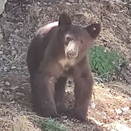
I'm wondering if there's a wildlife stampede going on in foothill areas right now.
This fire has exploded with lightning speed and advanced like gunpowder. I wonder what's happening in the interior of the burned areas. My hope would be that it moved fast enough to clear out the understory and blast onward to the next area without lingering to kill off every last living thing in all of that mature forest. Time will tell.
I'm wondering if there's a wildlife stampede going on in foothill areas right now.
-
walker
- Posts: 248
- Joined: Mon Apr 08, 2013 11:14 pm
Another chasm of doom view from Mt. Harvard and Mt. Wilson right now - looks like the next few hours will be decisive for the observatory