Detour At Dusk

TRs for the San Gabriel Mountains.
Post Reply
User avatar
Tom Kenney
Posts: 383
Joined: Sat Sep 29, 2007 7:51 pm

Post by Tom Kenney »

I did a quick run up Mt. Baden-Powell yesterday, taking one of several alternate routes I have on my todo list, the North West Ridge - AKA Rain Gauge Ridge. The start is a parking pull-out near a low stone wall and a rain gauge, where the NW ridge meets the highway. I started at a little after 3:00 PM, and was back at the car by sometime after 8:00 PM, going up the NW ridge, PCT to the summit, then PCT to Vincent Gap and highway back to the start.

The route up the NW ridge is quite pleasant. Any potential bushwhack can be easily rounded, and a nice use trail leads all the way to the PCT, passing several very nice campsites along the way. Weather was decidedly un-November again, and I was in shorts'n'shirtsleeves until nearly at the PCT (~8800' el) and minutes before sunset.

This time, I bothered to drag my tripod for some longer exposures, and learned that clouds don't stand still for 20 seconds! Some pics:

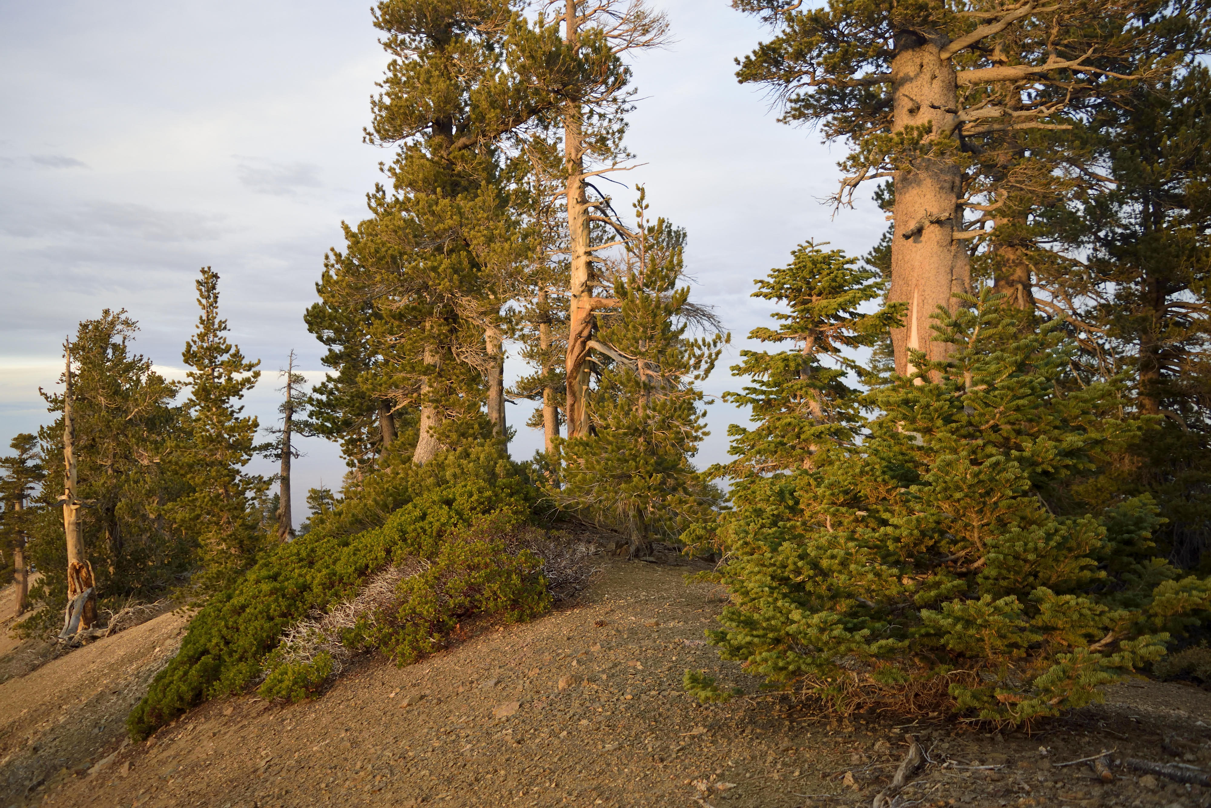
Typical difficult, dangerous, unpleasant cross country travel on the North West Ridge
Image

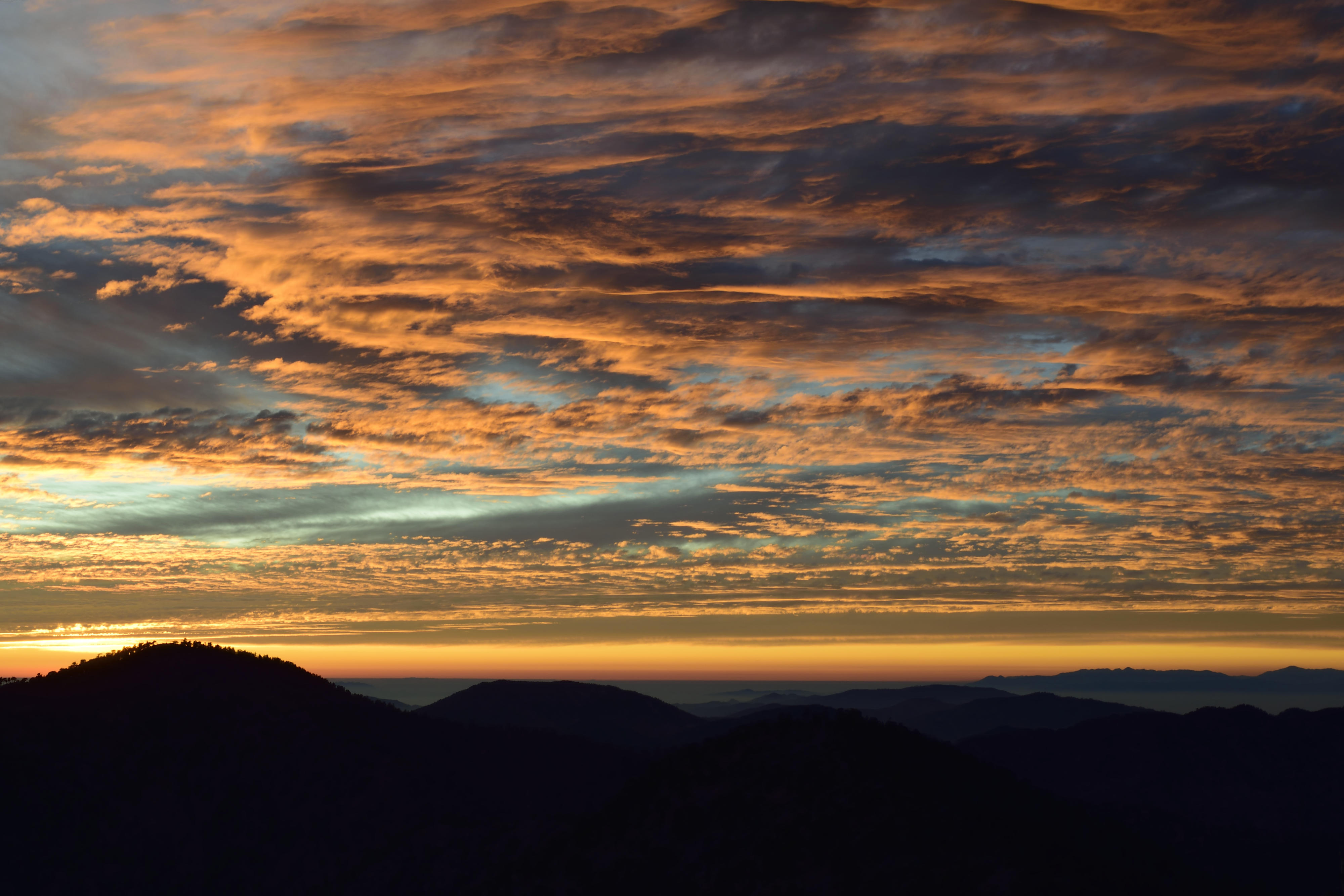
Sunset from just west of the summit
Image

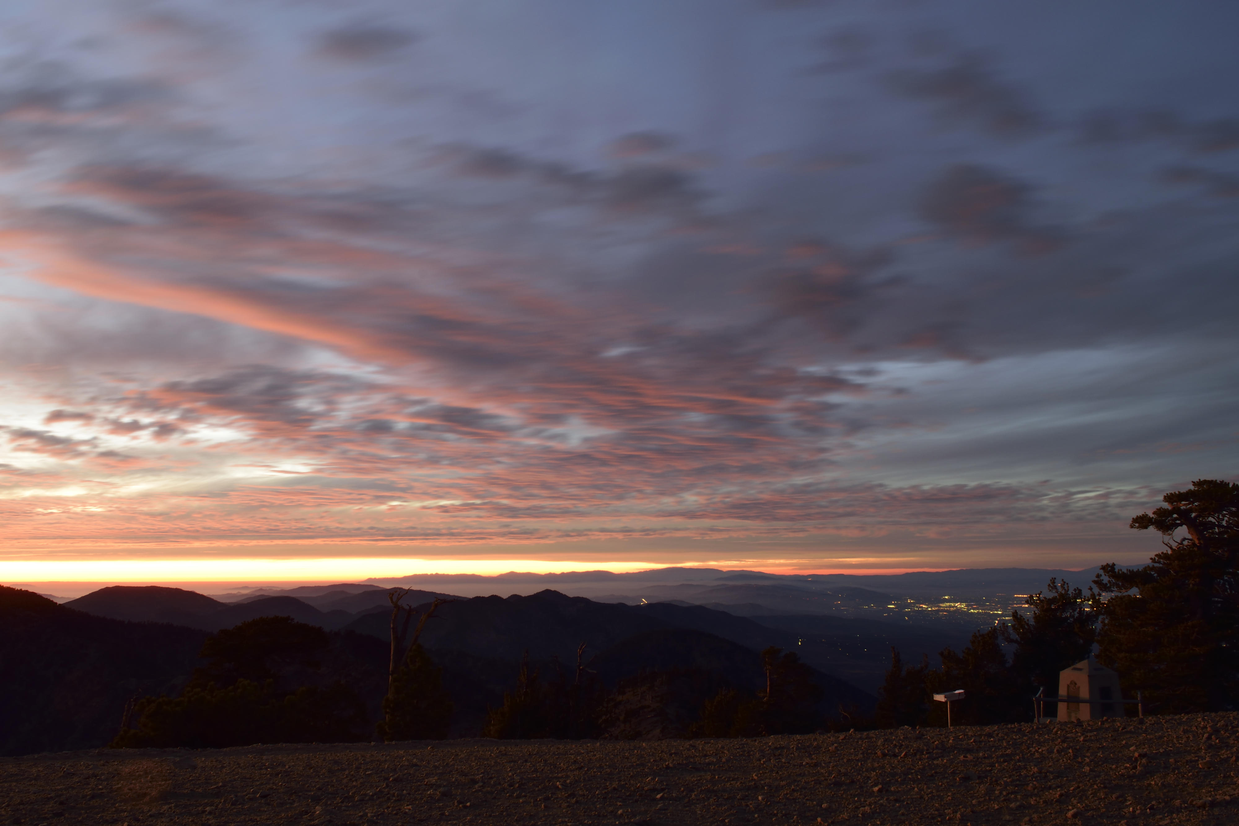
Last of the sunset, now on the summit
Image

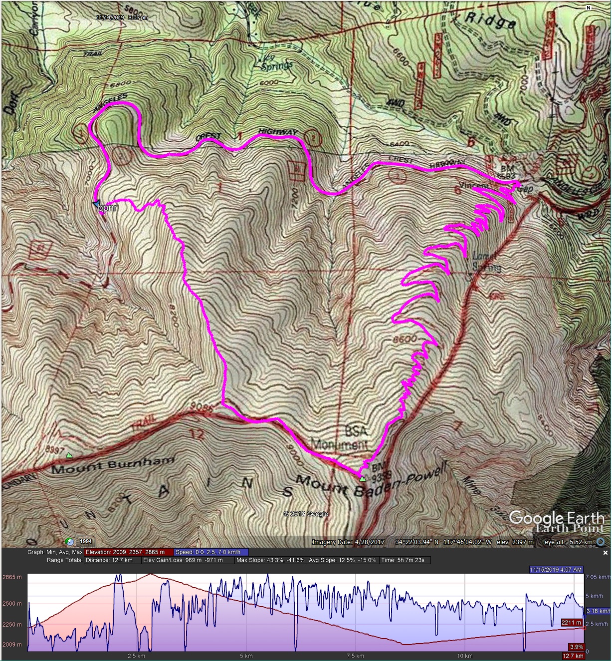
Route (counter-clock) and elev. profile
Image
User avatar
dima
Posts: 1433
Joined: Wed Feb 12, 2014 1:35 am

Post by dima »

Thanks for the post; I never thought of climbing any of the ridges up there. You walked back on the road from Vincent Gap to past Dawson Saddle? Was that as much of a slog as it sounds?
User avatar
Tom Kenney
Posts: 383
Joined: Sat Sep 29, 2007 7:51 pm

Post by Tom Kenney »

Fortunately, my start was less than halfway from Vincent Gap to Dawson Saddle. Easy, but grueling after my knee-straining descent.
User avatar
David R
OG of the SG
Posts: 556
Joined: Sun Jun 12, 2011 10:28 pm

Post by David R »

dima wrote: Thanks for the post; I never thought of climbing any of the ridges up there. You walked back on the road from Vincent Gap to past Dawson Saddle? Was that as much of a slog as it sounds?
You can also go up the ridge that leads you directly to Burnham. I did that as a shortcut once while hiking Ross.
User avatar
dima
Posts: 1433
Joined: Wed Feb 12, 2014 1:35 am

Post by dima »

Oh, I see now. I just glanced at your map earlier, and thought the road loop near your start WAS Dawson saddle. I'm on board now. Seems less sloggy :)
User avatar
CrazyHermit
Posts: 343
Joined: Mon Sep 07, 2015 1:03 pm

Post by CrazyHermit »

That first sunset is spectacular. You should put some of those up on Flickr and make some money.
User avatar
Sean
Cucamonga
Posts: 3918
Joined: Wed Jul 27, 2011 12:32 pm

Post by Sean »

Thanks, is this very steep?
Post Reply