
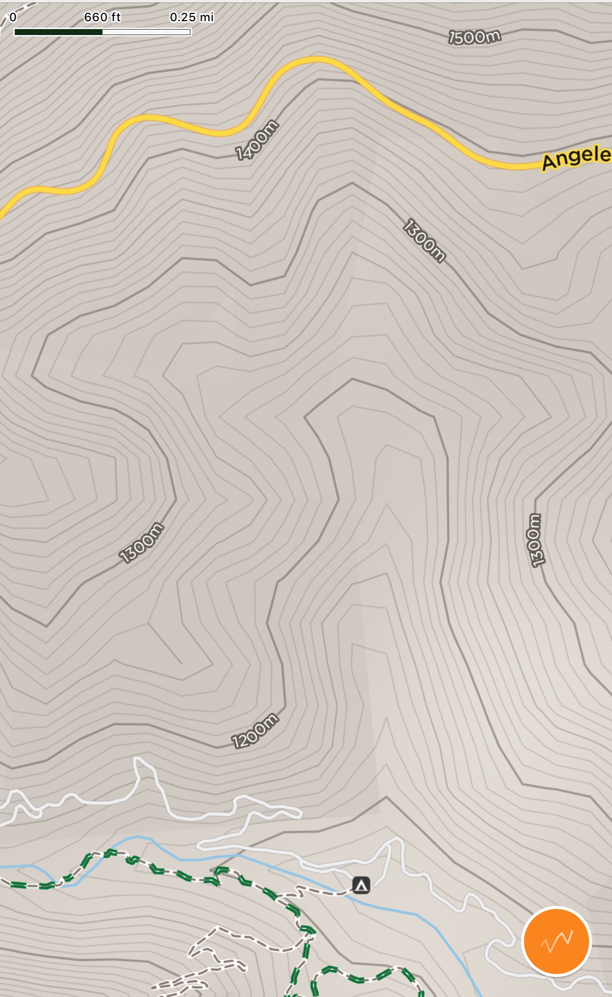
I've noticed this trail in the past; it takes off from the turnout off Angeles Crest Highway at MP 40.41 at the upper west wall of Valley Forge Canyon but I cannot find any record of it in any of the common sources. Anyone know anything about it? Logic suggests that it gives access to Valley Forge Canyon and thence to the Valley Forge Lodge site, but that's just logic. Any information, thoughts, speculation appreciated.Trail from next turnout east
Trailhead with gate looking down from turnout at MP 40.41
1994 USGS aerial shows a fairly robust trail/road
Google view of Valley Forge Canyon; red arrow marks trailhead at ACH.
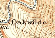
Mystery Valley Forge Canyon Trail
-
Paul Ayers
- Posts: 50
- Joined: Fri Sep 14, 2012 5:21 pm
You do not have the required permissions to view the files attached to this post.
-
stonehillnews
- Posts: 84
- Joined: Thu Dec 15, 2016 1:31 pm
That is strange. It’s not even showing on OSM.
-
dima

- Posts: 1734
- Joined: Wed Feb 12, 2014 1:35 am
- Location: Los Angeles
I just looked through the old aerial imagery. Apparently
- This trail didn't exist in 1938. And the road East from Barley Flats has some mean switchbacks that have been smoothed out now.
- This trail was in great shape in 1956
Aerials are available here: http://mil.library.ucsb.edu/ap_indexes/FrameFinder/
The frame I'm looking at is c-22555_5-43.tif. Copy here: http://pub.secretsauce.net/c-22555_5-43.jpg
My uplink is slow. Link needs a few minutes to upload.
-
Paul Ayers
- Posts: 50
- Joined: Fri Sep 14, 2012 5:21 pm
Thanks Dima, didn't look at the 1956, just earlier aerials. Doesn't look like the trail/road goes anywhere, just goes into Valley Forge Canyon and dies.
-
dima
- Posts: 1734
- Joined: Wed Feb 12, 2014 1:35 am
- Location: Los Angeles
Ever been in that canyon? Could it be an access road for something? Somebody's cabin?
-
Sean

- Cucamonga
- Posts: 4249
- Joined: Wed Jul 27, 2011 12:32 pm
By 1934 they had pushed up Valley Forge Canyon a bit. There was a trail from Valley Forge Lodge to a lone cabin a short distance upstream. My guess is that once the ACH went through, they started on an access route from above. Maybe they wanted to build more cabins upstream or connect the existing trail with the new highway.
You do not have the required permissions to view the files attached to this post.
-
Paul Ayers
- Posts: 50
- Joined: Fri Sep 14, 2012 5:21 pm
What is interesting is that there is no sign of the trail prior to the 1956 aerial; it is not on the 1944nor on the 1952
and it doesn't seem to go anywhere but down to the floor of the canyon where it appears to stop. I begin to believe it was a built to facilitate a special construction, perhaps a debris dam. Only one way to find out.
and it doesn't seem to go anywhere but down to the floor of the canyon where it appears to stop. I begin to believe it was a built to facilitate a special construction, perhaps a debris dam. Only one way to find out.
You do not have the required permissions to view the files attached to this post.
-
Sean
- Cucamonga
- Posts: 4249
- Joined: Wed Jul 27, 2011 12:32 pm
Maybe this will inspire a subset of explorers obsessed with finding debris dams and their date stamps. If you find one, we can start a new thread for this, like the one for triangular peak/firebreak signs.Paul Ayers wrote: I begin to believe it was a built to facilitate a special construction, perhaps a debris dam. Only one way to find out.
-
Paul Ayers
- Posts: 50
- Joined: Fri Sep 14, 2012 5:21 pm
Well they would have a world of work up Fern Canyon.
Fern Canyon DD #1.
Fern Canyon DD #1.
You do not have the required permissions to view the files attached to this post.
-
walker

- Posts: 248
- Joined: Mon Apr 08, 2013 11:14 pm
If you zoom in, you can see a couple of the buildings at Valley Forge on the '56 image.
-
Sean
- Cucamonga
- Posts: 4249
- Joined: Wed Jul 27, 2011 12:32 pm
Willie and I went down this road yesterday.
It was relatively easygoing until the last stretch, which was heavily rutted.
Approximately fifty feet above the stream, the obvious road ended at a debris field and some pipes.
We then found a class 3 route down to the stream and arrived at two tanks and a pump house.
Next to the pump house there was a small rock dam.
Based on equipment found in the pump house, the water works were installed sometime after January 1947, which fits with the road not appearing on aerials until the '50s.
Also, the tanks can be seen on current satellite imagery.
I'll include more information with an upcoming trip report on Valley Forge Canyon.
You do not have the required permissions to view the files attached to this post.