Iron Mt via Stanley-Miller mine

TRs for the San Gabriel Mountains.
Post Reply
User avatar
dima
Posts: 1358
Joined: Wed Feb 12, 2014 1:35 am

Post by dima »

From a previous trip to Stanley-Miller mine (stanley-miller-mine-t6251.html) I recall that the area was somewhat brushy, but not overwhelmingly so, and I've been curious about ascending Iron Mt that way. The aerial imagery and topos made it look doable as well, and apparently Zé descended this way (http://socalhikes.com/2010/05/east-fork ... mine-loop/), so on Friday I teamed up with headsizeburrito to explore this ridge.

The hike to the start of the climb was uneventful, and we got to the hobo cabin a bit after sunrise; this is about a mile above the bridge. The cabin now has a tarp covering the roof, and two swings consisting of large pieces of shale suspended from the tree:

Image

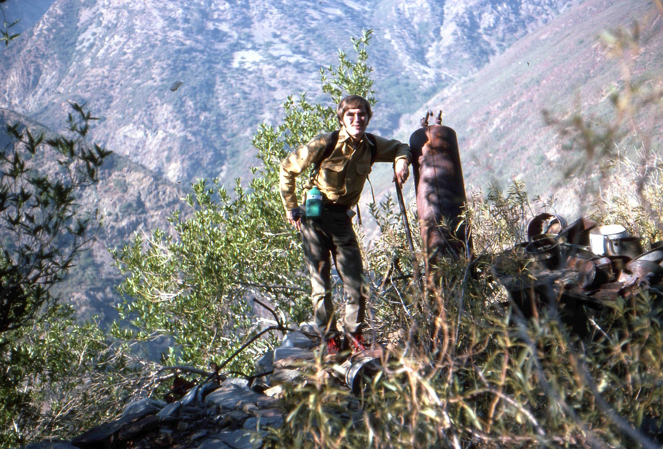
The climb starts on the rock slide behind the cabin. This is steep and in places, loose. The first indication of the mine is a long steel cable coming down from a tree that it's tied to. The mine area is a bit above this tree at elevation 4100ft-4200ft or so. The cabin is on the left, the mine is on the right. The mine and cabin are as they were before, except I got a decent photo of the ore cart this time:

Image

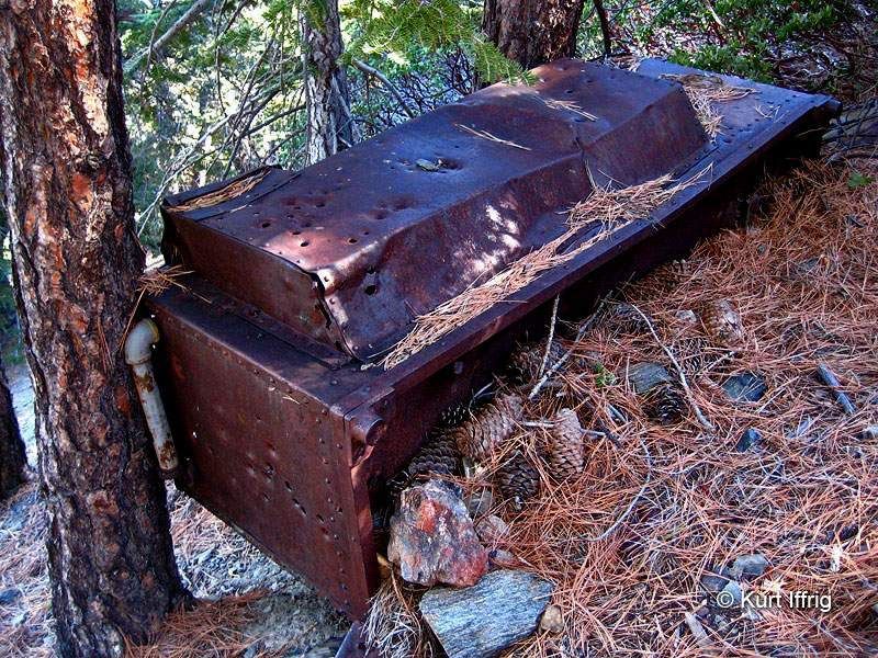
Hikin_Jim mentioned some sort of secondary tunnel "paved with gas cans". I looked around for it, but couldn't find it. Instead we found some sort of stove (I think) around some miscellaneous metal bits:

Image

If we spent more time searching the area, we probably would have found it, but we had a mountain to climb! It'd be fun to come back at some point to find this tunnel and see what's left of the original wetwater trail.

In any case, directly above the mine the brush can be bypassed in most places, but in spots you do have to crawl through it. There's a pipe that was used to supply pressurized water to the mine, and this has a use trail alongside it, in places:

Image

At 5000ft of elevation, the pipe ends unceremoniously in some concrete:

Image

Does anybody know if this is anything more than an end of open pipe fixed to the ground? To get water do you need to do anything other than just dig a hole and put a pipe in? The brushiest area is probably between 5000ft and 6000ft of elevation. Again, there's some crawling, but it's really not terrible. At point 5948 the minor ridge we were climbing joins the main ridge to the peak. Zé calls this the "NW ridge". This ridge is high-enough such that there're pines on the shaded (N side), so staying on the N side of the ridge was generally the path of least resistance, as far as brush goes. The views open up as you ascend. Rattlesnake and the bridge (and also Monrovia, Rankin, Yale, Harvard, Wilson, Occidental):

Image

Ross and Baden-Powell:

Image

In places there're still clumps of brush, but it all is mostly bypassable:

Image

Image

There're a few bumps towards the end:

Image

And eventually you can see the peak:

Image

Especially towards the end, there're a few class 3 sections. These are hard enough to be really fun, but not so much to be dangerous. The rock can be loose, but it's manageable. We reached the peak, raised the fallen W15 marker, and took in the views. Looking at the register books, it became apparent that this is now a really popular peak to climb. The state of the main trail on the descent confirmed this: it's no longer the faint use trail it once was. Even so, we didn't see anybody else all day outside the parking lot.

This is a good route. Other than the raw distance, elevation gain numbers, it's straightforward and fun.
User avatar
headsizeburrito
Posts: 279
Joined: Wed Nov 15, 2017 1:18 pm

Post by headsizeburrito »

I don't have anything to add, but it was a good adventure! I'm looking forward to doing some of the other off trail routes up when I have a chance.

Your photos look much better than mine as expected, especially the mine cart!
User avatar
tekewin
Posts: 1195
Joined: Thu Apr 11, 2013 5:07 pm

Post by tekewin »

Awesome trip!
User avatar
CrazyHermit
Posts: 343
Joined: Mon Sep 07, 2015 1:03 pm

Post by CrazyHermit »

GREAT REPORT as always. That third photo down is indeed a stove.
I found a similar one near Big Horn Mine's miner's camp, that flat area before you reach the mine ...

Image
User avatar
dima
Posts: 1358
Joined: Wed Feb 12, 2014 1:35 am

Post by dima »

Oh yeah, that does look similar. Thanks for posting that. I haven't been to the Bighorn yet; any particularly interesting spots to check out? Somebody recently mentioned the gully below it as containing STUFF. Anything else?
User avatar
Sean
Cucamonga
Posts: 3791
Joined: Wed Jul 27, 2011 12:32 pm

Post by Sean »

dima wrote:At 5000ft of elevation, the pipe ends unceremoniously in some concrete...

Does anybody know if this is anything more than an end of open pipe fixed to the ground? To get water do you need to do anything other than just dig a hole and put a pipe in?
Did you follow that pipe for 1000' of elevation gain? I have the Stanley-Miller Mine around 4000', and you say the pipe ended at 5000'. Maybe they had to climb that high to find a reliable water source. It might be worthwhile to go back in springtime to see if there is water flowing from the pipe. Perhaps they tapped the groundwater supply.
User avatar
dima
Posts: 1358
Joined: Wed Feb 12, 2014 1:35 am

Post by dima »

Sean wrote: Did you follow that pipe for 1000' of elevation gain? I have the Stanley-Miller Mine around 4000', and you say the pipe ended at 5000'. Maybe they had to climb that high to find a reliable water source. It might be worthwhile to go back in springtime to see if there is water flowing from the pipe. Perhaps they tapped the groundwater supply.
Yeah, the pipe goes up about 1000' of gain above the mine. The intake isn't in any obvious spot. There's no gully or a visible spring or anything; it's just sitting in the middle of a slope. Checking it out in the spring could be interesting. The pipe is all sorts of damaged, though, so the water wouldn't end up anywhere near the mine.
User avatar
dima
Posts: 1358
Joined: Wed Feb 12, 2014 1:35 am

Post by dima »

Tom Mahood says the upper end of the pipe connects to a flume to connect to an intake at an adjacent ravine: http://www.otherhand.org/home-page/arch ... alifornia/

I didn't see that, but I didn't look very hard either.
User avatar
Sean
Cucamonga
Posts: 3791
Joined: Wed Jul 27, 2011 12:32 pm

Post by Sean »


dima wrote:Tom Mahood says the upper end of the pipe connects to a flume to connect to an intake at an adjacent ravine: http://www.otherhand.org/home-page/arch ... alifornia/
Is that an alien drone floating in the air to the left of his head?

Image


>> In the beginning God created the mountain and the trail. <<
User avatar
headsizeburrito
Posts: 279
Joined: Wed Nov 15, 2017 1:18 pm

Post by headsizeburrito »

Nice find on the site, cool to see those old photos. And like he said, most of those small objects are no longer there. Glad there were a few left to give it that old timey flavor.

I remember reading his death valley germans report, looks like I should poke around the rest of his site a bit.
Post Reply