Blue Ridge to Jackson Flats via Fish Fork.

TRs for the San Gabriel Mountains.
Post Reply
User avatar
Pat
Posts: 39
Joined: Mon Jul 21, 2008 10:11 pm

Post by Pat »

6 Scouts, 3 adults. Made quite a few changes along the way from our planned itinerary, but we gave the scouts one to remember.

Day 1: Blue Ridge CG to Guffy CG. Get the legs warmed up, sort out any equipment issues. No water at spring.
Day 2: Guffy CG to Lupine CG. Filtered water from Prairie Fork @ road crossing. Lunch @ Lupine. Continued on to Little Fish Fork CG. Wash outs were a little intimidating for our 2 younger Scouts. Filtered @ spring past camp.
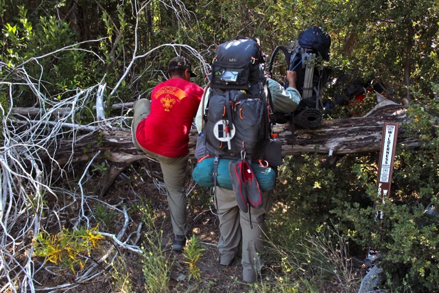
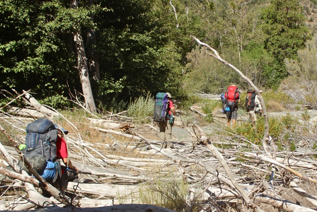
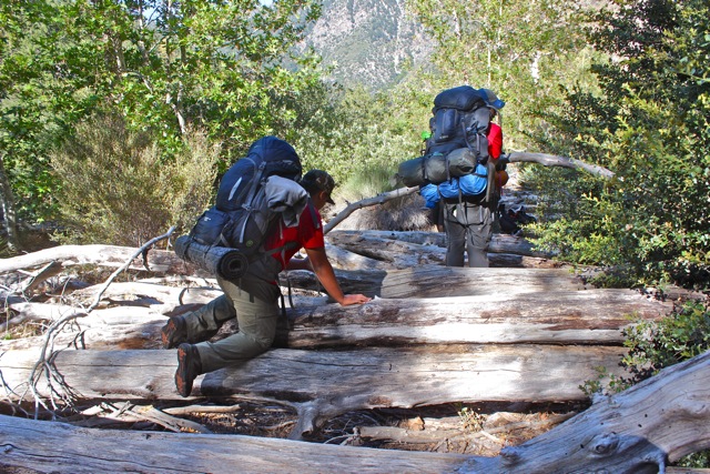
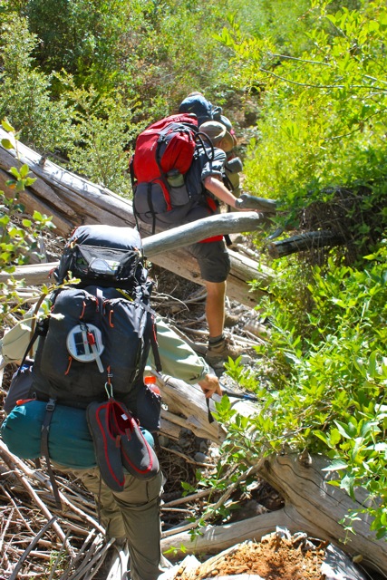
Day 3: Little Fish Fork CG to Lupine for lunch. Filtered @ spring above Lupine. Ran into SlowestHiker on Pine Ridge. Lupine to Cabin Flats, filtered water. Attempted to reach Mine Gulch. Fought the brush/downed trees for ~2 miles before we found a nice bench above the stream and called it a day.
Day 4: Continued the battle to Prairie Fork/Vincent Gap trail junction. Up Vincent Gap trail/PCT to Jackson Flats. Struck a deal with the concessionaire for a reduced rate in exchange for some work around the camp.
Day 5: Jackson Flats to Grassy Hollow VC.

Image
Image
Image
Image
Image
Image
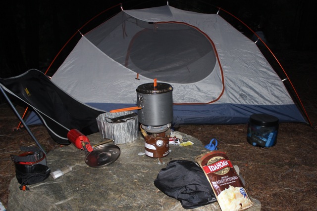
Coleman 400. 1982 Xmas gift from my parents. Still lugging it around.
Image
Image
User avatar
Sean
Cucamonga
Posts: 3782
Joined: Wed Jul 27, 2011 12:32 pm

Post by Sean »

That's quite an adventure. Those boys are lucky to have you as a leader. Are the pics of the downed trees from the stretch between Cabin Flat and Vincent Gulch?
User avatar
Pat
Posts: 39
Joined: Mon Jul 21, 2008 10:11 pm

Post by Pat »

Yes, trees are CF to VG.
User avatar
AW~
Posts: 2040
Joined: Mon Oct 01, 2007 12:00 pm

Post by AW~ »

Cool!....that was an earned achievement :) Its like 'What do you know about camping?'..."5 day 4 night route in the wilderness, including off-trail and non-trade sections". Very few get that done.
User avatar
Slowest_Hiker
Posts: 252
Joined: Sun Jul 31, 2011 12:31 pm

Post by Slowest_Hiker »

Pat wrote: Continued on to Little Fish Fork CG. Wash outs were a little intimidating for our 2 younger Scouts.
They're allowed! I had some choice words for that rockfall. Hats off to everyone who got off that without summoning SAR. :q22:
User avatar
Slowest_Hiker
Posts: 252
Joined: Sun Jul 31, 2011 12:31 pm

Post by Slowest_Hiker »

p.s. Nice to "meet" you! :q38: (That's a root beer float for the scouts)

If you saw our tent in Lupine, it's from the early/mid-90's, $30 from Target. We haven't found anything that beats it for size/price/weight.
User avatar
hiiker
Posts: 21
Joined: Thu Jul 01, 2010 11:56 am

Post by hiiker »

Congratulations to those Scouts and their Leader, that's one tough hike/backpacking trip.

It's really refreshing to see kids of their age doing things outdoors. So many kids don't get opportunities like that and unfortunately the only things they know is how many "likes" they have on Social Media.

BTW, looks like a chain saw would have come in handy, that's a lot of downed trees to cross.


Hiiker
User avatar
Sean
Cucamonga
Posts: 3782
Joined: Wed Jul 27, 2011 12:32 pm

Post by Sean »

I fixed your original image links and deleted the duplicate post.

Re-bumping topic...
User avatar
Slowest_Hiker
Posts: 252
Joined: Sun Jul 31, 2011 12:31 pm

Post by Slowest_Hiker »

Hey Pat, or anyone else familiar, where do you pick up the Prarie Fork trail (such as it is) from Cabin Flat to Mine Gulch? Do you just take the obvious trail out of camp to the water and start pushing downstream? We tried that a little bit but quickly got to this and bailed.
dsc01070.jpg

But looking at my old map collection, it seems the trail once paralleled the stream just south of it. Do you maybe cross the stream and then find something?
User avatar
headsizeburrito
Posts: 279
Joined: Wed Nov 15, 2017 1:18 pm

Post by headsizeburrito »

Here is my report from passing through that area, as you can see in the picture the trail near Cabin Flat was very overgrown and difficult to see, especially if you were coming from the Cabin Flat side:

cabin-flat-overnight-loop-from-vincent- ... t7728.html

Here is a zoomed in view of our GPS track for that section:

cabinflattoprarieforktrail.jpg


We popped out onto the loop from the old trail very close to the old outhouses, a little SSW. That section was particularly crowded in with vegetation, so it would be a bit hard to see from the Cabin Flat loop. I think there was still some little remnant if you looked a bit and got lucky though. If that doesn't work there isn't much of a trail anyway, so as long as you can push through a little and get to the south side of the creek you can start following that downstream and just follow the remnants and/or pick your own route from there, the vegetation along the banks is generally open enough to walk along it pretty comfortably.
User avatar
Slowest_Hiker
Posts: 252
Joined: Sun Jul 31, 2011 12:31 pm

Post by Slowest_Hiker »

Cool, thanks! From the locations of my photos it looks like we were poking around in the right areas, in particular near where I saw the triangular marker
CabinFlat.png

Google's imagery also shows stuff going on around there.

CbnFlt.png

Anyway, we didn't spot it. There was a ton of poison oak near the stream, which discouraged investigating too much.
Post Reply