Frankish archaeology

TRs for the San Gabriel Mountains.
Post Reply
User avatar
dima
Posts: 1354
Joined: Wed Feb 12, 2014 1:35 am

Post by dima »

Last month there was another aviation disaster in the San Gabriels. This time it was on the East side of the range: a small Piper airplane impacted in the mountains above Upland. I've never been to that area, so last weekend I took a short trip to climb the local high point (Frankish Peak), and to hopefully find the wreckage on the way.

The most logical route to this climbs Frankish from the SW. The ridge begins just East of San Antonio Dam, and climbs up via the Pole benchmark. The impact site should be in one of the canyons on either side of this ridge.

Apparently this is a not-unknown route people take to the top of this peak; the beginning looks like this:

Image

There's an odd structure along the firebreak:

Image

The ridgeline is clear. The south-facing canyon walls are covered with thick brush. The north-facing ones, not so much. I made a few detours on the way up to look for the crash site without luck.

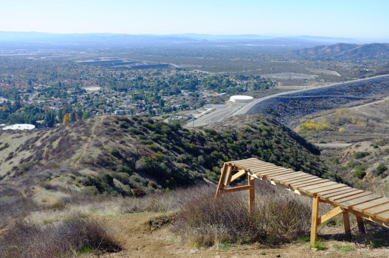
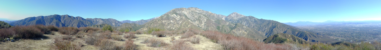
Pole is an uninteresting bump with no benchmark. Frankish is fairly uninteresting also, although the views are nice (click):

Image

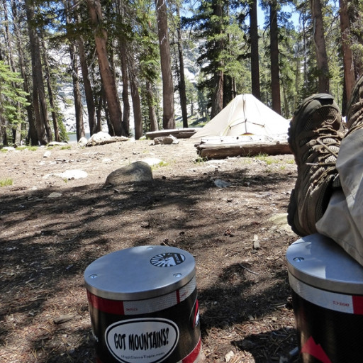
I found the register and signed in. This peak is clearly visitated regularly, but the register is very sparse. This peak isn't for hikin', it's for beer-drinkin':

Image

I took a different minor ridge on the way down to peek into some other canyons. Then at a likely location I found wreckage. But instead of a recent plane wreck, it was an old truck wreck:

Image

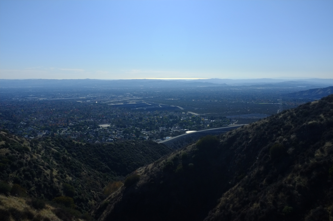
This was mildly disappointing, but at least I could console myself with views of the ocean and Catalina Island

Image

So I don't know where this thing is. It's possible that it isn't in the canyons I thought it was in. Or maybe the site got cleaned up (it's closer to civilization than the other one) and was more difficult to see
User avatar
robow8
Posts: 43
Joined: Wed Oct 12, 2016 4:14 pm

Post by robow8 »

That odd structure is a mountainbike jump.

Thanks for the writeup.
User avatar
dima
Posts: 1354
Joined: Wed Feb 12, 2014 1:35 am

Post by dima »

robow8 wrote: That odd structure is a mountainbike jump
Oh yeah, that makes a lot of sense. I looked up some more news reports, and apparently the crash site was clearly visible from the road:

http://losangeles.cbslocal.com/2016/11/ ... of-upland/

I didn't see it, so the major parts were cleaned up, presumably.
User avatar
mattmaxon
Posts: 1137
Joined: Mon Mar 24, 2008 12:48 pm

Post by mattmaxon »

https://goo.gl/maps/nE6bdpL6TEB2

This is the spot here
User avatar
mattmaxon
Posts: 1137
Joined: Mon Mar 24, 2008 12:48 pm

Post by mattmaxon »

This show has lots of good info about how the investigations are conducted

http://www.smithsonianchannel.com/shows ... ns/1004287
User avatar
dima
Posts: 1354
Joined: Wed Feb 12, 2014 1:35 am

Post by dima »

mattmaxon wrote: https://goo.gl/maps/nE6bdpL6TEB2
This is the spot here
Good spot. The "trailhead" is immediately SE of there. There're no big chunks of anything there anymore, but probably lots of small things scattered around.
User avatar
dima
Posts: 1354
Joined: Wed Feb 12, 2014 1:35 am

Post by dima »

So I climbed Baldy today, and on the way back decided to go check out this site, now that I've seen footage showing the location. Walking up towards the site there was a visible glint. When I finally arrived, it turns out that the glint wasn't from plane parts (which were there), but from the beer containers of people admiring these parts.

There're few interesting things left. I don't know if the site was just cleaned up, or if the beer-drinkers grabbed some souvenirs. In any case, there's a fire road running pretty close, and a short use trail from there. I guess wreckage that is visible from the main road and that just happens to have a fire road nearby would end up picked-over and full of beer bottles. At least there were no personal items remaining at all, so this one isn't morbid.
User avatar
Sean
Cucamonga
Posts: 3787
Joined: Wed Jul 27, 2011 12:32 pm

Post by Sean »

Thanks for the report. Now I don't have to bother looking for Pole BM.

I did Frankish from the Barrett-Stoddard road a few years back. The bikers have constructed a race course on the north side of the mountain.
User avatar
Anthony
Posts: 324
Joined: Mon Jun 05, 2017 11:53 am

Post by Anthony »

Apparently there's at least three routes to Frankish: via Barrett-Stoddard Road (the longest route), via the SW ridge as described in this post, and via West Cucamonga Truck Trail. Has anyone done the latter?
User avatar
Girl Hiker
Posts: 1335
Joined: Fri Apr 04, 2014 7:46 am

Post by Girl Hiker »

Nice report. I still need to bag that peak. So are you saying that the route you took would be the easiest?
User avatar
Anthony
Posts: 324
Joined: Mon Jun 05, 2017 11:53 am

Post by Anthony »

I attempted Frankish via the West Cucamonga Truck Trail and the SW ridge (as mentioned in this thread) today but failed at both.

My first attempt was the West Cucamonga Truck Trail, but there were warning signs near the parking area about private property and Cucamonga Canyon being closed. I decided to play it safe and drive over to the SW ridge.

There were no signs at the parking area for the SW ridge, so I began the steep climb. However, I came across a rattlesnake about a .5 mile in. It didn't seem wise to continue given that a) I had only just begun and already saw a rattlesnake b) the trail was overgrown and c) I was wearing shorts. I recommend doing this route in late fall/winter when the rattlers aren't out. It's also completely exposed, so not ideal for warm months for that reason alone (unless you go early or late).
User avatar
Sean
Cucamonga
Posts: 3787
Joined: Wed Jul 27, 2011 12:32 pm

Post by Sean »

Anthony wrote: My first attempt was the West Cucamonga Truck Trail, but there were warning signs near the parking area about private property and Cucamonga Canyon being closed. I decided to play it safe and drive over to the SW ridge.
You can hike the road. You just can't drop down to the waterfall.
Post Reply