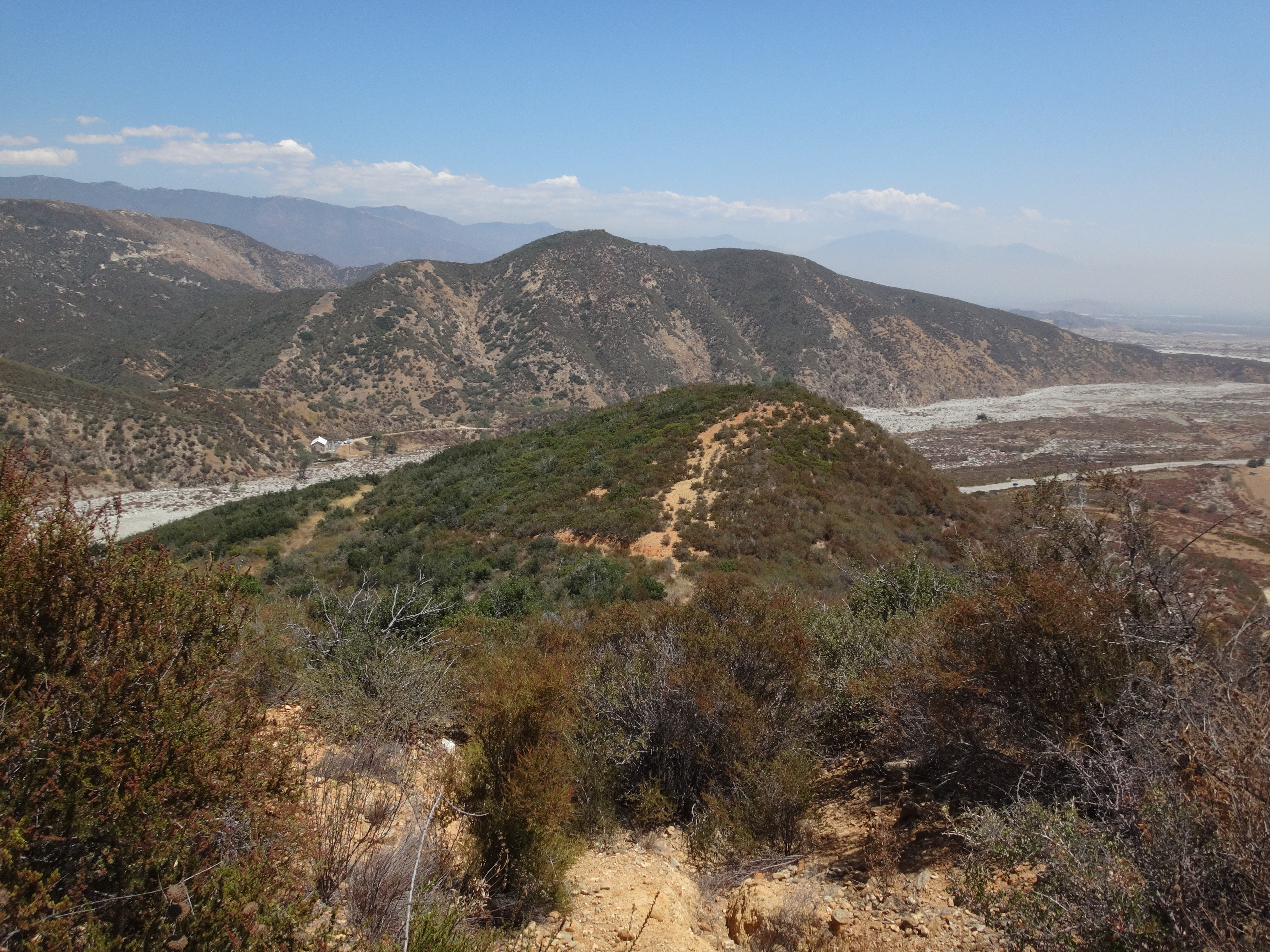
I started by walking through the closed San Sevaine Road gate. After rounding the first bend, there was a fence that closed off an area on the right, where the blasted south face of Texas Hill came into view.

I didn't notice any signage, but it might be considered trespassing if one were to locate and exploit the hole in the fence in order to walk an overgrown, deteriorated roadbed up to the Hill. This would be the shortest route to the peak. I didn't go up this way. Though maybe I came down it later.
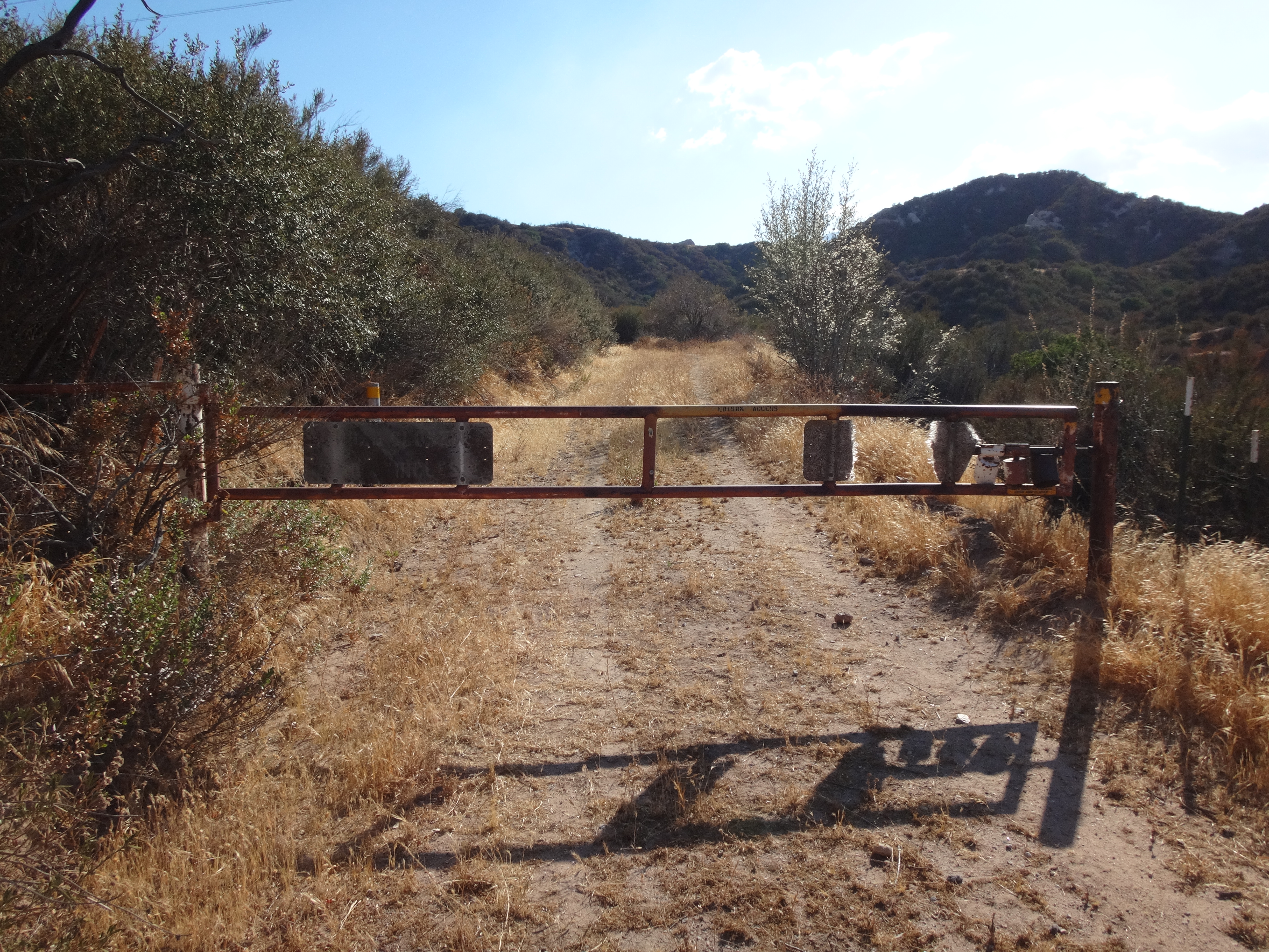
Instead I kept hiking the San Sevaine Road, crossing the mouth of Grapevine Canyon to the opposite ridge and climbing a little to another gate on the right, this one open.
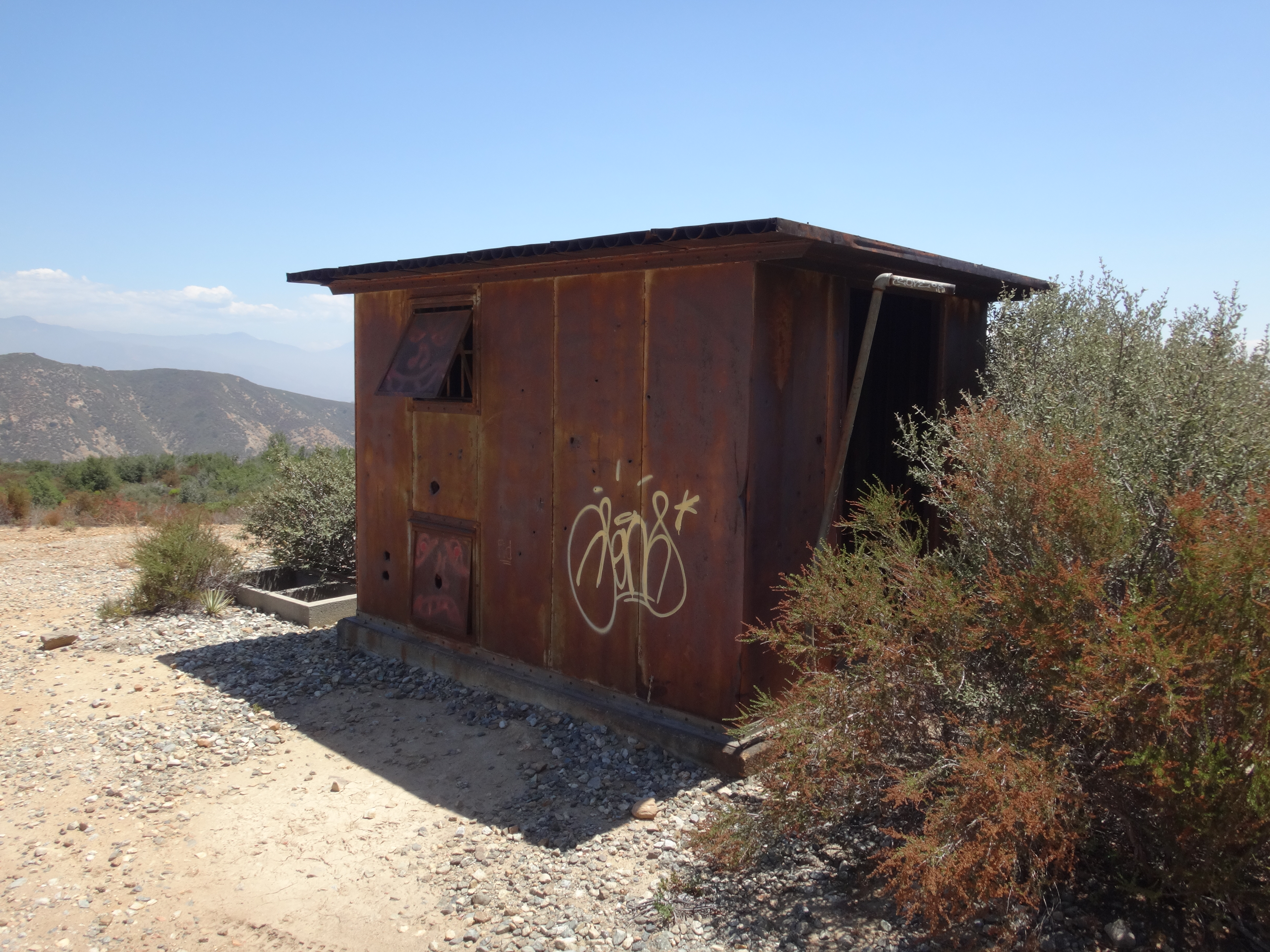
I then jumped on this new path, a service road for the power lines. It recrossed the canyon and briefly ascended to a ridgetop with an e-tower and an old shack.
My topo map showed another road splitting off here and heading down-ridge to Texas Hill.
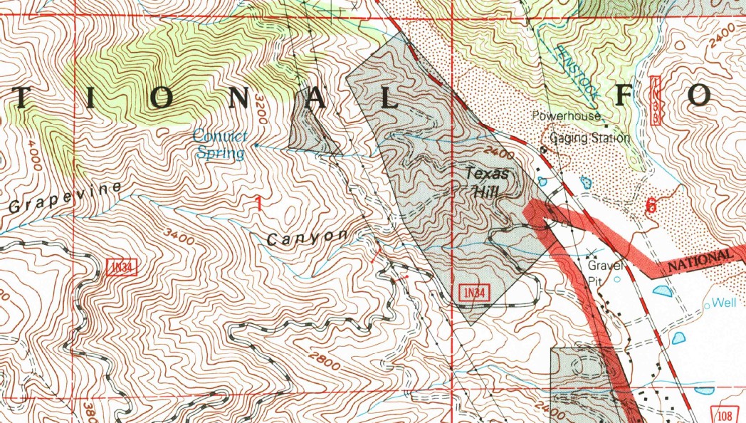
But in reality the road no longer exists, and I had to push through light brush along deer trails.
At the small summit bump I found the same sort of aluminum signage that exists on Mt. Jo over at Upper Lytle Creek Ridge.
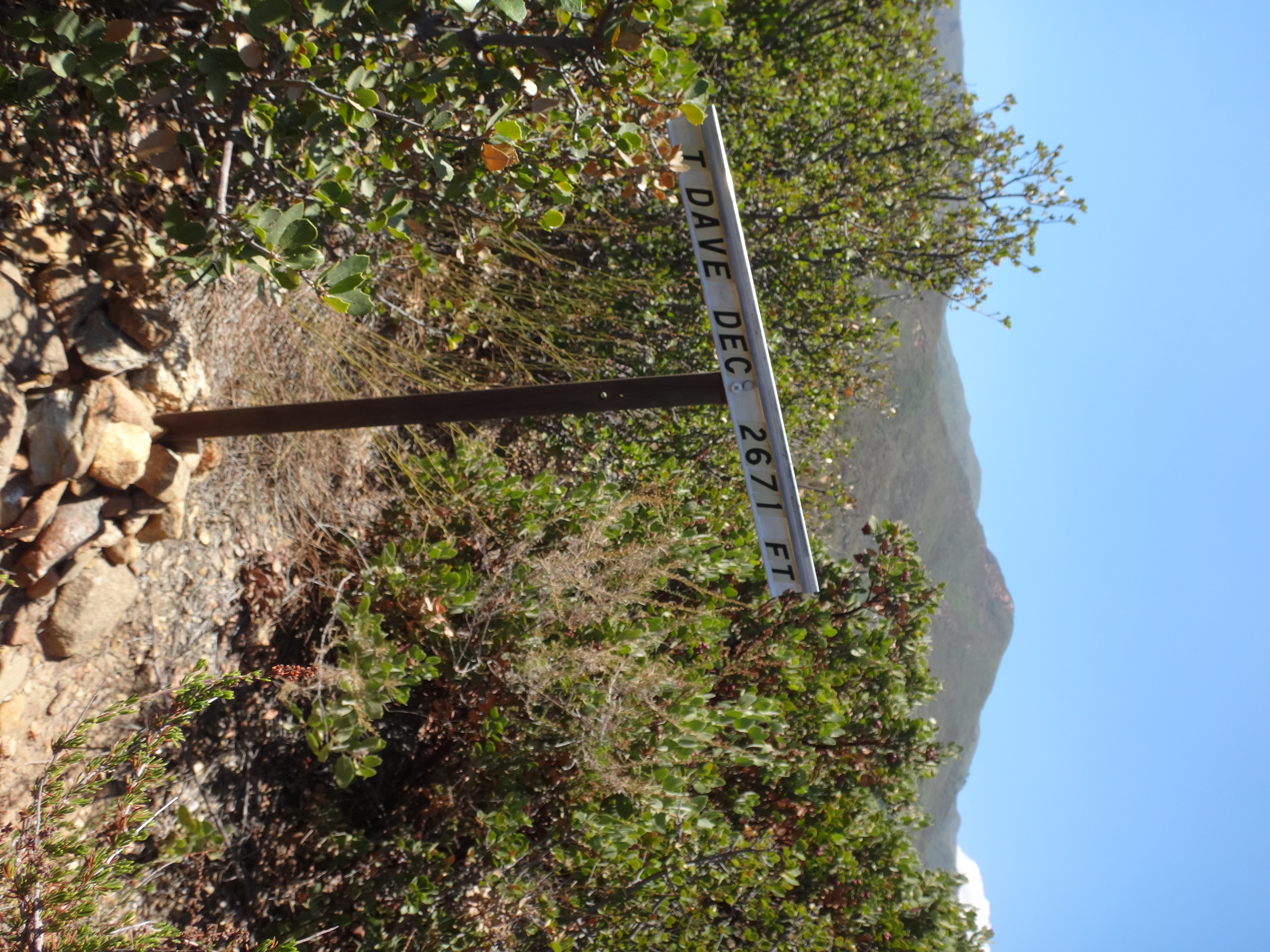
Unfortunately, I have to give this sign an overall failing grade. The bump already has an official name. It's also clearly not worthy of being called Mt. Dave, as it's nothing like a mountain, but more like a pinky toe of a minor ridge. Furthermore, I have no idea where the creator of the sign got his inaccurate elevation info. Maybe there's some source I'm unaware of, but on my USGS map the Hill doesn't even reach the 2600' contour line.
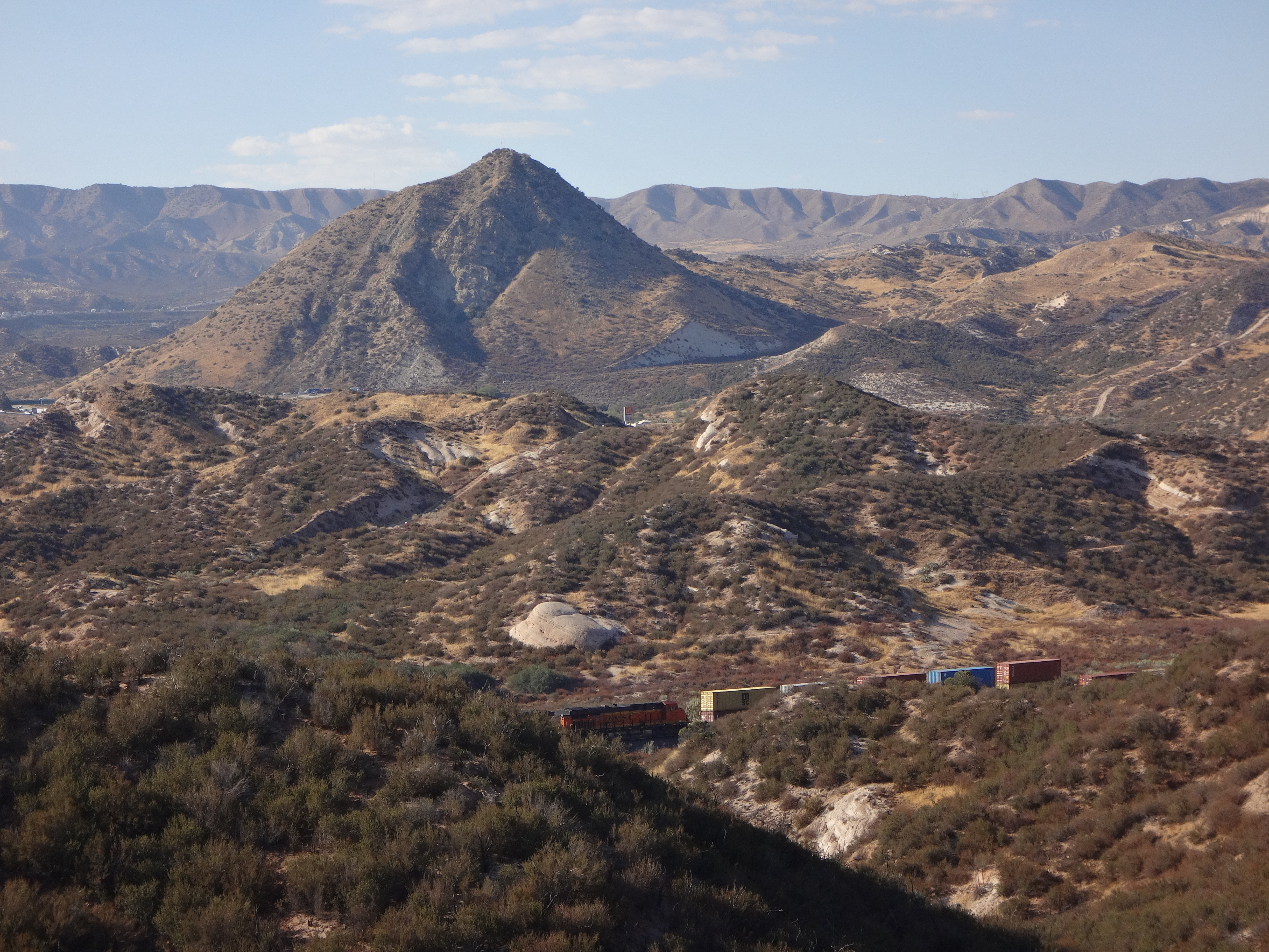
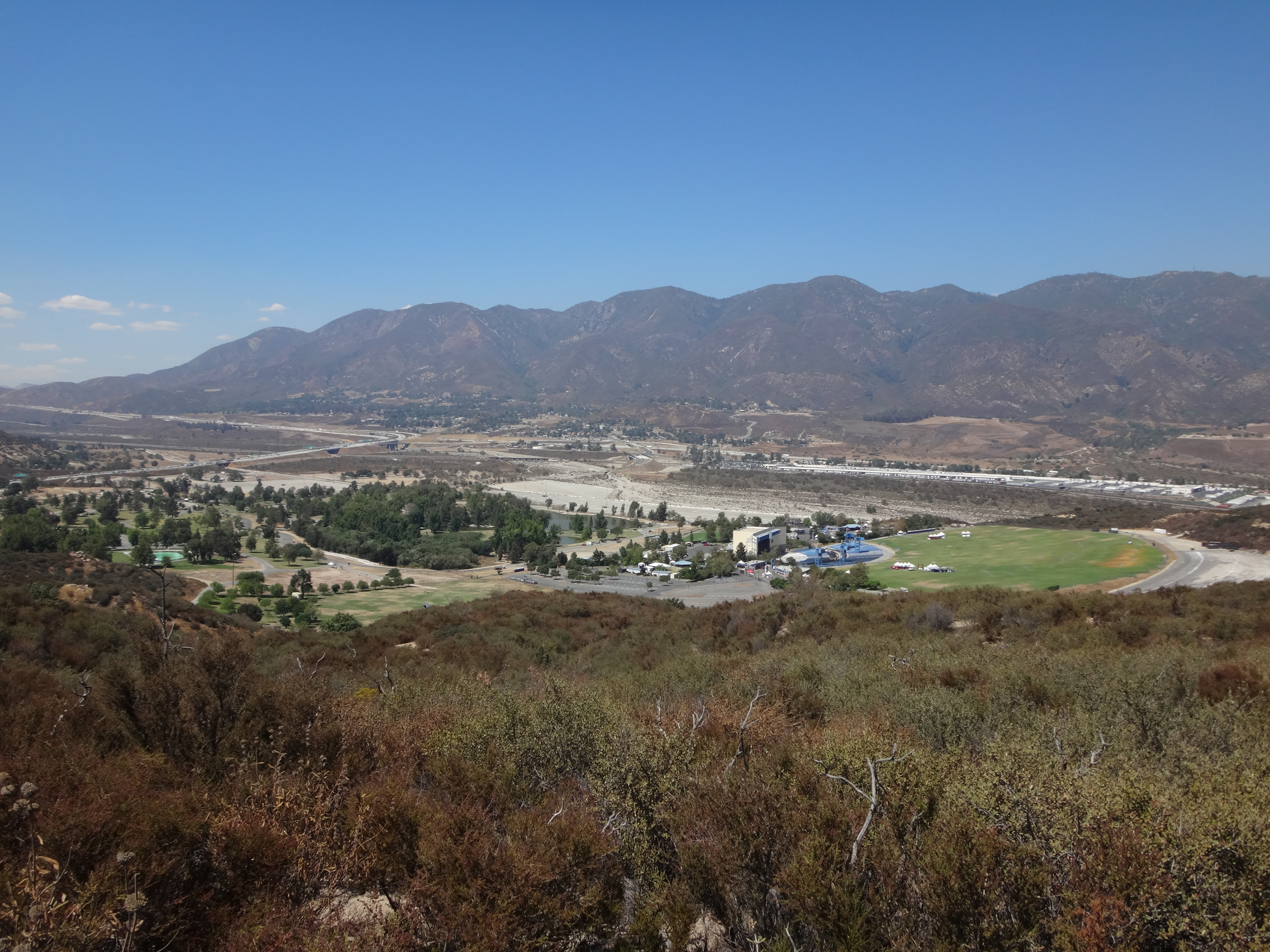
Moving on, I finally began my tour of Cajon Pass with a peak at the extreme eastern tip of the San Gabriel range. Mormon Battalion Mountain (2350'), rises immediately south of Glen Helen Regional Park, overlooking the wide wash of Cajon Canyon, running through Devore to the north.
The peak's name does not appear on the most recent USGS topo, but it is in the Garmin BaseCamp database, which is good enough for me.
Getting to the peak took some trial and error. The areas south and west of the mountain are currently being developed for housing. Thus, road configurations have changed, making the USGS topo a bit less useful than usual. So I was blocked from legal approaches off of Glen Helen Parkway and Clearwater Parkway.
The easiest and most legal approach is from inside Glen Helen Regional Park, which costs $8 for vehicle entry.
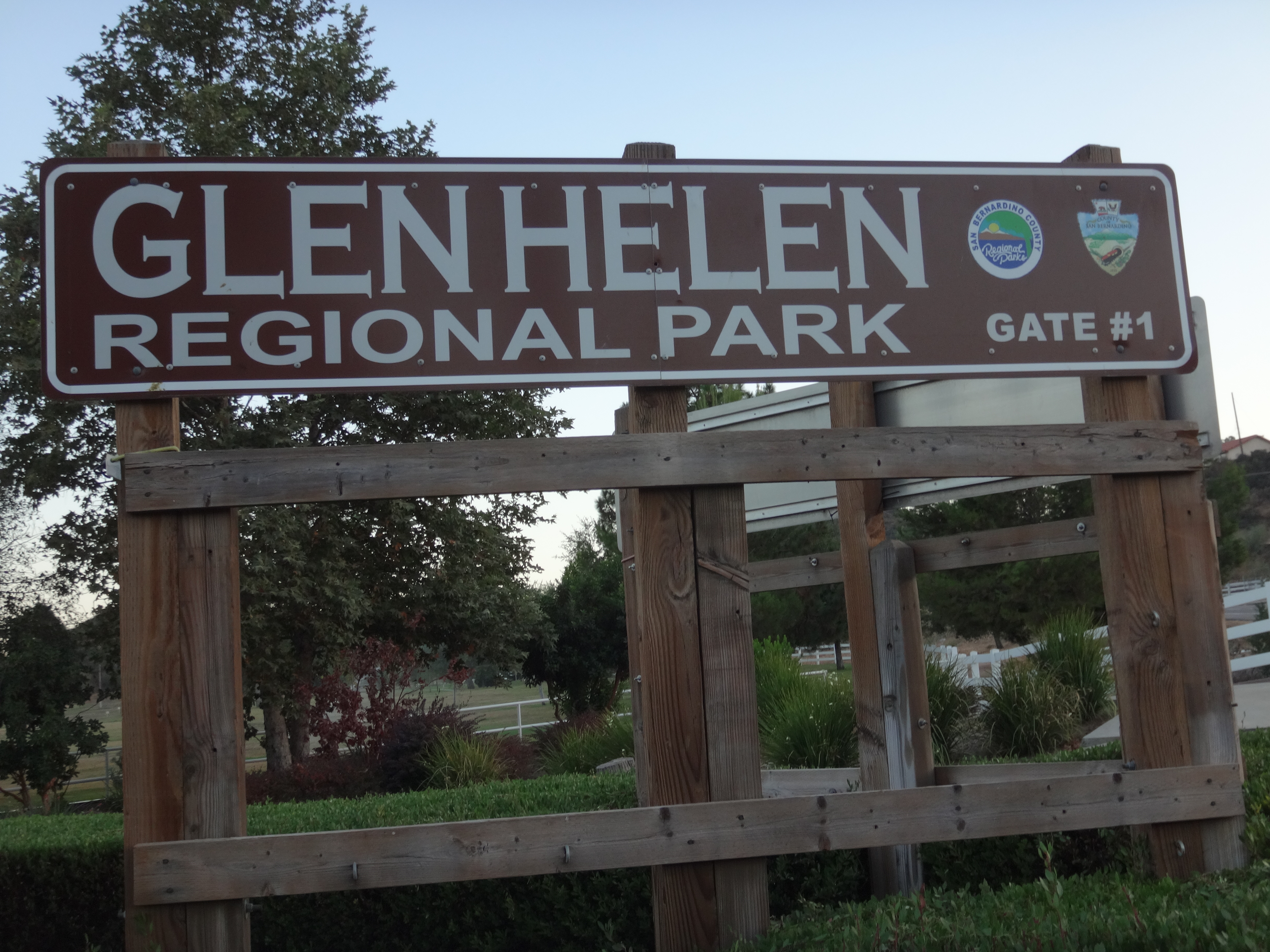
Not willing to cough up the cash, I found parking down the street at the corner of Glen Helen and Clearwater, and walked into the park. The attendant at the entrance booth informed me of a nature trail in the adjacent hillside, but he said it was closed to let the area recover. So instead I headed over to the Water Park.
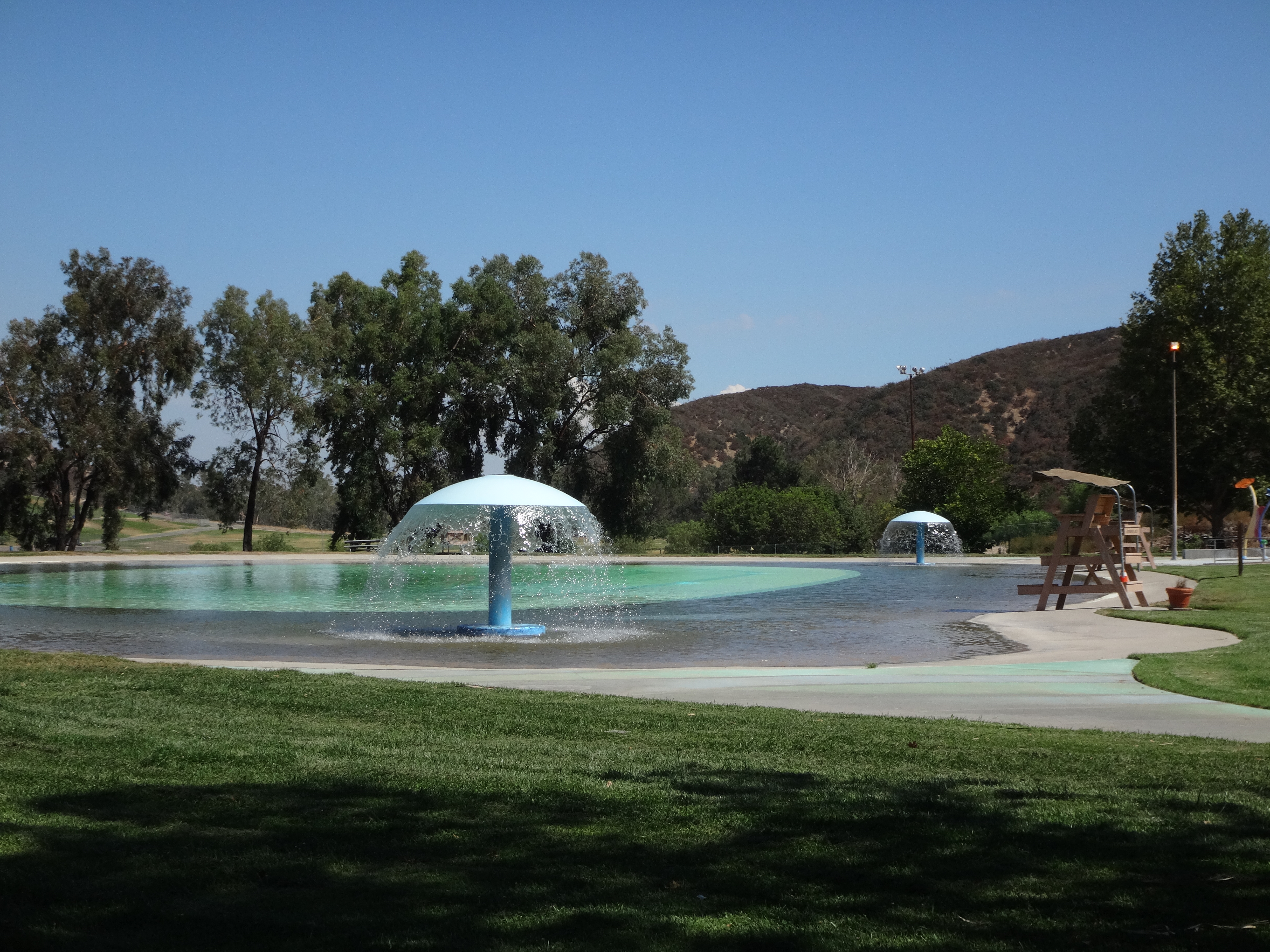
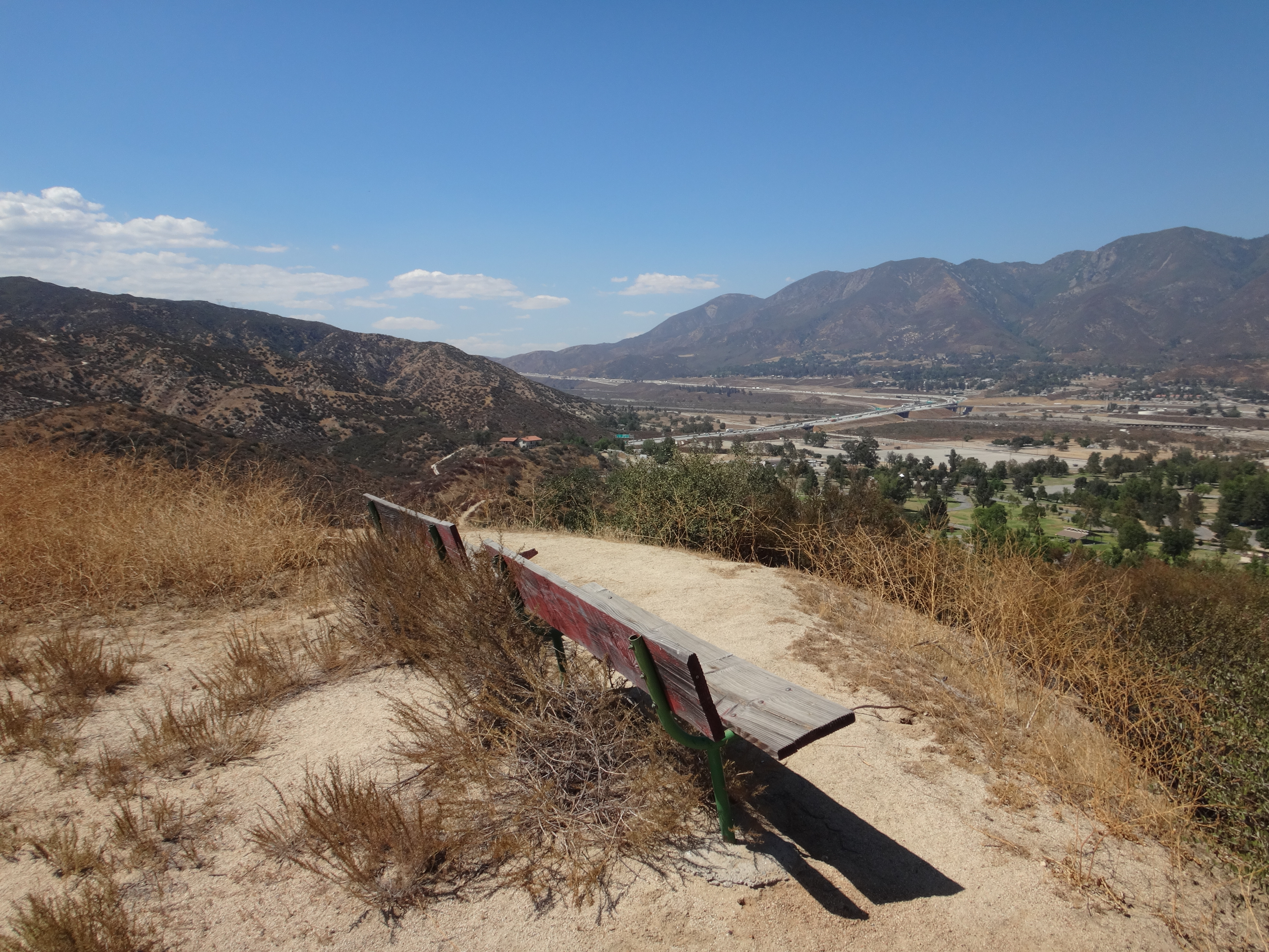
Behind the Water Park there was a fire road trail that skirted the southern perimeter of the park and ran up to the main ridge road, which then took me to the highpoint.
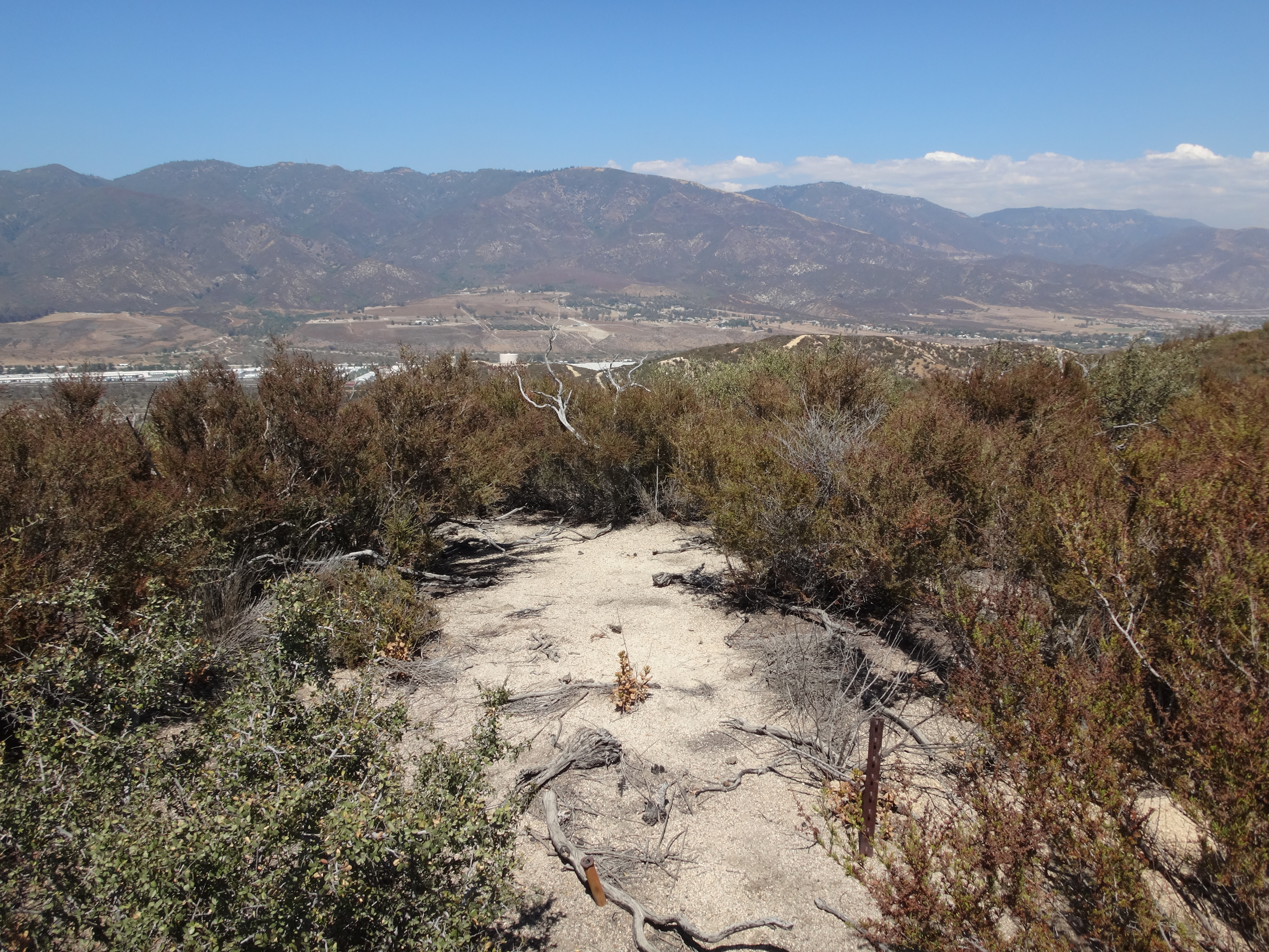
The top had only a couple metal posts in the ground. But a few spots along the road offered benches for sitting and enjoying fine views of the canyon pass.
My next destination was a simple, drive-up summit called Tokay Hill, on the opposite side of the canyon in Devore Heights. The hill has a paved street (Knoll St.) atop it. There is nothing up there except houses.
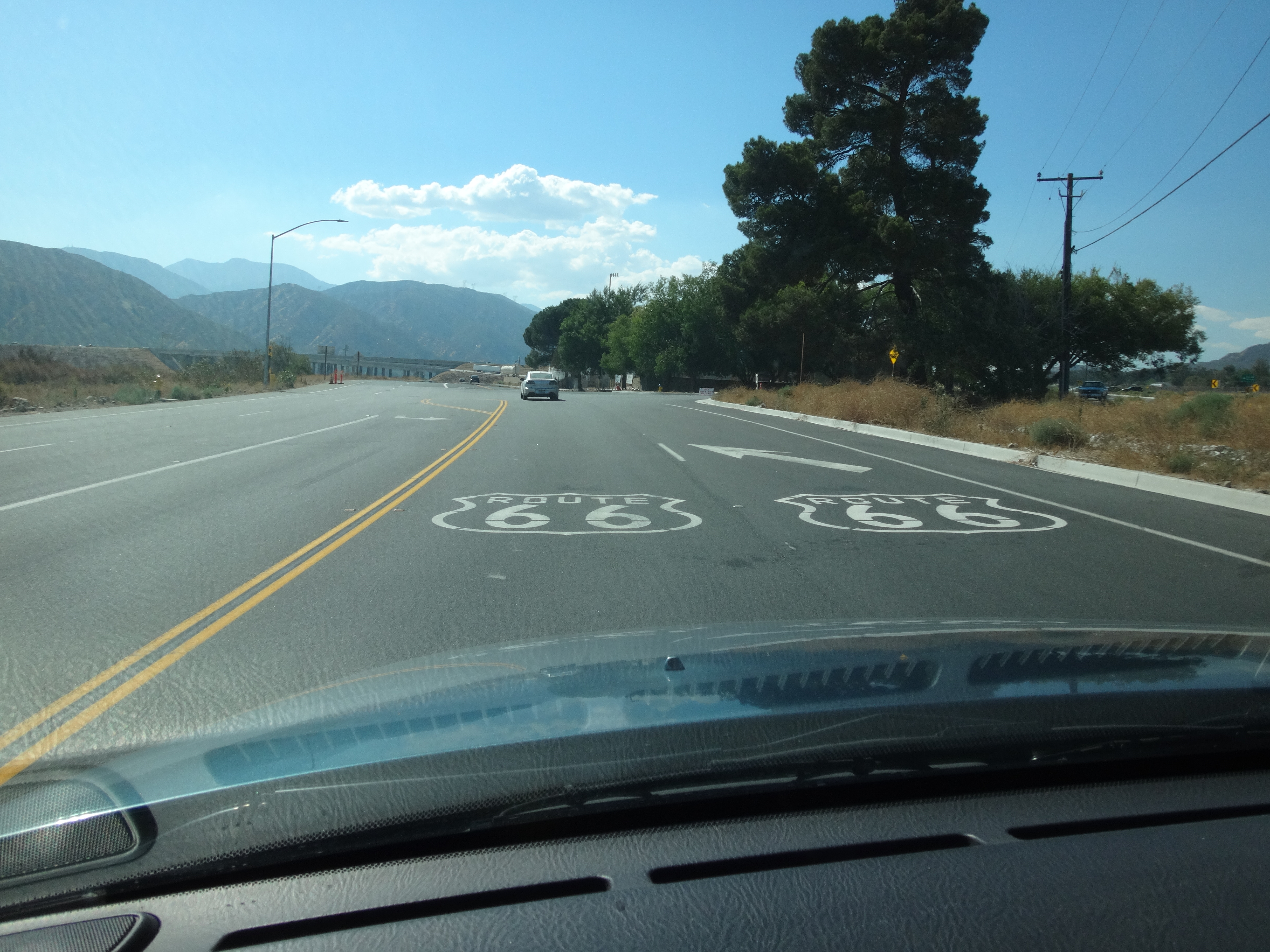
I then descended and turned onto Cajon Blvd, which is also Route 66.
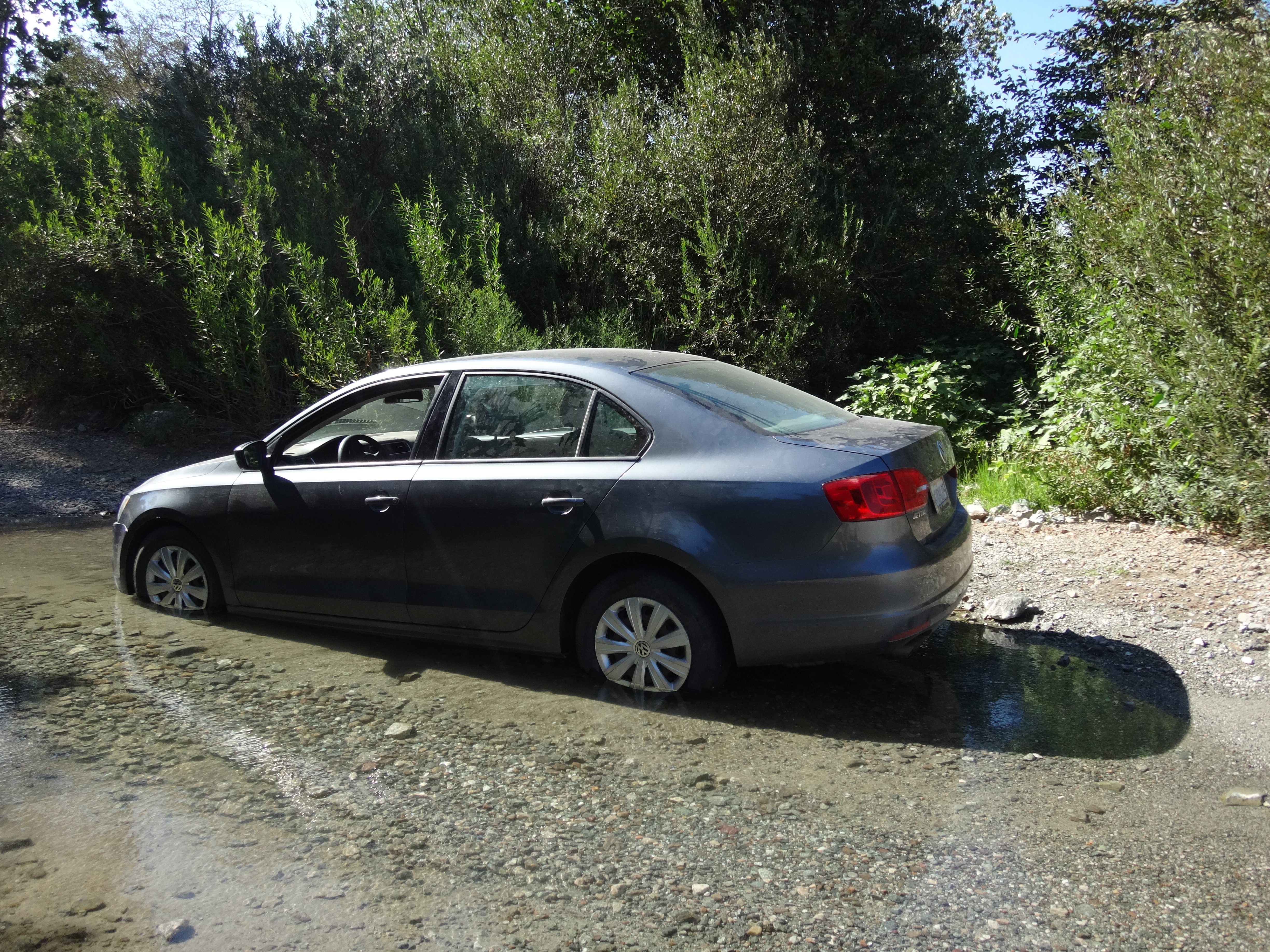
I next wanted to bag Ruddell Hill (2520'), about three miles up the canyon. It could be seen on the opposite bank from Route 66, across the river and railroad tracks. I turned onto Keenbrook Road, hoping it would take me closer to the peak. The dirt track was okay for my Pilot, but then I encountered a blue Jetta stuck in the creek crossing.
I thought I might park along the road here and head out on foot down the wash, but I only got a few yards before a Sheriff's unit rolled up. He passed my car and went to deal with the Jetta. Nevertheless, I figured it wasn't a good time to leave my Pilot parked on the road and scramble along the wash in plain sight of the fuzz. Hopping back in the car, I took off for the next oddball landmark on my list.
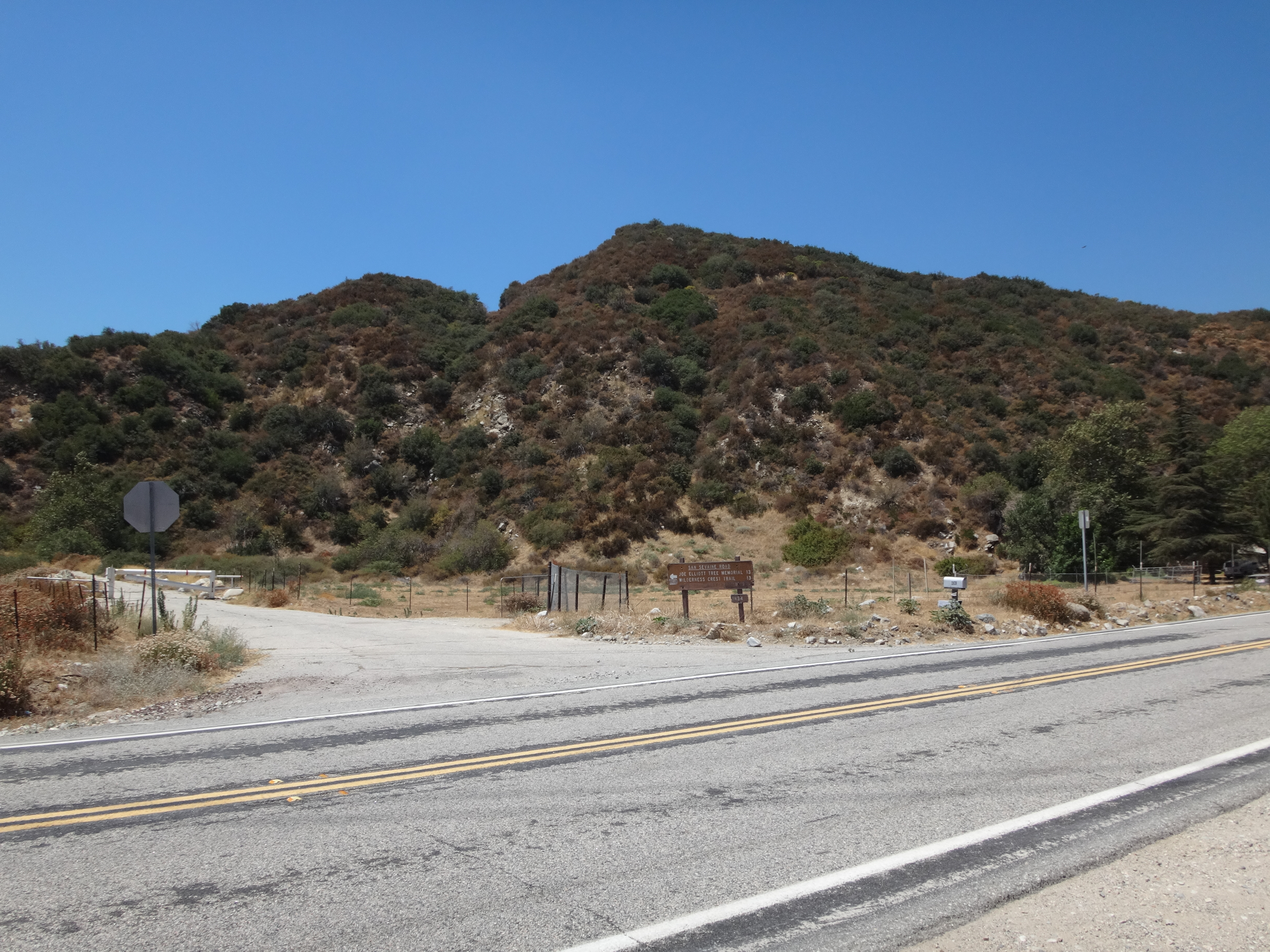
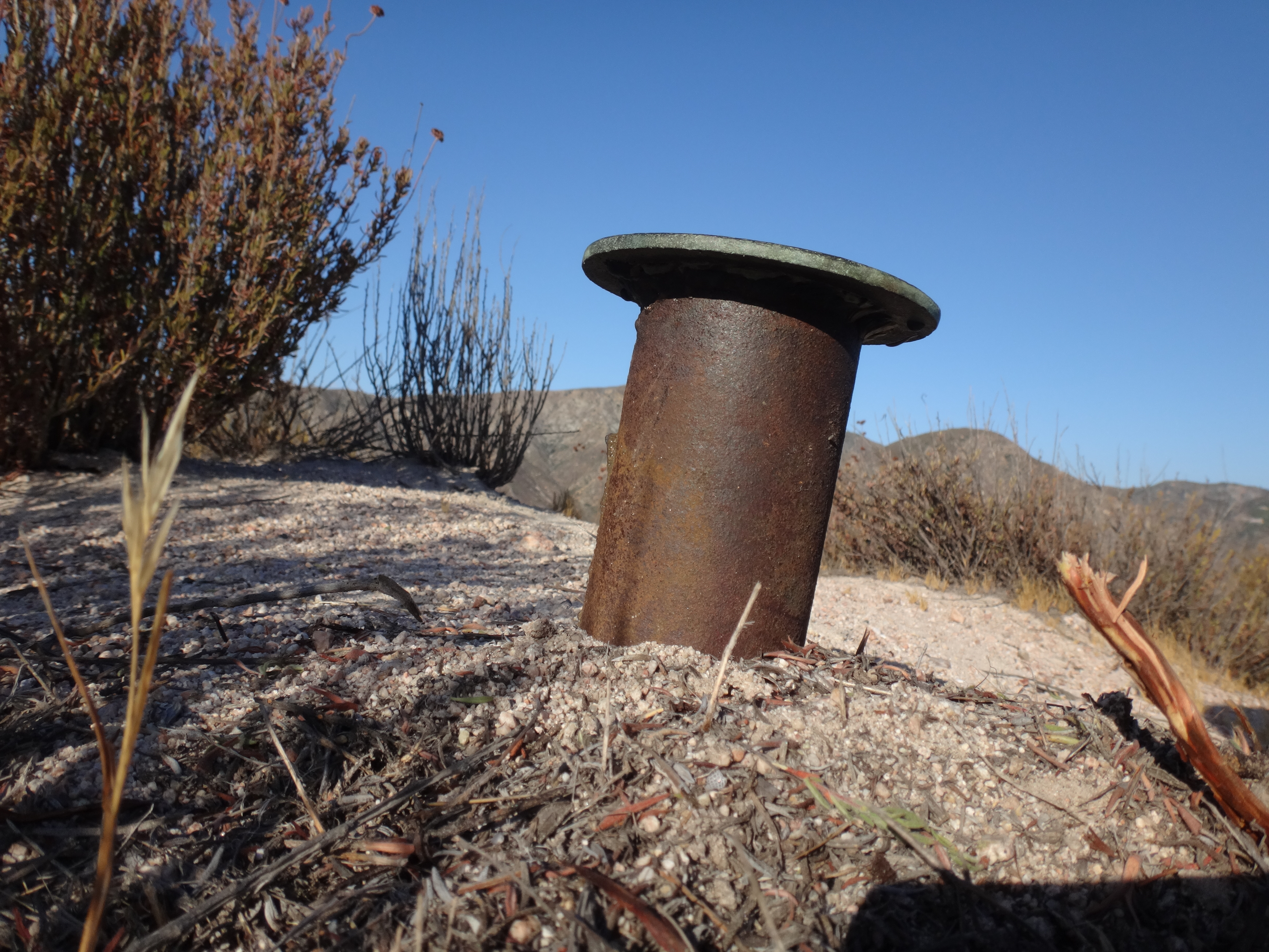
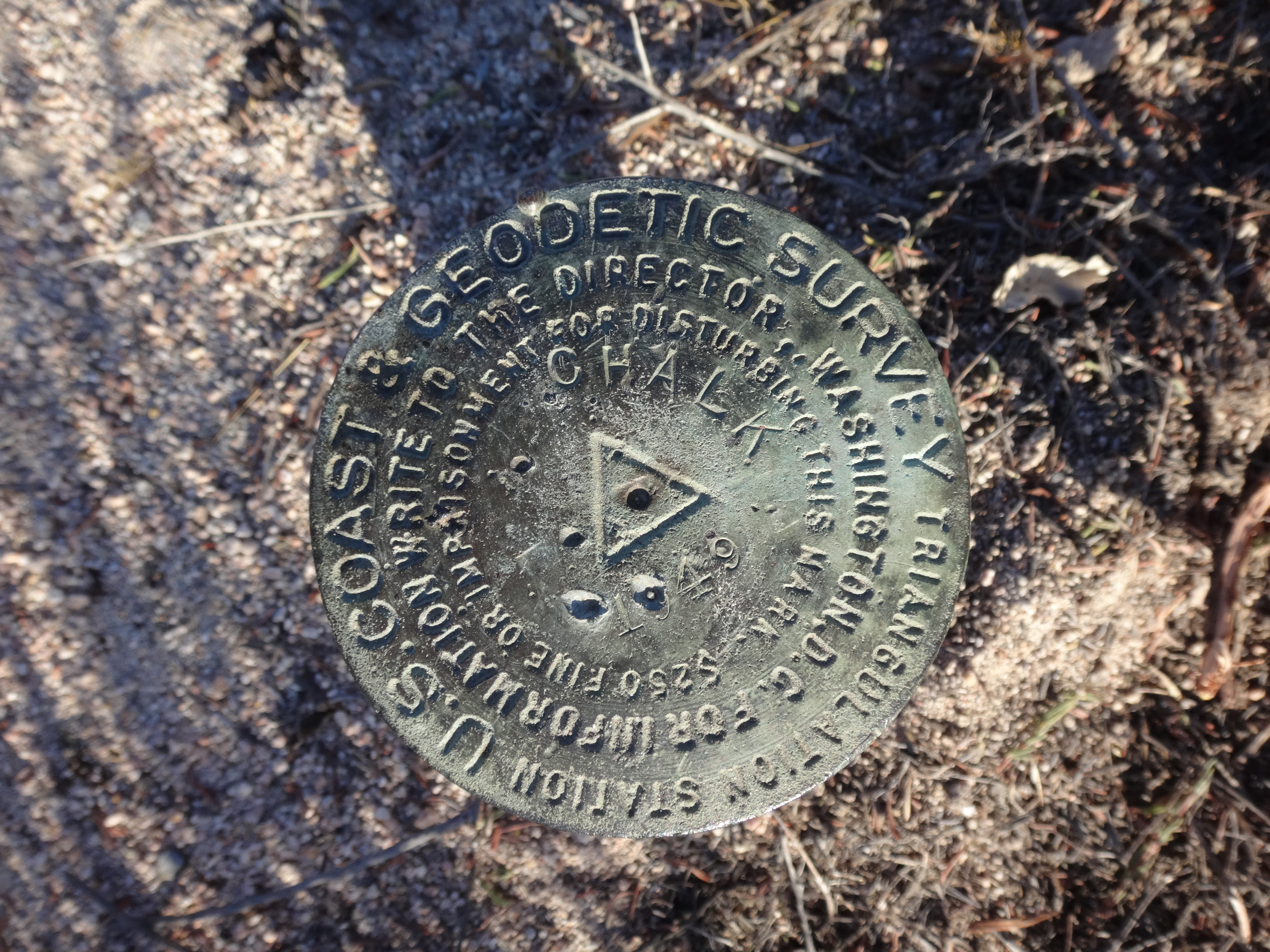
Chalk Benchmark (3406') appears on the 1996 Cajon quadrangle, approximately 1.8 miles south of Cajon Junction.
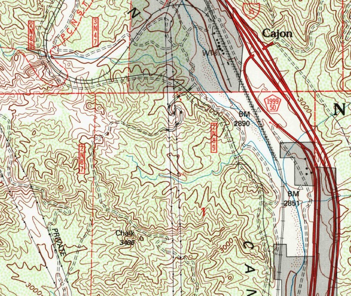
I continued up Cajon Blvd to where it banks right and passes under the Interstate. Instead of banking right, I kept straight onto a dirt road that parallels and crosses the railroad tracks on the left.
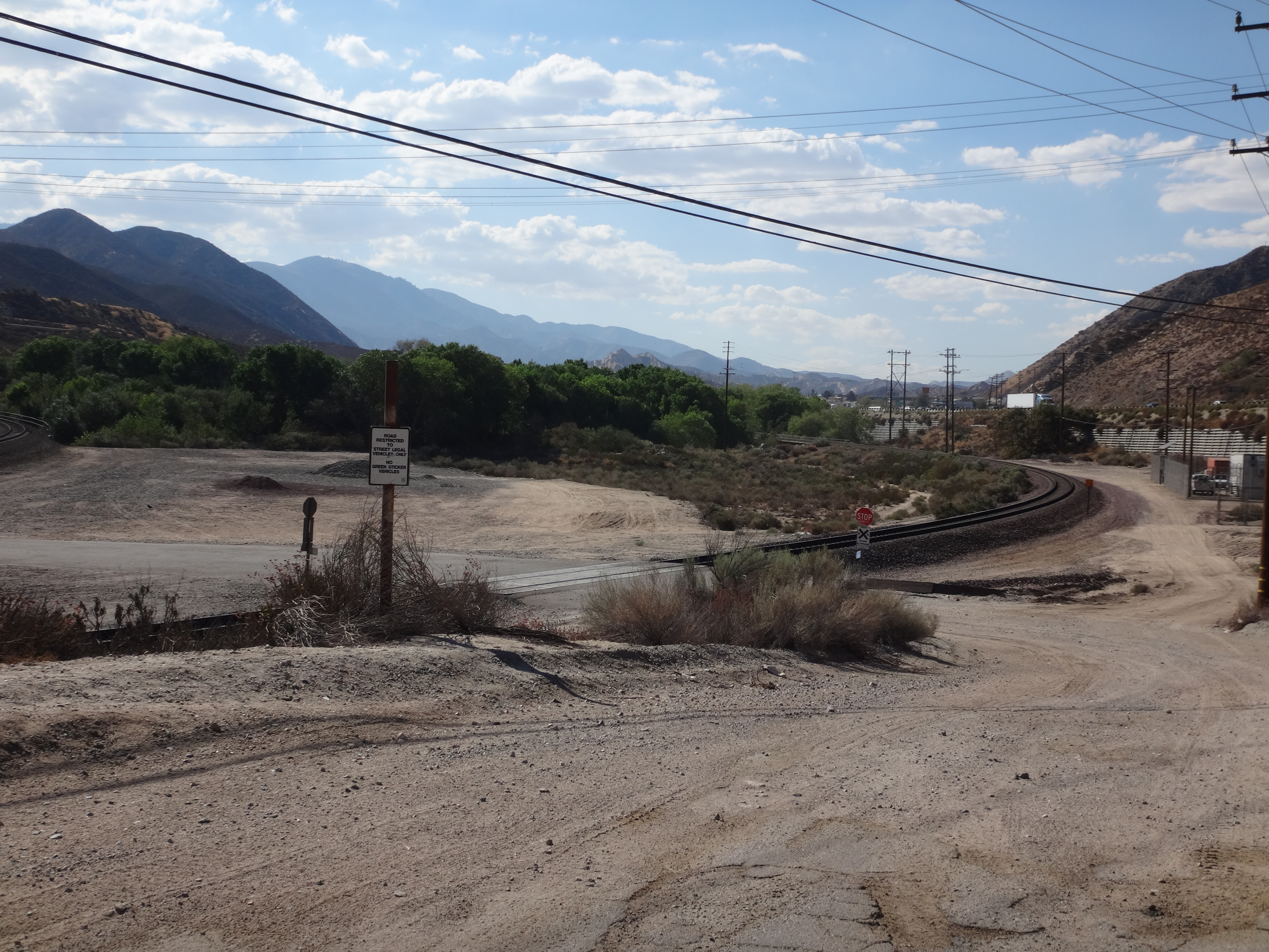
After an easy creek crossing, there was a sandy, bumpy part of the road that gave me pause. So I retreated and parked before the crossing, deciding to get some extra exercise instead of a stuck SUV. I grabbed a bottle of Vitamin Water and headed out along the unsigned network of fire/service roads.
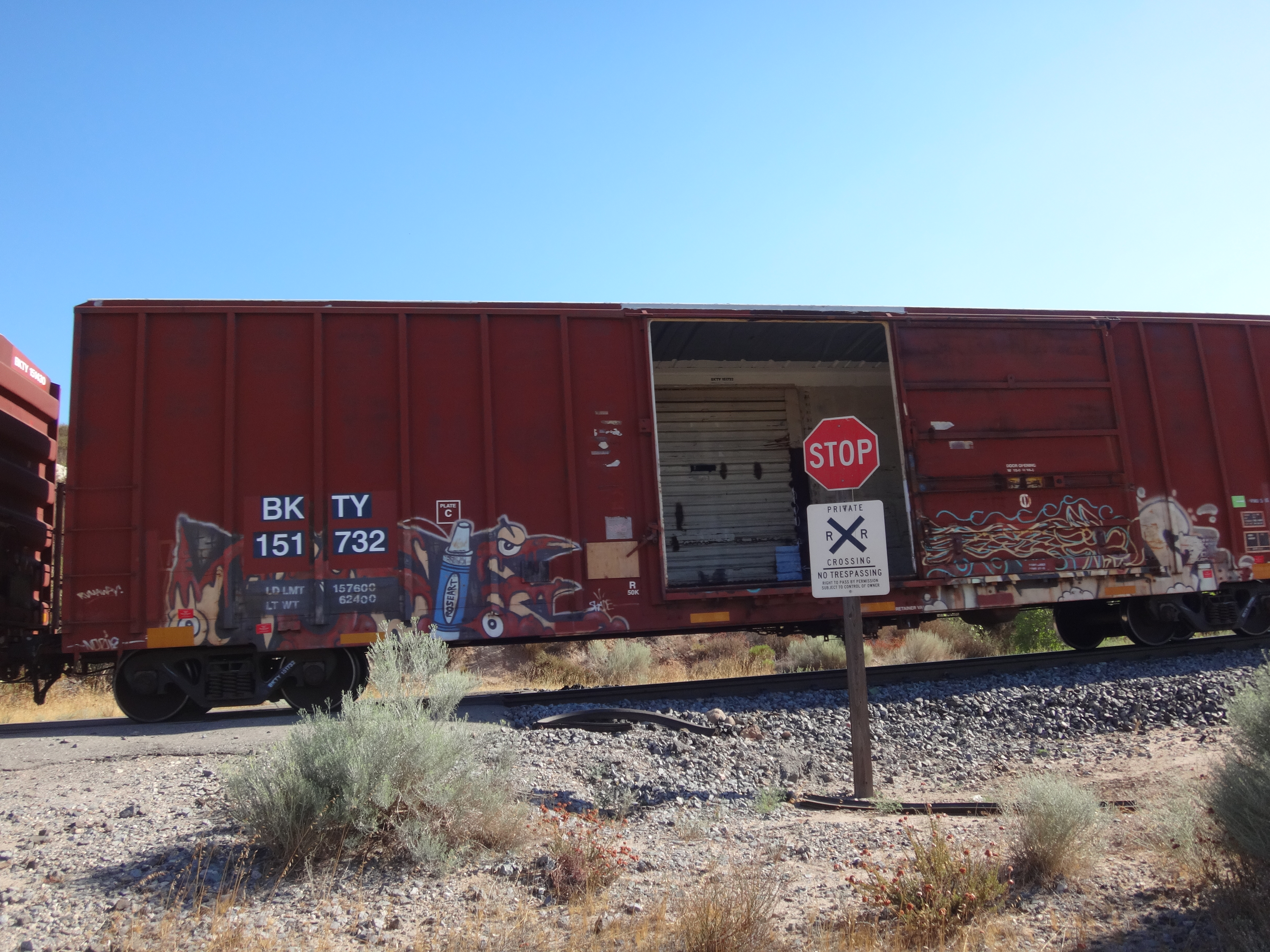
There is another set of railroad tracks higher up. Long trains were constantly creeping through the area, forcing me to twiddle my thumbs as they rolled by as slowly as possible.
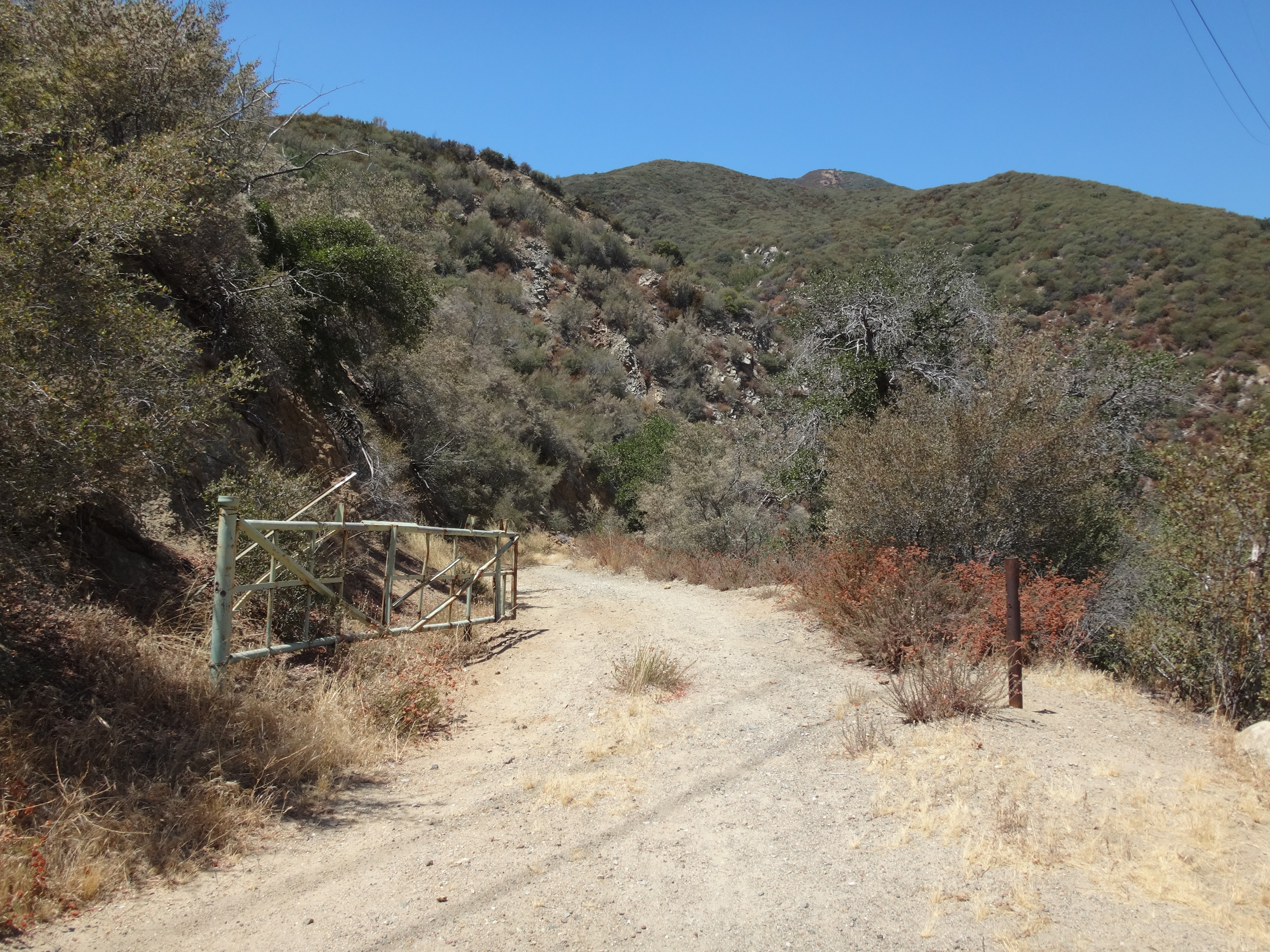
Another issue was my out-of-date USGS topo map, which contained a slight error where FR 2N87 crosses the upper tracks. The road no longer flows straight across the railbed. It's necessary to head left, beside the tracks for a bit, in order to locate the upper, gated road segment.
This error caused much confusion at first. The upside of which being that I got to experience old, overgrown side roads that nobody uses anymore. In any case, I eventually figured out the problem and got back on the correct route.
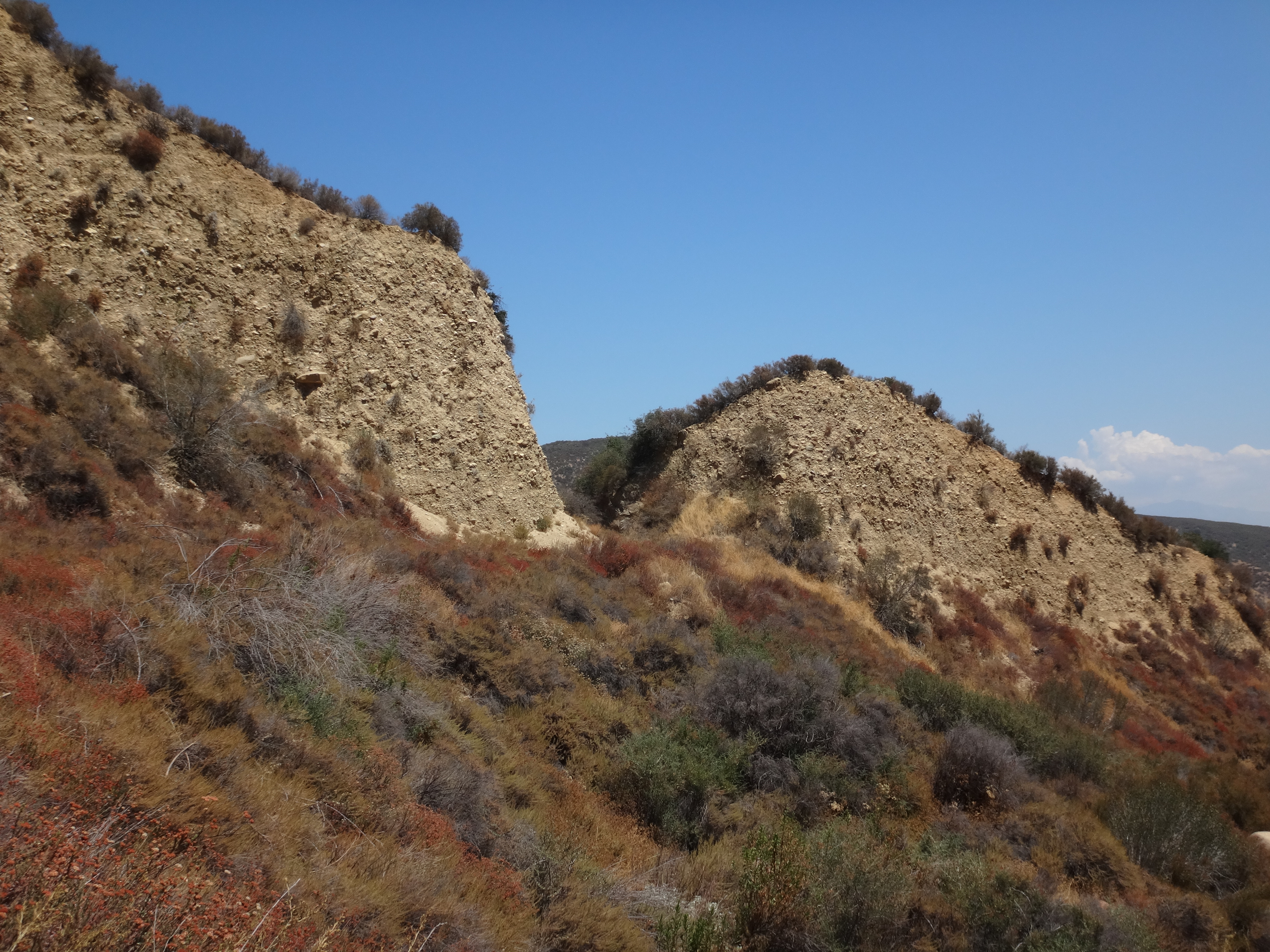
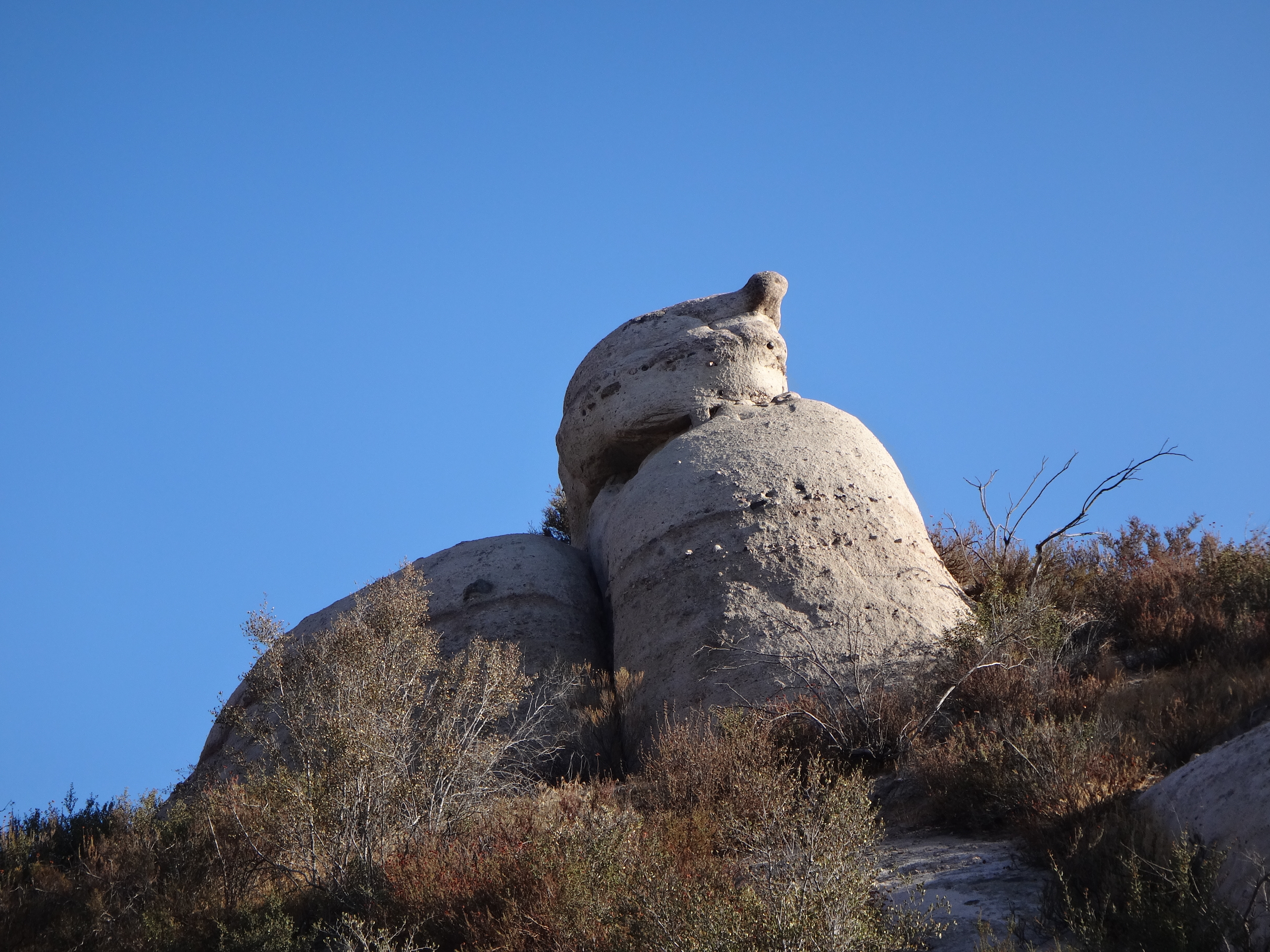
The upper road portion wraps around the head of a small tributary. Looking across the gully I could see in the distance the boulder-studded point of Chalk BM.
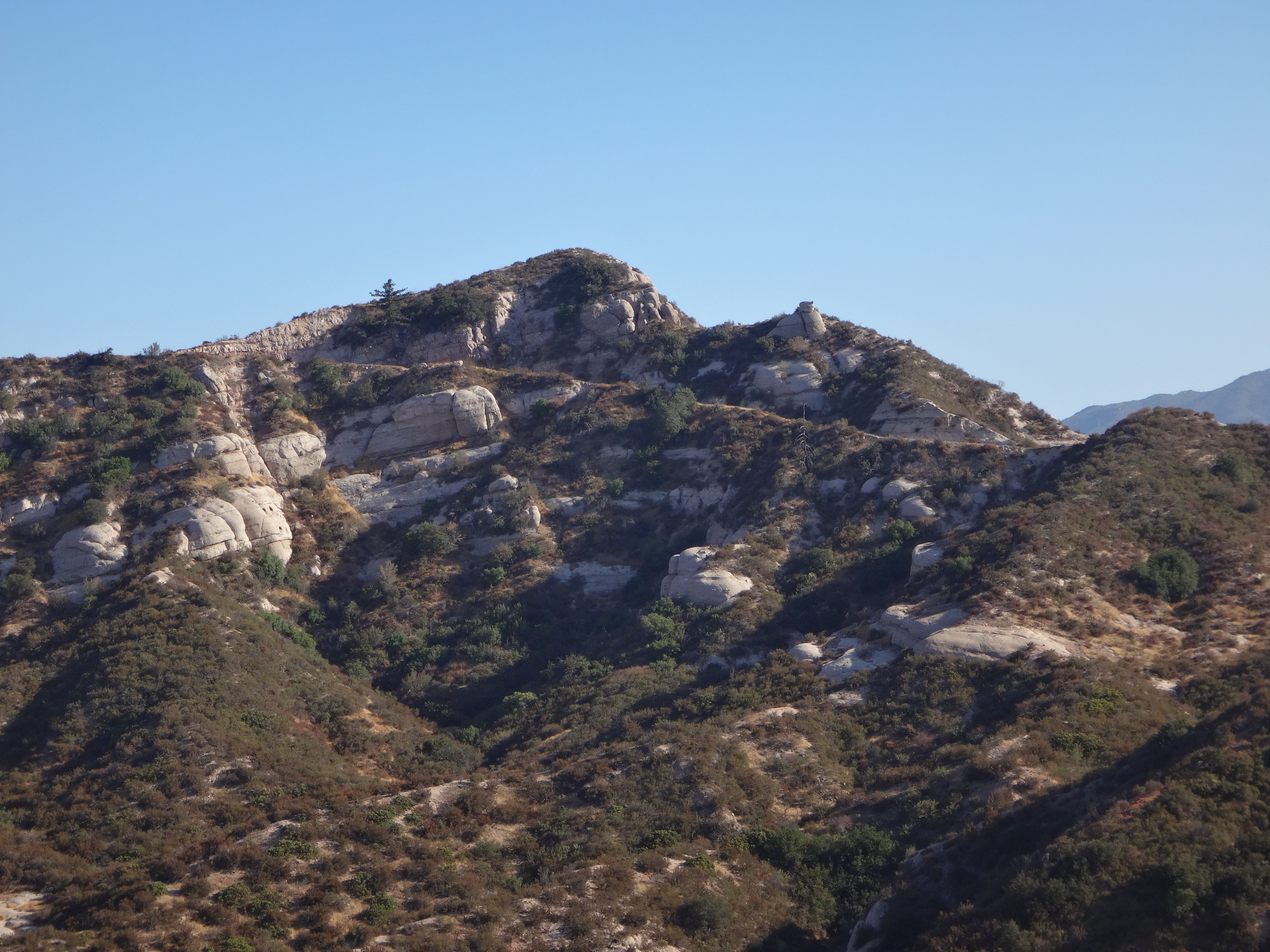
In fact the whole area kind of looked like that with neat rock features.
In total it was about two miles one-way to the peak, where the benchmark was waiting for me on the open but small summit.
When I returned to the car, it was 7pm and time to return home to catch some TV coverage of the Olympics.