I've done a little homework on the possible alternative routes mentioned with a different approach from Buckhorn. See Caltopo map...
http://caltopo.com/m/6416
Red + Green = approach from Smith saddle. This looks too long and I don't know if the climb from the east face is possible (especially for me). Doesn't look promising.
Yellow = Drop off 39 at a turnout and follow Bear Creek to the scree slope.
Loss 2749'
Gain 3452'
Total Gain RT 6201'+
One way 3.92 miles, RT 7.84 miles
Blue = Buckhorn down a gully to Bear Creek, around bumps to the scree slope.
Loss 3199'
Gain 2785'
Total Gain RT 5984'+
One way 4.25 miles, RT 8.5 miles
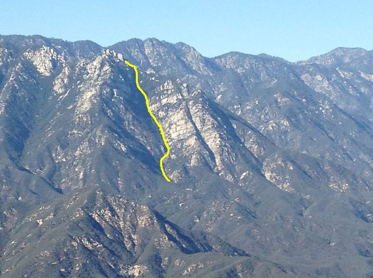
What the yellow and blue routes share is a 2500' gain over the last 1.2 miles up scree and dirt! That slope has to be class 3+, but maybe hugging the tree line on the left side of it would give you some natural anchors.
Buckhorn looks like it might be the best non-ridge option, but you also have to watch out for "grow friends" in the area.
Every option looks like an absolute bitch. Google Earth can't see long sections of Bear Creek for the trees and vegetation. Those sections could be snarls or just canopy. Can't tell without going there.
The ridge at Ze's pace is about 15 hours. If the alternate routes are an average 1/2 per hour, then you are not saving much. If they are 3/4 mile per hour, Buckhorn could be around 11.3 hours. That might be worth it.