Occidental Peak Traverse

TRs for the San Gabriel Mountains.
Post Reply
User avatar
Sean
Cucamonga
Posts: 4052
Joined: Wed Jul 27, 2011 12:32 pm

Post by Sean »

Dima, Hank, and I thought that Occidental Peak needed to be bagged early Sunday morning. So at 8am we set up a car shuttle between Eaton Saddle and Mt. Wilson, with the intention of traversing the peak east to west.

Image

After parking at a sort-of turnout next to the driveway for the most western tower complex (K-CBS), we looked for signs of a use trail along the ridge. Unfortunately, we hadn't sufficiently studied our homework and probably made the hike more difficult than necessary by choosing to skirt the property line along the south side of the fence. In hindsight, following the north fence is probably much easier.

Image

After pushing through some brush, we came upon a stepped and railed path which led downward to an impressive support anchor for the tower.

Image

Image

Back up the steps, we continued westward in pursuit of Occidental Peak. The path gave out, and we found ourselves side-hilling across very steep and loose junk. Eventually the slope proved to be too dangerous. We scrambled to the ridgetop and found ourselves still within the tower complex, this time at an apparently defunct building and smaller tower. These proved to be the last structures on the west end of Mt. Wilson.
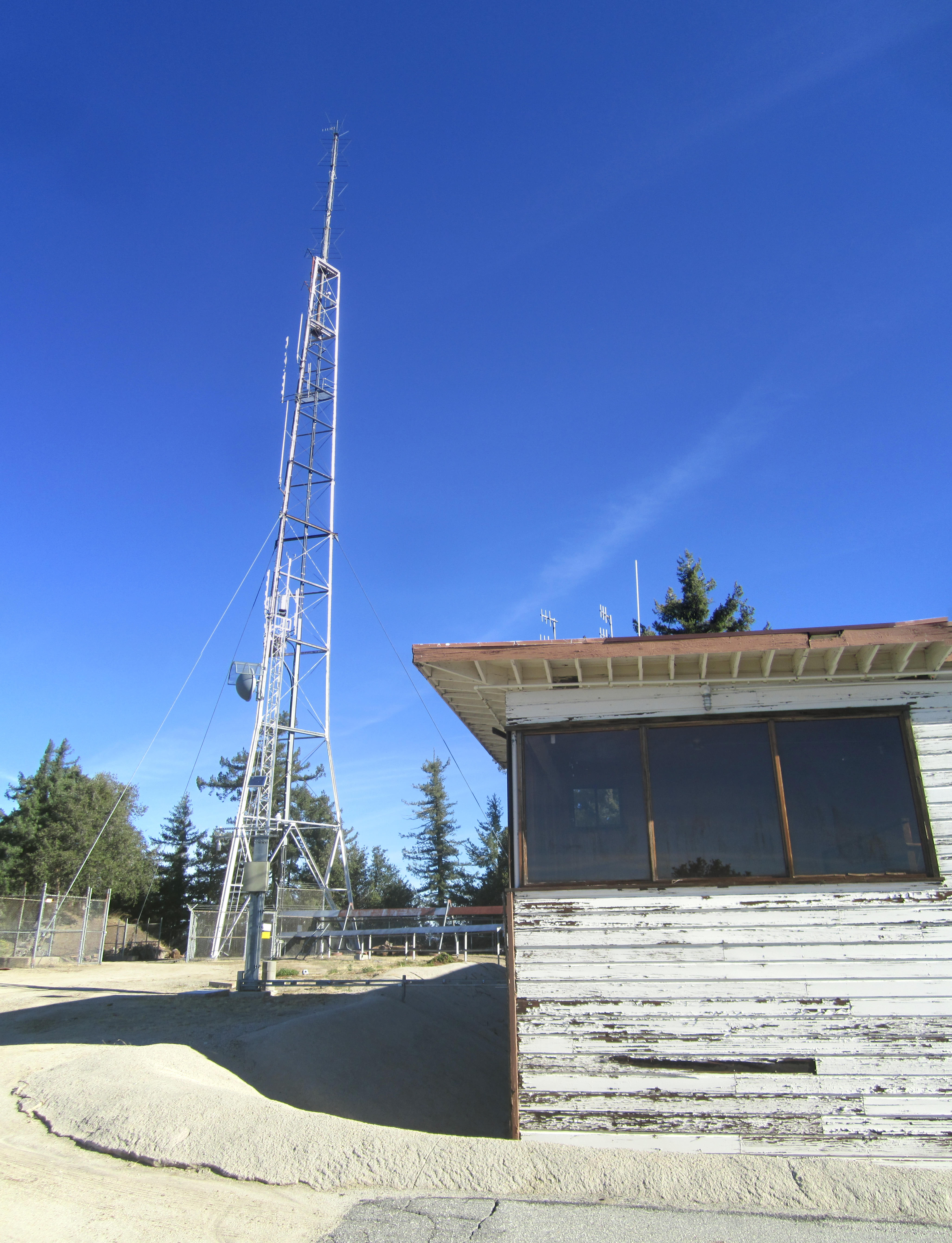
Image

There was a final fence to bypass, a helipad to cross, and at last the real use trail to pick up.

Image

The path descended a little, running along the north slope of the ridge, bending toward a saddle. It then bypassed a small bump before climbing a short distance to the rather unremarkable summit, which was covered in rocks and brush and offered no great views.

Image

Dima and Hank found a small spot tucked between the tall brush, where they could sit and drink some water.

Image

A search of the summit turned up part of a plastic bag and a piece of an energy bar wrapper. But no register could be found.

After our break, we continued the traverse by scrambling down the west ridge, which can be negotiated through a series of faint use trails and a bit of genuine bushwhacking and bouldering.

Image

We stayed fairly close to the ridgetop on the shaded north side. At a clear bump west of the peak we were invited to take in the views of surrounding peaks, including Lowe, Markham, and San Gabriel.
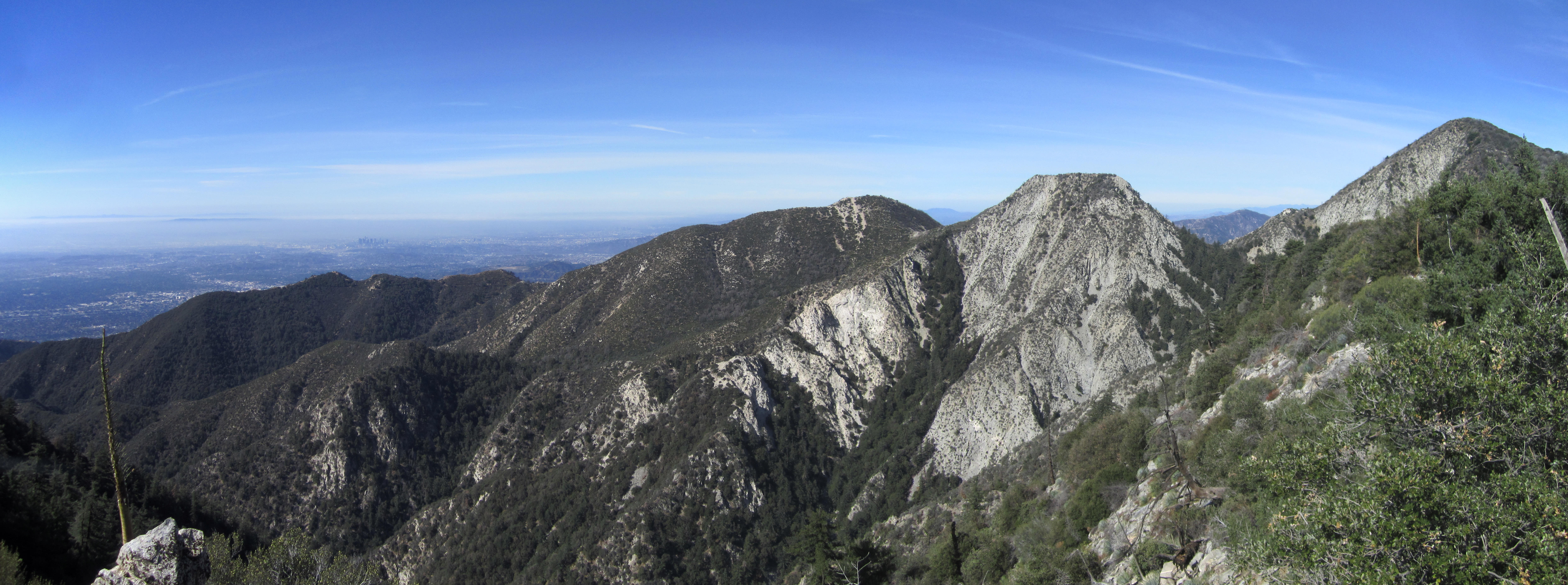
Image

After this bump the ridge continued placing obstacles in our way. Mostly, however, there was some sort of faint path to follow here and there. And after starting on Mt. Wilson two hours prior we reached Eaton Saddle around 10:30am, completing our traverse of Occidental Peak.
User avatar
tekewin
Posts: 1259
Joined: Thu Apr 11, 2013 5:07 pm

Post by tekewin »

Cool traverse, and apparently dog friendly.

There was a register there last November in a Pirouline can.

Isn't there some kind of drop or notch on the east side of the peak?
User avatar
walker
Posts: 248
Joined: Mon Apr 08, 2013 11:14 pm

Post by walker »

Nice job, guys!

I went from West to East and enjoyed arriving at the use trail after the bushwhack and scramble that's involved in navigating the west side of the peak. The north side of the fence is definitely the way to go.

I like those view spots with big dropoffs to the south, I think that one just east of Eaton Saddle is where you got the view shot?
A search of the summit turned up part of a plastic bag and a piece of an energy bar wrapper. But no register could be found.
Maybe somebody has a vendetta against summit registers, or at least that one in particular. When I was there, the register was present, but somebody had ripped up all the written pages of the booklets into little scraps of paper and then deposited them back in the can and plastic bag and scattered some around the area for good measure.
User avatar
Sean
Cucamonga
Posts: 4052
Joined: Wed Jul 27, 2011 12:32 pm

Post by Sean »

tekewin wrote: Isn't there some kind of drop or notch on the east side of the peak?
Image
(Occidental Peak's SE Face)

The SE face is extremely steep. But I didn't notice a huge drop or notch in the east ridge. It does descend about 80 feet though over a quarter-mile. The use trail around the bump is nice, and the saddle is mellow. It was rather easy once we found the trail.
User avatar
Sean
Cucamonga
Posts: 4052
Joined: Wed Jul 27, 2011 12:32 pm

Post by Sean »

walker wrote: I think that one just east of Eaton Saddle is where you got the view shot?
Yeah, the bump directly NW of the summit is a good vista point.

Sounds like the Register Ripper hit this peak sometime after last November.
Post Reply