Barley Flats

TRs for the San Gabriel Mountains.
Post Reply
User avatar
dima
Posts: 1349
Joined: Wed Feb 12, 2014 1:35 am

Post by dima »

Today I went to Red Box, intending to summit Lawlor, to take the ridge to Barley Flats, and then check out some other stuff in the area that I've never visited before. Oddly, two of the trails I wanted to check out had loud environmental closure signage, so I cut the day short, which was just as well given the heat.

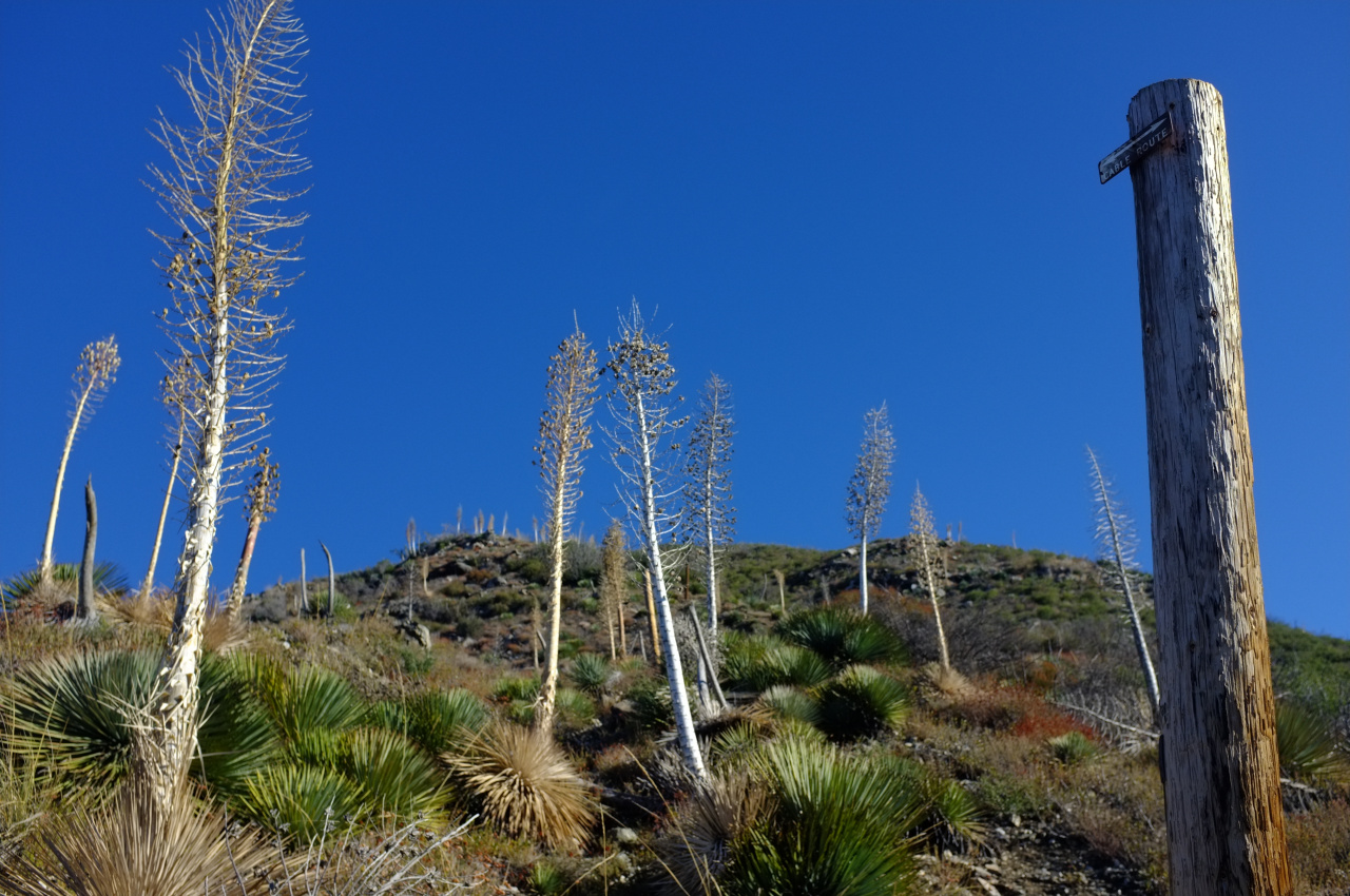
First things first. Lawlor has an express route climbing one of its South ridges. From Red Box saddle you can gain the ridge bypassing the road cut on the East. Then there's a steep-but-reasonable ridge to intersect with the trail. From the intersection one can continue straight up on a steep-and-sometimes-unreasonable ridge:

Image

The route is one of the ridges in the center of the photo. A helpful sign in the middle of the climb declares this to be a "cable route":

Image

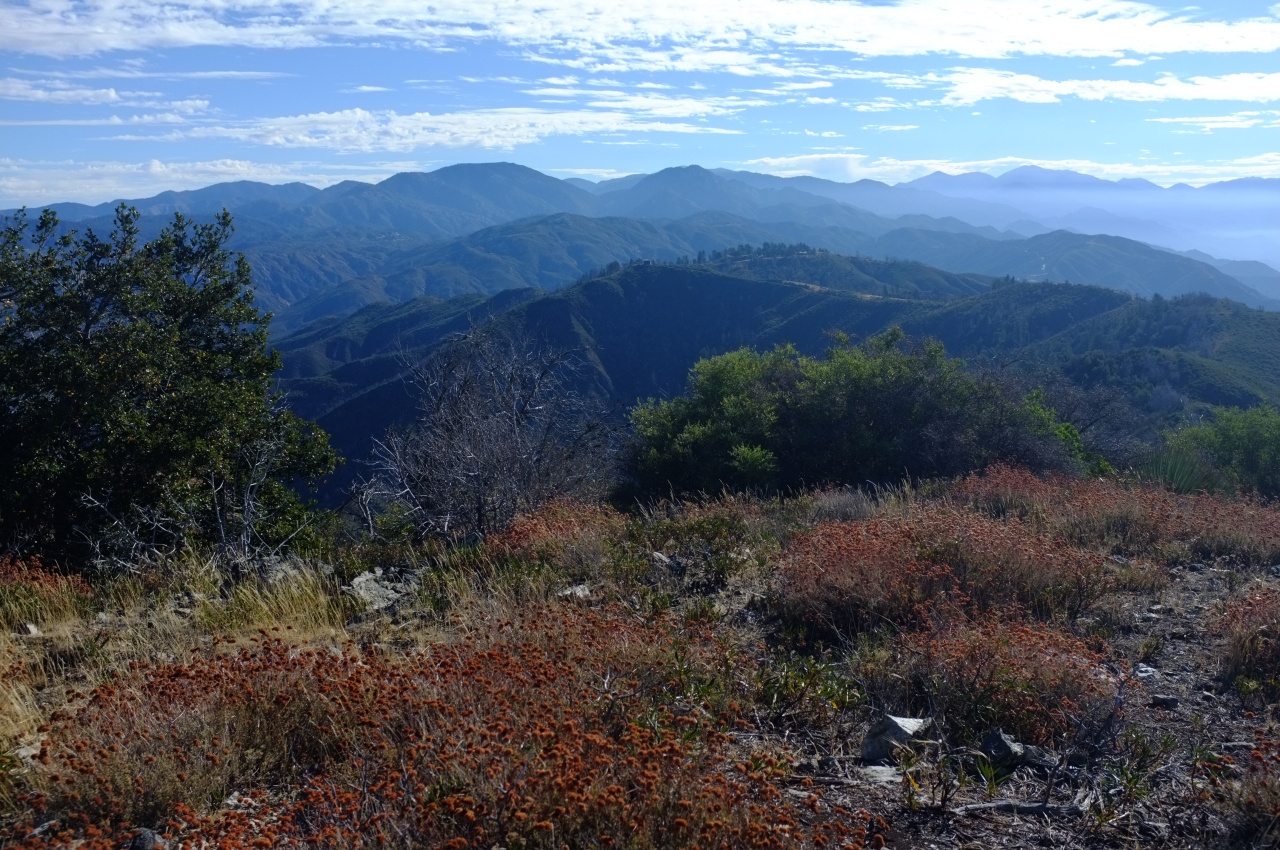
The views from the top were nice, as usual. View to the East:

Image

I took the ridge to the East towards Barley Flats. There's a good use trail that has some brush, but it's really not terrible at all. There's some kind of construction at Barley Flats:
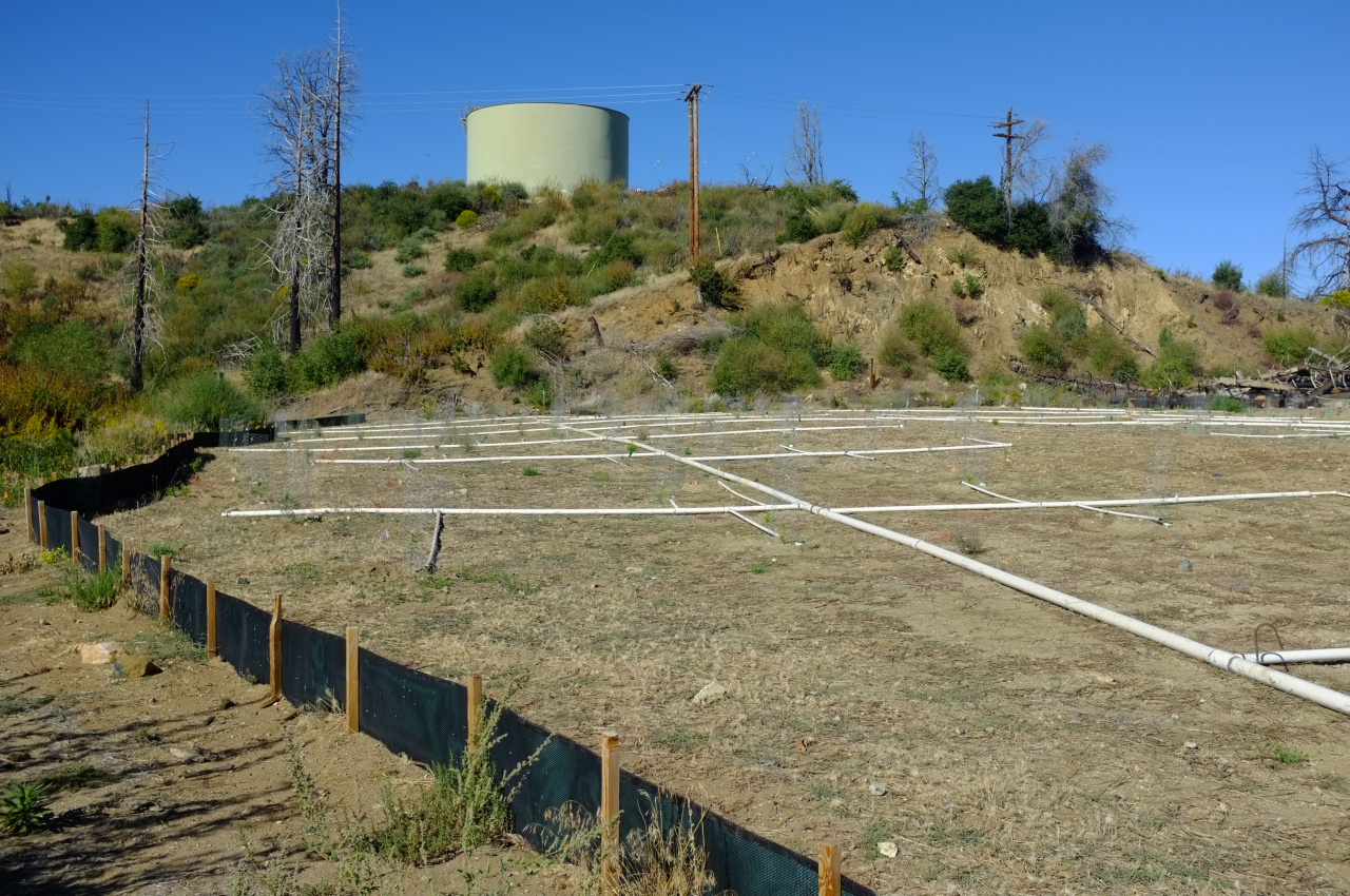
Image

Irrigation lines?

From Barley Flats I was intending to take the trail called out on the USGS topos that drops down to Big Tujunga. This one:

http://caltopo.com/map.html#ll=34.28375 ... f&a=shared

There was loud signage (strangely unpictured) declaring the trail closed to let it recover, from the Station Fire presumably. I checked out a bit of it, and it would be a very unpleasant bushwack. It's VERY overgrown.

Fine. The plan was to descend on this, then ascend up Lynx Gulch:

http://caltopo.com/map.html#ll=34.31794 ... f&a=shared

I walked back to Red Box, which was very warm and took a little while. I then drove to Lynx Gulch to be greeted by several more loud closure signs (also strangely unpictured). These were different, but the gist was the same. One of them said something about the road being in an "arto" zone. I was fine to be done at this point, so I didn't push it. Does anybody know what the closures are about? Is it still Station Fire related? Is there a list somewhere of everything that is closed? What is an "arto" zone?
User avatar
Uncle Rico
Posts: 1402
Joined: Thu Mar 20, 2008 7:48 pm

Post by Uncle Rico »

Sweet pics dima. That Cable Route looks steep. As an old guy, I deliberately avoided that the last time I was in the neighborhood. I disclaim any knowledge about "arto."
User avatar
mattmaxon
Posts: 1137
Joined: Mon Mar 24, 2008 12:48 pm

Post by mattmaxon »

dima wrote: A helpful sign in the middle of the climb declares this to be a "cable route" :?
I believe this "Cable Route" was from the Nike Missile Radar station on Mt Disappointment to the Launch Facility at Barley Flat, communication, radar data etc between the two.

You'll see similar "Cable Route" signs on Mt Gleason between the Radar and Launcher

I am sure there are other similar locations around the country

Matt
User avatar
AW~
Posts: 2040
Joined: Mon Oct 01, 2007 12:00 pm

Post by AW~ »

Lynx Gulch is now SoCal Edison territory....in exchange for the transmission lines, SoCal Edison is tasked with managing the upper Tujunga per FS protocol under the guise of rehabilitation required.
ARTO is Arroyo Toad.
User avatar
dima
Posts: 1349
Joined: Wed Feb 12, 2014 1:35 am

Post by dima »

AW wrote: Lynx Gulch is now SoCal Edison territory....in exchange for the transmission lines, SoCal Edison is tasked with managing the upper Tujunga per FS protocol under the guise of rehabilitation required.
ARTO is Arroyo Toad.
Thanks for that. Is everything that's now managed by SCE technically closed? Is there a map? For what it's worth, the sign at Lynx Gulch was very sturdy and permanent-looking.
User avatar
AW~
Posts: 2040
Joined: Mon Oct 01, 2007 12:00 pm

Post by AW~ »

dima wrote: Is everything that's now managed by SCE technically closed? Is there a map? For what it's worth, the sign at Lynx Gulch was very sturdy and permanent-looking.
I havent seen any map of whats considered SCE worksite territory or not. I dont think they could or would stop someone from walking in non-worksite crosscountry(be aware of snakes!)....the area itself is not officially closed. Though at some point if you continue north, I think you would encounter a worksite road.
Post Reply