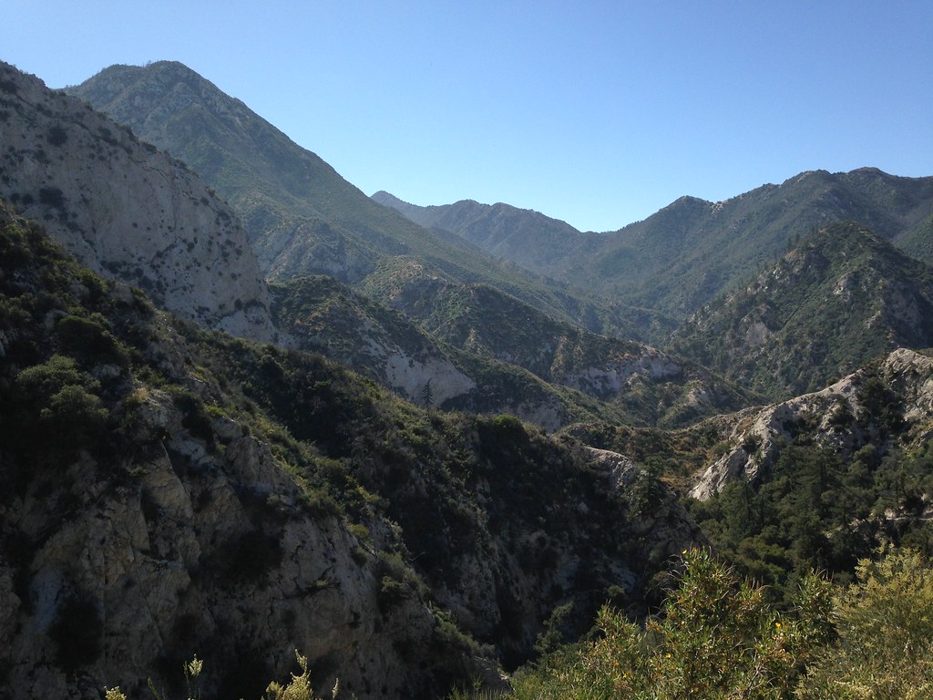
Several Sundays ago, after a few years of scoping out and scouting little bits of this, I finally gave it a run. The hike starts in the Arroyo between Bear Canyon and Little Bear Canyon and eventually continues up to peak 5058. The ridge involves a bit of class 4-5 scrambling on sometimes loose and crumbly rock and an increasing amount of brush and poodle dog as you work your way higher up. Bear in mind that the ascent is the easy part, once you've reached peak 5058, you find yourself right in the middle of a big chunk of trailess country with no quick and easy descent or return route and lots of brush on all sides, in some cases a descent will drop you into a trailess canyon or much further from your starting point. A smart person would probably set up a car shuttle and continue all the way over deception and down the disappointment trail/road, but I didn't have that forethought. In any case, anyone who does this should bring lots of water and his favorite brush ninja gear and beware that there still is a fair amount of poodle dog up in this area, though not nearly as abundant as a few years ago. (My descent involved crashing straight down through 600 feet of brush wearing my retired-raingear hazmat suit, but even so, I was a bit concerned about kicking up dust off all the poison oak and poodle dog and breathing in particulate matter, so some caution is advised. But I digress...)
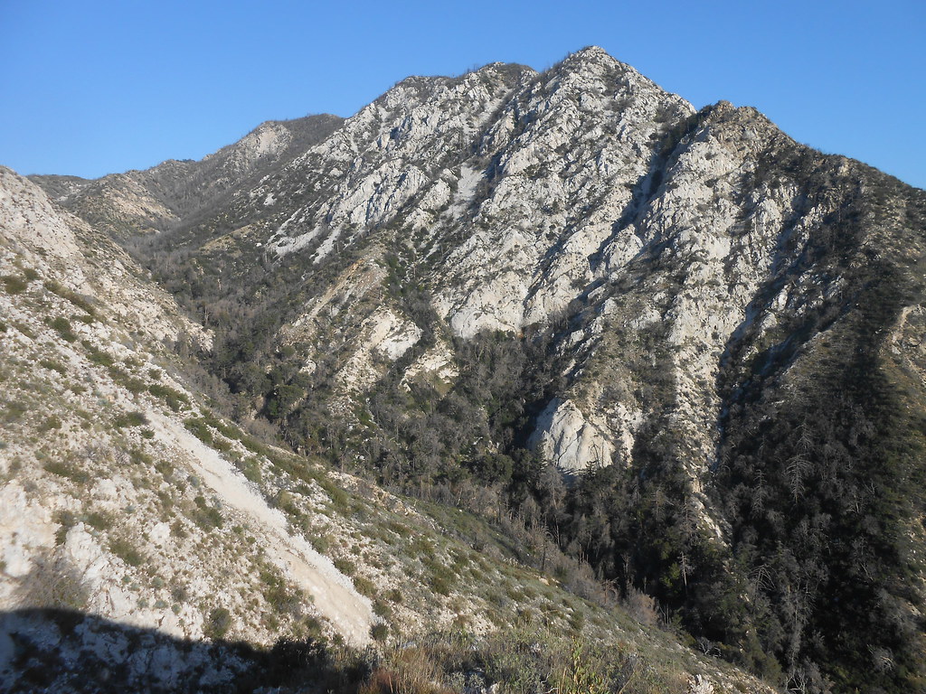
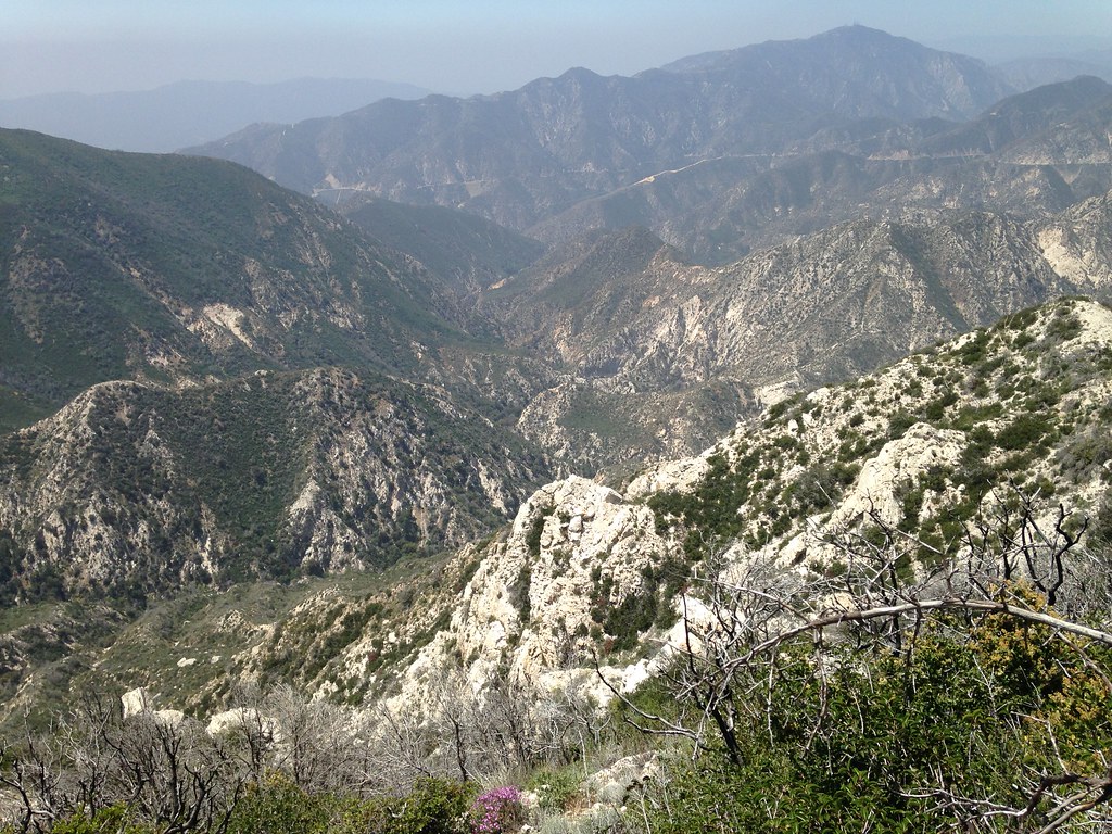
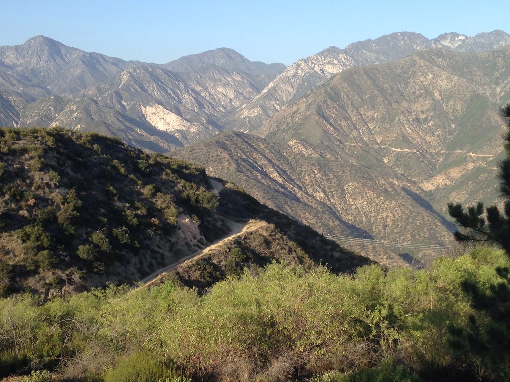
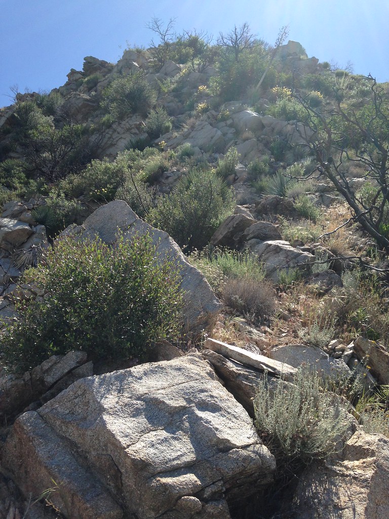
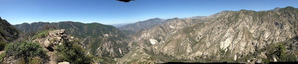
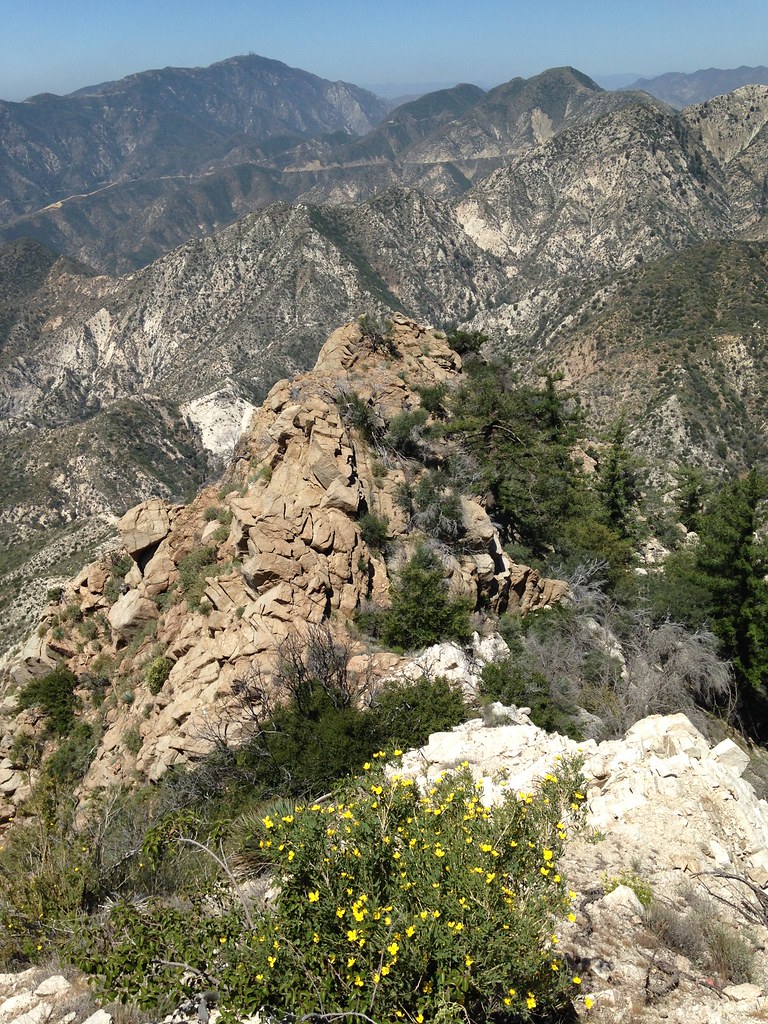
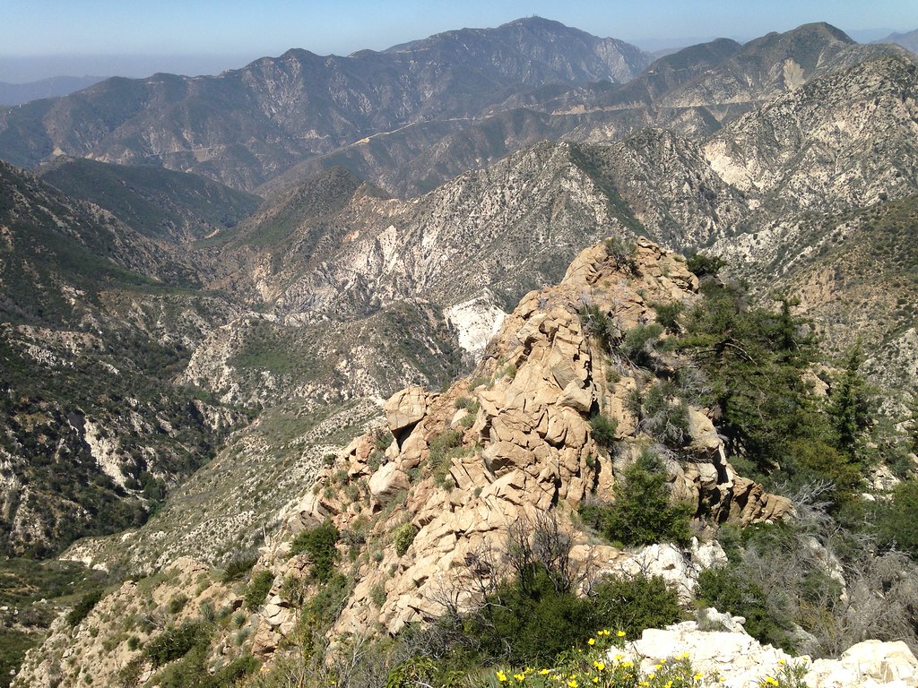
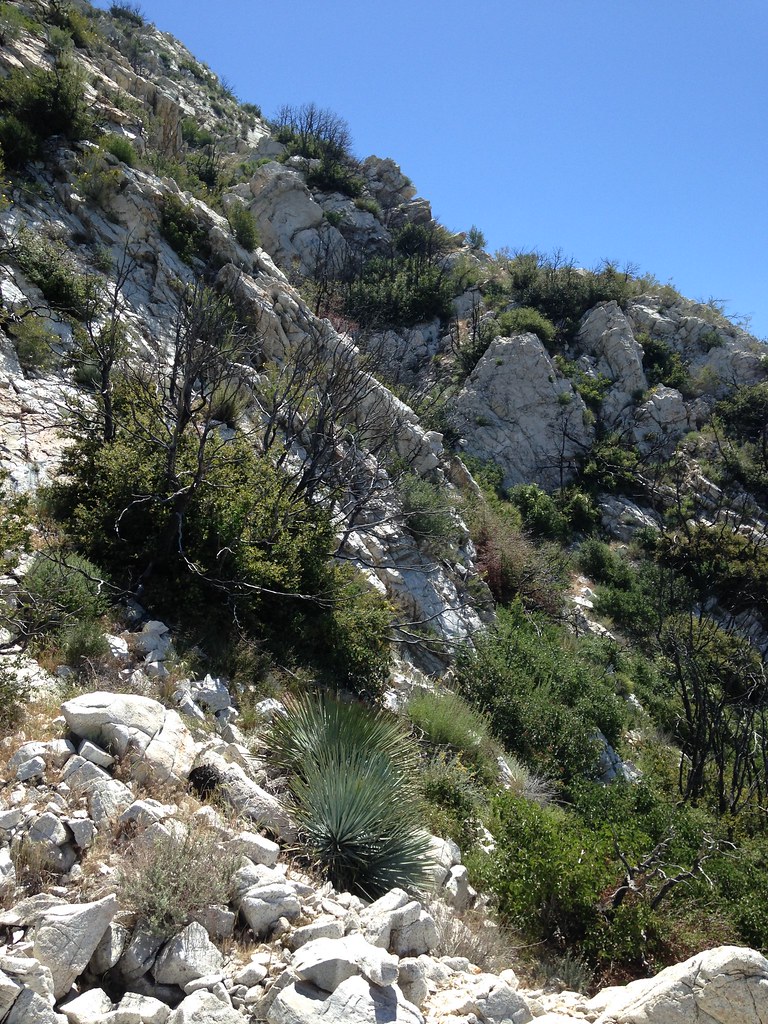
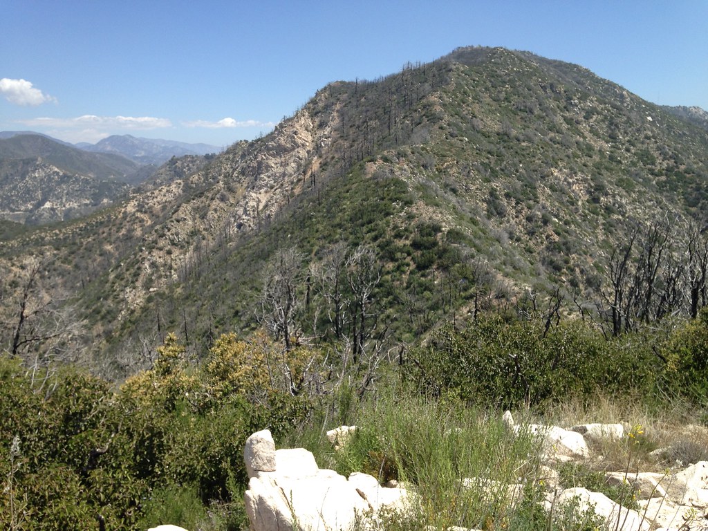
Here you can see the ridgeline in the middle distance starting down in the canyon and ascending upwards to the left and ascending the headwall. Though there's definitely some brushwork, some lower sections of the ridge have been nicely cleared by the station fire. In addition, after some trial and error on scouting trips, I managed to find a pretty good network of game trails to work through some minor cliffs and obstacles in the lower section.
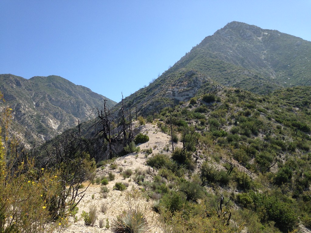
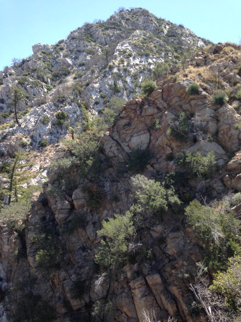
Looking up at the headwall, there are three steps visible. The first is of a brownish colored rock, the second looks like a white pyramid and the third is broken up by some brushy gullies.
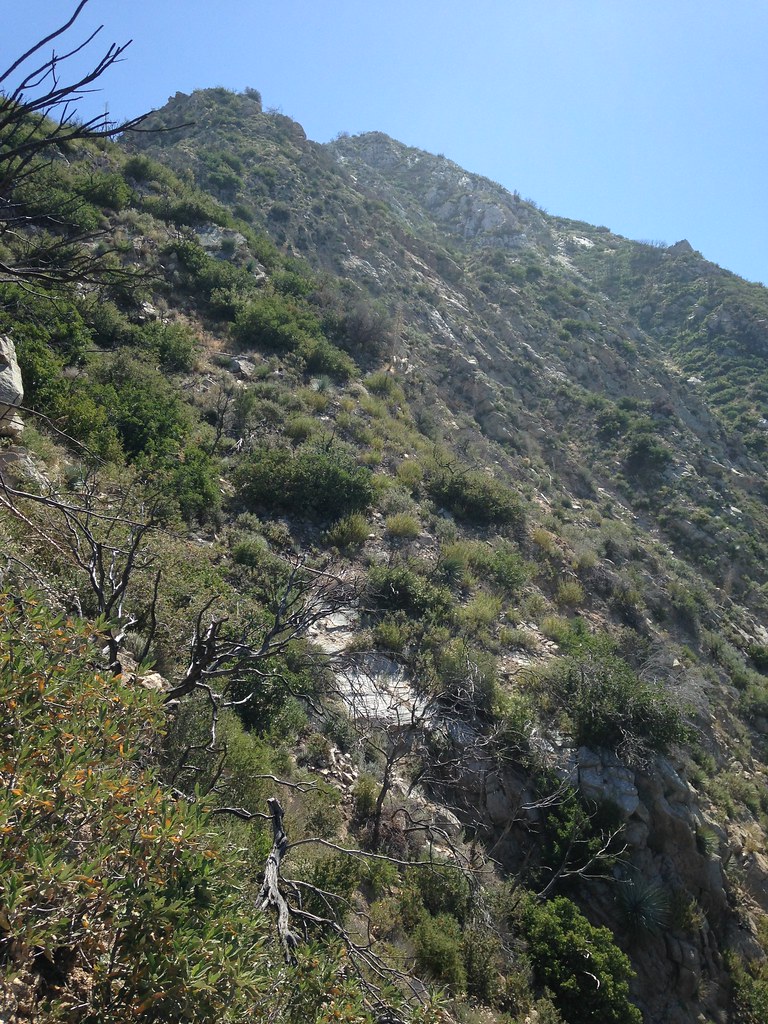
Approaching the first, brownish step:
Ascending the first step:
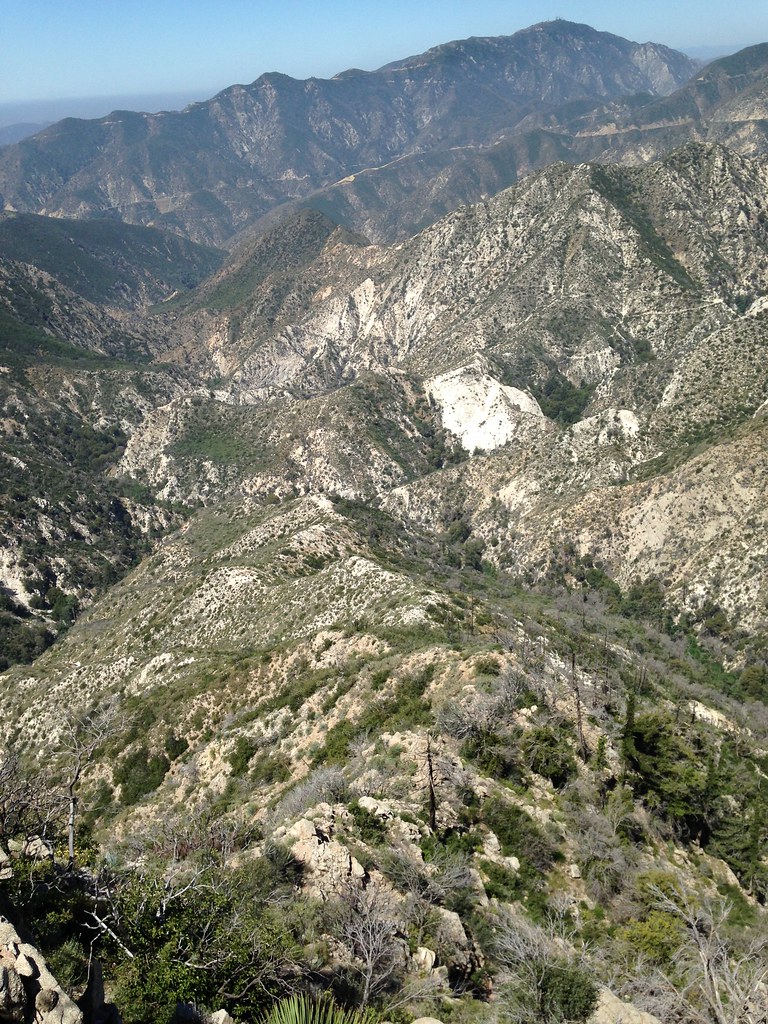
Here's looking back down the ridge so far. The Gabrieleno Trail is visible down there:
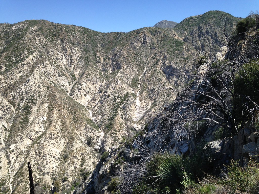
To each side, the terrain drops away more steeply:
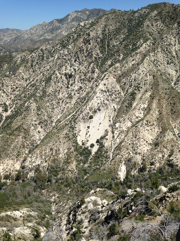
Atop the first step you get a look around:
Once you've reached the top of the first step, you realize that the first step is actually a narrow section of ridge (not quite a knife edge) comprised of several towers made of the same brownish, decomposing granite. You must climb directly over the towers in most cases and across the notches between them. I think there were three towers. Below you see one of the towers plus the second and third steps above it:
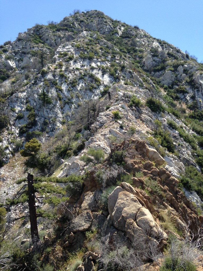
Here's looking at the final brown tower, the second step (white pyramid) and the third step above it:
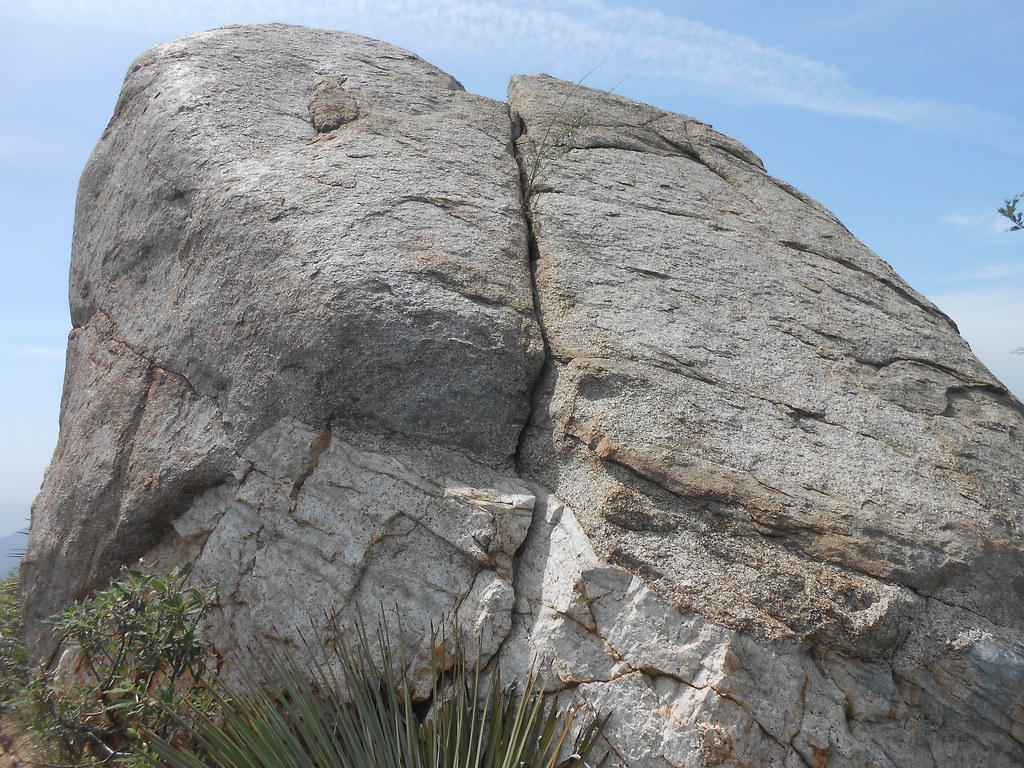
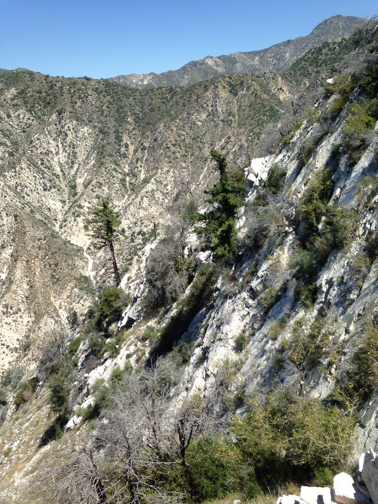
After the towers, you transition to the white quarzite-type rock on the other side of the notch. Here's where the two rock-types meet:
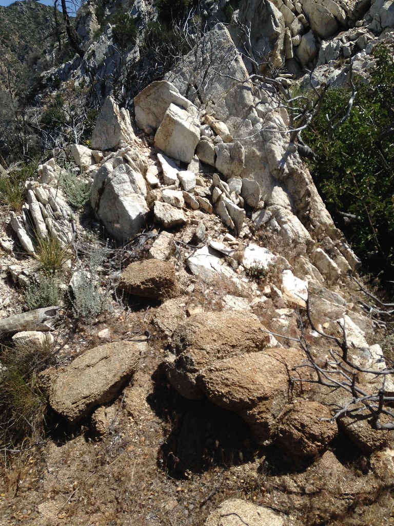
Looking back at the brown towers, notice the transition from brown to white rock:
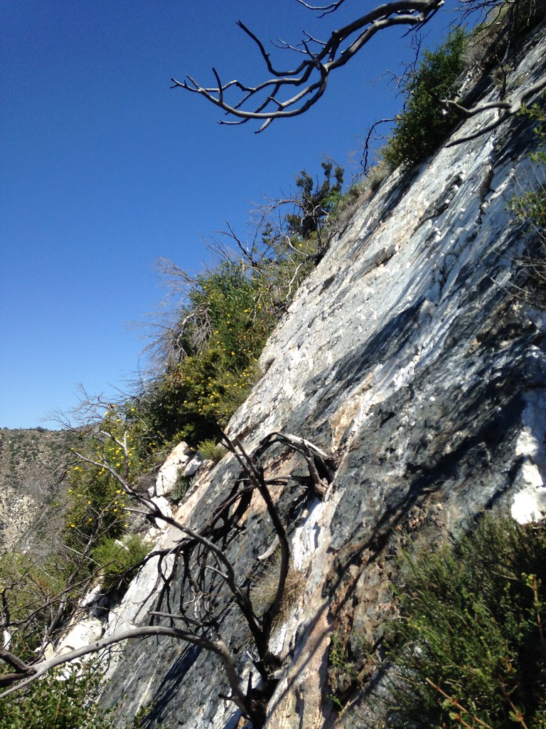
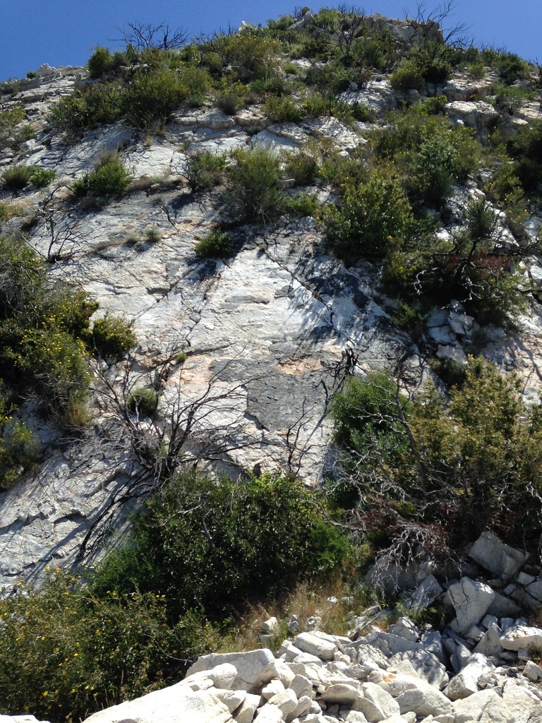
Compared to the brown rock, the white stuff is remarkably solid, but this being the San Gabriels, the challenge soon becomes how to climb through and around bushes growing out of the rock. Even though the white rock feels much more solid than the brown stuff, some fragments are dangerously deteriorated as well, so care must be used.
Finally at the base of the "white pyramid" second step. Slightly to the right of this photo, a break in the rock can be used to climb directly up the face through a bunch of bushes:
If you prefer the bushes, it looks like there's probably a bypass involving lots of brush:
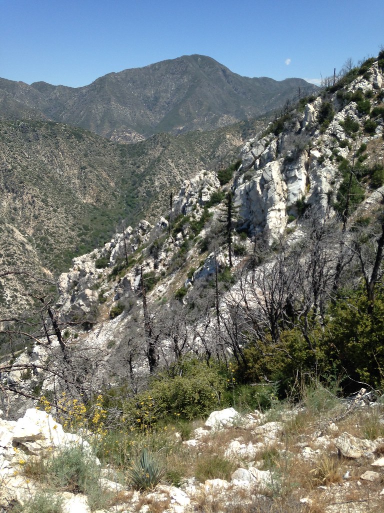
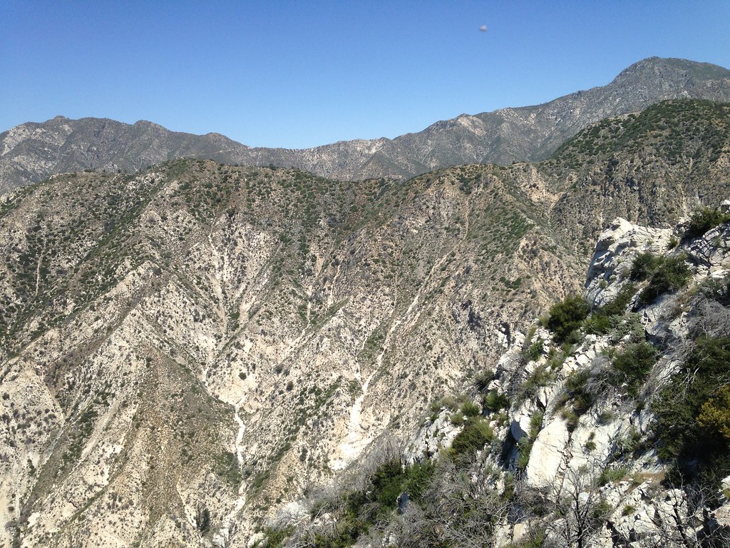
From near the base of the third step, the view gets better:
The third step doesn't look very steep, but it gets much steeper much faster than you expect it to. I went straight up a gully at the head, but the rock quality turned out to be a bit precarious and it was almost overhanging in spots. I made a dicey transition out of the gully and got on the shoulder to the right, but it involved a couple of sketchy moves. I originally intended to angle to the left and around to the shoulder instead of going directly up the gully, but was sort of committed once I got into the gully. Maybe left is the better way to go. I was reminded to be more cautious on this stuff since even a twisted ankle could really be problematic in a spot like this. In any case, maybe some Aetherians were up on Strawberry, because I caught a rare glimpse of a flying saucer coming in for a landing:
Last view down the steep part:
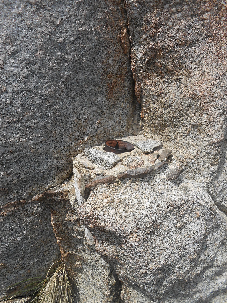
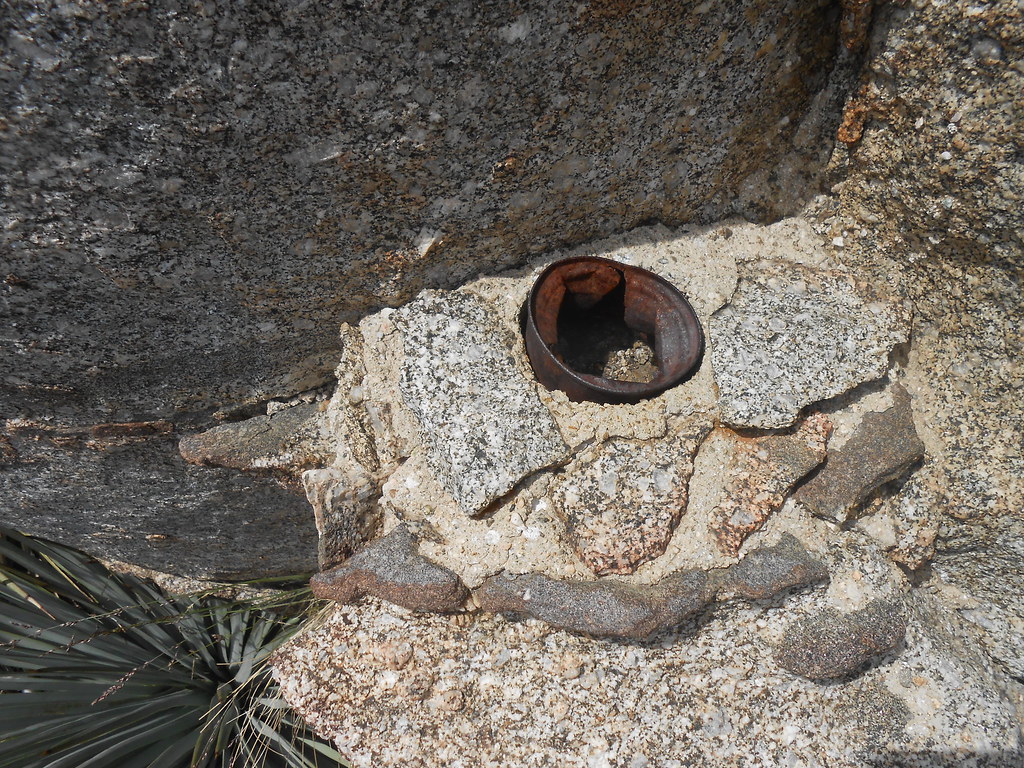
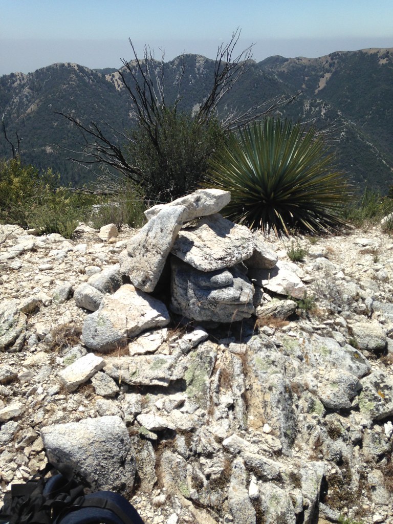
Once past the third step I ascended a slope and came upon the first cairn of the day, complete with steel wires:
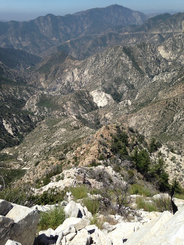
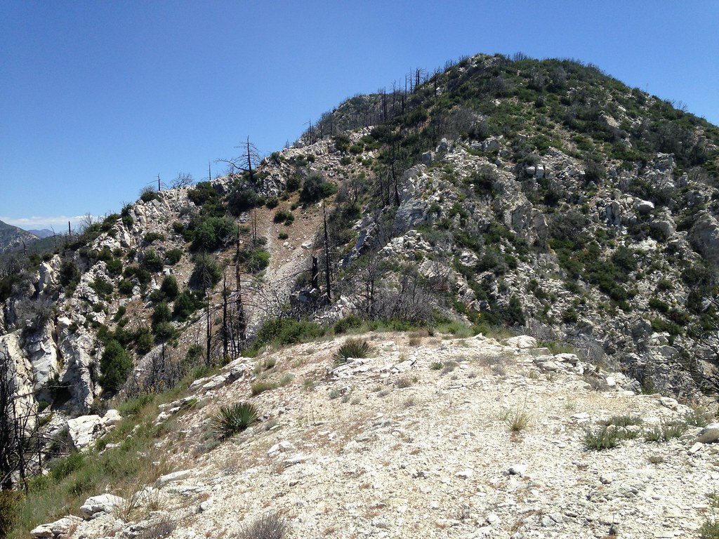
At this point, we get our first look at the summit beyond a pair of huge gullies that come in from each side. It's slightly to the left in the back. I didn't get any good pictures of them, but there do seem to be some interesting rock features on the sides of these gullies a little ways down.
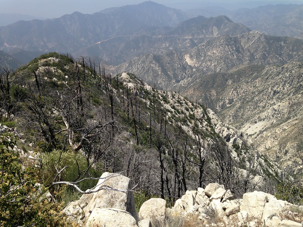
And arriving at the peak, we get a look back at the way we've come:
By this point my mind was sufficiently bleary to infect the functionality of my phone camera and produce this bizarre blurring effect:
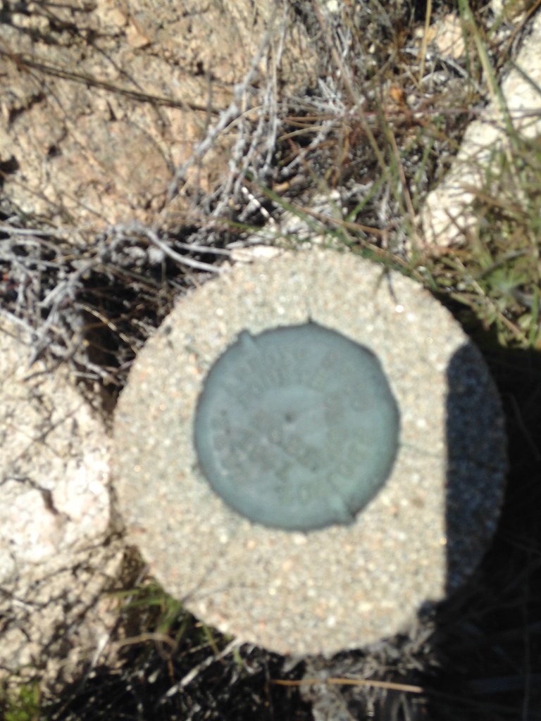
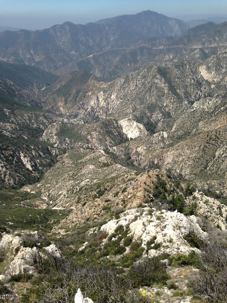
Aside from the year 1941, I have no idea what the rest of it says. Even being there in person I read some syllables like ORT DORP GLORT stamped in uneven letters and scratched my head. Maybe the surveyors who placed it were also experiencing a moment of distortion or distraction. Anyhow, I've tried in vain to locate any reference to this bench mark in any datasheet records and so on. Maybe those of you who are more experienced with this sort of thing can shed some light on this? Well, by this point I'd consumed about half of my water and was getting a bit concerned about the distance to go. Looking ahead didn't exactly inspire confidence. Oh, well, so be it:
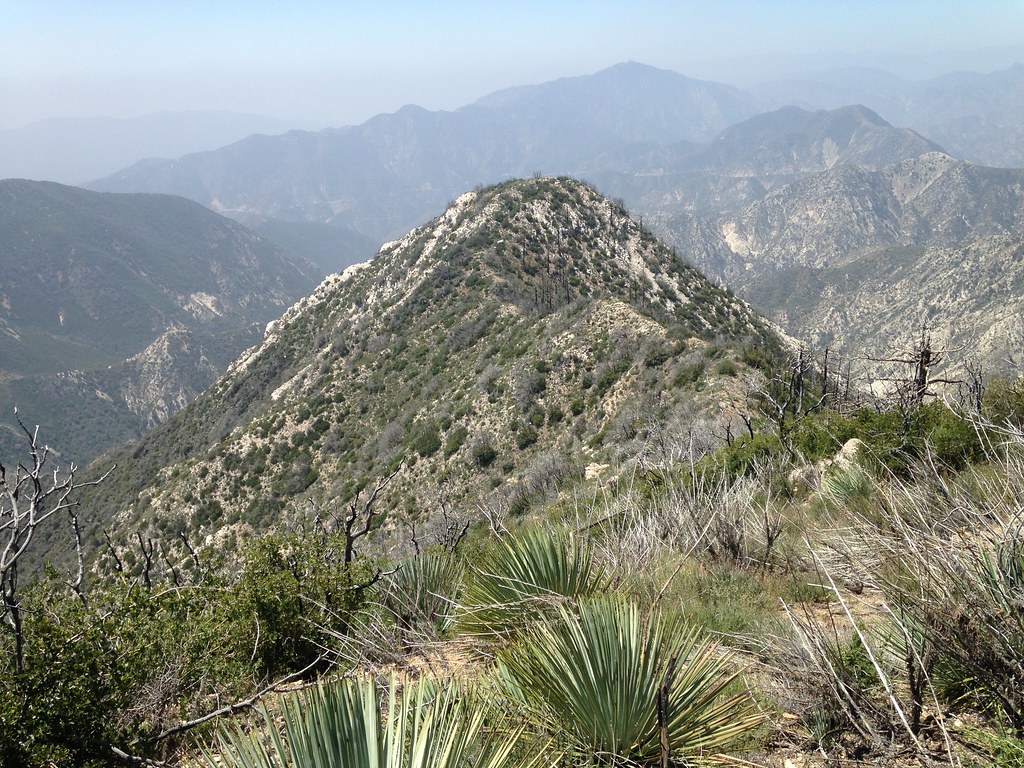
I pressed onward and got this nice view looking back at glorious Peak 5058, a seldom visited front range summit bump:
I guess at this point the options are to continue all the way to deception/disappointment and down to a car shuttle if you're smart enough to organize that kind of thing. I entertained the idea of descending one of the ridges documented by hbandrew:
https://eispiraten.com/viewtopic.php?t=6281
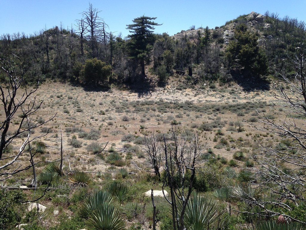
However, that would drop me more trail miles away from my car. My thought was to somehow loop back to the Gabrieleno trail and descend to my car. I soon arrived at beautiful Lake Disappointment:
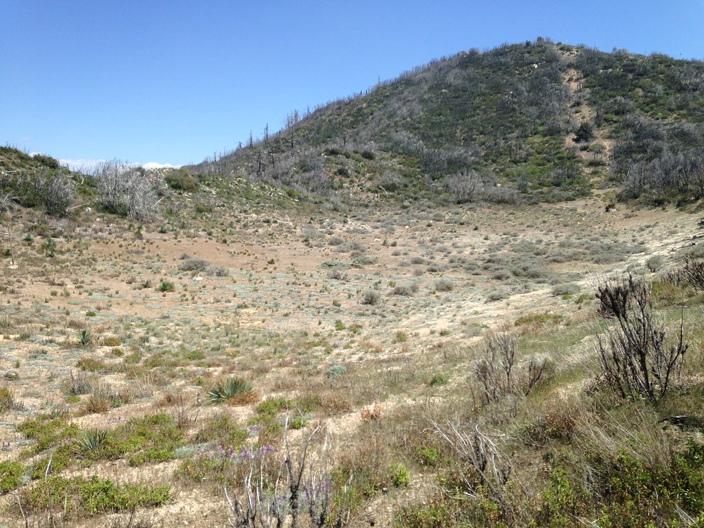
Or should it be called Lake Deception? I tried to imagine what it would be like with a real body of water here:
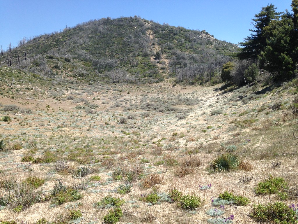
There are a few robust trees under which to rest in the shade and collect your thoughts. After a break, I decided to opt for a cross country descent skirting across an upper drainage near the top of one branch of Little Bear and then down a slope to the Gabrieleno trail just a bit below Cloudburst Canyon. I bid farewell to this enchanted spot:
The first part of the descent was aided by what appeared to be old switchbacks from a logging or fire road. The vegetation was sparse and the slope gentle. After crossing the upper part of the Little Bear drainage and reaching the final ridge, the drop down to the Gabrieleno is a bit daunting. The steeper north facing slope is filled with clusters of poodle-dog many of which have dried out, but many are still robust. I suited up in my old shredded and duct-taped Gortex, but I'm still not sure it protects me from any particulate or airborne toxic droplets from those plants as I come crashing down through the bushes like Super Dave. I didn't seem to get anything afterwards, so my system must have worked. Once on the Gabrieleno Trail I jogged back to my car for a six-hour round trip.
In my book this would rank as a pretty remote spot for the front range. The eerie thing is that you can often hear people talking on one of the trails somewhere around you, but this particular spot is pretty hard to get into and out of. I wouldn't want to twist an ankle up in there. Happy trails.
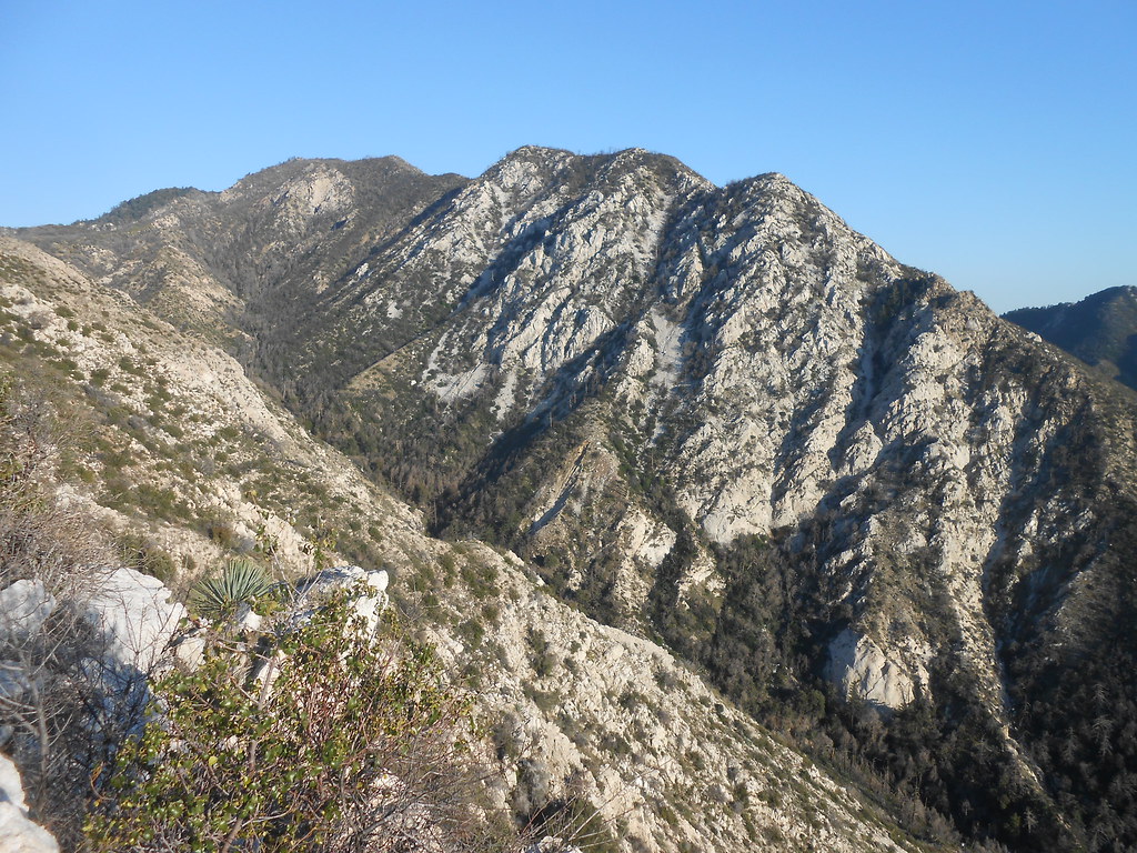
Here's one final nice view of the ridge and peak from a novel angle: