

Based on the limited information on the web, I decided that we would make this an overnighter because getting to Upper Fish fork after Little Fish Fork seemed a bit of a challenge with the trail being hard to follow.
Friday Night: I met Jeremy Boggs at his work in Burbank to leave my car and take his down Blueridge road to Guffy Campground. The plan was to get the drive over with the night before so it wouldn’t be overwhelming the next day. A few weeks prior, I solo hiked Pine and Dawson. I had to start from Guffy because the gate was closed off from there. I was pretty certain this time would be no different and the road down to Prairie Fork would remain closed. When we drove down around midnight, the Guffy sign came into view, and I didn’t see the gate locked across. I was shocked to see it open! This was great news because it meant saving a few miles and elevation gain. On the gate poles there were signs posted warning of a closure .5 mi east from Lupine Campground. Apparently a wash had eroded part of the road making it impassable. Otherwise, we had no idea what kind of condition the rest of the road was in getting to that point but we didn’t hesitate to find out.
So down we drove the poor camry. Initially it was ok, but progressively worsened. Our anxiety heightened and Jeremy got out a few times to move rocks. We managed to drive until the wash area. We parked along the road where there were already a few other cars. It was already late into the night, so we decided to car camp. There were several other cars that passed throughout the night.
Saturday morning: we slept in instead of getting an early start since we parked pretty close to the trailhead. As we were packing up for our adventure, a few passing folks informed us that they were hunters and it was actually opening weekend for hunting season. Little did we know!! So this was the reason the gate was open and why there were so many cars parked down by Lupine. So much for expecting desolation! I felt disheartened for a little because I was looking forward to having Little and Upper Fish Fork campgrounds all to ourselves. But the fact that everyone was very friendly helped lessen the blow.
Walking on the rest of the road to get to the trailhead on the left hand side just before Lupine Campground.
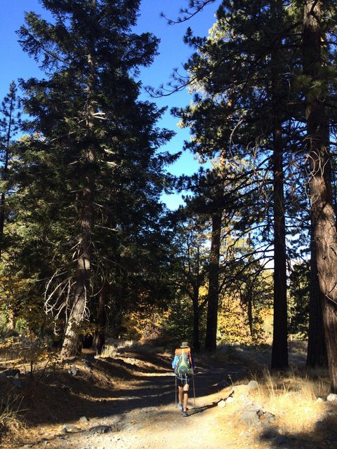
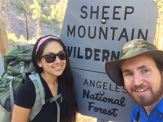
Entering Sheep Mountain Wilderness
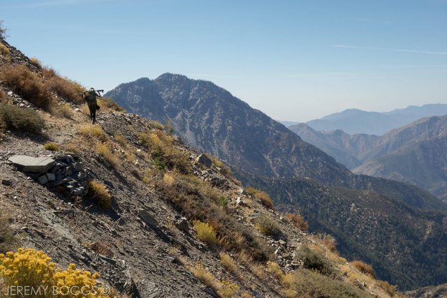
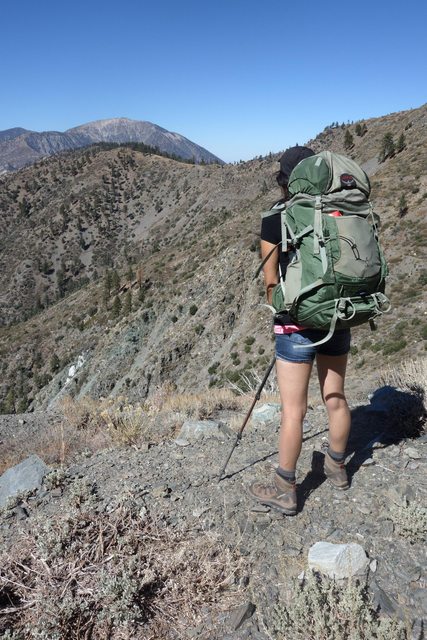
Start of the Epic Adventure!
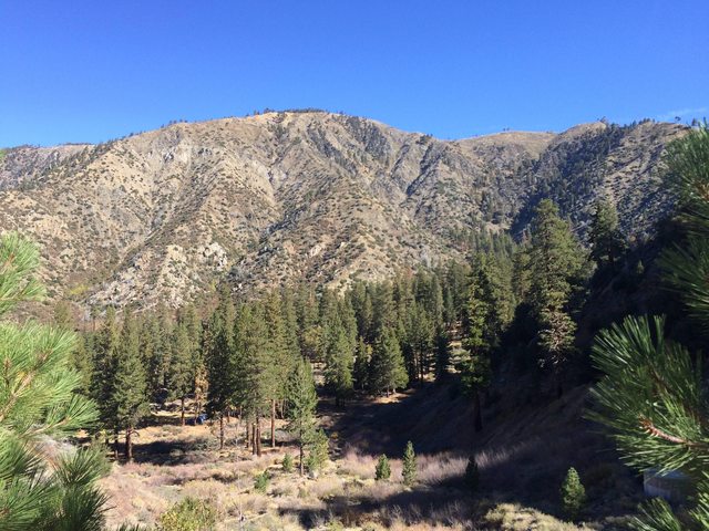
View of Lupine Campground as we hiked up
We followed Pine Mountain Ridge road which was an old logging road back in the day
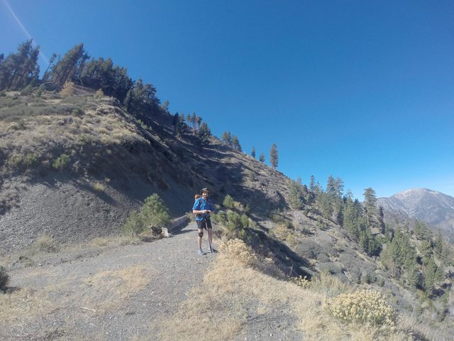
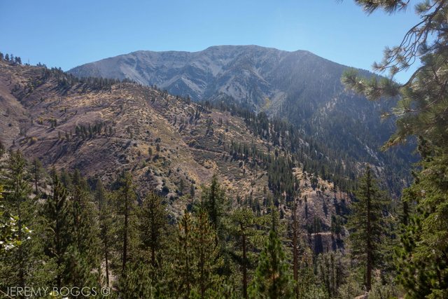
Views of Baden Powell most of the way up.
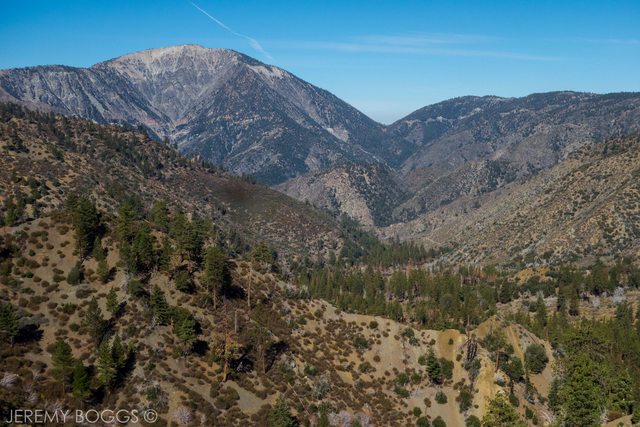
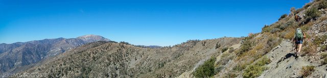
Finally at Pine Mountain Ridge, grand views opened up of East Fork country.
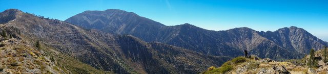
We took a breather at the ridge, naming as many peaks as we could while we stuffed down crackers with cheese and sausage. After awhile we got back up and started the descent to Little Fish Fork by following a path down the side of the mountain. There are many trails because of game running all over the place.
Panorama at the Pine Mountain Ridge
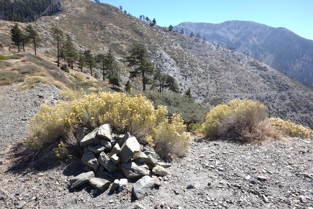
Before leaving the ridge we were looking for the Old Fish Fork trailhead sign that was supposed to be there. But nothing but rocks?
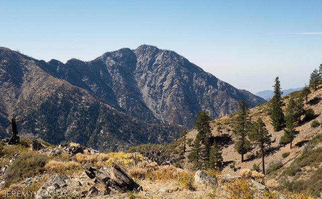
Towering citadel of Iron Mountain while on our down to Little Fish Fork campground.
Just around where you leave Pine mountain ridge, we saw the last of the weekend crowd. (woohoo!)
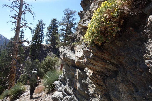
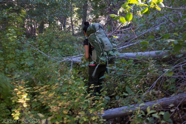
Trail begins to switchback steeply down a forested slope to Little Fish Fork
The misleading sign of the Dawson Peak trail.
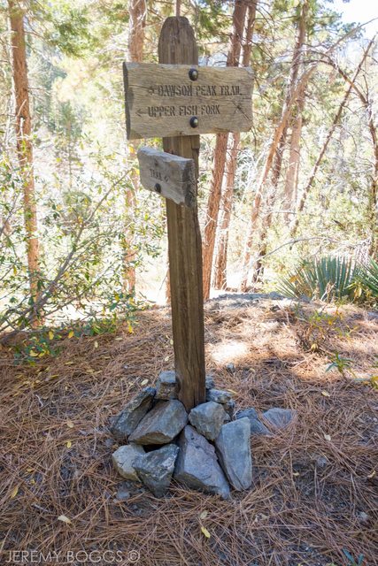
You can see the old roadbed that is called the Dawson Peak trail. Its has not been maintained in long time and it missing in some areas. It would be a long day to follow this trail (but sign me up!)
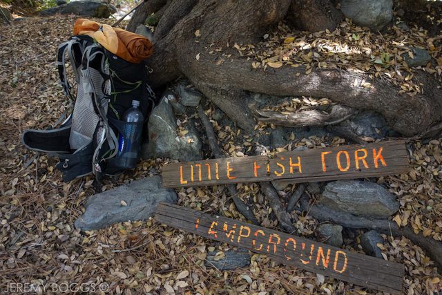
Woohoo! We made it to Little Fish Fork! It was a bittersweet feeling arriving at Little Fish Fork campground because the stream was completely dry. Would there be water at Upper Fish Fork?
After a little bit of discussion and encouragement we were on our way down to Upper Fish Fork no matter what but we were prepared to ration what we brought.
We knew leaving Little Fish fork would come the real adventure.
down down forever!
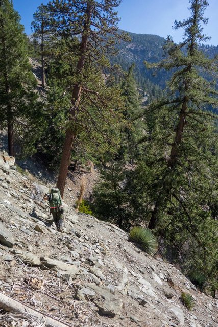
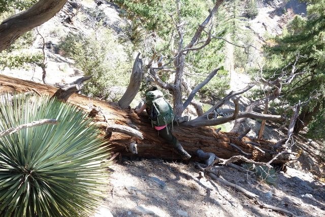
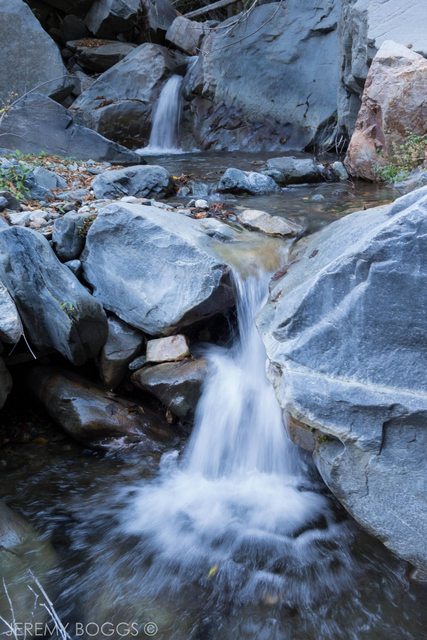
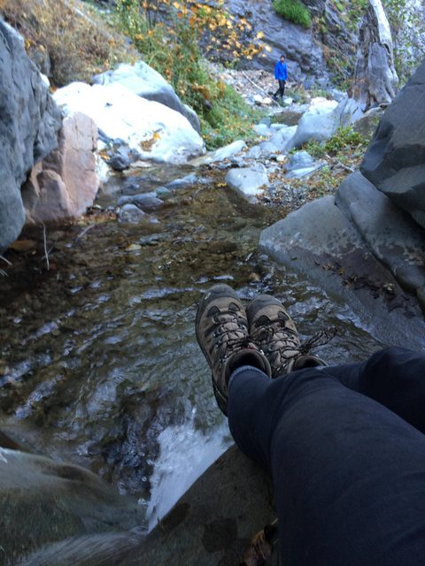
The trail becomes considerably much harder to follow and disappears in a few areas. It narrows with steep drop offs. We bush-whacked, climbed over trees and nervously crossed steep scree slopes until the roaring sounds of Fish Fork made us jump for joy! We would have enough water be comfortable during our overnighter.
just right over this small tree
The quarter mile down the trail to UFF becomes only a subtle series of foot tracks on the ground. The trick was to keep trekking down in a gradual and diagonal fashion. However, falling was inevitable and we both took several bad falls (it was hilarious and totally worth it!)
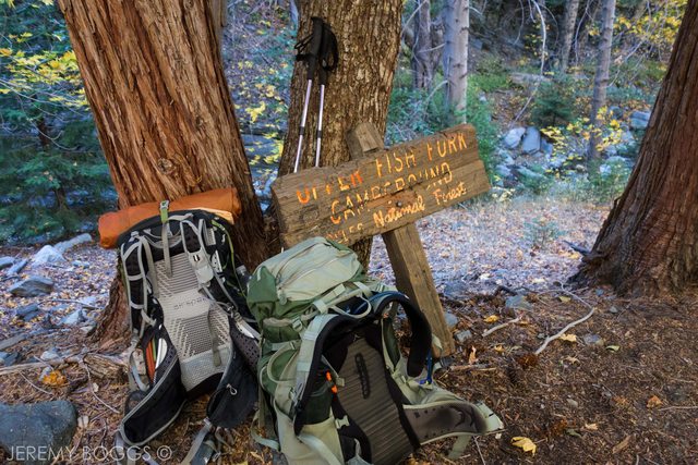
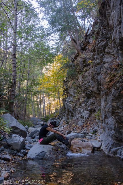
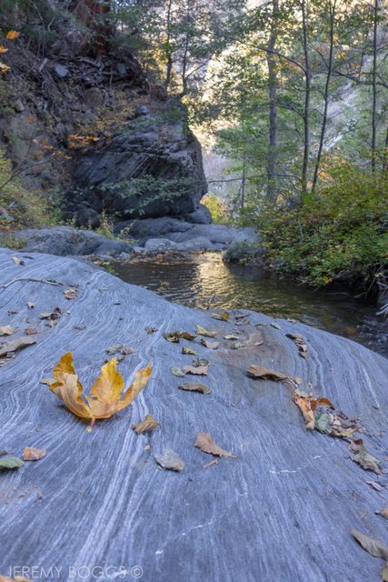
Upper Fish Fork!
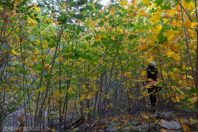
I was stunned at the abundance of vibrant foliage scattered along the unspoiled creek. It truly felt desolate. The beauty made me ache with emotion that I gave out on a few tears. It was unlike anything I had ever came across in the San Gabriels and I knew that it was already my favorite place.
Foliage was unreal!
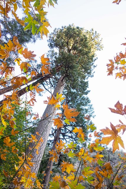
Beautiful Fish Fork
Our home for the night.
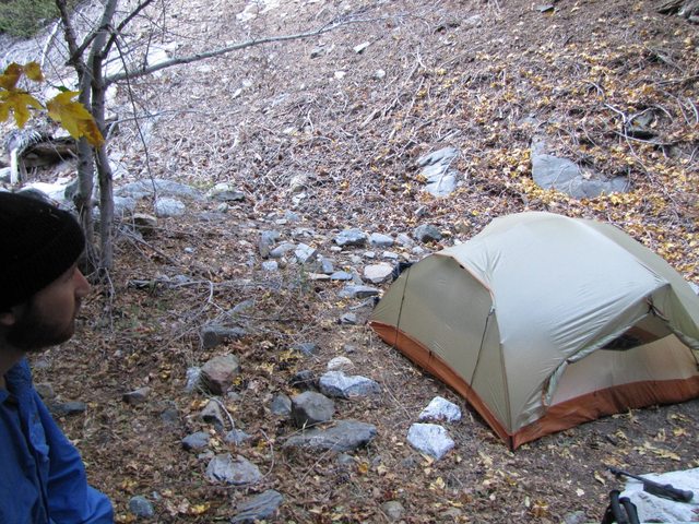
We created a fire, cooked our dinner and toasted to our victory with some drinks. We shared many great laughs before retiring off to bed for the night.
The next day we opted for an early start since most of our elevation gain would be done that day. After our ridiculously delicious oatmeal essential cup of mountain coffee we were ready to go.
The mile getting to Little Fish Fork would be difficult to retrace with my phone being dead and nothing to reference to. Luckily, Jeremy has some amazing navigation skills and a great memory.
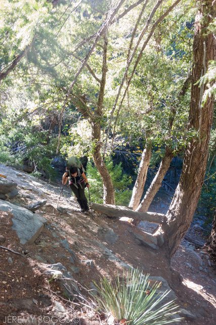
Going up the first section was really difficult the weight of my pack, requiring some climbing on all fours.
For awhile I was leading us and Jeremy got a sense that we missed a turn. He was completely right, we almost ended up following the Dawson peak trail (oopsy daisy lol)
We turned back around and got on the right track.
Bush-whacking
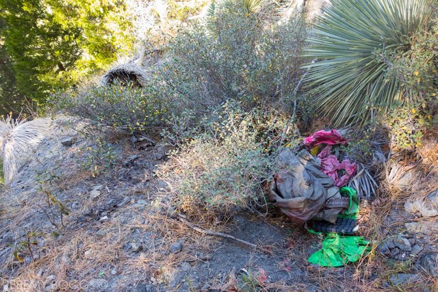
Passing some garbage that some novice hikers decided to leave because they no longer could bear the weight. Some items included: air mattresses, BBQ lid, and chair (ugh idiots!). We felt bad that we didn't have the space or energy to carry out these heavy items and stayed there cursing out loud for a few moments.
Before we knew it, we were at LFF again. We were really relieved because the hardest part was done and the rest of the way would be a sure way!
Heading back up
Taking it all in the last few miles.
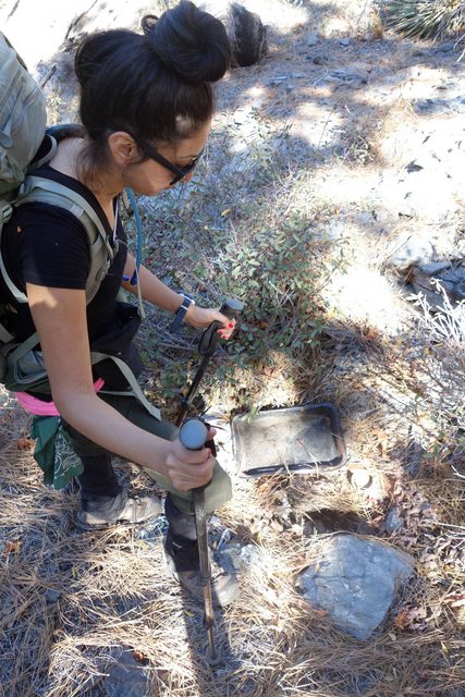
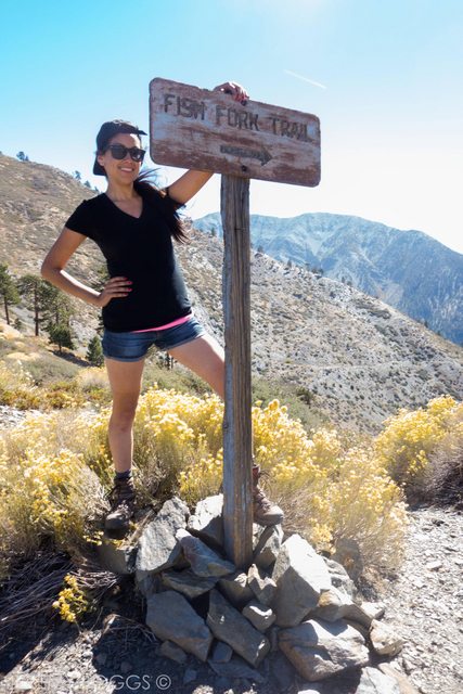
Back at Pine Ridge we were wondering why the old “Fish Fork trail” wooden sign wasn't there. We decided to put our packs down and look for the sign. Maybe it had fallen over and was on the slope somewhere? I peered down closer and spotted the wooden pole.
I filmed Jeremy hiking down and carrying the sign up back to its proper place. We cheered loudly as we planted the sign down. The hunters at the ridge stared at us as if we were nuts. We felt heroic nonetheless. We took some pictures but didn't waste anytime on the descent portion. We were almost done and some beer sounded amazing.
I blasted through the downhill section but waited to cross the official finish line with Jeremy so that we could cross it together. We only need a short walk back up to the car but a long drive on the dirt road. We didn't mind it at all, this adventure will make a great story to share around the next campfire.[/i]


