Falls of High Creek

Archived TRs for ranges in California.
Post Reply
User avatar
Hikin_Jim
Posts: 4686
Joined: Thu Sep 27, 2007 9:04 pm

Post by Hikin_Jim »

I did a little cross country travelling this past weekend up in the San Gorgonio Wilderness. One of the routes I did was a route up high Creek from the Halfway Camp area. Here is my GPS track showing the route I took from Halfway Camp to High Creek Camp.

There was some pretty heavy brush between Halfway Camp and the drop in at High Creek.
Image

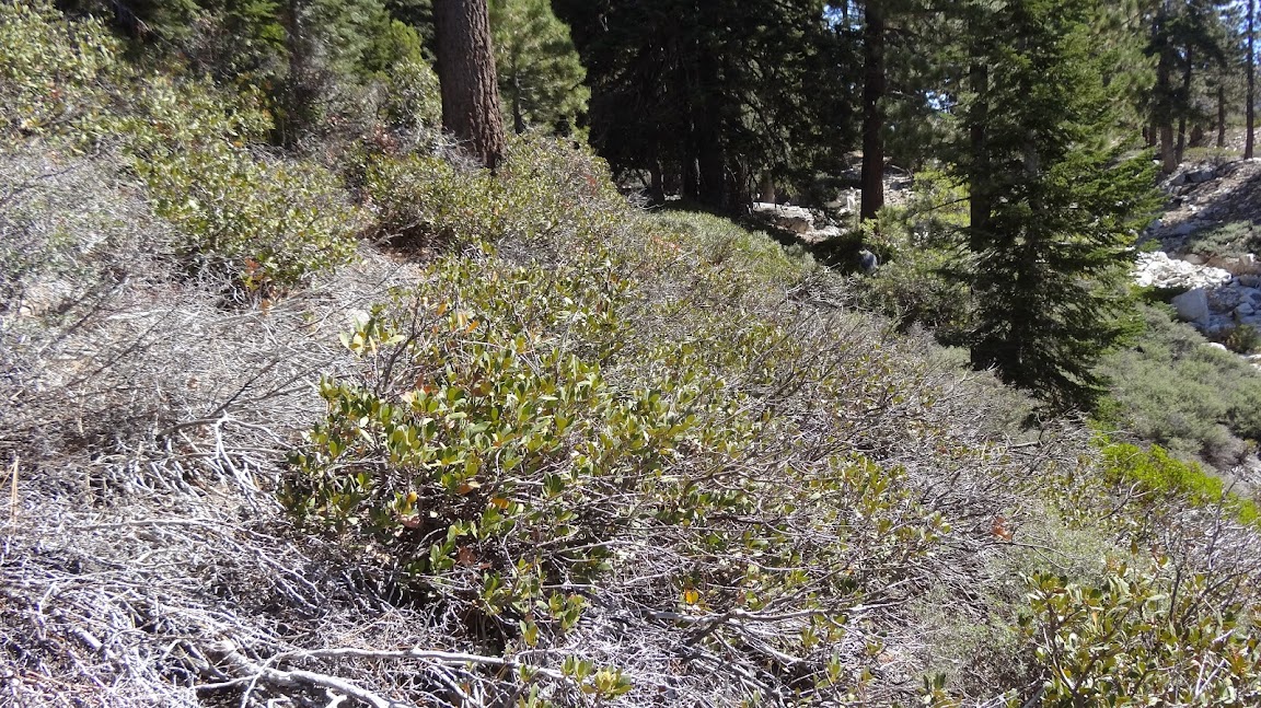
However, once in the drainage, the brush generally wasn't bad.

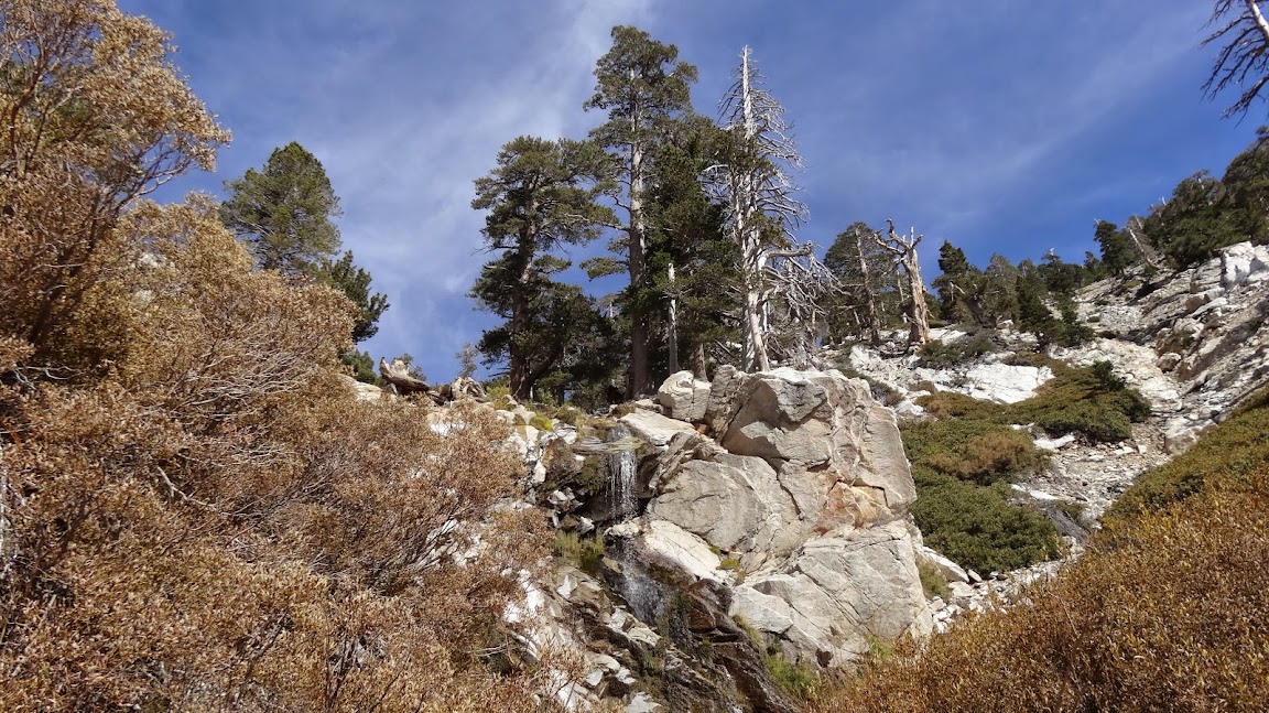
It was a nice route with plenty of water.
Image

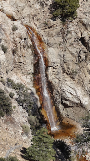
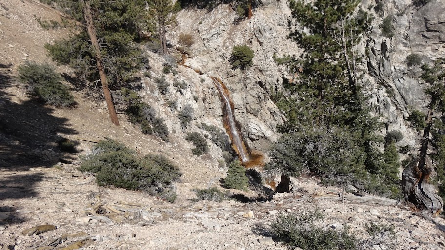
Of interest to me were the three water falls between the drop in point and High Creek Falls. I've known about High Creek Falls for a number of years (it's visible from the Vivian Creek Trail), but I wasn't sure what I would find below High Creek Falls. I found another three falls.

A word of warning to anyone who might be interested in ascending High Creek: Each of the falls requires a certain degree of rock climbing skill (this is not hiking). The falls generally require class three moves to surmount. See backcountry travel classes for definitions.

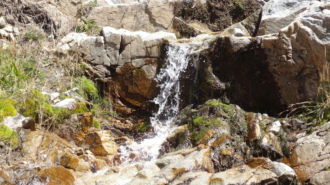
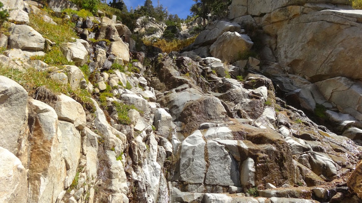
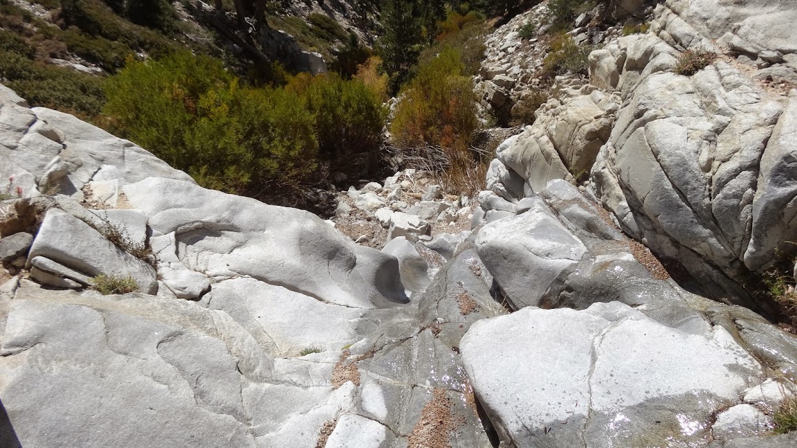
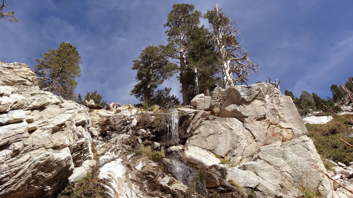
First falls (really more of a steep cascade):
Image

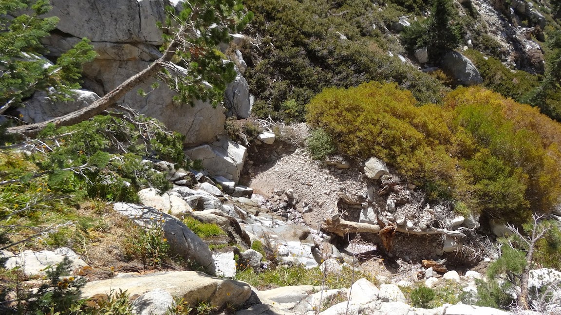
Looking down from first falls:
Image
Yes, you need to scale straight up the face.
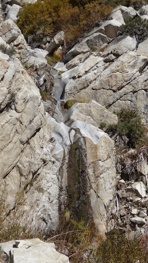
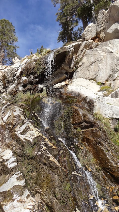
Second falls:
Image

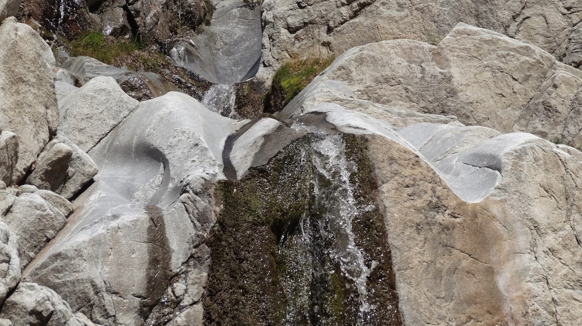
I thought the second falls was really interesting. It had these beautiful fluted grooves worn into the rock by the water.
Image

Looking down the second falls.
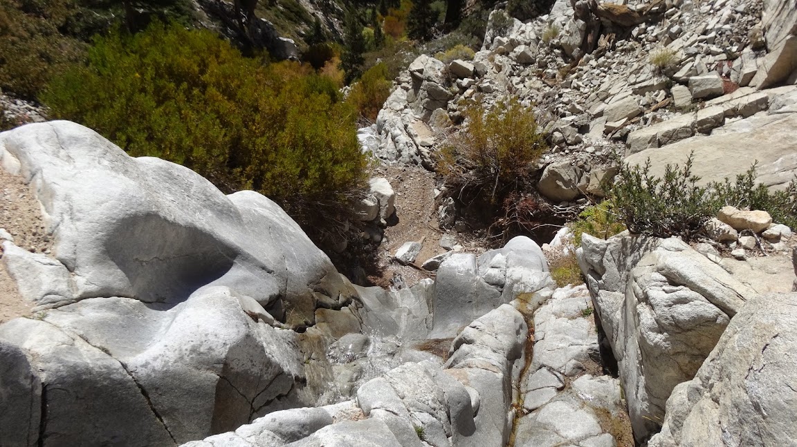
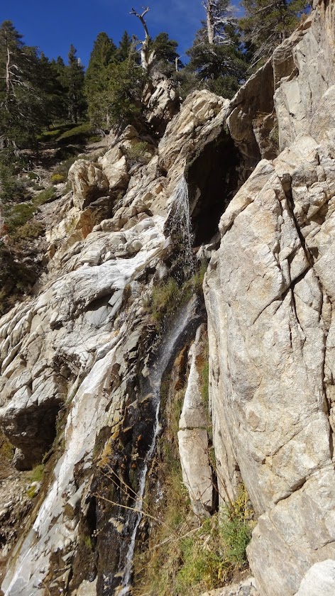
Image

Third falls:
Image

Looking down the third falls:
Image

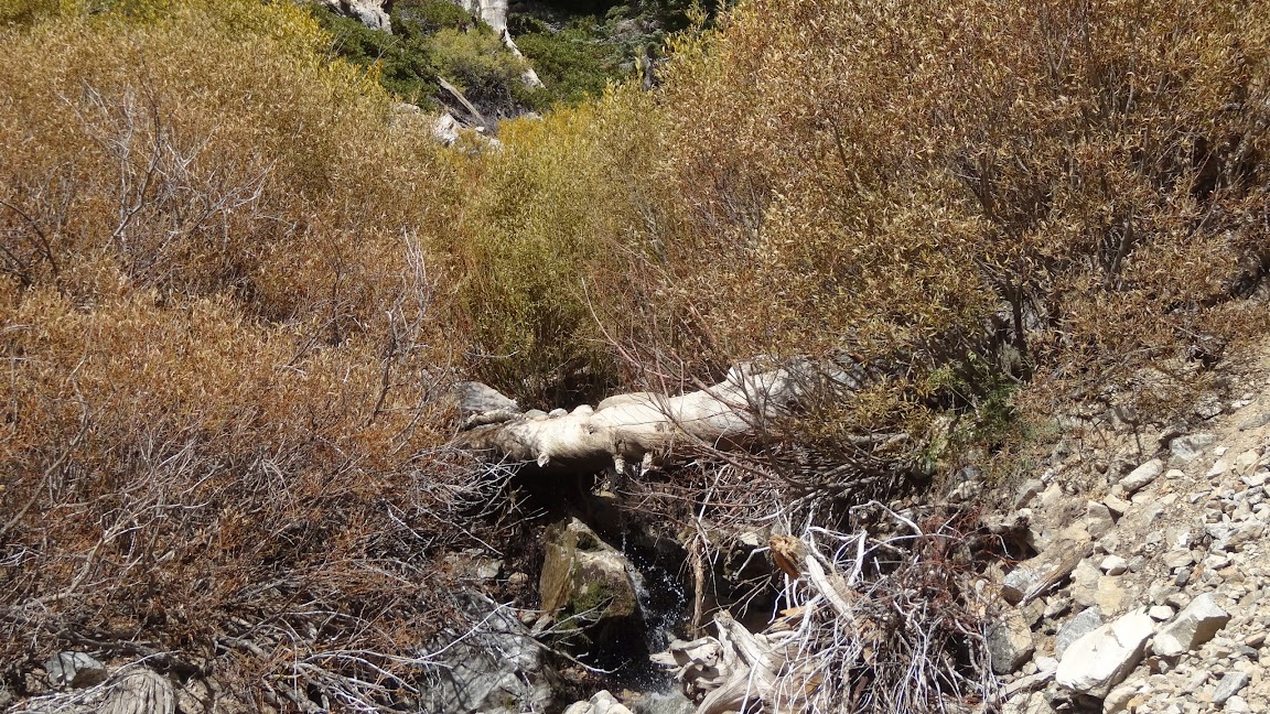
Above the third falls there were some unpleasant willow thickets, but nothing horrible.
Image

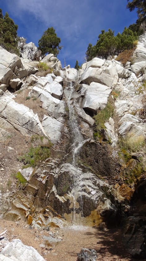
And finally, one comes to High Creek Falls, which is just below High Creek Camp. I've always thought this was one of the most attractive falls in the San Gorgonio Wilderness.
Image

Image

Image

Image

A very interesting trip, but again one would be well advised to consider what rock climbing skills are involved before embarking on the journey.

Regards,

HJ
User avatar
VermillionPearlGirl
Posts: 239
Joined: Wed Apr 06, 2011 9:57 am

Post by VermillionPearlGirl »

Water! :)

Looks pretty cool HJ!
User avatar
Hikin_Jim
Posts: 4686
Joined: Thu Sep 27, 2007 9:04 pm

Post by Hikin_Jim »

Yeah, I was very pleased at how much water there was. A couple of weeks ago I did a trip to, among other things Dollar and Dry Lakes. There was no water at either lake or at the springs near the lakes. I had to dry camp. Fortunately I had packed 3 liters of water just in case.

HJ
User avatar
Uncle Rico
Posts: 1401
Joined: Thu Mar 20, 2008 7:48 pm

Post by Uncle Rico »

What's the source of that water HJ?
User avatar
Hikin_Jim
Posts: 4686
Joined: Thu Sep 27, 2007 9:04 pm

Post by Hikin_Jim »

Uncle Rico wrote: What's the source of that water HJ?
Presumably the past. It sure isn't recent.

HJ
User avatar
Sean
Cucamonga
Posts: 3772
Joined: Wed Jul 27, 2011 12:32 pm

Post by Sean »

Very cool. I'm going to add this to my to-do list.

I'm doing the Dobbs loop soon, dropping down the south ridge to High Creek Camp. Ever do that one?
User avatar
Hikin_Jim
Posts: 4686
Joined: Thu Sep 27, 2007 9:04 pm

Post by Hikin_Jim »

I haven't, Sean, but I know it's a "go". I've talked to several people who have done it.

The Dobbs loop I want to do is one going up the ridge from Vivian Creek Camp, and then down Falls Creek to Allison Falls and Dobbs Camp, and then exiting at Forest Falls.

Allison Falls is one of the better kept "secrets" of the SGW. Very worth seeing in my opinion although this is a drought year.
Image

Image

HJ
User avatar
AW~
Posts: 2040
Joined: Mon Oct 01, 2007 12:00 pm

Post by AW~ »

Awesome....I suspected SanBerns were keeping secrets LOL.
'All we got in the San Bernadino mountains are some short granite leftovers and trees....nothing to see other than that and a couple of lakes...move on'.
User avatar
Hikin_Jim
Posts: 4686
Joined: Thu Sep 27, 2007 9:04 pm

Post by Hikin_Jim »

Ha, ha, no way. Allison is maybe 60', and those falls on High Creek were all at least 25', some bigger.

HJ
User avatar
tekewin
Posts: 1194
Joined: Thu Apr 11, 2013 5:07 pm

Post by tekewin »

Great trip, Hikin' Jim. You may have to write a book some day. In the mean time, you could add more secrets to your blog (hint, hint). ;)
User avatar
Hikin_Jim
Posts: 4686
Joined: Thu Sep 27, 2007 9:04 pm

Post by Hikin_Jim »

tekewin wrote: Great trip, Hikin' Jim. You may have to write a book some day. In the mean time, you could add more secrets to your blog (hint, hint). ;)
yeah. Just a matter of having time to do it. I've got years worth of good hikes I'd like to document in the SGW alone. Don't know if I'll ever get to it. We'll see.

Fun stuff over there.

HJ
User avatar
Taco
Snownado survivor
Posts: 6010
Joined: Thu Sep 27, 2007 4:35 pm

Post by Taco »

Allison Falls, eh? Hmmm. :twisted:
User avatar
Hikin_Jim
Posts: 4686
Joined: Thu Sep 27, 2007 9:04 pm

Post by Hikin_Jim »

Taco wrote: Allison Falls, eh? Hmmm. :twisted:
Here you go, Taco: Ten mile loop including Allison Falls and several canyoneering options.

HJ
Post Reply