Trip planning, history, announcements, books, movies, opinions, etc.
Hikin_Jim
Posts: 4688Joined: Thu Sep 27, 2007 9:04 pm
Post by Hikin_Jim Sun Dec 15, 2013 7:57 pm
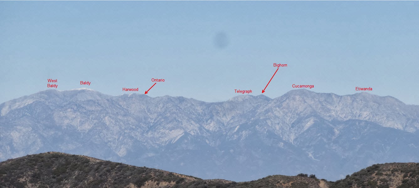
I was out in the Santa Ana Mountains yesterday and snapped this photo of the Eastern High Country of the San Gabriels:
I always like seeing the peaks from afar and seeing if I can identify them.
HeyWhatsThat is an excellent resource for checking if you're right.
HJ
Augie
Posts: 345Joined: Fri Sep 28, 2007 2:17 pm
Post by Augie Mon Dec 16, 2013 4:22 pm
Cool.
tekewin
Posts: 1385Joined: Thu Apr 11, 2013 5:07 pm
Post by tekewin Mon Dec 23, 2013 4:25 pm
You must have been in the very northern part of the Santa Anas.
I also try to identify peaks I see on the horizon, then I try to figure out how I would attempt to climb them
It can be very distracting while driving.
Hikin_Jim
Posts: 4688Joined: Thu Sep 27, 2007 9:04 pm
Post by Hikin_Jim Mon Dec 23, 2013 5:27 pm
tekewin wrote: You must have been in the very northern part of the Santa Anas.
Maple Springs Road
It can be very distracting while driving.
I'm the same way.
HJ
tekewin
Posts: 1385Joined: Thu Apr 11, 2013 5:07 pm
Post by tekewin Mon Dec 23, 2013 6:25 pm
Hikin_Jim wrote: tekewin wrote: You must have been in the very northern part of the Santa Anas.
Maple Springs Road
HJ
Doh! I forgot you have high powered cameras. I have to stop thinking through my limited phone camera lens.
Funny that you also think about climbing routes of distant objects. I feel a little less weird now.
Hikin_Jim
Posts: 4688Joined: Thu Sep 27, 2007 9:04 pm
Post by Hikin_Jim Mon Dec 23, 2013 9:40 pm
At the very least I'm trying to put the pieces together. My mental map is my constant double check against nav errors. Gotta keep the big picture in mind.