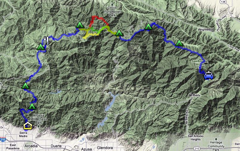
Obviously, water is key. There are some stretches of the route I've planned out that I'm extremely familiar with, but others (like Shortcut Canyon) I've never set foot in. The spacing of the campsites is about as perfect as can be, I was surprised.
Does this look possible?

http://goo.gl/maps/SiuH5
Day 1 - Mt Wilson Trail up and over Manzanita Ridge (the bench) to Hoegees (7 miles)
Day 2 - Gabrielino Trail over Newcomb Pass to West Fork Campground (8 miles)
Day 3 - Shortcut Canyon up to Chilao (11 miles)
Day 4 - Chilao to Cooper Canyon Trail Camp including detour to Newcomb's Ranch (14 miles)
Day 5 - Cooper Canyon TC to Little Jimmy (10-14 miles depending on route: PCT Closure, ACH bypass, or long ass detour up and over Williamson)
Day 6 - Little Jimmy to Baden-Powell Summit (6 miles)
Day 7 - Baden-Powell to Pine Mountain Ridge (13 miles, majority downhill)
Day 8 - Pine Mt Ridge up to Baldy (7 miles) then down to Manker (4.5 miles)
I think my best bet is to go late winter/early spring once the Pine Mountain to Baldy bit is ice free.
My biggest question is regarding reliable water sources between the West Fork Campground and Little Jiimmy (a huge chunk of the journey)
Any advice? (other than "Don't do it")
